
How four mayors from the Deep South are leading the expansion of national passenger rail

The three mayors smile broadly in front of the U.S. Capitol building in full suits (Monroe Mayor Friday Ellis sports a cowboy hat)

The mayors of Monroe, Ruston, and Shreveport, Louisiana, have joined forces with the mayor of Vicksburg, Mississippi to fight for new Amtrak service through their communities. This move has placed these four local officials at the center of the national conversation about expanding long-distance passenger rail service.
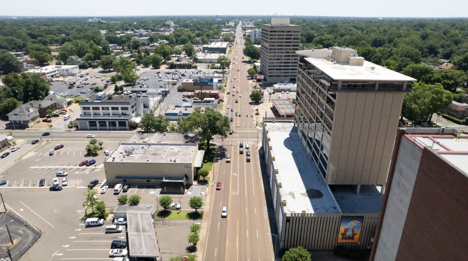
The three mayors smile broadly in front of the U.S. Capitol building in full suits (Monroe Mayor Friday Ellis sports a cowboy hat)
(from left) Ruston Mayor Ronny Walker, Shreveport Mayor Tom Arceneaux, and Monroe Mayor Friday Ellis

The I-20 Corridor

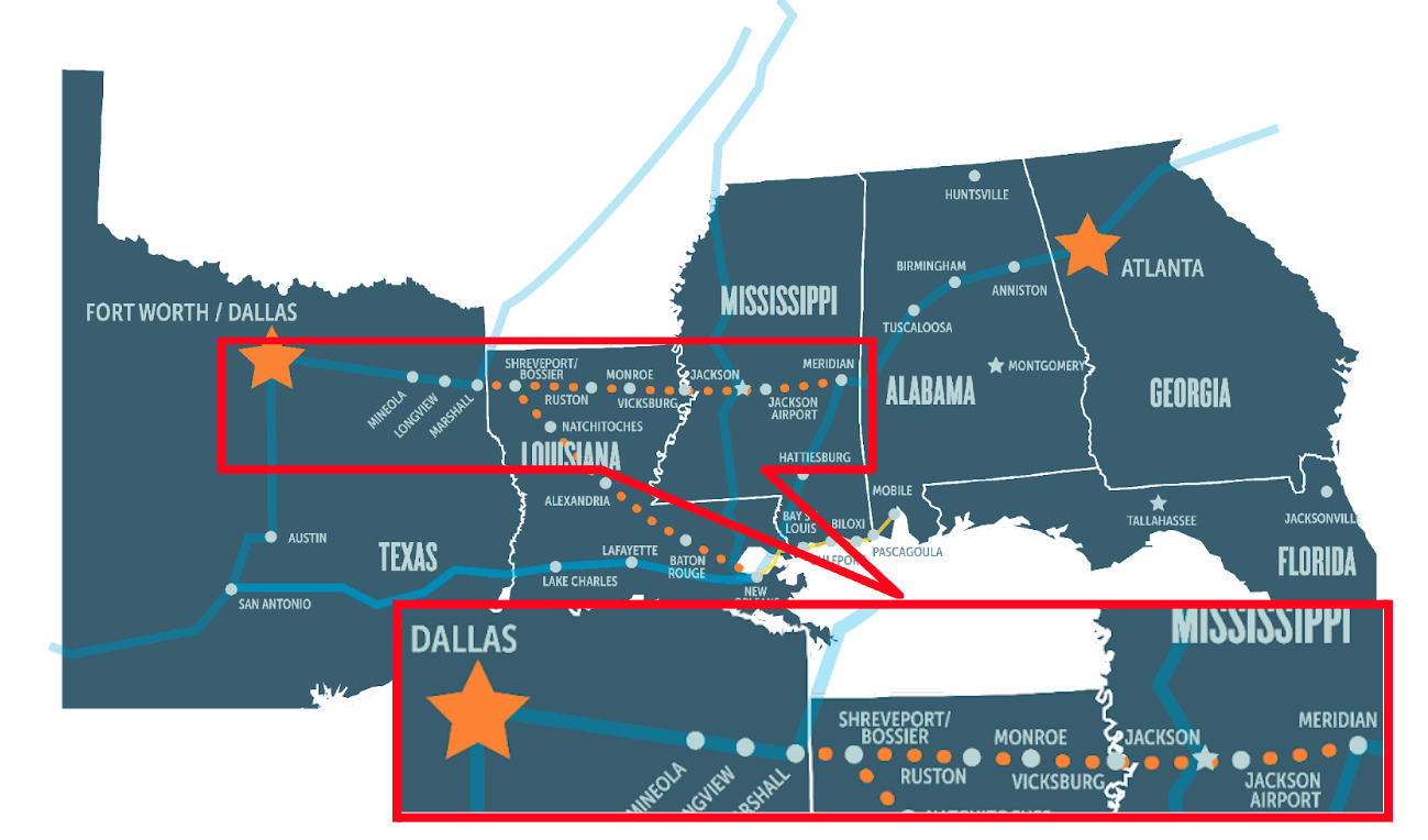
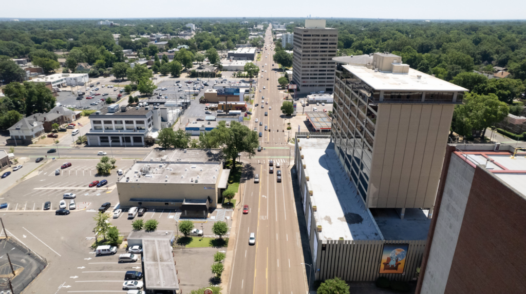
Mayor Friday Ellis of Monroe, Mayor Ronny Walker of Ruston, Mayor Tom Arcenaux of Shreveport, and Mayor George Flaggs Jr. of Vicksburg are working together to establish new passenger rail service along the freight rail corridor that runs along I-20 from Meridian, MS to Dallas/Fort Worth, TX (depicted below). The new service would be an expansion of Amtrak’s Crescent service through Meridian, allowing passengers along the I-20 Corridor to access Atlanta and other points north by rail. 

“This route will be one more arrow in the economic quiver for small and midsize communities across the Deep South,” said Beth Osborne, Director of Transportation for America, in our statement in April.

On April 21, in partnership with these mayors, Amtrak and the Southern Rail Commission (SRC) submitted an application for the Federal-State Partnership for Intercity Passenger Rail (Fed-State) program to study the corridor and plan for future service. This application is a huge step forward and has led to much fanfare in the cities that stand to benefit, but service isn’t guaranteed yet. First, the FRA needs to decide whether to grant the award. 

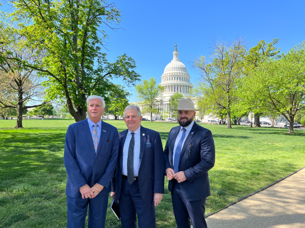
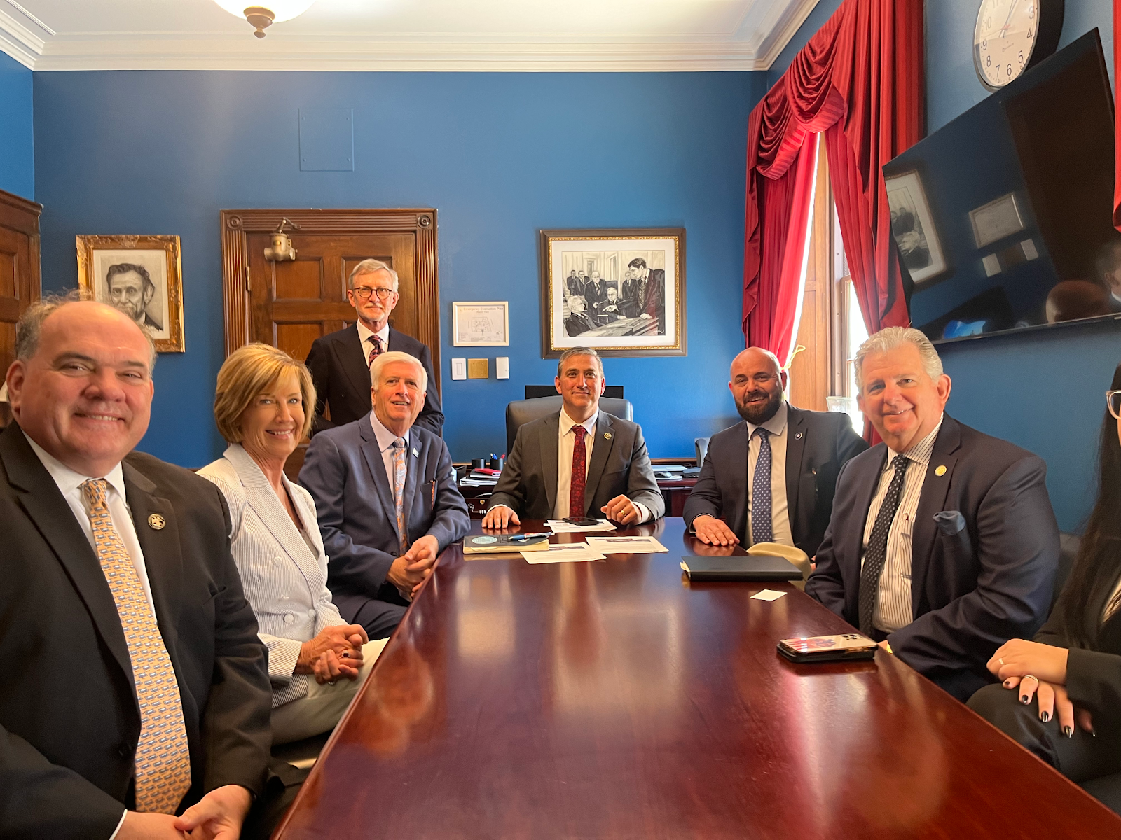
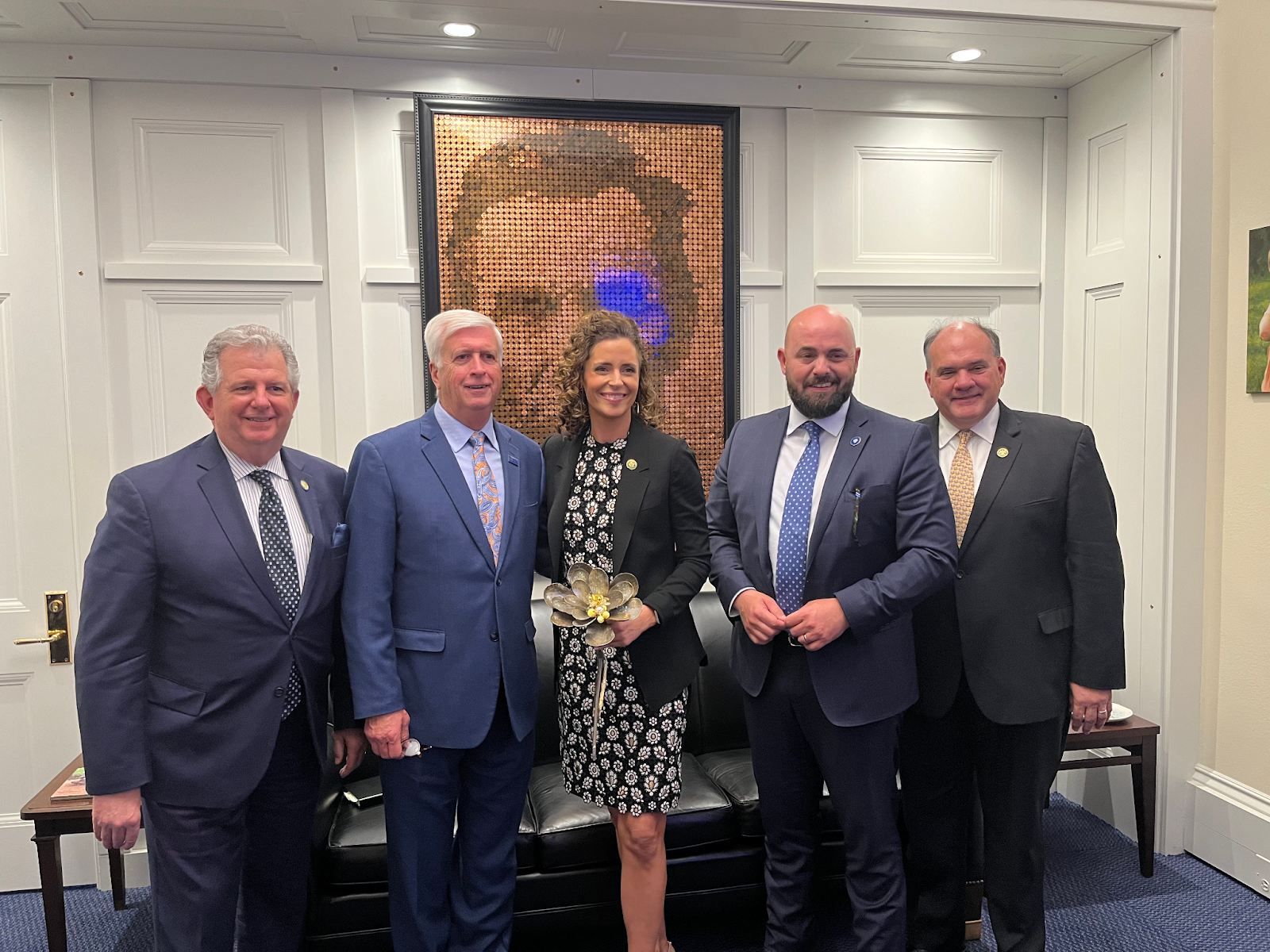
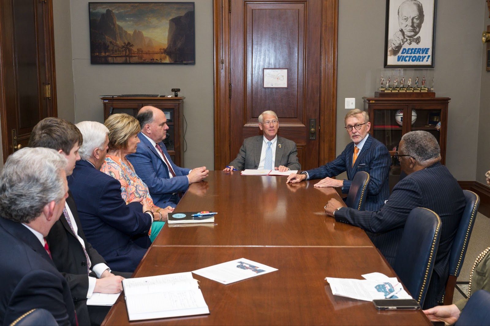
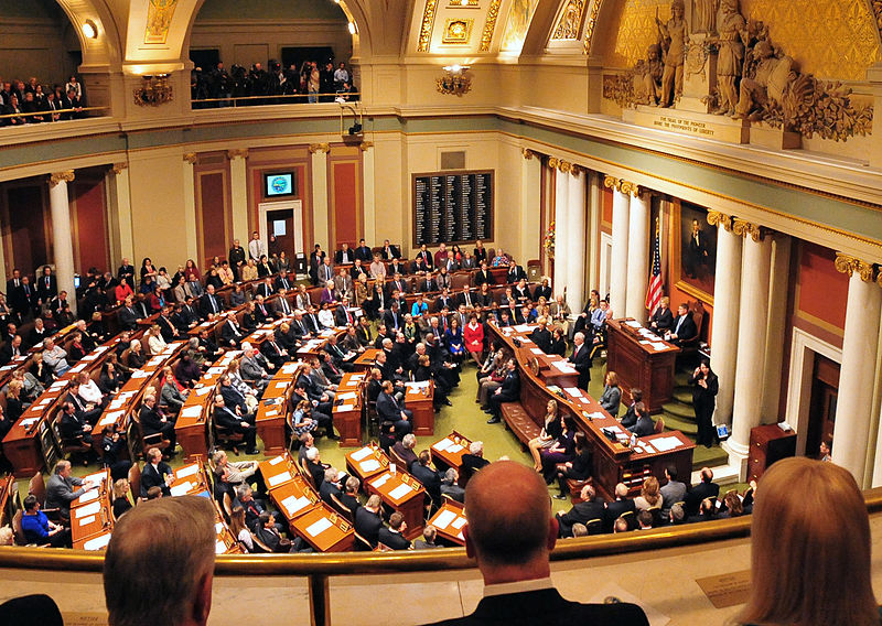
So the four mayors, joined by the SRC and CPKC (the railroad set to host this new service) Assistant Vice President of US Government Affairs Arielle Giordano, traveled to Capitol Hill to meet with members of Congress and build a coalition of support around their application.

And we had the pleasure of escorting them around.

Map of proposed route from Fort Worth, TX to Atlanta, Georgia, with a dotted section from Shreveport to Meridian.
Map of the I-20 Corridor. The dotted section needs infrastructure work before service can start, for which the mayors are pursuing federal funding.

Local leaders have national impact

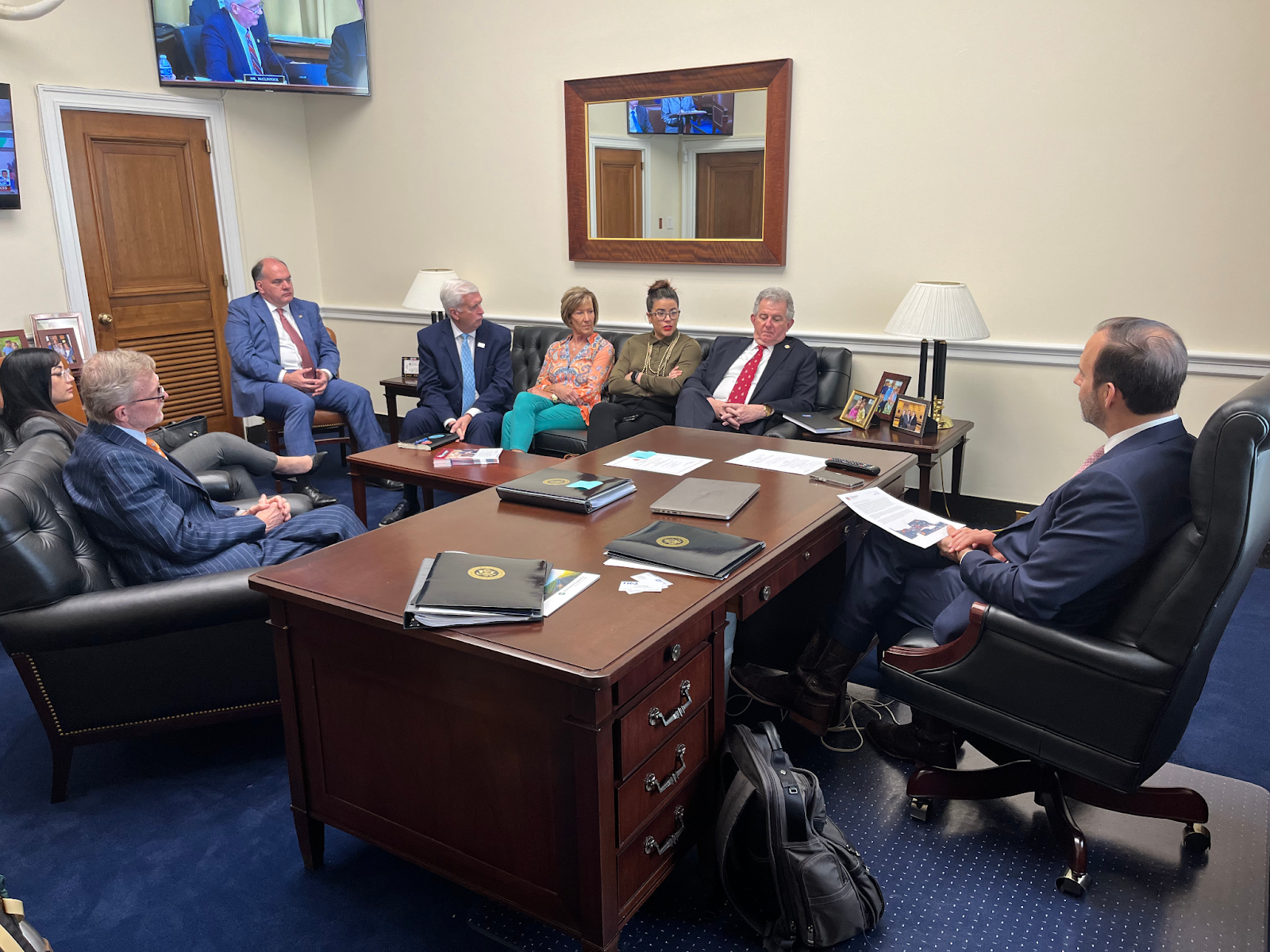
Mayors Ellis, Walker, Arceneaux, and Flaggs Jr. joined us in Washington, DC during the week of April 17-20 to meet with their senators and representatives as well as officials from Amtrak and the Federal Railroad Administration to discuss the I-20 passenger rail project. They outlined the details of the project, what federal funding they need, and why the project is important to their cities.

To make their case, the mayors focused on how the new passenger rail service will fit into their communities. They each told a story about who will ride the train, for what reason, and to where. Each community’s story was different, and each contributed something different to the group’s collective argument.

Mayor Friday Ellis described how the new station would be a core piece of Monroe’s plan to revitalize its downtown. So when the train stops in Monroe, people will have dozens of options for restaurants, shops, offices, and other amenities to choose from within walking distance. This will allow families with young children, students at the University of Louisiana Monroe, and every Monroyan to better access downtown and West Monroe (across the Ouachita River). This is why Mayor Ellis often says that the people of Monroe are more excited about this project than any other.

Mayor Ronny Walker is even further along. Much of Ruston’s downtown revitalization is well underway, and the station will fit right into it. Ruston has also invested in automated vehicle transit systems to connect the station to the nearby Louisiana Tech University (which along with nearby Grambling State University is a strong supporter of the project). The Ruston station will also be directly adjacent to the Louisiana Center for the Blind and therefore serve a community that relies heavily on rail and other transit to get around.

Mayor Arcenaux in Shreveport was inaugurated in January, so he is brand new to the role. But he has already developed a strong relationship with SporTran, the city’s transit agency, which is now working on plans to connect people from all over Shreveport and neighboring Bossier City to the new station. This will improve access to goods and services for the whole community, especially for residents that do not own cars.

Mayor George Flaggs Jr., an advocate of historic preservation, has latched onto the passenger rail plan as an opportunity to efficiently bring tourists into Vicksburg’s historic downtown and its Civil War battlefield. He has been able to pitch the project as a way to meet the immense tourism demand by bringing train-loads of riders straight into downtown – taking advantage of this major advantage of passenger rail over air or road travel. This will generate economic growth in downtown Vicksburg that will benefit residents for years to come.  

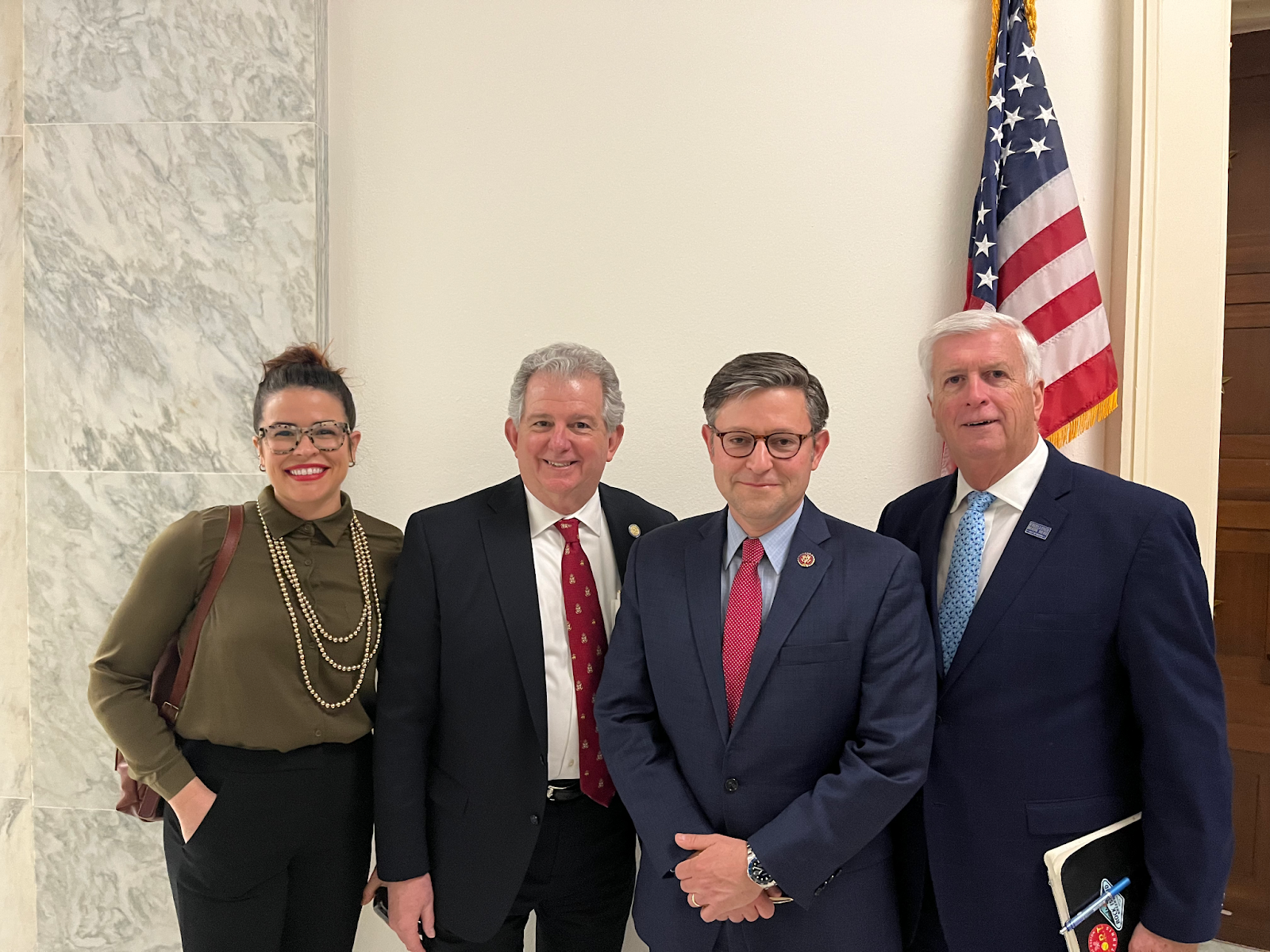
By telling these stories, the mayors were able to make considerable progress in the push for the I-20 Corridor—perhaps more progress than anyone else in the 30-year long effort to bring this service to the Deep South. For example, one of the most impactful visits was with two representatives from Texas whose districts would host part of the new service. None of our group was from Texas, but they made such a persuasive presentation that the two representatives decided to submit letters of support to FRA for the project. Members of Congress rarely make such commitments to non-constituents.

The passage of the Infrastructure Investment and Jobs Act (IIJA) in 2021 ushered in a once-in-a-generation opportunity to expand passenger rail. But taking advantage of this $100+ billion in federal funding will require the rapid coalescence of federal, state, and local governments. Mayors Ellis, Walker, Arceneaux, and Flaggs Jr. are demonstrating that local leaders are often best suited to make that push. Our job is to help them.

See more of the mayors’ visit by clicking through the gallery below.

New Community Connectors grant program and resources for advocates

A new grant program from Smart Growth America will help advance locally driven projects that will reconnect communities separated or harmed by transportation infrastructure and tap available federal and state funds to support them.

Removing divisive infrastructure is largely uncharted territory in the United States, but the need to fix the damage it has caused is imperative. Transportation infrastructure like divisive highways and dangerous arterial roads often separates and harms the communities living around them. This is particularly true for Black and Brown communities, who are more likely to live near large roads and have to live with the environmental, economic, and social harms they cause.

The movement to remove divisive infrastructure has often required communities to be pioneers and the lack of a roadmap and the nature of the work often meant that there were few others to easily learn from. The Community Connectors grant program aims to change that by providing financial resources to help build local capacity and advance these projects, but also by connecting local leaders to experts and other cities attempting to accomplish similar things.

Applications are due before July 15, 2023 at 11:59 p.m.

Who is eligible to apply for the program?

Community Connectors welcomes diverse, multi-entity project teams from small to mid-sized U.S. cities (between 50,000–500,000 in population) to apply for the program. Teams may consist of non-profit community-based organizations and advocates, government agencies (including U.S. territories), and tribes. For-profit entities may be part of the wider project team but are not eligible to receive any of the funds directly or indirectly disbursed through the grant or technical assistance.

What support will selected teams receive?

Selected teams will receive grants of up to $130,000 for capacity building and to advance their projects. In addition, the selected teams will also receive customized technical assistance and participate in a learning exchange program over the next 18-24 months, which includes an in-person convening in Atlanta, Georgia, in November 2023.

What kinds of projects are eligible?

We encourage teams to submit proposals for projects or concepts to reconnect communities separated or harmed by transportation infrastructure through an integrated transportation, land-use, housing and economic development approach. Applications for proposals at all stages are welcome. Teams are not required to have applied for or formalized an application for U.S. Department of Transportation programs.


The Community Connectors program is led by Smart Growth America in partnership with Equitable Cities, the New Urban Mobility Alliance, and America Walks and is supported by the Robert Wood Johnson Foundation.

Bonus: New tools for all “Community Connector” advocates

In coordination with this new grant opportunity, we have launched a brand new suite of resources to support all Community Connectors in communities of any size. These are the advocates all across the country who are working to reconnect their communities: fighting freeway expansions, advancing projects to remove old highways, making wide, dangerous arterial roads a little safer for people to cross, or just improving basic infrastructure people depend on each day.

While the new grant opportunity is limited, Transportation for America’s Community Connectors portal is for anyone, providing tools and information for advocates to decode the complex and confusing maze of programs, acronyms, and decision points that determine what gets built with federal and state transportation dollars.

Expect to hear much more about this new portal of resources. Our team will be regularly updating it with new explainers and stories over the coming months.

Want to get updates on new content? Be sure to sign up for our email list here.

House threatens funds for reconnecting communities

press release

The House’s debt ceiling package, H.R. 2811, proposes cuts to several programs, including the Neighborhood Access and Equity Program established under the Inflation Reduction Act. In response, T4A Director Beth Osborne issued the following statement:

“The Neighborhood Access and Equity Program is a valuable, needed investment that will support local economic development and knit communities back together across overbuilt and obsolete roadways. Governments across the country are looking for federal partners to build safer, better connected, and more prosperous communities. The program has not even begun, so now is not the time to strip the program’s funding. But that’s exactly what the House’s debt ceiling package H.R. 2811, also known as the ‘Limit, Save, Grow Act,’ would do.

“That’s why we’re leading a sign-on letter with organizations nationwide calling on Congress to keep the Neighborhood Access and Equity Program fully funded so we can realize the benefits of these critical investments.”

This letter can only be signed by elected officials and those authorized to represent their organization.

Sign the letter.

Greener Fleets: How federal dollars can supply the demand for clean transit

Electric buses line up in a brightly lit warehouse with an American flag in the background
Electric buses line up in a  brightly lit warehouse with an American flag in the background
Image source: Proterra

The Low and No Emission Vehicles (Low No) program saw a big increase in funding in America’s historic infrastructure law, but an outdated and arbitrary requirement is pushing transit agencies toward buses that still pollute. Here’s how Congress and the Federal Transit Administration can avoid locking in emissions for years to come.

While scientists have rung the alarms on climate change for decades, the 2021 infrastructure law is American policymakers’ first significant response. While unfortunately allowing for much climate-damaging investment in highway expansion, the IIJA also invests significantly in public transit systems including $5.5 billion over its five-year appropriation period for the Low or No Emission Vehicle (Low No) program—six times more than the program’s previous five years of funding. As the title suggests, the Low No program helps transit agencies transition their fleets to low- and zero-emission buses. Additionally, the IIJA provided nearly $2 billion in funding over five years for the closely-related Bus and Bus Facilities Program. While these programs are record-breaking for their level of investments in clean buses and supporting infrastructure, this legislation has flaws that are holding the nation back from cleaning up the bus fleet.

In October of 2022, Transportation for America filed a Freedom of Information Act (FOIA) request with the Federal Transit Administration (FTA) for a synthesis of all applications submitted to the Low No and Bus and Bus Facilities programs in fiscal year 2022 (FY22). We wanted to better understand how the programs are serving U.S. transit agencies’ needs and supporting America’s climate goals and emission reduction efforts. What we found was worrying.

As we wrote in Greener Fleets, a white paper we’ve submitted to Congressional leaders, we found that the program encourages transit agencies to buy diesel hybrid and compressed natural gas (CNG) buses instead of zero-emission buses running on electricity or hydrogen. The root cause: 25 percent of the Low No program’s funding is reserved for low-emission (as opposed to zero-emission) projects. This is artificially constraining the supply of zero-emission funds, locking in unnecessary transit emissions for decades.

Low No is coming up short

Applications for grants in FY22 for zero-emission projects of the Low No and Bus and Bus Facilities programs were in extremely high demand, composing 86 percent of the combined two programs’ grant requests. 

The Bus and Bus Facilities program does not place constraints on fuel types when considering awards, focusing on the applicant’s project rating (Highly Recommended, Recommended, Not Recommended). Still, as shown in the graph below, zero-emission projects had a one in six chance of being awarded while consuming 83 percent of the program’s available funding.

Bar chart showing FOIA findings. Notable: over $2,780,000,000 was requested for no emission funding, but only $456,694,932 was awarded. Compare this to about $295,000,000 requested for low emission and $17,721,272 awarded.

The strong demand for zero-emission buses and facilities shows that transit agencies have gotten comfortable with relatively new electric and hydrogen bus products and are more ready than ever to invest in the zero-emission transition.

Bar chart depicting probability of winning a grant across all programs. Notably, low emission projects had a 100% chance of winning Low No funding, while zero emission projects had a 33% chance. On the Bus & Bus Facilities side, no emissions projects had an 18% chance, compared to a 27% chance for all other fuel types (low emission and traditional). More information in the paragraph below and in our white paper linked at the bottom of this post.

The Low No program is statutorily required to reserve 25 percent of available funds for projects using low-emission fuels, such as CNG, diesel-electric hybrid, and propane. In other words, even though 88 percent of applications were for no-emission buses and facilities, FTA was required to award 25 percent of the funding to more polluting low-emission projects. Due to this requirement, as shown in the graph above, nearly 100 percent of the low-emission projects received an award, while more than two-thirds of clean zero-emission applications were rejected. There weren’t even enough low-emission projects in the application pool to meet the 25 percent requirement.

We were concerned that this funding acceptance rate would encourage American transit agencies to give up competing for zero-emission funds (in extremely high demand), and instead apply for the less competitive low-emission funding. Based on early trends in FY23 applications, our concerns were justified. More transit agencies are competing for low-emission project funding than in FY22, putting them on track to deploy buses that will continue polluting for a decade or more, and slowing the development of an EV transit bus supply chain.

How did the 25 percent requirement come to be?

In 2015, the law that outlined the details of the Low or No Emission Vehicle program was passed by the U.S. Congress and Senate. Senator Toomey of Pennsylvania argued for a mandate to require funds be reserved for low-emission vehicles in the legislation. He successfully included a statutory requirement that 25 percent of the Low No program funding go to projects using low-emission fuels, such as CNG, a key product of Pennsylvania, whose natural gas production is second only to Texas. This statutory requirement to subsidize fossil fuels in an age of energy transition leads the IIJA to invest 1.4 billion over this 5 year authorization period in buses that still pollute.

Change the status quo

The Low No and the Bus and Bus Facilities programs are essential to ensuring American transit agencies can replace their aging bus fleets with low and zero-emission vehicles, and transit agencies are clearly eager to rise to the challenge. Congress can do more to ensure that these programs are working to accomplish emission reduction goals. They could start by eliminating the outdated and arbitrary requirement that 25 percent of Low No funding goes to low-emission vehicles. But they should go further: increasing funding for both programs to meet the overall demand for buses and facilities; creating incentives for both programs to leverage other funding sources; and increasing transparency of the program by making basic application and award information available on FTA’s website and looking for ways to simplify the application process. 

Ultimately, Congress and FTA should work together to form a vision for how the Low No and Bus and Bus Facilities programs can support American transit agencies in providing excellent transit service in our communities and converting their operations to zero-emissions rapidly enough to meet greenhouse gas reduction goals and improve air quality in the communities they serve.

Greener Fleets: Meeting the demand for cleaner transit

For more information on this problem and how to solve it, read Greener Fleets: Meeting the demand for cleaner transit.

Is the federal government squandering clean transit funds?

press release

A new report shows splitting clean transit funds between zero-emission vs. low-emission is holding U.S. transit agencies back from cleaning up the bus fleet.

WASHINGTON—A new report by Transportation for America (T4A), “Greener Fleets: Meeting the Demand for Clean Transit,” examines the Low or No Emission Vehicle (“Low No”, “5339(c)”) and Buses and Bus Facilities (“5339(b)”) grant programs. The report finds that zero-emission projects were in high demand, representing 95% of Low No funds requested in applications last year, and relatively few project applications were funded. In comparison, low-emission projects made up such a small proportion of applications that nearly all applications were funded with money left over in that category. 

Higher demand for zero-emission grants significantly lowered the probability of accessing zero-emission project funds. The report finds that this discrepancy could incentivize transit agencies to change their clean transit plans in favor of low-emission vehicles that still pollute. Click here to read the report, executive summary and access graphics.

“Seeing this kind of demand for electric public transit buses shows that America is ready for mass adoption, and we need to revise these programs to reflect that new reality,” said Chris Rall, outreach director for T4A. “Our number one recommendation to improve the programs is to remove the outdated and arbitrary split between zero- vs. low-emission categories to ensure 100% of the funds find their best use.”

U.S.-based transit fleets compete for Low No program grants to help them transition to the lowest polluting and most energy-efficient transit vehicles. Last year, the program received $1,105,329,750 in funding, of which 25% must go to low-emission buses and facilities such as diesel hybrid buses, compressed natural gas (CNG) buses and fueling infrastructure. The remaining 75% is for using electricity and/or hydrogen as a fuel for zero-emission buses and facilities. The report finds that this 75-25% funding split is unsustainable.

“As an industry leader in clean transit, we see Low No funds as essential for helping transit agencies like ours transition to modern electric buses that deliver service at a lower operational cost with zero tailpipe emissions,” said Corey Aldridge, CEO and General Manager of Mountain Line, Missoula, Montana’s transit agency, which has been transitioning its fixed route fleet to be fully electric since 2017. “The data in this report is intriguing. We encourage the legislature to consider its recommendations. Updates to the program could help fleet managers access the cleanest vehicle technologies that make the most sense for them.”

Using data collected from a Freedom of Information Act (FOIA) request from the U.S. Department of Transportation, the T4A research team analyzed applications submitted by American transit agencies to the Low No and 5339(b) programs funding. 

TOP FINDINGS

  • Overall, transit agency-requested funding exceeded awards by over 4.5 times in the combined programs. Requested zero-emissions project funding made up 86% of all requested funding.
  • Low-emission projects in the Low No program were so undersubscribed that every low-emission applicant received an award regardless of the project rating (Highly Recommended, Recommended, Not Recommended). 
  • In contrast, applicants with zero-emission projects had only a 33% chance of receiving any funding. In the 5339(b) program their chances were even lower, at just 18%

“Congress’s goal was not to drive a shift in demand and investment toward low-emission projects at the expense of investments in zero-emission transit,” continued Rall.  “This trend could lock transit agencies into more polluting technologies for decades.”

The report concludes that this unbalanced dynamic creates a strong incentive for agencies to avoid applying for zero-emission projects and instead use the Low No program to apply for funding for diesel-electric hybrid buses. This is already evidenced by the fact that applications for low-emission projects are up for the 2023 application window.

Here is a summary of the report’s recommendations for improving the programs:

  • Eliminate the arbitrary requirement that 25% of Low No funding goes to low-emission vehicles.
  • Increase funding for both 5339(b) and Low No to meet the overall demand for buses and facilities.
  • Create incentives for both programs to leverage state, regional, utility, and local funding to encourage applicants to propose zero-emission projects at scale and increase the return on investment.
  • Reduce the matching funding requirements of Tribes and Justice40 communities.
  • Increase transparency by making basic application and award information available on the Federal Transit Administration’s website.
  • Simplify the application process and help agencies understand how to make their applications competitive.

“As the market of zero-emission vehicles grows and changes, so must our programs that support the transition,” said Rall. “The increased demand for zero-emission projects is a good thing. We can update these programs to make them better for transit agencies that want to save money and clean up their air.”

“The Champaign-Urbana Mass Transit District has stepped out as a leader in transitioning to zero emission vehicles. Our hydrogen fuel cell electric buses run on hydrogen that we produce on-site utilizing 100% renewable solar energy, said Karl Gnadt, managing director for Champaign-Urbana Mass Transit District (MTD). “The remainder of our fleet is made up completely of hybrid buses so we have long appreciated the value of low emission vehicles as well. However, as zero emission technologies advance, we believe it is time to focus on a national transition to zero emission buses. Removing the dedicated low emission set aside within the Lo-No grant program will allow the program to be more responsive to transit’s needs.”

###

San Juan, PR: Trampling communities and a national rainforest in the name of “economic progress”

Aerial view of Puerto Rico prior to PR 66 construction with forest and aerial view of PR 66 after construction with forest construction and sprawl

Deemed a project of major economic significance for several decades by the Puerto Rico’s Department of Transportation (DTOP), the agency rammed through community opposition, environmental review processes, and legal battles to construct PR-66, a limited access tollway that is benefitting few and scarring communities and their environs.

Aerial view of Puerto Rico prior to PR 66 construction with forest and aerial view of PR 66 after construction with forest construction and sprawl
Images of PR-66’s Construction in February 1999 (Source: A. Casas-Macias, UAGM) vs Present Day (Google Earth)

History and context

As its historically rural population rapidly urbanizes, Puerto Rico has been iterating ways to stimulate and diversify its economy and facilitate speedy travel. Because of its status as a US territory, Puerto Rico’s transportation policy and investment strategy has been molded by an auto-centric lens pushed by both Washington and private sector investors filling transportation funding gaps for decades. However, federal transportation investment in Puerto Rico has been scant. (For example, in fiscal year 2022, Puerto Rico received $173 million in federal funding from the 2021 infrastructure law. Compare that to Utah, with the same population receiving $460 million or Connecticut, with slightly larger land area receiving $665 million.) Because of limited transportation funding, Puerto Rico has had to rely on private sector investment, which prioritizes roads with tolls over transit.

In the 1960s, inspired by the Eisenhower Interstate Plan, Puerto Rico created its Highway Development Plan with the goal of creating high speed roadway connectivity of the various island communities to San Juan. From this plan, all but one of those highways were built by the 1990s. The highway yet to be built would prove to be the most hotly contested. 

PR-66, as envisioned by the Puerto Rico Department of Transportation and Public Works (DTOP by its Spanish acronym), connects PR-1 (the historic route between San Juan and Ponce) and PR-52 (an expressway parallel to PR-1) to PR-3 (the historic route that connects the eastern island communities to San Juan) and the PR-53 northeastern terminus.

Aerial view of PR 66 proposed route. More information available in the paragraph above.
Approximation of the originally proposed PR-66 Corridor route

A hard-won battle over federal regulations

Development of this 31-mile 4-lane tollway corridor started in 1992, when the National Environmental Policy Act (NEPA) process began. This process required the DTOP to assess environmental considerations, such as noise, water, air pollution, stormwater runoff and erosion, impact to historical resources as well as community displacement.

DTOP justified the route by arguing it would reduce congestion (reducing travel time from Fajardo to San Juan by 30-40 minutes each way), increase travel time reliability for vehicles, and stimulate economic growth and job creation in the corridor.

Communities along the proposed corridor were caught off guard as the NEPA process got underway. A sole public meeting on project impacts was held two days before New Years Eve 1992, providing little to no information to the community, soliciting minimal feedback, and yielding a questionable Environmental Impact Statement (EIS). In May 1993, the Environmental Quality Board (JCA in its Spanish acronym) provided preliminary feedback on the EIS, stating that the EIS was only analyzing economic impacts and failing to assess other critical aspects of the NEPA process which include displacement, environmental degradation (like runoff, erosion, and noise), and never exploring alternative solutions to achieve the project’s purpose and need. Additionally, the JCA questioned DTOP’s vague analysis, as well as its statements on where and what it intended to build in the corridor. Despite some procedural setbacks, DTOP proceeded to develop the project and move to finalize the EIS. By the mid 1990s, DTOP began to seize homes and businesses via eminent domain to clear the way for road’s construction. 

A local resident, Wanda Colón Cortés, was outraged with how DTOP was skirting the NEPA process, and she created a group of community members called the Communities Opposed to Route 66 to oppose the project. The demands from Communities Opposed to Route 66 were crystal clear: stop any construction and thoroughly evaluate the corridor for a broad array of alternatives and their impacts as required by NEPA. They reasoned with DTOP and JCA that they agree with the purpose and need of the project, but want to ensure a fair, thorough, transparent process. 

Rather than address the community’s comments, DTOP amended the EIS in February 1996 to shorten the corridor, and JCA declared this EIS adequate in May 1997. In 1997, arguing that the EIS determination was premature, Communities Opposed to Route 66 took both DTOP and JCA to court. The case would be interfered with by the Puerto Rico legislature, and go all the way to the Puerto Rico Supreme Court by 1999. The community group declared victory in April 2000, when the Puerto Rico Supreme Court issued its ruling, determining that:

  1. The legislature’s involvement violated separations of powers and deemed their actions unconstitutional,
  2. JCA could not be edited out of the environmental review process as DTOP and the legislature attempted, and 
  3. The NEPA process needs to be thoroughly followed for the full proposed corridor, not just its segments.

A highway slowed but never stopped

After DTOP was defeated in court, it went back to the drawing board and prepared a new EIS draft in late 2001, focused exclusively on a 13-mile segment of the original corridor (now Canovanas to Carolina). When presented with this proposal, the community again expressed discomfort over environmental impact and community displacement. So DTOP tried again, and in 2002, they prepared an EIS that placed the corridor further away from the existing community—encroaching into the El Yunque National Rainforest instead. Because this proposal impacted fewer community members, community opposition dwindled. DTOP was then able to finalize the EIS in late 2002, with construction of the corridor starting by summer 2003.

The PR-66 toll corridor would fully open in October 2012 under a 50-year public-private partnership agreement, but it was not without other issues along the way. On multiple occasions, the project required additional funding to continue and complete construction, with $160 million for seizing other properties along the corridor. In late 2006, the Northeast Ecological Corridor Coalition blasted DTOP in an op-ed for El Nuevo Dia (the island’s main newspaper) for not doing enough to mitigate environmental harm and failing to follow through on its promises in the EIS. 

That coalition also emphasized that the JCA needs to fulfill its role in reviewing and providing oversight on DTOP’s environmental mitigation, especially on stormwater runoff, erosion, noise and air pollution, water quality, and deforestation. This sentiment was shared by Fanny Peña Roque, a community advocate, who called out DTOP for not mitigating community access to jobs and services for their cut off mountainside community to facilitate speeding up construction. Her community remained cut off for months, even after the highway project was completed. 

The coalition also tried to raise the alarm on the impact PR-66 has and will continue to have on incentivizing new suburban sprawl and the incongruent development across communities within the corridor (with even some new developments caught in the crosshairs of the corridor for seizure after recently being approved and/or built). But these calls never gained momentum. 

Ten years have passed since the full opening of the PR-66 corridor. Traversing it today traffic volumes are very low (no more than 30k average annual daily traffic volume), roadway fatalities high, erosion and flooding impacts a regular occurrence, and toll rates are very high (at 30 cents per mile, it is the second most expensive roadway in the United States) with deliberations in the past year to increase toll rates to help with the project’s debt service.

Lessons for budding Community Connectors

Photo of the PR 66
PR 66 eastern termini at Rio Grande, looking westbound (Image from Wikimedia Commons)

Understand the regulatory tools at your disposal—and don’t be afraid to use them. As other communities look to challenge divisive transportation infrastructure, it will be important for advocates to be informed about the NEPA process and related regulatory requirements, and hold firm on accountability of those requirements. However, NEPA alone won’t be enough. 

Find your message and hold your vision, even as circumstances change. Community advocates fighting the PR-66 project needed to have a vision beyond protecting homes and buildings. Yes the project impacted homes and businesses, but advocates were unable to translate the messaging and sustained attention more broadly when DTOP revised the corridor footprint and continued developing and building the project. 

Recognize project alternatives. Advocates should also try to articulate a clear alternative approach to address the project’s purpose. Then Governor Luis Fortuño in a 2011 conference keynote (and under the backdrop of community protests) blasted opponents of the project, stating “Puerto Rico can’t permit the well being and progress of our community to be held hostage by people who think all progress is bad.” To address this issue, community connectors should work with other stakeholders to inclusively formulate an alternative vision/strategy to tackle the aspirations of present and/or proposed divisive transportation infrastructure.

Community Connectors: tools for advocates

You may be fighting against a freeway expansion. You may be trying to advance a Reconnecting Communities project to remove an old highway. You might be just trying to make wide, dangerous arterial roads a little safer for people to cross. This Community Connectors portal explains common terms, decodes the processes, clarifies the important actors, and inspires with helpful real-world stories.

Is your state missing the bus? Evaluating state transit access and ridership

Transit riders representing a range of ethnicities board a bus in the state of Washington

The state you live in plays a major role in the quality of transit near you. Back in February, we took a look at state financial support for transit. This post focuses on the results of those investments.

Transit riders representing a range of ethnicities board a bus in the state of Washington
Flickr photo by Seattle DOT.

We partnered with the National Campaign for Transit Justice and the Labor Network for Sustainability to assess the quality and support of transit systems across all 50 states, the District of Columbia, and Puerto Rico.

In our first post of this series, we focused on state transit funding. But the level of funding transit has received doesn’t necessarily line up with how easily residents are able to use transit on a regular basis. To understand that piece of the puzzle, we focused on two metrics: quality of transit access and how often residents choose driving over transit.

Measuring transit access

Public transit becomes a viable option only when people are able to rely on it for quick, convenient travel to their essential destinations. But, as we wrote back in 2021, while about 80 percent of people in the US live within areas classified as “urban” (which includes the suburbs of urban centers), less than 10 percent of Americans live within walking distance of reliable, high quality transit that comes every 15 minutes. And 45 percent of Americans have no access to transit at all.

To get a better understanding of transit access in each state, we took a look at data from the Environmental Protection Agency’s Smart Location Database to get a sense of how well transit was connecting people to their essential destinations. The EPA collects the number of jobs within a 45-minute drive and the number of jobs within a 45-minute transit ride. From that information, we were able to compare the number of jobs accessible by driving and the number of jobs accessible by transit.

But we couldn’t stop here. We found that some states, like New York, have dense, transit-rich cities with more jobs accessible within a 45-minute transit ride than within a 45-minute drive. This didn’t mean transit access was well-distributed across the state.

To better understand transit access for all state residents, we looked at regional parity, meaning the average person’s access to jobs by transit compared to the most transit-rich areas around them. We found that New York and Hawaii, which initially scored near the top for transit access, did not have consistently strong transit networks throughout the state. 

Map of quality of transit access by state according to our research (described in the above paragraphs of this section). Results in the last two paragraphs of this section.
Map is not drawn to scale.

We took the average of these combined factors to determine the quality of transit access in each state, shown on the map above. Oregon and DC had the highest transit access, while 20 states (Alabama, Arkansas, Connecticut, Georgia, Indiana, Kansas, Kentucky, Louisiana, Maine, Michigan, Mississippi, Missouri, North Carolina, Ohio, Oklahoma, South Carolina, South Dakota, Tennessee, Texas, West Virginia, and Wisconsin) had the lowest access scores.

These scores don’t include Puerto Rico because the EPA’s Smart Location Database doesn’t include data on access to jobs via car or transit for Puerto Rico. The EPA, and the federal government as a whole, should work to capture this information for all U.S. territories in order to provide a stronger picture of the return on federal investments.

Transit ridership (or lack thereof)

Vehicle miles traveled (VMT) is the measure of the total miles driven by all vehicles on a given state’s roadway in a given year. VMT is usually used as a measure of roadway usage, but here, it functions as a proxy measure for transit usage by measuring its inverse: car usage. We assume states with more driving on average also have less transit ridership on average.

During the COVID-19 pandemic, more people drove less often and transit ridership also dipped dramatically. To provide a more a relevant picture of travel habits, we looked at travel data from 2019.

Eight states and territories had less than 8,500 VMT in 2019, and so transit ridership in these states is likely high. They include: Oregon, Illinois, Washington, Alaska, Pennsylvania, Hawaii, Rhode Island, New York, and DC. The areas with the highest VMT (and therefore lowest transit ridership) were Puerto Rico, Wyoming, and Alabama.

Map of vehicle miles traveled by state. Key findings in the paragraph above.
Map is not drawn to scale.

What’s next?

In the final part of this series, we’ll share the combined scores for each state so you can see how your state ranks overall in transit support and availability, including the specific data we used for our analysis. Stay tuned!

Senators call on President Biden to take national approach to passenger rail

Senator Cruz smiles as he speaks into a microphone in front of a shiny backdrop

Members of the Senate are stepping up to the plate to support passenger rail service across the country. Two sign-on letters from Senator Ted Cruz (R-Texas), the new ranking member of the Senate Committee on Commerce, Science, and Transportation, urge the administration and federal agencies to do right by the national network.

Senator Cruz smiles as he speaks into a microphone in front of a shiny backdrop
Flickr photo by Gage Skidmore

Senator Roger Wicker (R-Miss.), a long-time champion of passenger rail, announced last year that he was stepping down as ranking member of the Senate Committee on Commerce, Science, and Transportation. Some rail advocates were concerned that his replacement, Senator Ted Cruz (R-Texas), would not be interested in picking up the mantle on rail.

But Senator Cruz’s first moves as ranking member—two sign-on letters advocating for Amtrak’s national network—are very encouraging. One letter calls for better representation on the Amtrak Board for the national system, while the other calls for distributing rail infrastructure dollars more equitably between the Northeast Corridor and the rest of the nation. Let’s dig in.

Letter 1: Diversify the Amtrak Board

In his first letter, Cruz points out that five of President Biden’s six nominees to the Amtrak Board of Directors are from the eight states that constitute the Northeast Corridor (NEC). He correctly argues that this violates the language laid out in the Infrastructure Investment and Jobs Act (IIJA), which requires a geographically diverse board, not to mention being patently unfair to the other 42 states in the Union.

Cruz’s request to the president was simple: “withdraw one of your Democratic nominees from the Northeast Corridor and replace that person with a nominee from outside the Northeast Corridor.” Six other senators signed onto this letter: Todd Young (R-IN), Roger F. Wicker (R-MS), Jerry Moran (R- KS), Marsha Blackburn (R-TN), Eric Schmitt (R-MO), and JD Vance (R-OH).

Senator Jon Tester (D-Mont.) recently went even further, sending the president back to the drawing board by personally blocking all of his nominees. All told, the Senate’s message to President Biden is clear: the Amtrak Board needs to represent the whole country, not just the Northeast Corridor. (Frankly, we are surprised Sen. Cruz doesn’t have partnership from other Democrats from outside the Northeast.)

Our take

Transportation for America has long maintained that for the Amtrak Board to represent the whole country, it must have members from across the whole country. T4A’s Chairman John Robert Smith served as chairman of the Amtrak Board after serving 16 years as the mayor of Meridian, Mississippi. His experience of riding Amtrak trains outside the Northeast Corridor as well as the then-new Acela service, provided him a valuable perspective that most of President Biden’s current nominees lack. For this reason, we agree wholeheartedly with Sen. Cruz’s letter.

But the letter leaves out some key issues. While those who signed this letter are  right about the problem with the president’s slate of nominees, they omit the role the Senate GOP has to play. Senate Republican leadership is responsible for deciding which Republicans the president will nominate, since the Amtrak Board consists of an equal number of Republicans and Democrats. Yet the GOP has put forth only one of their four nominees and the one is from the Northeast.

In order to get a full picture of this prospective Amtrak Board, we need a full slate of nominees—Democrats and Republicans. It’s past time for Senate GOP leadership to put forward a geographically diverse slate of Amtrak Board nominees, and we would have liked to see this letter address that.

We nonetheless applaud the Senators’ efforts as well as Senator Cruz’s leadership on this issue, and will support him in holding the Biden administration to the requirements in the IIJA. He is building on the work that Sen. Wicker and Sen. Cantwell (D-Wash.) have done to steer Amtrak toward a national vision for passenger rail.

Letter 2: Spread the Fed-State wealth

In his second letter Cruz, along with his fellow committee Republicans, writes that the Federal Railroad Administration (FRA) has inappropriately  prioritized the NEC and barred the rest of the country from key infrastructure dollars. His particular gripe is with FRA’s rollout of the Federal-State Partnership for Intercity Passenger Rail (Fed-State) program, a $43.5 billion competitive grant program that funds rail infrastructure improvements nationwide.

The IIJA states that at least 45 percent of Fed-State grants shall go to the 8 NEC states and at least 45 percent shall go to the 42 non-NEC states (the National Network). Those figures were amended in the Consolidated Appropriations Act of 2023 (the annual spending bill) to increase the maximum  amount of Fed-State funding that FRA can allocate to the NEC to two-thirds of program dollars. Implicitly, that would lower the guaranteed amount of funding for the rest of the country to one third, but the law does not explicitly say that.

FRA chose to immediately use their new discretion to max out the possible funding for the NEC to two-thirds of this year’s Fed-State grants.  In their notice of funding opportunity (NOFO) for the Fiscal Year (FY) 2023 round of Fed-State grant applications, they broke the National Network and NEC into two separate pools of funding. 

This move ensured that the NEC would receive the maximum amount of funding allowed by law (two-thirds of program dollars, or $9 billion) and the National Network would receive the minimum amount (one third of program dollars, or $4.5 billion). Cruz and his fellow Commerce Committee Republicans argue that this move essentially deprives the National Network of $7  billion worth of Fed-State funding, using a legal loophole to evade the intended use of IIJA dollars.

Our take

Senator Cruz is spot on. This issue is actually fairly simple: FRA should use its discretion to equitably balance the needs of 8 states along NEC and the 42 states in the rest of the country. The 2023 spending bill did not specifically repeal the 45 percent guarantee to the non-NEC national system and, therefore, FRA should do everything they can to adhere to that law that was passed with bipartisan support. FRA should certainly not exercise its discretion in a way that violates the written—and unamended—text in the US Code.

This letter gets at an issue we’ve harped on before: the importance of a national approach to passenger rail. One of the reasons that support for  Amtrak has been so bipartisan is that it serves the whole country. If Amtrak becomes a creature of the Northeast that doesn’t care about the other 42 states, it will quickly lose political support and likely funding.

FRA’s counterargument to Sen. Cruz’s point might be that the NEC has a pipeline of large, important projects ripe for Fed-State dollars, so it should receive funding commensurate with that pipeline. But that’s because the federally-funded Northeast Corridor Commission has had 15 years to plan and develop that pipeline. The rest of the National Network is only just beginning that process, with the creation of the Interstate Rail Compact program (IRC) and Corridor Identification and Development Program (CIDP) in the IIJA. They should not be punished for chronic federal underinvestment and lack of planning support. This administration needs to focus on the national passenger rail system in a way that gives those 42 states the chance to catch up and have a fair shot at the Fed-State grants and indeed all FRA dollars.

If the FRA wants the National Network to have a better pipeline of shovel-ready projects for the Fed-State program, it can hasten the rollout of the IRC and CIDP and provide technical assistance to build momentum for passenger rail in the Deep South, the Pacific Northwest, and other regions eager to build up their rail connectivity.

Advocates call for White House council to track and reduce emissions

A man rolls a stroller down a wide sidewalk along a tree-lined street with a painted bike lane and crosswalk

While NEPA exists to protect the environment and communities, it has long fallen short of addressing climate emissions and protecting disadvantaged communities. In response to a call for comments about new guidance on climate change and greenhouse gas emissions, Transportation for America joined a nine-member working group to urge the White House to address transportation’s role in climate emissions and historic injustices. Read the full comments here.

A man rolls a stroller down a wide sidewalk along a tree-lined street with a painted bike lane and crosswalk
Streets like this one allow for multiple modes of travel, helping to reduce emissions from personal vehicles. Flickr photo by Billie Grace Ward.

On January 6, 2023, the White House Council on Environmental Quality (CEQ) released Guidance on Consideration of Greenhouse Gas Emissions and Climate Change, directing federal agencies to improve the evaluation of climate impacts in environmental reviews as part of the National Environmental Protection Act (NEPA) process. 

The CEQ, created in 1970 with the passage of NEPA, is a body that oversees federal agencies’ implementation of NEPA-required environmental assessments of federally funded projects. As the lead body for the NEPA process, the CEQ’s Guidance determines the scope of scrutiny that projects must undergo through the NEPA process. However, for decades, the NEPA process and the CEQ have ignored or understated the significant role that federally approved transportation projects play in contributing to climate change emissions and overburdening Black and Brown communities.

The current approach from CEQ allows agencies like the Federal Highway Administration (FHWA) to sign off on faulty traffic models that fail to account for the role increased highway capacity has in increasing car usage and the associated CO2 and fine particle pollution that follows. Inaccurate models used today often project, paradoxically, that new highways will reduce harmful emissions. But decades of previous experience have consistently shown that these projects worsen the congestion problems they were built to solve, while harming the communities they go through.

New highways, roads, and lanes are proven to induce more driving, a process called “induced demand.” Read more on induced demand and its impact on emissions here.

In response to the White House’s call for public comments on the CEQ interim guidance and in partnership with Coalition for Smarter Growth, Elders Climate Action, Equiticity, Institute for Transportation Development Policy, National Association of City Transportation Officials, Sierra Club, RMI, and the Southern Environmental Law Center, Transportation for America called for the CEQ to improve its Guidance to accurately measure, report, and minimize the production of greenhouse gasses from the transportation sector, one of the nation’s most polluting sectors. To do so, the coalition urged CEQ to take the following actions:

  • Ensure that transportation agencies’ actions and plans reduce emissions in order to meet the country’s international commitments to cut greenhouse gas emissions. 
  • Direct FHWA and states to include realistic assessments of how transportation infrastructure investments could contribute to or reduce greenhouse gas emissions
  • Devise criteria in the NEPA process that prioritizes actions to reverse damage to community health from transportation infrastructure projects.

By taking into account these comments and other points included in the working group’s response to the Guidance, the CEQ can align the NEPA process with national climate policy. More detail on why the Council on Environmental Quality should consider these goals and how they would achieve them is included in the full comments document.

Read the full comments

Reconnecting the Hill District to downtown Pittsburgh

A brightly colored mural decorates the side of a building in the Hill District

In its heyday, the historic Hill District neighborhood was bursting with life. It was full of opportunities and culture; residents treasured it. After slowly cultivating a unique identity through generations and incremental layers of growth, it was nearly destroyed in just a few short years through the building of I-579 and the Civic Arena. Now, 60 years later, some connections are being restored.

A brightly colored mural decorates the side of a building in the Hill District
Mural of playwright August Wilson, who once called the Hill home. Photo from the City of Pittsburgh.

A cultural district cut off from downtown

The Hill District of Pittsburgh, Pennsylvania, located just to the east of the core of downtown Pittsburgh began as a community of freed Black men and women early in the 20th century. As the city’s first Black district, it became a “cultural icon,” known for its jazz scene, radio station, and weekly newspaper, the Pittsburgh Courier. Following World War II, the Hill’s aging housing infrastructure, in conjunction with “crime and disease” (how the city defined it) became the basis to justify drastic urban renewal. Over 95 acres were condemned by the city. Developers came in and began taking houses by eminent domain to “revitalize” the neighborhood. This was the beginning of a swift downfall for the Hill District.

Black and white photographic of a highway cutting through Pittsburgh, with a small segment of the highway outlined in green
Aerial view of Hill District (right) separated from downtown (left) by I-579, with project site for the “cap” connector outlined in green. Historic photo from Pittsburgh-Exhibition Authority.

The plan for I-579, which today cuts directly across Pittsburgh and crosses the Allegheny River to connect with I-279, was conceived almost a decade before any work began. In 1949-1950, there were ongoing conversations about building a highway from Liberty Bridge to Grant Street, at the the end of Bigelow Boulevard. This would cut across the Golden Triangle, enabling a quicker, less congested commute across the city. After a few years of back-and-forth over route and cost, the city and county finally agreed to split the cost of an “82-foot-wide, six-lane expressway.” The City Council passed an ordinance establishing the right-of-way for the partially elevated, partially below grade project, cutting through the Hill District. The repercussions of the expressway on the Hill District were either never considered or blatantly ignored.

Pittsburgh Post Gazette black and white aerial photographs of the Hill District before demolition (rows of clustered buildings) and after (large, cleared area for the arena and highway)
A before and after of the changes made to the Hill.

In 1957, much to the City Planning Commission’s displeasure, the state announced that Crosstown Boulevard would be part of the newly created national Interstate System and moved forward with a larger, wider highway than they had originally approved, now backed by federal dollars.

The expressway, built in two sections, was completed by 1964. Simultaneously (1961) a new arena (home to the NHL’s Pittsburgh Penguins) and adjacent parking were constructed in the Hill District (South Side). All told, the destruction required to build I-579 and the greater urban renewal efforts resulted in the displacement of over 8,000 predominantly Black residents and 400 locally owned businesses. In addition, almost overnight, the Hill District was cut off from downtown right next door. 

“The massive highway constructed at the base of the arena severed the residents of the Middle and Upper Hill from downtown and any kind of continuity with civic life,” according to this piece in Belt Magazine. For residents of this low-income neighborhood, in a (previously) well-connected central location, walking to work, or walking to access essential needs and services, was no longer an option. By the mid-1980s, the Hill District had “deteriorated into a shell of its former self.”

A path forward: The “Cap” Connector

Streets form an open square over another segment of roads
The open square is filled in with green space and sidewalks, allowing pedestrians to walk over land that was once entirely highway

Before and after cap construction. Photos from HDR, Inc.

Today, there is a new cap over a portion of I-579, creating a limited new connection between the Hill and Downtown, restoring access to employment, education, and services—now known as Frankie Pace Park. The cap and park were built (2019-2021) in the open air space above a portion of the below grade I-579 just to the west of the old Civic Arena site The project was initiated by the Penguins’ move into a new arena a few blocks away in 2010, after which the owner of the Penguins demolished the arena and replaced it with 28 acres of parking. The Urban Redevelopment Authority threatened to take one-fifth of the parking revenue unless 6.45 acres were redeveloped by 2020. The Penguin’s owner acquiesced. Approximately half of this land would become Frankie Pace Park, the remainder would be used for mixed-use development.

The space includes bicycle, pedestrian, and ADA access through and around the three acres of land, as well as rain gardens, performance areas, recreation space, and other public amenities. Improved sidewalks, lighting, and signage were included in the project for improved safety and use at all times of the day, as well as curb-cut ramps and enhanced crosswalks at intersections leading into the space.

This project was funded by a combination of federal and state sources including: USDOT through a TIGER (round 8) grant, PA Redevelopment Assistance Capital Program, PA Department of Transportation (Multimodal PennDOT), PA Commonwealth Financing Authority (Multimodal DCED), and PA Department of Conservation & Natural Resources (DCNR Keystone Recreation, Park and Conservation Fund). Several local agencies and foundations also provided funding.1

An additional aspect of this project was its location near an existing subway station, a new bus stop, and a (then) proposed bus rapid transit system (BRT). In March 2023, the Pittsburgh Regional Transit announced approval for the first phase of this project, connecting Downtown, Uptown, and Oakland. Five new stations will be added downtown, including one at Steel Plaza station, made more accessible to Hill District residents by the new park. The electric buses will move along dedicated lanes to ease congestion and improve commuter efficiency.

Map of proposed rapid transit (description in caption and in text above)
Map of proposed BRT. The red route indicates bus-only lanes and shows the new proposed stops between downtown (far left) and Oakland (middle-left).

Still more work to do

In August of 2022, Pittsburgh received a federal RAISE grant to further address the harms caused by I-579. Projects funded by the RAISE grant, including curb extensions, new sidewalks, and intersection improvements, will help make the Hill District a safer place to walk for those who are still left in the Hill District.

From the looks of the new park, it can be deemed a success. However, this new park and new connections do not address the issues of past and current displacement and harm that was done to this community over decades, and which continues today.

Lessons for budding community connectors

Transportation and land use are inherently intertwined. As we advocate for development, and redevelopment, and fight to reconnect communities, we must always consider how one variable impacts the others—at the micro and macro levels. The building of I-579 had tremendous repercussions on housing and access (to employment, healthy food, community services, etc). That transportation decision to cut an entire neighborhood off from opportunity to serve thru-commuters had cascading effects on land use decisions across the region. And then 60 years later, the land use decision to create the cap created valuable new transportation connections between the Hill District and downtown. These decisions are inexorably connected.

Projects like these can require significant cooperation and a diverse range of funding sources. Building an interstate is relatively simple—the federal government provides 90 percent of the funding for the project. But Frankie Pace Park, which took nearly a decade to develop, required the cooperation of multiple local, regional, and state agencies, leverage placed on private landowners, and funding from a wide range of sources. Engaging a broad range of stakeholders is required for these complex projects, so get everyone to the table.

The cap is a band-aid on a historical wound. The cap and new park, although successfully built, doesn’t do enough to right historical wrongs and steer the benefits to come from the connection to those who were displaced. The best intentions are no replacement for listening to, including, and prioritizing the voices of those who lost their neighborhood in the first place. Successful reconnecting communities projects should reflect the needs and goals of the existing community, and that can only happen by engaging everyone in the process and empowering them to shape the final product.

Community Connectors: tools for advocates

You may be fighting against a freeway expansion. You may be trying to advance a Reconnecting Communities project to remove an old highway. You might be just trying to make wide, dangerous arterial roads a little safer for people to cross. This Community Connectors portal explains common terms, decodes the processes, clarifies the important actors, and inspires with helpful real-world stories.

Tracking damaging divides in Gretna, LA

Two sedans break as a train approaches, unable to cross

In an astonishing sight in this small southern city across the Mississippi River from New Orleans, daily freight trains run right down the center of their main street. Local elected leaders and the busy nearby port are hoping to relocate this incredibly disruptive freight rail line, but they’ll have to raise local and state money, negotiate with freight companies, and apply for federal support to make it happen.

Two sedans break as a train approaches, unable to cross
An incoming freight train blocks traffic on an busy road in Gretna, Louisiana. Photo courtesy of Jimbaux’s Journal.

For the people of Gretna, Louisiana, miles-long freight trains are a part of daily life. But in a far different way than other smaller cities with a few at-grade crossings. Multiple times a day, freight trains cruise down the middle of their main street at 15 miles per hour through 120 unprotected intersections, grinding the city to a halt. Vehicles stop, people can’t cross the street, and the noise swallows nearby conversations. If a parked car is in the way of the train, the train stops, blocking traffic, as the operator tracks down the owner to remove their vehicle. 

But the people of Gretna aren’t taking this lying down.

This project is one of 15 that we are supporting through our Community Connectors grant program to help small and mid-sized communities repair the damage of divisive infrastructure. Learn more about that program from our parent organization, Smart Growth America.

Impact on Gretna

Situated just across the Mississippi River from New Orleans, the small city of Gretna is a vibrant, historic, and diverse community that functions as a critical trade hub for the region due to its proximity to the Plaquemines Port Harbor & Terminal District. Gretna, like many communities on the lower Mississippi River, developed around the railroad to house the industrial workforce that the freight rail companies served. One side effect of this complementary growth, however, was that daily freight trains continued to run through Gretna. And we do mean through Gretna.

Today, in one of the most astonishing sights around, freight trains from Union Pacific (UP) and the New Orleans and Gulf Coast (NOGC) railroads run right down the middle of 4th Street and Madison Street in historic Gretna, dividing the city in half and stunting the city’s growth. To appreciate the full impact on the city and the people of Gretna, watch this video:

For 12 minutes, the train blocks all of Madison Street and passes through 120 intersections, blocking emergency vehicles, personal travel, and economic activity. In 2006, a resident’s home burned to the ground as an emergency vehicle was held up for 20 full minutes, separated from the house by a passing train. 

In addition to the dozens of crashes between vehicles and trains in Gretna over the years, trains have also derailed in the city several times. Luckily none of them were carrying hazardous materials, but consider the impact of  a massive toxic derailment—like the recent one in East Palestine—right in the middle of a city street surrounded by homes and businesses.The public health and environmental damages would be orders of magnitude worse.

Call to action

In 2014, NOGC announced that it would be increasing freight service through Gretna to serve a new coal export terminal in Plaquemines Parish. This announcement sparked outrage from community members and catalyzed the pursuit of an alternative route as residents and public officials realized they could no longer ignore the problem. They collectively decided: the tracks had to go.

The first step was getting everyone to the table. A coalition that included Gretna’s Mayor Belinda Constant and representatives from Jefferson Parish and the New Orleans Regional Planning Commission quickly hammered out a plan with NOGC and UP to move the tracks several miles to the west, cutting through an industrial zone and away from the residents of Gretna. While this deal was good news, the freight companies were unwilling to chip in a cent to turn the city’s plan into a reality, preferring the local governments pick up the tab (for what would also be a more convenient route for the railroads). 

But this agreement with NOGC and UP did allow the coalition to enlist the help of the Federal Railroad Administration (FRA) in conducting an Environmental Assessment of the plan, finding that the realignment would eliminate 97 at-grade railway-roadway crossings, relieve congestion downtown, improve emergency access and evacuation routes, and even improve NOGC and UP rail service in the process. And, well, remove giant trains from the middle of a city street. The project was a slam dunk.

The proposed new rail route would avoid areas of persistent poverty, giving those areas more room to flourish.
A map from CSRS shows the current freight rail path through the city in black, the proposed new path in red, and the area around the existing tracks that would benefit from removal. Areas of persistent poverty around the existing tracks are highlighted in blue, several of which would benefit from removal.

Though the coalition was able to quickly garner support for the project, they’ve struggled to overcome its large price tag, especially with the railroads unwilling to contribute. Jefferson Parish and Gretna are willing to foot part of the bill, but will need federal support to get it over the finish line. They unsuccessfully applied for a Mega Grant from the U.S. Department of Transportation in 2022, and have applied for another one this year, which is currently pending before the FRA. Until  they come up with the necessary funds, this badly needed project will not move forward.

In the meantime, Mayor Constant and Jefferson Parish President Cynthia Lee Sheng have focused on stopping the problem from getting worse. When NOGC and Union Pacific wanted to build even more tracks through Gretna, Mayor Constant bought up portions of the land and halted further plans by the railroads to take city lands because the city felt that it had a stronger public purpose. The city was able to establish in court that the people of Gretna had more of a right to use their community’s land than the freight companies did.

Lessons for budding Community Connectors

This is an incredibly complicated and ambitious project, possibly the most among the 15 projects T4America and Smart Growth America are supporting through the Community Connectors grant program.

Gretna and Jefferson Parish, along with new stakeholders like Plaquemines Parish and the Port of Plaquemine, continue to seek funding for the project, regularly engaging the Federal Railroad Administration and their congressional delegation on the matter. Additionally, they continue to work through the finer points of negotiations with the railroads to ensure that there is a win-win project. Of note, the United States Department of Transportation has recently asked them to include improvements to the existing alignment (greenways, transit connections or other interventions) as part of a larger request that would showcase a range of public safety, freight efficiency and community revitalization benefits.

There will surely be dozens of lessons to come in the future, but here are a few things learned so far during this project:

In some instances, there are ways to challenge railroad, state, and federal land rights. This will not be feasible everywhere, but the case in Gretna proves that some courts are sympathetic to the public purpose arguments presented by a city. If you’re an advocate looking to stop a disruptive rail construction project, see if you can engage your local government to strategically acquire land, granting you leverage in court and otherwise.

Build as big of a coalition as possible. The real win in Gretna came from the extensive collaboration between all levels of government, and with the railroads, to move the costly realignment project to the point where it could possibly happen. The combined authority of Mayor Constant, Jefferson Parish, the New Orleans Regional Planning Commission, and the Federal Railroad Administration made the partnership with NOGC and UP possible, especially with the significant price tag attached to the coalition’s proposed solution.

Your most powerful advocates may be your elected officials—get them on board to fight for you. Gretna’s fight has taken more than a decade of persistent effort, but having a unified set of elected leaders to take the message to the railroads and negotiate was key. Advocates fighting similar David and Goliath battles against freight railroads, highways, or any other divisive infrastructure should take inspiration from Gretna and remain persistent. Proactively engage stakeholders to find mutually beneficial solutions. Understand competing perspectives and be willing to work through them. Engage your federal, state, local—and when applicable—railroad partners early and often.

Community Connectors: tools for advocates

You may be fighting against a freeway expansion. You may be trying to advance a Reconnecting Communities project to remove an old highway. You might be just trying to make wide, dangerous arterial roads a little safer for people to cross. This Community Connectors portal explains common terms, decodes the processes, clarifies the important actors, and inspires with helpful real-world stories.

Off the rails: A call for freight railroad reform

Aerial view of several rolled train cars piled on top of and near each other, with smoke, debris, and water surrounding them.

Between all seven Class I freight railroad companies, the U.S. saw over 1,000 derailments in 2022. Norfolk Southern (the company responsible for the derailment in East Palestine) had 119 by itself. Other railways had even more, like BNSF which derailed 279 times in 2022. Derailments are harmful to the supply chain at best and record-setting environmental disasters at worst. The systemic problems within the freight industry that have led to derailments also have the side-effect of delaying passenger rail service.

Aerial view of several rolled train cars piled on top of and near each other, with smoke, debris, and water surrounding them.
Image by the National Transportation Safety Board via Wikimedia Commons.

Last May, we announced that the Surface Transportation Board (STB) was finally taking action to improve the on-time service and safety records of freight railroads. With the recent freight disasters in East Palestine, Ohio, Springfield, Ohio, and Calhoun County, Alabama, it would seem that the freight railroads have not learned their lesson.

“Inconsistent and unreliable rail service”

On top of the freight industry’s frequent derailments and propensity to skirt regulations, the quality of their normal service is at an all-time low. Last year the National Grain and Feed Association decried three of the largest nationwide freight carriers—Union Pacific, BNSF Railway, and Norfolk Southern—for delaying shipments, resulting in the shuttering of several flour mills and livestock facilities. These delays were also a major cause of the 2022 supply chain crisis.

To hear the Surface Transportation Board (STB) say it, the freight railroad industry provides “inconsistent and unreliable rail service” that has “continued to deteriorate” in recent years. As a result, the STB continues, “shippers cannot get their products to market on time or receive essential raw materials for their companies.” This is why shippers and their customers are some of the biggest critics of freight railroad companies.

Regulators at the Federal Railroad Administration (FRA) and STB have the power to impose safety and performance regulations on freight railroads, so why does freight continue to get away with poor safety records and low performance?

Flying in the face of regulators

The FRA is responsible for regulating the railroad industry but lacks the resources to fulfill its mandate. FRA Administrator Amit Bose, although committed to making a difference, has neither the staff nor the funding he needs to proactively regulate the freight railroads. Between responding to frequent derailments and managing a $66+ billion grant and loan program, the agency is stretched thin. FRA resources have not kept pace with their increased authority, so regulators don’t have the tools they need to push freight railroads to develop their workforce, invest in safety technology, or conduct basic infrastructure maintenance.

The freight railroad industry, in turn, has lengthened trains and reduced their workforce, a common cost-cutting practice known as precision-scheduled railroading. Railroad industry labor leaders have noted that longer trains are unwieldy and make derailments more likely. A 2019 Government Accountability Office (GAO) report found that train lengths increased across all seven Class I railroads, with some companies reporting average train lengths of 1.4 miles. The GAO, however, recommended only that FRA “work with railroads…to identify and reduce impacts of longer freight trains on highway-railroad crossings,” as FRA has little authority to do much else.

These issues are compounded by freight railroad companies’ refusal to provide basic information to federal regulators. In a filing before the STB in September, one freight railroad asserted that their rail traffic control data was confidential and proprietary and that turning it over would hinder their competitive advantage. This is simply not true, since anyone with a camera and enough time on their hands could collect most of the data that these companies claim to be secrets. But they use that line anyway, and FRA rarely has the legal authority to refute it. In the case cited above, STB only got access to the data after years of litigation. 

But even when regulations exist and are enforced, they don’t work. While FRA can (and does) issue fines to freight rail companies that violate federal regulations, the penalties have little effect. Internally, freight railroad companies have long held the position that being fined by the FRA is just the cost of doing business. They factor it into their annual budgets.

Impacts on Amtrak service

Unreliable freight rail service means unreliable Amtrak service, since for the most part, Amtrak operates on tracks owned by freight companies. This problem is so pervasive that Amtrak has a dedicated page on its website to warn passengers about freight delays. They estimated that freight companies caused 900,000 minutes of delay for Amtrak passengers in 2021. Every Amtrak route outside the northeast corridor was delayed by freight trains more than 50 percent of the time in 2022.

On a personal note, I was recently on a Crescent train from DC to New Orleans to attend Amtrak’s announcement that they are pursuing new long-distance passenger rail service along the I-20 corridor from Atlanta to Dallas. But our trip was interrupted when a freight train derailed ahead of us, forcing us to disembark in Atlanta and delaying our trip.Like many passengers, I could not wait for my train to resume service, so I had to find an alternate route to my destination. I could see how that experience would make someone hesitate before riding another Amtrak train. 

How can we expect to build out a national network of passenger rail if passengers cannot reliably reach their destinations even half the time? Money is not the issue. In fact, federal funding for rail remains at an all-time high. But no amount of passenger rail funding can prevent delays caused by other companies. With freight trains in the way, Amtrak is going nowhere.

Getting back on track

In recent months, federal regulators have taken some more aggressive measures to ensure safe, on-time freight rail performance. For example, the FRA recently proposed a rule that would require most trains to be staffed by at least two crewmembers. This would eliminate the most egregious instances of understaffing. But why stop there? Freight railroads—as the Biden administration has emphasized—are a crucial pillar of our national supply chain.

Recent bipartisan proposals are a good start. The Railway Safety Act introduced in the Senate by Senators Sherrod Brown (D-OH) and J.D. Vance (R-OH) and the RAIL Act introduced by Ohio Representatives in the House would tighten safety regulations: requiring two person crews, expanding the classification for highly hazardous flammable trains, and imposing bigger fines on companies that violate these rules.

But these proposals still leave FRA without the tools it needs to prevent future derailments. Congress should pass legislation granting FRA the staff, resources, and authority to proactively regulate the freight industry as the national utility and public safety hazard it is. One way to do this would be to give FRA a stronger mandate to go after “proprietary” freight railroad data. 

Congress should also give Amtrak stronger authority to ensure on-time service despite freight delays on its National Network. The Rail Passenger Fairness Act (S.1500 and H.R.2937), introduced by Sen. Dick Durbin and Rep. Donald Payne, Jr. in 2021 but not passed, is a good model for future legislation.We do not need to be held hostage by freight railroads. After all, we gave them the property to build their tracks. So let’s get back on them.

Streets are for people in theory, but why not in practice?

A full range of transportation options are on display: bicyclists and pedestrians in the left lane, a bus in the right lane, and wide crosswalks in the foreground.

Streets have always been a community gathering place since the beginning of civilizations. But why do we continue to elevate the car over people? Bogotá’s weekly Ciclovía is a regular reminder of how people can take back their streets to improve safety and access.

A full range of transportation options are on display: bicyclists and pedestrians in the left lane, a bus in the right lane, and wide crosswalks in the foreground.
Community members of all ages and abilities biking, walking, running at the weekly Ciclovía event in Bogotá, CO. T4A photo by Benito Pérez.

T4A Policy Director Benito Pérez visited Bogotá, Colombia in February and brought back his transportation takeaways. Read his blog on Bogotá’s transit system here.

The common experience we have traveling in our communities here in the United States is to hop in the car and drive at high speeds to our destination, park, and walk in. However, for many in urban, suburban, and rural areas, hopping in a car can mean troublesome delays, let alone health and environmental impacts.

This doesn’t even begin to account for many people in communities big and small who rely on bikes, transit, and walking to get to and from their destinations (with urban and rural areas seeing up to a third not having access to a private vehicle). Pedestrians and cyclists are often subject to unsafe roadway conditions, because they are deemed an afterthought to the movement of the transportation system, further reinforced by auto dominance in roadway design, operations, and perception.

Having traveled recently to Bogotá, Colombia in mid February 2023, I was exposed to a different culture of transportation. Though not perfect, Bogotá hosts a weekly community event, Ciclovía, that serves as not only a community amenity, but a powerful reminder that the streets of the city were and still are for moving people safely and effectively to their destinations.

What is Ciclovía?

Turning back the clock, Ciclovía in Bogotá started as a protest. The brainchild of Jaime Ortiz Mariño, the event started in 1974 to recognize the role and importance of affordable, safe, equitable, and sustainable transportation in the midst of a city and society rapidly urbanizing. Mariño had just studied architecture in the US and was worried that rapid urbanization in his home country would entrench costly auto dominance, thus his revolutionary push for cycling and engaging the community to take to the streets on a regular basis on foot, pedals, or other non-auto means.  The city’s administration formally sanctioned the event starting in 1976, providing support for the weekly event currently held every Sunday (and holidays) from 7 a.m. – 2 p.m.

The Ciclovia routes weave across Bogota. In Spanish: Mapa rutas Ciclovia por corredores
Map of Ciclovía in Bogotá, CO. Map from Bogotá Recreation and Sports Department.

Today, the weekly event has multiple routes, totaling up to 80 miles (128 km), that cross every corner of the city via neighborhood streets, major avenues, even expressways. City transportation department staff are deployed early on event mornings to set up temporary barricades (via cones and some water-filled barricades), support services and community programming, implement bicycle traffic calming at key locations where speed can be a factor, and (with police support) start detouring vehicular traffic away from Ciclovía routes. As the event kicks off, the community comes out in force, engaging in family walks, an easier and safer bike commute, community commerce (street fairs and food carts), and entertainment like concerts and group fitness classes.

A staff member places cones in the middle of the roadway, while cyclists and pedestrians start traveling
Cyclists stand on the sidewalk to the left of the roadway, waiting for set-up to finish

Ciclovía staff setting up and supporting the event in Bogotá, CO. T4A photo by Benito Pérez.

The success of Ciclovía in its nearly half century existence has elicited the event being replicated not only in other cities throughout Colombia (like Medellín and Calí), but the world. Looking at home here in the US, similar events inspired by Ciclovía have popped up in the last two decades, initially on an annual basis and at a much smaller scale (only a few miles or within a large community park). However, more events are becoming frequent and expansive, only drawing more attention to the need for safe, reliable, and accessible transportation alternatives and open streets for people as a result of the COVID pandemic.

Ciclovía in action. Video by Benito Pérez.

Community event or regular practice?

Having experienced my first Ciclovía in Bogotá, there was a lot to take in. But beyond the novelty to me of this community event are key takeaways we should look to replicate as regular practice. Designing and opening streets for people opened up a wealth of opportunities.

Children were able to learn to use bikes, scooters, and walk the real world streetscape, which lended opportunities on navigating their community safely and expanded awareness of mobility choice and community amenities. People of all ages, including seniors, were engaging with each other throughout the event, lending itself to awareness of and yielding to each other through the rest of the week, if they happen to get behind the wheel of a car. There was also increased economic vibrancy along the routes, with people engaging commerce on bikes and on foot (people want to see more walkable communities, as our Foot Traffic Ahead report states).

Smart Growth America’s Foot Traffic Ahead report shows that there is a growing demand for walkable communities. Read more here.

Where do we walk or bike next?

Benito smiles for his selfie with bicyclists and pedestrians milling behind him.
Policy Director Benito Pérez enjoying Ciclovía.

Ciclovía was a wonderful event to have participated in while in Bogotá. It reminded me of the lengths we still have to navigate here in the US to make such a community event, already happening in dozens of US cities, transition from novelty to regular practice.

For starters, I would point to bureaucracy and the car-centric status quo, a major roadblock that needs to be overcome to retake our streets for people. That means things like federal transportation design standards like the Manual of Uniform Traffic Control Devices or AASHTO’s Highway and Street Design Manual need fundamental rewrites, not conservative and inconsequential changes, to reprioritize our street design to emphasize safe and accessible movement of people.

Additionally on the bureaucracy front, there needs to be a revolution of transportation culture. This revolution needs to shake up our decision makers and our transportation professionals operating state and local transportation departments to fundamentally orient and humanize their mission towards moving people safely and efficiently with mobility choices to jobs and services, not jargon priorities like level of service (LOS), speed, traffic volume, or crash density. Only then can our own communities, here in the US, come out to the street, and recognize the vitality and importance of streets as a tool and asset for all people.

The stakes in the states

Members of the Minnesota legislature convene in a warmly lit room with gold embellishments and white columns

The next federal transportation reauthorization won’t pass for another three years, but change can still happen at the state level. Here’s why state legislatures play a key role during this time and what they should do with that power.

Members of the Minnesota legislature convene in a warmly lit room with gold embellishments and white columns
Photo from Wikimedia Commons

By passing the Infrastructure Investment and Jobs Act (IIJA, or infrastructure law), the federal government authorized transportation programs through November 2026. There are occasionally new programs proposed, such as Rep. Cori Bush’s BRT Bill, and annual fights to ensure that discretionary programs which didn’t receive advance appropriations are adequately funded. However, Congress’s general dysfunction likely means that no significant new transportation legislation will be passed at the federal level. The infrastructure law left a great deal of power in the hands of the states, and what states choose to prioritize will impact our safety, access, repair, equity, and climate goals for years to come. Therefore, it is a critical time for state legislatures to pick up the slack, and inaction is itself an action.

The state legislature behind the curtain

State legislatures have always had a critical role in determining what transportation networks look like. In many states, a significant portion of the transportation budget comes from state coffers, not federal funds. Illinois and Washington are two states whose legislatures have passed significant spending packages in recent years. In addition, no matter where money comes from, state legislatures have significant leeway over how that money is spent. They can set conditions on spending and conduct oversight of state DOTs whose urban and rural roads are disproportionately deadly. They can also direct state DOTs to spend funds on modes that aren’t just driving, such as investments in rail and subsidizing transit operations.

The passage of the 2021 infrastructure law made state legislatures’ role even more important, as it made a significant sum of money available to the states. However, a significant portion of these federal funds are being distributed through formula programs that don’t come with few strings attached, which means it could easily further entrench the unsafe, unsustainable status quo. Left to their own devices, state DOTs can profess to use that money in the name of good (setting a goal to limit the number of pedestrian fatalities), while ignoring key problems (setting a goal that’s higher than the actual number of fatalities in the previous year). The same could be said for goals of reducing emissions and ensuring that transportation’s inequitable past doesn’t become its future: without state legislative action, much of the funding from the 2021 infrastructure law could be used to make these problems worse.

Importantly, with many legislative sessions coming to an end in 2-3 months, state legislators’ windows for action on a number of these issues are rapidly closing. As federal funds go into state piggy banks, safety, sustainability, and equity could all suffer without sufficient guidance to state DOTs. As funding for passenger rail is distributed, state legislatures risk their state missing out on popular transportation options. At the same time, alarms are sounding from transit agencies facing a fiscal cliff. If state legislatures don’t step up, any promise in the infrastructure law could very well go unrealized.

What state legislators can and should do

The first step state legislators can take is to rethink the status quo on road spending. Rather than building new infrastructure that further divides communities, state legislatures should prioritize maintaining the infrastructure they have built that’s useful, and reconnecting communities where old infrastructure does little more than divide. Rather than getting people to their destinations as quickly as possible, states should prioritize getting them there safely and ensuring they don’t have to travel as far to meet their needs in the first place. These are all specific, clear transportation goals and priorities that state legislatures can direct their state DOT to pursue.

To do this, they simply need to follow the lead of, and improve upon, state innovations that have already been implemented. In Colorado, the Greenhouse Gas Pollution Reduction Planning Rule requires metropolitan planning organizations (MPOs) to plan for greenhouse reductions by limiting projects which will increase emissions and promoting those which expand multimodal options. Minnesota lawmakers are pursuing legislation similar to that of Colorado. In 2021 Maryland established a required baseline for transit maintenance funding, securing it from the whims of annual budget conversations. This is an important step that other legislatures should consider. Relatedly, Virginia’s SMART SCALE is a transportation project evaluation tool that ensures factors like improved safety, increased accessibility, and efficient land-use make a project more likely to get funding from Virginia Department of Transportation. Unfortunately, no state has copied their work yet.

When it comes to passenger rail, state legislatures should take advantage of new, time-sensitive opportunities. The 2021 infrastructure law created the Interstate Rail Compact Program (IRC) to help states work together to develop regional passenger rail networks across the country, as well as the Corridor Identification and Development Program (CIDP). However, given shifts in Congress, both of these programs may receive less funding in future years. Legislators interested in bringing rail service to their state should not allow this opportunity to pass. 

Finally, as transit agencies approach fiscal cliffs over the next few years, state legislatures should move to give them the operating funds necessary to not only maintain current service, but increase it. Although federal Capital Investment Grants are still available to agencies, financial support for operations that the federal government distributed during the pandemic is unlikely to come back any time soon. Any legislature that’s serious about maintaining, if not expanding, the role of transit in their state to avoid increased emissions must provide direct support to agencies for operations.

The bottom line

Transportation spending can be a lot like the game plinko—although a lot of money may be poured in at the top, where it actually ends up depends on decisions made at the state and local levels in between federal reauthorizations. As we approach three-and-a-half years until the next federal infrastructure law, the power over what our transportation system looks like rests in states’ hands.

Advocates can help steer their representatives in the right direction by contacting them and highlighting key transportation concerns. Include specific suggestions on how they can tackle the issue, such as direct more funding towards transit or support policy proposals. During legislative sessions, advocates also have an opportunity to engage through testimony on transportation issues that are most important to them. Ask your state leaders: Will you accept the current deadly, carbon-intensive, community-destroying status quo? Or will you usher in an era of safer, more sustainable transportation that brings our communities together?

Mining public funds for (minimal) private gain

A line of electric trucks wait to be charged in a wide, half-empty parking lot

Lawmakers in Nevada have recently introduced legislation to set aside Carbon Reduction Program funds—about $3.9 million per year—for medium- and heavy-duty vehicle (MHDV) electrification. Although MHDV electrification is essential, assembly bill AB184’s method for doing so is inefficient, ineffective, and unnecessarily generous to private actors at the expense of taxpayers.

A line of electric trucks wait to be charged in a wide, half-empty parking lot
Flickr photo by National Renewable Energy Lab

When the 2021 infrastructure law was passed, it included a number of new formula and competitive transportation programs. The focus of these funds ranged from culverts and wildlife crossings to set-asides for state and regional level Complete Streets planning. Among them was the Carbon Reduction Program (CRP), which was authorized to disperse $6.4 billion on projects that—as the program’s name would suggest—reduce carbon emissions. It is the first federal program created within the national highway program explicitly focused on reducing carbon emissions and most of the eligible uses for the funds are focused on getting more efficiency out of the transportation system by moving trips to less polluting modes.

Unfortunately, even this small amount of funding dedicated to shifting travel to emissions-free modes is under threat. As we wrote last summer, this formula program has a significant loophole in it that could allow up to half of its funds to be spent on projects that actually increase emissions. And now, a group of Nevada state legislators want to require over one-third of the funding to be reserved for truck electrification only.

Nevada lawmakers set a low floor

Introduced last month, Nevada assembly bill AB184 would stipulate that 35 percent of CRP funds—or approximately $3.9 million dollars per year—that Nevada receives would go into a newly created funding pot called the Account for Clean Trucks and Buses. With money in this account, medium- and heavy-duty vehicle (MHDV) purchasers could receive a subsidy for buying electric versions of these vehicles, so long as they meet minimum criteria for how they’re operated.

Electrifying MHDVs does not violate the CRP. Deployment of alternative fuel vehicles is indeed one of the thirteen types of projects that these funds can be used for, and it is an important use: over one-fifth of transportation emissions come from MHDV emissions. In addition, electrifying MHDVs would have significant public health benefits for communities across the country (especially those living near ports, both inland and waterway). It is for these reasons that the Coalition Helping America Rebuild and Go Electric (CHARGE)—which Transportation for America co-leads—outlined MHDV electrification as one of three principles that should guide the electrification of our automobile fleet. However, AB184 has flaws in its execution and its decarbonization logic that ensures it would be no more than mining public funds for (minimal) private gain.

Click here to read CHARGE’s recent report on how electrification investments (including electrification of MHDVs) can advance climate goals.

As it is written, AB184 has three requirements for contractors to receive a rebate for their purchase. First, they must agree to operate or store their electric MHDV in Nevada for at least five years. Second, they must agree to operate said vehicle for at least 5,000 miles or 1,000 hours per year. Third, at least 75 percent of the time the vehicle is in operation must be in Nevada. This means that, in order to receive a rebate, purchasers would only have to operate an MHDV for 18,750 miles or 3,750 hours in Nevada. According to Department of Energy (DOE) data, this is less than one-third of the amount that an average Class 8 truck travels. If the taxpayer is going to help pay for these trucks to displace gas-powered emissions then these trucks should be used to the maximum extent possible throughout their useful lives.

Robbing driving reduction to pay for driving electrification

Electrifying the vehicle fleet across the country is absolutely essential. It must be done. But it is just not sufficient to meet our climate goals (much less our equity, public health and economic goals). Just like we couldn’t make HVAC systems maximally efficient while keeping the windows in buildings open and still meet our emissions goals, we can’t electrify the fleet and force people to drive more, farther every year, and meet our climate goals. The CRP is an important element in allowing people to move in more efficient modes.

The CRP has thirteen eligible use categories—including public transportation capital projects and building active transportation infrastructure—but there are multiple other programs specifically intended to electrify MHDVs. These include the Bus and Bus Facilities Grant, the Clean School Bus Program, and the National Highway Freight Program. Importantly, many of these provide for the construction of public infrastructure, such as recharging facilities, that will induce private actors to purchase electric MHDVs on their own. More effective than incentives are efforts like in California to simply require newly-purchased drayage trucks to be electric starting in 2025, with all registered trucks being zero-emission by 2035. In addition, the infrastructure law and Inflation Reduction Act (IRA) provide further investments in port electrification, as well as a tax credit explicitly for qualified commercial vehicles that simply hasn’t been implemented yet.

AB184 doesn’t address reducing how far people need to drive or giving their constituents access to more low-emissions travel options. As CHARGE, Transportation for America, and the Climate and Community Project have all noted, any proposal to electrify existing transportation infrastructure without significant reductions in how far people need to drive is fundamentally insufficient. If Nevada already has a strong plan to ensure that the state isn’t cutting into the gains made by electrification with investments that cause more vehicle travel overall, then it might be time to dip into CRP funds as they have proposed. If not, the state DOT and legislators need to consider whether the emissions benefits of this diversion is sufficient to justify it.

Considering that the rebate program as currently formulated would provide at least $175,000 (with potential increases for purchasers who meet additional criteria, such as being a minority- or veteran-owned business, AB184 could only be used for buying about twenty-two electric Class 8 vehicles. When combined with the DOE data, this means that the standards for this rebate are so low that they might only replace eight Class 8 trucks. The question for Nevada lawmakers is whether that benefit is enough to justify taking this funding from other needs that might be hard to fund any other way.

The bottom line

The central flaw of AB184 is simple: there is no consideration of whether there are better uses for CRP funds today or in the future. There is no consideration of other needs such as improving transit or active transportation and whether the state has access to sufficient funding elsewhere to address these needs before a portion of this funding is diverted. Additionally, Nevada lawmakers are creating a program that could be exploited by those who want to expand their MHDV fleets on the taxpayer’s dime without having to demonstrate sufficient use of those vehicles or emissions reductions.

Steps taken toward first expansion of passenger rail in decades

press release

Amtrak and SRC submit a planning grant that will expand long-distance passenger rail service along the I-20 Corridor and in the Deep South.

Today, the Southern Rail Commission and Amtrak announced their application for a Federal-State Partnership for Intercity Passenger Rail Grant from the Federal Railroad Administration for the I-20 Corridor—the first concrete steps to expand long-distance passenger rail service in decades. This grant would fund planning efforts for a new passenger rail service from Fort Worth, TX, across Mississippi and Louisiana, to Atlanta, GA, and is a critical step in bringing connectivity to communities along the route. 

“This route will be one more arrow in the economic quiver for small and midsize communities across the Deep South,” said Beth Osborne, Director of Transportation for America. “We thank Amtrak for their leadership in moving this expansion forward, and we applaud Canadian Pacific for setting an example by serving as a willing and strong partner throughout this process. We look forward to seeing the completion of this route, which has been a long time coming, and hope for similar results in the greater Northwest and Mid-Atlantic, as well as all other underserved parts of the country.”

The I-20 Corridor has been previously studied twice for passenger rail and was determined to be an excellent candidate. The corridor includes numerous underserved and historically disadvantaged communities that will benefit from better transportation options. The rail line would link communities along the route to universities and larger cities, opening the door to attracting a bright young workforce, increasing economic opportunity, and bringing a sense of place to their downtowns. Amtrak’s decision to move forward with plans for the expansion comes before the FRA’s long-distance rail study, which was mandated under the 2021 infrastructure law, demonstrating tremendous initiative to move the project forward.

Partnerships between freight companies and passenger rail providers have been pivotal in moving this expansion along. Freight railroad Canadian Pacific acquired the route from KC Southern, and they’ve proven to be a willing and supportive partner to passenger rail. They will work to implement service for at least one round trip per year within two years, and two round trips within four years.

A proposed bridge is haunting the Bay Area

A sunny hill filled with cheerful homes framed by a palm tree and blue sky

The Southern Crossing over the San Francisco Bay, proposed repeatedly over the past 77 years, has been rejected over and over again. Even as Reconnecting Communities funds will help Oakland study repairing the damage resulting from the interstate spur rammed through the heart of Oakland to serve as the eastern approach for this never-built bridge, the Southern Crossing shows how past choices continue to haunt the present—and future.

A sunny hill filled with cheerful homes framed by a palm tree and blue sky
The beautiful hillsides of the Bayview residential neighborhood in San Francisco. Image Source: Bayview Hunters Point Community Advocates

History of the Southern Crossing

The Southern Crossing is an additional Bay bridge highway crossing that has been proposed over a dozen times since the plan was developed (in 1946) by various departments of California’s state government. The proposed bridge would be the fourth bridge to cross the San Francisco Bay, partner to the built “northern crossing” pictured above in yellow. As shown above, the “southern crossing” would originate from the east side near Bay Farm Island (fed by a new interstate, I-980), cross to the west side, and land on the San Francisco peninsula in the Bayview neighborhood, at Hunters Point. The vision was to provide East Bay motorists on I-580 and Highway 24 with a direct connection to I-280.

Historical map of proposed Bay bridges. Description in first paragraph under "History of the Southern Crossing"
Map of proposed Southern Crossing Highway Bridge: Source: Wikimedia Commons

In 1961, the Southern Crossing bridge came close to construction, but white environmental activists concerned about the environmental degradation of the Bay prevented the project from moving forward. Even though the bridge was dead (for now), construction of I-980 moved ahead in the heart of Oakland, starting over two decades of work that would ultimately divide Black residents in West Oakland from downtown and demolish over 500 homes and nearly two dozen businesses and churches

Simple map with I-980 in red slicing between West Oakland and downtown Oakland
I-980 separates West Oakland residents from downtown. Image by OpenStreetMap.

In 1971, a bill for the construction of the Southern Crossing was passed in the California State Assembly by both houses but vetoed by then-Governor Ronald Reagan, who believed that the citizens of the Bay Area should weigh in on the decision to construct such an expensive and controversial infrastructure project. Voters rejected a bond measure in 1972 that would have paid for the construction of the bridge via a toll increase on existing bridge infrastructure by a three-to-one margin. Without the bridge, the finally completed, roughly two-mile stretch of I-980 ended abruptly at 18th Street, and in the decades that followed, the underused strip became little more than a redundant eyesore.

Every iteration of the Southern Crossing proposed across nearly eight decades has failed due to costs, environmental concerns, or interference with air flight operations from the nearby but now-decommissioned Naval Air Stations of Treasure Island and Alameda. But notably, never because of the desires of the low-income, historically Black and brown communities on either side of the Bay, as they have always been excluded from the project’s discussion and decision-making process.

State departments of transportation in the U.S. have a documented history of systematically targeting low-income communities of color, wiping them out with highway infrastructure construction. These development patterns have been repeated since the 1950s under the guise of urban renewal.  I-280 and U.S. Route 101 already surround the historically Black neighborhoods of Hunters Point and Bayview on the San Francisco side of the Bay, subjecting them to air pollution and water runoff and cutting them off from the rest of San Francisco. 

Hunters Point and Bayview collectively have 110,200 residents within approximately nine square miles—a population density of 12,762 people per square mile. The median home was built in 1966 and is valued at $690K. The construction of the Southern Crossing bridge could destroy hundreds of those homes and local businesses, a disproportionate number of which belong to low-income residents of color.

A path forward

Picture taken through a bus front window of a street lined with vehicles leading to the hills of Bayview and Hunters Point
Highway 101 and Interstate 280 separate Hunters Point and Bayview from much of San Francisco. T4A photo by Benito Pérez.

The San Francisco Bay has five highway bridges and an underwater tube carrying BART trains in each direction in separate tunnels. Billions of dollars have been spent to build this infrastructure, along with miles and miles of other interstates, highway connections, and arterial roadways. Even so, a 2017 Metropolitan Transit Commission (MTC) study found that Bay Area traffic congestion has only increased, going up by 80 percent from 2010-2017. Leaders continue to turn to new vehicle lanes to solve the congestion problem. Though the Southern Crossing proposal has never garnered the political support needed to proceed, since its inception in 1946, it’s been raised again and again to “solve” San Francisco’s traffic.

In 2017, Senator Dianne Feinstein (D-CA) revived the Southern Crossing proposal. The resulting 2019 joint study between the MTC and the Association of Bay Area Governments considered seven different scenarios to relieve traffic congestion based on growth projections by 2050. Only three of the options involved new bridges for vehicle travel, while six of the seven options were scenarios that involved transit solutions. The study found that the most cost-effective options were transit-only solutions, recommending these over the Southern Crossing highway bridge. 

Still, nearly eight decades later, no full, final decision has been made on the Southern Crossing bridge, which keeps the specter of a massive, destructive project hanging over both the region and specific neighborhoods.

Induced demand is the phenomenon where an increase in supply results in a decline in price and an increase in consumption. To frame this within the context of highway construction, adding more lanes to a roadway creates more space for vehicle travel, attracting more cars, and ultimately exacerbating traffic congestion. Learn more in our report The Congestion Con, and use the SHIFT calculator to find out how much more driving new lanes can produce.

In Oakland, residents like the advocates at ConnectOakland have pushed for years for a project to reconnect low-income communities of color divided by I-980,  which was intended primarily as a connection for the Southern Crossing. The Reconnecting Communities Program recently granted the city and Caltrans (California’s department of transportation) $680,000 to study possible projects to tackle the divisive and underused highway, including the possibility of removal, though that’s not necessarily the stated purpose of the project at this point. Clearly, once built, highways are difficult and expensive to remove—even when built to connect to a bridge that has ultimately never been built. But this study, funded by the first-ever federal program of its kind, is an important step towards repairing the damage wrought by I-980 and closing the longstanding divide.

Aerial view of I-980 with arrows showing possible connections across the entire route. Get a full description of the plan at the link in the caption below.
Proposed plan to reconnect West Oakland, from ConnectOakland.

Even as I-980 gets a chance at a new fate, as long as the Southern Crossing bridge refuses to die, it could threaten the best efforts to reconnect Oakland. Even as all facts point to the contrary, some are likely to say that this underutilized highway is still needed to feed an unbuilt bridge. To get the most out of the Reconnecting Communities dollars they’ve received, decision makers will need to stand firm in what has already been proven time and again—it’s time to put the Southern Crossing to bed.

Lessons for Community Connectors

Even when it’s over…it’s not always over. It can feel like a victory when a divisive infrastructure project is halted, but proposed projects like the Southern Crossing won’t always go away after being stopped once. Once these lines get drawn on official maps and planning documents, these projects are never truly dead—they’re just waiting for a different leader (or the availability of new funding, as with the infrastructure law) to bring them back to life. It’s hard to stop a proposed infrastructure project, but it’s even harder to stop one permanently.

Black man in hoodie walks down a long crosswalk in a wide open street, hemmed by the elevated I-980
Pedestrians navigate intersections surrounding I-980, elevated to the left, and the nearby arterial Martin Luther King Jr Way. Image from Google Maps street view.

The mere suggestion of divisive infrastructure can lead to harm. I-980 would likely have never been built without the proposal for the additional Bay bridge, Southern Crossing. This is one example of how divisive infrastructure can harm a community even before it’s built, or if it’s never built at all (here’s another example from Shreveport). Notably, the Hunters Point and Bayview neighborhoods on the San Francisco side of the Bay have survived decades of Southern Crossing proposals and still managed to attract investment such as the T-Third light rail line and the Indian Basin Waterfront Park, but original residents haven’t been properly protected and many were ultimately displaced by rising property values as demand for the area grew.

Include the voices of the community being impacted. As decision-makers weigh the options to reconnect communities divided by I-980 in Oakland, they should learn from their recent and past mistakes. Whether West Oakland or the Bayview and Hunters Point neighborhoods were destroyed or allowed to flourish, the residents of color that called these communities home were never included in the decision-making process. Any reconnection projects should include the voices and perspectives of Black and brown residents and ensure that these residents are able to benefit from the changes that are made.

Community Connectors: tools for advocates

You may be fighting against a freeway expansion. You may be trying to advance a Reconnecting Communities project to remove an old highway. You might be just trying to make wide, dangerous arterial roads a little safer for people to cross. This Community Connectors portal explains common terms, decodes the processes, clarifies the important actors, and inspires with helpful real-world stories.

Think creatively, go bold, iterate time and again on transit

Three TransMilenio buses are waved on by a police officer in a brightly colored vest

Transit serves as the sustainable mobility lifeline for people in many communities around the world. Transit also serves as the great equalizer, transporting white collar workers, essential workers, tourists, as well as youth and seniors. Yet in the US, transit is still deemed over-resourced and undeserving. Traveling on Bogotá’s TransMilenio highlighted what matters most in transit service delivery: a willingness to think creatively in order to improve service.

A line of six red TransMilenio buses stream down a tree-lined street
Various bi-articulated bus routes traversing a major Transmilenio trunk line in Bogotá, CO. T4A photo by Benito Pérez.

Serving billions around the rapidly urbanizing world, transit is a mobility lifeline lifting people out of poverty and connecting them to jobs and services in their community. In many transit conversations, major cities like London and Tokyo are held in high regard for having stellar transit operations and infrastructure. What many decision makers in the United States take from comparing such examples is robust, permanently fixed, expensive infrastructure in transit to attract ridership, calling for the investment in the shiny new rail or streetcar line in their community.

Folks in the United States often assume that the transit systems are so good in other major cities because those cities are wealthy and come from the developed world. We would do well to consider how well cities in developing countries, like Colombia, are doing in providing high quality transit before letting ourselves off the hook. If we peel back the layers of any highly regarded transit system, we’ll see that they are seeded in decades of trial and error, flexibility, and low cost solutions improving frequency and reliability, before doubling down on capital intensive investments that many US decision makers look to replicate.

If leaders in the US want to have a serious conversation on how to evolve public transportation into the world class mobility option that is needed and deserved by all, then they should take a field trip down to Bogotá, Colombia. Within a week, I had a chance to be immersed with TransMilenio, a living lab of public transit innovation and evolution for world class transit that stands miles above and beyond many US transit systems.

What is TransMilenio?

Three TransMilenio buses are waved on by a police officer in a brightly colored vest
A bi-articulated bus traversing a major Transmilenio trunk line in Bogotá, CO being directed by transit police. T4A photo by Benito Pérez.

Prior to 2000, Bogotá was a city of major congestion and very unreliable and incongruent transit mobility options. Transit that was available in the metropolitan area of 7 million people consisted of private on-demand shuttles and buses (informally creating fixed routes where there was regular demand for service). Those uncoordinated shuttles were subject to irregular schedules due to being stuck in traffic with all other vehicles. Planning in the city in the 1980s and 1990s called for the creation of wider boulevards, elevated highways to increase vehicle throughput, and construction of a heavy rail line.

However, in the 1990s, Bogotá mayor Enrique Peñalosa changed the conversation on transportation in the Colombian capital, proposing and building an integrated transit system modeled after Curitiba, Brasil, which relied on bus rapid transit (BRT), a trinary road system (system of one-way circulating streets surrounding a smaller footprint two-way street that has exclusive bus lanes), and transit-oriented development. The TransMilenio project was to be larger in scale to Curitiba’s system, expansive in reach in the metropolitan area. It would enhance mobility reliability for all users to get to jobs and community services, but also accomplish this goal at a fraction of the cost of past proposals of highways and heavy rail.

About 13 different bus routes intersect across Bogota in a brightly colored map
Map of TransMilenio in Bogotá, CO. Map from Wikimedia Commons.

Since the first TransMilenio trunk line went live in 2002, the system has looked at ways to optimize service delivery to ensure people can reliably use the system and expect buses to arrive at stops every 3-5 minutes. Changes have included BRT serving all stops along the route and creating a local versus express route system, which ultimately evolved into a local paired with a tiered express route system (with different express routes serving different stops along the route). Every time a new trunk segment was introduced to the system, TransMilenio would reoptimize the system to integrate the new trunk route, while still preserving frequency and reliability. As of 2022, TransMilenio as originally planned is nearly built out, with final trunk lines finishing design and starting construction.

Today, the TransMilenio system covers 12 major trunk routes served by nearly 1800 buses (each can carry 300 people) and 152 stations. It includes 71+ miles with 3-5 minute headways, and it’s the foundation of the metro area’s tiered bus network. The TransMilenio system, carrying between 2.5-3 million daily riders, exemplifies the best of bus rapid transit, to include but not limited to dedicated lanes, off-board fare collection, a common fare structure ($2950 COP = $0.60 USD as of this writing), and accessible stations.

Redefining world class transit through iteration

To exemplify a stellar transit system, decision makers have to engage in a conversation and take steps in implementing seamless, integrated, and simplified mobility that elevates moving people. As Bogotá’s system enters its second decade of service, it is iterating on its trials and errors to better serve its customers and pursue its mission.

TransMilenio has heralded several successes as well as shortcomings through its operations and evolution. The system today is moving people through the region 32 percent faster than other modes and has reduced greenhouse gas emissions in the city by 40 percent. Safety in and along TransMilenio has also improved, with significant reductions (80-90 percent) in road injuries and fatalities attributed to the system. However, TransMilenio leadership have expressed regret in not integrating transit signal priority in earlier routes to improve reliability. Additionally, accessibility remains a hurdle for the tiered transit system that feeds into TransMilenio, particularly for customers with mobility impairments boarding buses and getting to and from bus stops. This accessibility challenge is compounded by the initial lack of dedicated bus lanes for feeder buses—this system has only started to leverage painted transit priority lanes during peak periods to access TransMilenio stations more reliably.

As TransMilenio enters its third decade of operations, the agency will need to confront these challenges to maintain reliable service, before continuing to embark on future expansion plans, which includes the initial construction of the Bogotá metrorail system.

The bottom line: If at first you don’t succeed, try try again!

Decision makers at transit agencies, local governments, state DOTs, as well as legislators both at state houses and Congress, need to take a hard look at the transit paradigm in the US. There has been quite a prevailing and concerning mindset that public transit is a costly endeavor that yields minimal benefits. As such, the paradigm for public transit has been to provide the bare minimum for essential community service, if at all. Transit service has been considered as secondary to auto-centric transportation policy, investment, and operations in the US. The challenge here is changing the decision maker mindset that transit investments are a quick agent solution, akin to a weight loss miracle that happens overnight, and deemed an immediate failure when immediate results for transit don’t emerge.

To move the needle forward for transit in the US, decision makers should look to the TransMilenio example, where Mayor Peñalosa laid out a long-term vision and strategy to achieve a sustainable and reliable transit system that can connect people to everywhere they need to go (and not just the peak job commute as is currently the US transit system modus operandi). Transit evolution in the US needs to start with a bold rethink of what transit is for and how it can benefit communities. Only then should we lay out the initial investments (only reaching for capital intensive investments after proven sustainable transit growth), and start iterating towards our achievable goals.

Reconnecting Communities awards advance needed change

press release

This morning, the Biden administration announced the first awards for the Reconnecting Communities Program. $185 million will fund 45 projects designed to address harms caused by divisive infrastructure. In response, T4A director Beth Osborne released the following statement:

“We commend USDOT for this commitment to reconnecting communities, a brand new concept for federal infrastructure dollars. The first round of awards is an encouraging list of projects to repair divides across the country, from Alaska to Puerto Rico, and in communities large and small, opening the door for greater economic opportunity and safer travel.

“With 435 applications received, there is clearly a huge demand for funds to repair and reconnect divides caused by harmful infrastructure projects. There are a wide variety of efforts listed, including removing highway ramps, turning high-speed roads into safer streets, highway redesigns and caps, and pedestrian tunnels. With such a range, the success of these projects will be an important lesson for future awards. With just $1 billion available over five years, the administration will need to continue to think carefully about which projects will maximize the program’s impact. Only six projects received capital funds for substantially advancing a project—signifying both the challenges in planning and advancing these projects, and the sheer limitations of the available funding.

“USDOT said today that reconnecting communities is not just a program, but a principle. USDOT will need to use every dollar and tool at their disposal to advance that principle which is being undermined by other state and metro transportation projects advanced by last year’s infrastructure law. Even as this modest but welcome $185 million will advance some exciting projects to restore communities, states are right now planning billions on projects that can  further divide and segment communities. The Reconnecting Communities Program should be the tip of the spear for ushering in a new paradigm for the rest of the federal transportation program.”

Eliminating driver error doesn’t work. What does? Part III: The Seven E’s

Cities across the world are arriving at the same conclusion: the only acceptable number of pedestrian crash-related deaths is zero. How can state departments of transportation be part of the solution? In this third part of our blog series, we explore the seven E’s state DOTs should consider when making pedestrian safety infrastructure improvements.

When you are driving down a road that looks like the one above from Memphis, TN, what are you most likely to do? Increase your speed or drive slowly? T4America photo by Forever Ready Production

Changing roadway safety in design will take a change of culture in how Americans view pedestrians from behind the wheel. An essential part of this change in culture will come from how practitioners design our nation’s roadways. Who are we truly designing our roads for? For vehicles or for people?

This post is part III of a blog series, Eliminating driver error doesn’t work. What does? See parts I and II.

The Seven E’s

A comprehensive strategy is necessary to change our approach to road design. To guide state DOT safety efforts, some transportation professionals have suggested seven guidelines, or seven E’s. In part I of this blog series, our post covered the downfalls and areas of improvement for two of those E’s—education and enforcement. While education and enforcement have their place in roadway safety, they cannot be the top priority in a DOT’s approach. The remaining five E’s, evaluation, engagement, engineering, encouragement, and equity, are vital to our roadway’s safety-centric transformation.  

Proper evaluation of America’s roadways is required to create a foundation for change. Currently, there are no national standards for data collection and reporting of pedestrian crash-related deaths that are comprehensive and set tolerable safety goals. Without proper data collection standards, state DOTs are not able to fully comprehend the severity of the issue, or have insight into where the most dangerous roads are located. 

Community engagement has the potential to create inclusive, equitable grassroots movements that are fundamental in igniting the reform of state DOTs to create safer roads for all users, including pedestrians. When state DOTs engage with the local communities identified in their evaluation efforts, a more inclusive design process can evolve to meet the needs of those specific communities, in addition to their safety.

An example of effective community-generated programming is the 11th Street Bridge Park project. Throughout that project, which will build a pedestrian bridge over the Anacostia River, community engagement has been the central focus of the District’s DOT (DDOT). DDOT brought community members in from the very beginning and factored their feedback into the design process. The resulting community-generated programming of the pedestrian bridge includes outdoor performance spaces, playgrounds, urban agriculture, an Environmental Education Center with classrooms to teach students about river systems, public art that tells the rich history of the region, and kayak and canoe launches. 

The engineering of roads and streets directly impacts pedestrian safety and crash-related deaths. While there are myriad factors involved in these pedestrian crash deaths, our streets are designed to move many cars quickly at the expense of the safety of everyone who uses them. Roadway design strongly impacts how people drive, and it’s often more influential on driver behavior than the posted speed limit.

Smart Growth America’s Dangerous by Design report clearly outlines the American epidemic of deaths while walking and its direct relationship to the design of our roads.

Some DOTs, like NYCDOT, have been spurred on by the Vision Zero movement (read more about that movement in this prior blog post) and started implementing design-centered solutions to traffic deaths. NYCDOT’s recent report includes evaluations of specific design interventions and their impact on pedestrian safety. The image on the left recommends design schemes engineered to improve pedestrian safety and reduce crash-related deaths. 

Road designs that are engineered with safety as their priority complemented by transparent data reporting on their related reduced crash deaths are likely to encourage adoption across cities and states. Additionally, federal and state governments could financially incentivize the adoption of such road designs to further encourage safety improvements. 

Last and most definitely not least is the common thread that connects all of these themes together: equity. Everyone, no matter where they live, their income level, or the color of their skin should be safe while walking. When our streets are dangerous, the heaviest burden falls on communities of color. SGA’s Dangerous by Design report found that Black Americans and Indigenous Americans are particularly affected by unsafe roads for pedestrians, indicative of the road safety inequities these populations experience in their communities. To address these equity concerns, DOTs should prioritize change in communities that are most at risk.

What’s next?

State DOTs need to reprioritize how they think about public safety and the purpose of road design. Moving vehicles quickly at the expense of human life is not acceptable. The seven E’s can be repeated and contextualized across state DOTs, creating a framework for evaluating and responding to the endemic of pedestrian deaths. Collecting insights transparently, using the collected data to inform road design and safety improvements, and doing so in a systematic way, while prioritizing equity in all solutions, will help bring needed change.

You can learn more about how state DOTs can help create a transportation system that works better for everyone in Smart Growth America’s report Building a Better State DOT.