
Lemonade from lemons: Improvements worth celebrating within flawed infrastructure bill

Pier 1 embarcadero

Money from the finalized $1.2 trillion infrastructure deal is already flowing out to states and metro areas who are plugging it right into projects both already underway and on the horizon. After covering six things the administration should do immediately to maximize this mammoth infusion of unexpected cash, here’s a longer look at some of the law’s incremental or notable successes, with the aim of equipping the administration and advocates alike to steer this money toward the best possible outcomes.

promo graphic for a guide to the IIJA

This post is part of T4America’s suite of materials explaining the 2021 $1.2 trillion Infrastructure Investment and Jobs Act (IIJA), which governs all federal transportation policy and funding through 2026. What do you need to know about the new infrastructure law? We know that federal transportation policy can be intimidating and confusing. Our hub for the new law will walk you through it, from the basics all the way to more complex details.

Passenger rail

Amtrak train pulling into a station
Image from Wikimedia Commons

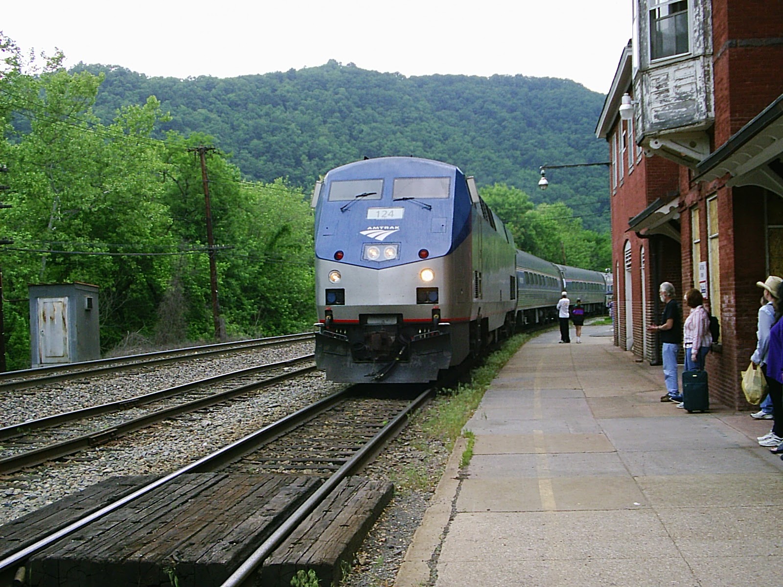
If you’re looking for good news in the infrastructure bill, passenger rail probably represents the most encouraging and exciting inclusion in the bill. After being woefully neglected over the past 40 years, passenger rail is one of the biggest winners, receiving a historic investment that totals just north of $100 billion over five years. (All of which is thanks to impressive bipartisan work by the Senate Commerce Committee earlier this summer—read our much more detailed take on all the passenger rail provisions here.

This will provide significant opportunities to reshape American passenger rail in a transformative way. With the record investment, there is ample opportunity to improve safety and state of repair for existing rail infrastructure, make existing service more reliable, and support new, expanded passenger rail service. Communities near rail and lacking in intercity mobility options could connect their community with affordable intercity mobility and integrate passenger rail service with first- and last-mile community connections. 

But these improvements are not going to happen automatically nor will they happen easily. The Biden administration, the Federal Railroad Administration, Amtrak and others will have to be very aggressive in ushering this money out the door and supporting state and local plans for those improvements to see the projects that have been promised or mentioned in breathless news coverage come to pass. If the administration fails on this count, this could turn out just like the 2009 Recovery Act, where money sat idle or was even declined by governors. On top of that, freight railroads will be opposed to the improvements in some places, just like they’ve fought or negotiated in bad faith against the publicly and politically popular plan to restore passenger rail along the Gulf Coast.

Additionally, Amtrak’s mission and governing structure have been adjusted to bring a greater focus on expanding and improving the national network. For the majority of Amtrak’s existence, the mission of passenger rail service was to justify investments with performance and operate to make a profit, no matter the cost to user experience, and no matter that nearly every other transportation mode fails to turn a profit. This hampered innovation and opportunity to build and retain rail ridership. Small but significant changes in the infrastructure bill reorient Amtrak’s mission towards the value of the customer and the importance of connecting those customers across urban and rural communities. 

While the bill lays out goals for an Amtrak Board of Directors that better represents a diversity of perspectives and communities across the Amtrak system, as we noted last week, those slots need to be filled immediately if the administration is serious about improving passenger rail service and taking advantage of the funding and this historic opportunity.

By reinvigorating passenger rail infrastructure and user experience, this bill could lay the groundwork for other future advancements, including high-speed rail.

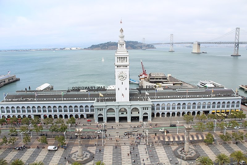
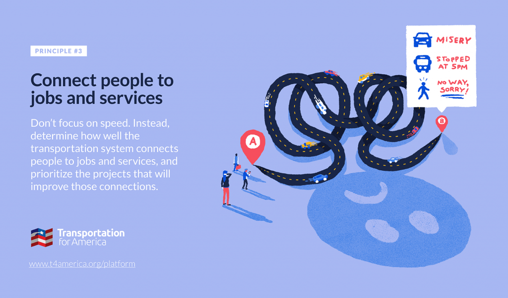
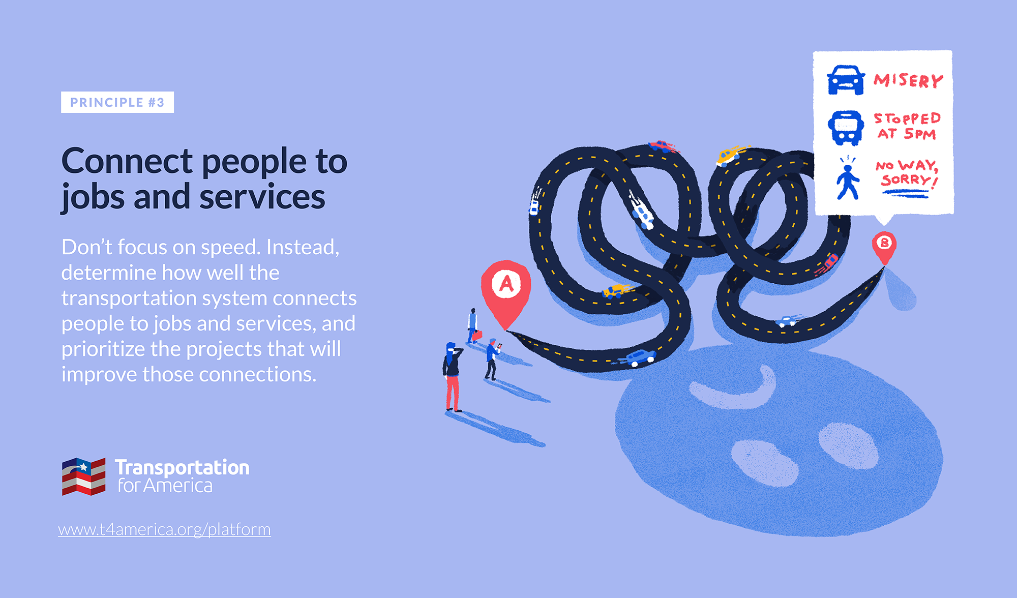
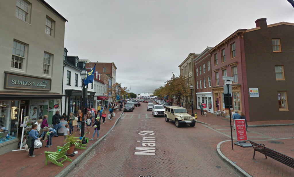
Connecting people to jobs and destinations

Alaskan Way Viaduct demolition in progress in Washington
Image from WSDOT via Flickr

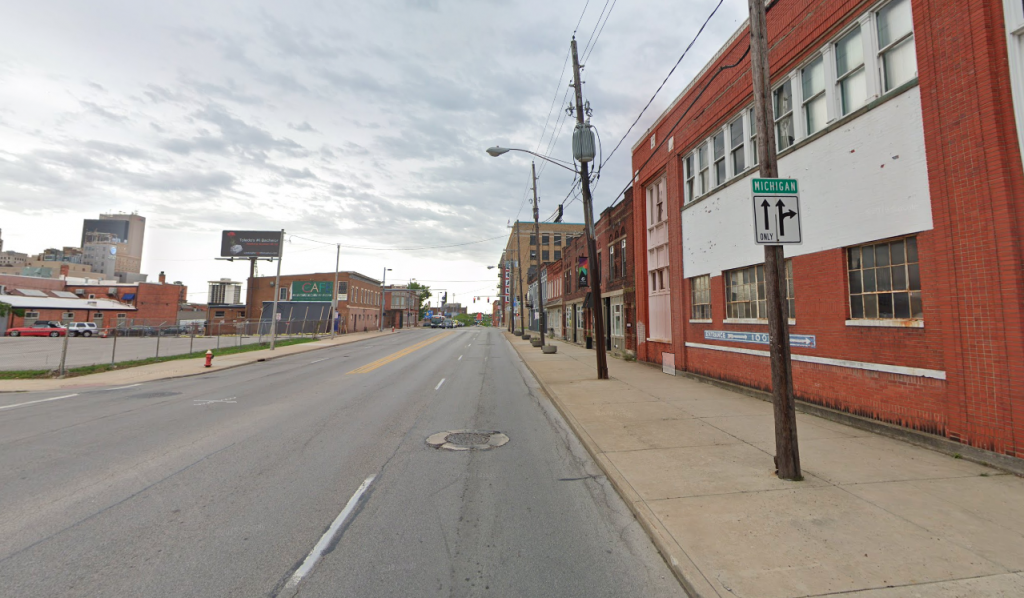
As we’ve noted, the bill pours the lion’s share of the funds into the same old highway programs with few substantial changes. And states are already responding to their hard-won flexibility and historic amounts of cash by supercharging previously planned or ill-conceived projects. But there are some notable ways the bill recalibrates the highway program for the long run. 

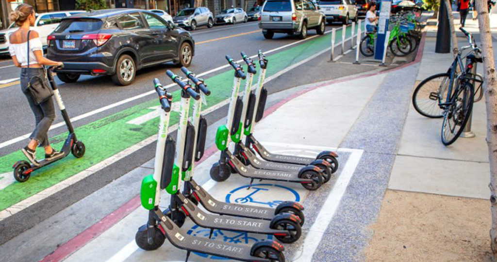
First, a portion of every state’s funding will go to new programs aimed at reducing carbon emissions, improving transportation system resiliency, and congestion relief, in addition to existing money devoted to Congestion Mitigation and Air Quality (CMAQ) dollars. States and metro areas must also now dedicate a portion of their planning money towards Complete Streets planning and implementation. (2.5 percent of each state’s State Planning Research dollars and 2.5 percent of their metropolitan planning dollars.) This money will be dwarfed by the hundreds of billions going into streets and roads being designed the same old way, but this is an incremental step toward elevating active transportation and livable streets within the transportation program. 

Within the largest pot of funding that states and metro areas control (the Surface Transportation Block Grant program), the amount set aside for smaller but vital transportation projects like bikeways, new sidewalks, safe routes to school, and micromobility was increased from 1.5 percent up to 10 percent. This bill also lets local municipalities control more of this funding directly by increasing the share of that 10 percent that they directly control from 50 up to 59 percent

Lastly, while the $1 billion Reconnecting Communities program will be overpowered by hundreds of billions in highway funds perpetuating the very problem this program aims to solve, its inclusion is an important step toward repairing the damage of past highway projects and is worth celebrating. For the first time, Congress is acknowledging the racist and damaging history of highway building, laying the groundwork for future efforts and also providing a way for advocates to spotlight how some of the worst excesses of the past are still going on today in many urban areas. But devoting any federal dollars to tearing down divisive infrastructure plus the means to stitch communities together again is a vital step on the path toward reorienting the highway program to serving people and communities with the transportation system. 
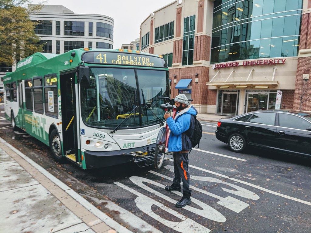
Transit

A Philadelphia bus drives through a snowy intersection
Image from BruceEmmerling via Pixabay

Most of the headlines and coverage about transit focused on the fact that it will receive historic levels of investment over the next five years from the infrastructure deal. That’s certainly good news, but that also glosses over some important shortcomings. 

First off, unlike the Senate Commerce Committee did with passenger rail, the Senate Banking Committee never actually drafted a transit title to incorporate into the infrastructure bill. This preserved the transit policy status quo in amber for the next five years. Secondly, while the House’s superior INVEST Act proposal focused on trying to maximize transit service, frequency, and access, this bill failed to fix the current priority of keeping costs down no matter the effects on people when it comes to service, ridership, and access to transit. T4America is still looking to Congress to redress that wrong within the still-in-progress budget reconciliation bill (the Build Back Better Act), ensuring that public transportation, a fundamental backbone in our communities and a lifeline towards affordable housing opportunities, is properly funded.

Thirdly, while the $39 billion is a historic amount for transit and many excellent projects will be built because of it, this amount should have been higher. $10 billion was cut from the original infrastructure deal’s framework agreement with the White House back in June. 

While we weren’t anticipating the Senate increasing the share for transit, the infrastructure bill did maintain the historic practice of devoting at least 20 percent towards public transportation and did not decrease it. On a positive note, the bill emphasized improving the nation’s transit state of good repair, plus improving transit accessibility via a grant program to retrofit transit stations for mobility and accessibility.

Environmental stewardship and climate adaptation

A parking space painted green with a symbol indicating the space is dedicated for EVs
Image from Noya Fields via Flickr

Although the infrastructure bill continues to heavily fund conventional highway and road expansions, digging us into an ever deeper hole of traffic congestion and greenhouse gas emissions, it is also the federal government’s biggest investment yet in climate adaptation and protection and recognizes the severity of the impacts of climate change which are already being experienced across America.

The new PROTECT program dedicates $7.3 billion (~2.9 percent of each state’s share of all highway funds) and $1.4 billion in competitive grants to shore up and improve the resilience of the transportation network, including highways, public transportation, rail, ports, and natural barrier infrastructure. Knowing where climate- and weather-related events are likely to be worse is a vital first step, and the National Oceanographic and Atmospheric Administration (NOAA) will invest $492 million in flood mapping and water modeling which could inform future infrastructure planning and investment.

The existing Alternative Fuels program is expanded and recalibrated to focus more, though not exclusively, on zero-emission vehicles and related infrastructure. A new Carbon Reduction program will dedicate ~2.5 percent of each state’s share of highway funds (~$6.4 billion total) to support active transportation, public transit, congestion pricing, and other strategies to reduce carbon emissions. (Although the core highway program will continue making emissions worse.)

All of this represents a positive first step in federal recognition of the severity of the impacts of climate change, but it is still not scaled to the level of risk that we face, though we applaud Congress for taking a bipartisan step on climate change and we hope to see more.

Safety

Cyclists on the Black Lives Matter Plaza in DC
Photo by Ted Eyton via Creative Commons

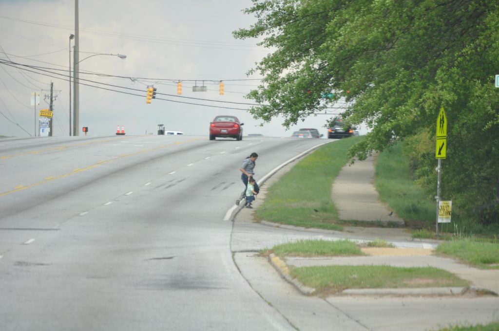
When it comes to safety, a new federal safety program, even a large one, is not what we need. The entire $300+ billion transportation program should be a safety program, with safety for all users as the highest and ultimate consideration in every single case on every single project. A transportation system that cannot safely move people from A to B should be viewed as a failure, regardless of whatever other benefits it brings.

With that backdrop in mind, there are key safety provisions that ensure a fairer shake for vulnerable road users. If injuries to and deaths of people walking, biking or using assistive devices exceed 15 percent of a state’s total traffic injuries and fatalities, then that state must dedicate at least 15 percent of their Highway Safety Improvement Program dollars towards proven strategies to make those people safer and lower that share. This helps put some teeth into highway safety dollars to target investments where they are critically needed, versus typical lip-service and disingenuous investments sold as safety projects that are really about increasing capacity, speed, or other goals.

The new Safe Streets and Roads for All program is a competitive grant program allowing applicants to seek funding to better plan and implement Vision Zero strategies in their communities and regions. Once deemed a niche concept, the Vision Zero safety framework has gained some prominence. For it to go mainstream, it will need to be fundamental to all highway spending.

Looking ahead

Though this bill leaves much to be desired, there are still some notable changes that will start to shape the direction of state, regional, and local transportation programs. The key will be how they are used. In the coming weeks, T4America will highlight key opportunities to better administer, deliver, and shape the US transportation program for generations to come. 

Two bills put “access” at the heart of transportation policy

For too long, the focus of the federal transportation program has been vehicle speed, not helping Americans access jobs, schools, grocery stores and more. It’s time to focus our funding on improving people’s access to jobs and services—and U.S. Rep. Chuy García’s (IL-4) two new bills will do exactly that. 

An “L” underpass in Chicago.

Transportation is fundamentally a means for getting people and goods where they need to go. Making sure you get your children to school on time, and yourself to work; having a safe, convenient and affordable way to reach grocery stores and healthcare. 

But our federal transportation program doesn’t make improving these connections its goal. U.S. transportation policy focuses on avoiding any delay to vehicles, making our roads wider and our communities more spread out and disconnected in the process. As a result our transportation system is in crisis. Americans are stuck in congestion on crumbling roads and transit systems, often forced to travel further and further because our system fails to provide safe and convenient choices other than a car trip. 

That’s where two new bills from Representative Jesús “Chuy” García (IL-04) come in. Today, Rep. García—along with his two co-chairs of the Future of Transportation Caucus—introduced the Improving Access to Jobs Act and Improving Access to Services Act to Congress with 12 co-sponsors, including Representatives Ayanna Pressley (MA-07), Mark Takano (CA-41), Rashida Tlaib (MI-13), Raúl M. Grijalva (AZ-03), Steve Cohen (TN-09), Jan Schakowsky (IL-9), Nanette Diaz Barragán (CA-44), Bennie G. Thompson (MS-02), Jahana Hayes (CT-05), Bobby L. Rush (IL-01), Ann Kirkpatrick (AZ-02), and Darren Soto (FL-9). 

These two bills would finally align federal spending with how people intuitively think about transportation: whether or not they can access their destinations. 

“Our transportation systems are failing Americans who face growing congestion, roads and transit systems in disrepair, and long-standing inequities that disproportionately hurt marginalized communities,” said Rep. García. “Any future transportation policies must make smarter investments to improve access, cut travel times, and lower the financial barriers to mobility for all.”

The two bills will create performance measures that make improving access the goal of federal transportation policy, and hold states accountable to improving access by all modes of travel. The bills would prevent metropolitan planning organizations (MPOs) from increasing the ratio of automobile to non-automobile access in urbanized areas, empowering MPOs and states to balance transit, bike, and pedestrian investments alongside new roadway investments over an entire region. This would guarantee that any new roadway investments do not degrade transit, bike, and pedestrian access. 

If states fail to improve access, they must invest 10 percent of federal transportation funds apportioned to a state from the previous fiscal year into efforts to improve access overall. This requirement is in effect until the Secretary of Transportation certifies that a state is in compliance.

This intuitive concept—prioritizing access, not speed—is revolutionary in the world of transportation policy, which adopted speed as a metric for success before we had technologies like cloud computing and GIS that make measuring access possible. Some states already use access to allocate state transportation funding, like Virginia DOT. 

Two bills, one goal

There’s an important reason why Rep. García introduced these transformative performance measures as two seperate bills, though: People perceive commutes to work and trips to services differently. This has implications for transportation planning. 

People generally have a higher tolerance for longer commutes to work. Tolerance is lower for long trips to services—like grocery shopping, doctor’s appointments, recreation, and more—because they are often linked in one trip, rather than multiple round-trip journeys to and from homes. So while people might consider a 30-minute commute to be manageable, an area that’s 30-minutes one-way to the grocery store qualifies as a food desert—hence the need for different performance measures. 

Together, these two bills are one huge step towards prioritizing access in federal transportation legislation. But there are additional actions the federal government can take to truly make access a priority. T4America has called for the U.S. Department of Transportation to develop a national assessment of access to jobs and services and set national goals for improvement; to phase out outdated metrics such as level of service; and to provide accessibility data to states, MPOs, and local communities. (You can read our full recommendations here.

Proposing a new way of doing things is never easy, particularly when it challenges how America fundamentally measures the success of our transportation system. We thank Rep. García for leading this effort toward a better, more accessible future.

Here’s what happens when Jarrett Walker takes over your Twitter account

A week ago, we gave the experts at Jarrett Walker + Associates the keys to our Twitter account to explain what a transportation system oriented around improving people’s access to jobs and services (not increasing vehicle speed) actually looks like. 

Last week was “Connecting people to jobs and services week” on our blog, where we focused on explaining our third principle for transportation investment. As we learned when brainstorming ideas for the blog for this week, the concept of measuring transportation success by access, not vehicle speed is often a tricky one for people to wrap their heads around.

So who better to explain how far we’ve deviated from transportation’s purpose—to connect people to opportunity—and how to get back on track than transit planner Jarrett Walker? Walker and his team are famous for communicating the “geometric truth” (as our outreach director Chris Rall calls it) of transit projects, helping cities across the world align their land use with transit goals.

Check out the highlights of the takeover below. And tune into our Twitter account for more takeovers and tweet chats!

Connecting people to jobs and services week: Hey Congress, we need your help to measure access

The Des Moines Area MPO wants to make a shift to award funding the transportation projects that do the most to improve the region’s resident’s access to jobs and services. But—like most MPOs and local governments across the country—its budget for the technology that makes this possible is small. It’s time for Congress to help local communities invest in the right projects. 

Ariels of Des Moines, Iowa from 10,000 feet May 6, 2017. USDA photo by Preston Keres

It’s “Connecting people to jobs and services” week here at Transportation for America. All week we’ll be exploring why improving access should be the goal of the federal transportation program—not vehicle speed. This guest post comes from Todd Ashby, CEO/Executive Director at the Des Moines Area MPO, which is trying hard to upend the broken status quo.

No matter how much funding a region has, there will never be enough money for every possible project. In Greater Des Moines, we want to guarantee that we spend our limited resources on projects that will do the most to connect our residents to their daily needs with affordable, efficient transportation.

Last year, Transportation for America came to Iowa to help the Des Moines Area Metropolitan Planning Organization (DMAMPO) do exactly that: create a scoring system to evaluate how proposed transportation projects work to achieve our goals, like improving people’s access to jobs and services (and not just for people driving cars). T4America inspired us to become a national leader in using performance measures to better align our project funding with regional priorities. 

To us, improving access to jobs and services is the gold standard for transportation investment, and one of the very best ways to use this relatively new idea of performance measurement. With improving access as our goal—not increasing vehicle speed or throughput— we would prioritize the projects that would do the most to improve our residents’ connections to jobs and services.  

But while very possible thanks to cloud computing and GPS, measuring access is expensive. We need data on where trips begin and end, where jobs are located, where people live, and where daily needs are located. This data is incredibly expensive. We also need additional resources and funding for models that help us process this data; the DMAMPO—like most other MPOs—has neither. 

Congress could help usher in a new era of picking projects based on how they improve access rather than on outdated 1950s measures like level of service or vehicle delay, but the federal program today is not oriented around this goal, nor around equipping states and metros to do so.

This is why the DMAMPO asked Iowa Senator Joni Ernst to cosponsor S. 654, the COMMUTE Act in Congress. This bill—an acronym for “Connecting Opportunities through Mobility Metrics and Unlocking Transportation Efficiencies”—would create a competitive pilot program at the U.S. Department of Transportation to provide states, local governments, and MPOs with data sets to calculate how many jobs and services are accessible by all modes of travel. 

Access to this data would transform how we are able to choose projects, empowering us with far better information to determine which proposed transportation projects would connect the most people to the highest quantity of jobs and services.

For a long time, ensuring high speed of travel within a corridor or minimal delay was a good enough rubric for spending billions of transportation dollars. It’s our goal to do something far better in Greater Des Moines. The COMMUTE Act would be a good start, but Congress can do so much more.

Connecting people to jobs and services week: The legislative path to make access the goal of transportation investments

A heat map of bike accessibility in the San Francisco Bay Area. Lighter colors indicate fewer jobs can be reached within 30 minutes on “medium-stress” bike routes while darker colors indicate more jobs can be reached. Map via University of Minnesota Accessibility Observatory.

Measuring access—not vehicle speed—is smart policy. But local governments, states, and metropolitan planning organizations need support from the federal government to make this happen. It’s high time for Congress to make robust travel data and analysis tools available to transportation agencies.

It’s “Connecting people to jobs and services week” here at Transportation for America. All week we’ll be exploring why improving access should be the goal of the federal transportation program—not vehicle speed.

Having thousands of jobs within a region doesn’t do much good if residents don’t have convenient, safe, and affordable transportation options to reach those jobs. That’s why the concept of measuring whether transportation investments improve access to jobs and services can be transformative. Improving access to jobs and services, not merely aiming for high-speed vehicle travel within a corridor or minimal delay, should be the goal of our transportation investments.

But right now, the implicit goal of all federal transportation investments is to increase vehicle speed, not improve access. Changing the goal from vehicle speed to improving access requires rethinking our federal transportation policy from the ground up.

With the current authorization for federal transportation spending—the FAST Act—set to expire in 2020, it’s time for Congress to determine transportation policy for the next five to six years. Once passed, this legislation will set federal funding levels and policy for transportation for the bill’s duration. It is critical for this bill to reform the federal program to prioritize access.

We need to determine how well the transportation system connects people to jobs and services, and prioritize projects that will improve those connections. Congress should require USDOT to collect the data necessary to develop a national assessment of access to jobs and services and set national goals for improvement.

To do this, Congress should:

  • Determine national connectivity: USDOT should develop a national assessment of access to jobs and services, and set national goals for improvement.
  • Measure the right things: apply accessibility to the federal transportation program in performance management and project selection.
  • Update standards: Phase out outdated metrics such as level of level of service.
  • Use 21st century tools: USDOT should provide accessibility data to states, MPOs, and local communities.

States such as Utah, Delaware, Virginia, California, Massachusetts, and Hawaii along with the cities of Sacramento and Los Angeles are already utilizing this type of data and seeing results.

Unfortunately, states and MPOs must currently pay to access this data while far less useful congestion data is made readily available by USDOT.

A bill before Congress would pilot destination access; let’s take it a step further

Earlier this year, members of Congress introduced the bipartisan Connecting Opportunities through Mobility Metrics and Unlocking Transportation Efficiencies (COMMUTE) Act in both the House and Senate. This legislation would pilot measuring access nationwide. We are grateful for the leadership of Senators Baldwin (D-WI) and Ernst (R-IA) and Congressman DeSaulnier (D-CA) along with Reps. Curtis (R-UT) and McAdams (D-UT), in the House.

The COMMUTE Act would create a competitive pilot program to provide five states, 10 metropolitan planning organizations (MPOs), and five rural planning organizations with data sets to calculate how many jobs and services (such as schools, medical facilities, banks, and groceries) are accessible by all modes of travel. These data sets will also be made available to local governments and researchers.

In July, Congress took an important first step on transportation policy when the Senate Environment and Public Works (EPW) Committee approved its portion of a surface transportation reauthorization bill (America’s Transportation Infrastructure Act). We were happy the bill included a pilot program based on the COMMUTE Act to help a select group of states and metros measure whether or not their investments are connecting people to jobs and services. This demonstrated the bipartisan support for the common sense idea of measuring the success of our transportation system by whether it creates access to jobs and services.

But we can and should do more. Access to jobs and services has to be the core of any transportation authorization. Support for the pilot in the Senate indicates an opportunity to do much more. That is why we are urging Congress to go further and require USDOT to collect the data necessary to develop a national assessment of access to jobs and services and set national goals for improvement.

The House of Representatives will soon release its proposed surface transportation authorization. This is an opportunity to demonstrate a new vision for transportation, based on modern data and valuing what really matters.

It’s time for Congress to act and hold ourselves accountable for improving access.

Connecting people to jobs and services week: Rethinking shared mobility to prioritize access

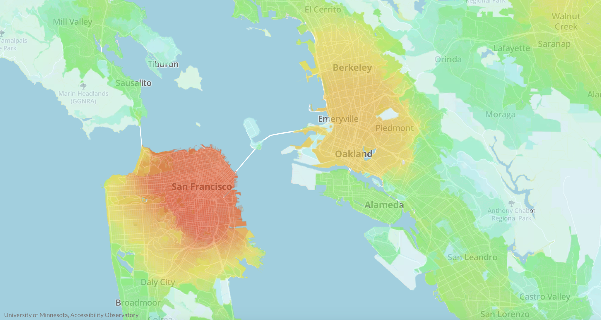
Transportation is fundamentally about connecting people, but America’s transportation system focuses on moving cars instead. Madlyn McAuilffe from the New Urban Mobility Alliance (NUMO) wrote this guest post about the consequences of our misguided priorities and how we can get back to focusing on building places and transportation networks for people.

It’s “Connecting people to jobs and services week” here at Transportation for America. All week we’ll be exploring why improving access should be the goal of the federal transportation program—not vehicle speed.

Transportation has always been about connection—connecting people to places, resources, experiences, and of course, other people. Moving people—facilitating access—was the original goal. Transportation was simply the means by which we reached our destinations.

We’ve journeyed a long way since the advent of the automobile, and somewhere along the way toward creating a national transportation system, our priorities shifted to focus not on moving people but on moving cars.

Living with the consequences

The consequences of American auto-centrism have been devastating and far-reaching. Despite an urgent global climate crisis, transportation is the primary source of emissions in the U.S., and a growing source as auto sales (particularly for SUVs and trucks) rise

We’re told by $40-billion worth of endless, highly-stylized auto commercials that cars represent independence, yet they often are the largest purchases many American households will ever make. 72 months of payments, thousands of dollars of high-interest debt, and economic dependence on an inefficient and dangerous mode of transport can hardly be called freedom.

Even the metrics we use to determine the success of our transportation system are off. We measure the efficacy of our roads and policies by speed traveled (i.e., level of service) rather than by the number and diversity of people who can safely and affordably access jobs, school, healthcare, grocery stores, and community centers. Yet rather than reimagine how we fund transit projects or investigate zoning land for multiple uses, we spend outrageous amounts of money on adding lanes to highways, inducing demand for driving, and then condemning commuters to become stuck in hellish congestion.

We often hear about “crumbling infrastructure,” but rarely mentioned is the fact that transportation decision-makers invariably decide and are incentivized to expand the network of roads that are already poorly maintained rather than fix what we have already built.

It doesn’t have to be this way, but how do we begin digging ourselves out of the ditch we have created?

Any roadmap forward starts with rethinking the values underlying how we do transportation, land use, infrastructure, labor, and more. Change the values, change the system; change the system, change the world. Sounds easy, right?

The principle of the thing

A tectonic transportation value shift is already underway, though—and unsurprisingly, it’s a team effort.

Early 2017 witnessed the debut of the Shared Mobility Principles for Livable Cities, a framework for policymakers, leaders, influencers, urban designers, academics, advocates—everyone—to guide stakeholders toward the best outcomes for all people. Developed by Robin Chase and a founding coalition of global NGOs including Transportation for America, the Principles encourage us to rethink how we plan not just our mobility, but also the design of both our transportation system and cities to value inclusivity, connectivity, and shared mobility that is sustainable and just.

The first three Principles—planning cities and mobility together; prioritizing people over vehicles; and supporting the shared and efficient use of vehicles, streets, and land—are key to understanding the Shared Mobility Principles as a whole. The remaining Principles stem from the core value of access, which must also serve as the metric by which any transportation, infrastructure, or other development project must be reviewed. What opportunities will this proposed transit-oriented development project provide and to which communities of people? Will this mobility hub provide first/last-mile solutions in transit deserts? Which transportation investment will create improved access to jobs, school, and other destinations for the greatest number of people: an additional lane for single-occupancy vehicles or a dedicated bus lane for thousands of passengers each day?

Admittedly, the Shared Mobility Principles are ambitious. Relearning everything we’ve come to accept as a given in planning, developing, designing, and maintaining not just our transportation system but cities themselves is daunting. To create lasting change that reaches and improves the lives of everyone, however, we must start by rethinking our values as well as what and whom we prioritize with the policies we craft and the projects we undertake. After all, cities are built for people, not cars. If people can’t access what they need where they live…we’ve failed.

Connecting people to jobs and services week: What do destination access metrics look like in action?

Academics have long pointed to a metric called destination access—called by Transportation for America “access to jobs and services”—as a better decision guide than older, conventional measures that focus mainly on the speed of cars.  But what does this new practice look like in real life, and where and how is it already being used?

A man loading a bike onto a bus in Arlington, VA. Photo from the Arlington Department of Environmental Services.

It’s “Connecting people to jobs and services week” here at Transportation for America, so Eric Sundquist, the director of our partner organization the State Smart Transportation Initiative, wrote this blog post explaining how measuring access actually works.

When we measure destination access, which takes into account distance of travel as well as speed, we can better assess how easily travelers can reach their desired destinations. And we can make predictions about how people will choose to travel. It’s long been a better theoretical way to measure success, but the data has been expensive and it’s largely remained the purview of academics.

Now destination access has broken out of the ivory tower. 

Newly available “big data,” much of it collected for use by GPS navigation software and devices—think Apple or Google Maps—has made measuring destination access possible in practice. 

Created by a 2014 bill that “revolutioniz[ed] the way transportation projects are selected,” according to then-Governor Terry McCauliffe, the Virginia DOT has been using destination access to help make investment decisions through three rounds of transportation project funding. 

How does this new system work in Virginia? VDOT assesses a wide range of projects together—highways, transit, walking, biking and demand-management projects—based on how they improve access to jobs and other common destinations, such as shopping, schools, and restaurants. After calculating destination access, VDOT then divides by cost of the project to the state, so that small, rural projects can compete with massive urban ones. In essence VDOT scores projects on destination access per dollar of investment, and this has led to a major shift in which projects they fund each year, increasing the benefits for each dollar invested.

For example, Virginia recently scored a project near the small town of Hopewell that would connect two regional bike-walk trails using a shuttle bus across a highway bridge with minimal shoulders and no sidewalks. The project scored modestly on destination access, but because it would cost only $44,000—very little by transportation infrastructure standards—it ranked first in its district and ninth out of 433 projects statewide. This is the type of small but vital project that can lose out when state agencies are so heavily focused on simply improving vehicle speed and avoiding delay.

Because we can use all this data to assess destination access across auto, transit, walking, biking modes, we can also combine those scores to predict how changes to the built environment will affect outcomes, such as mode share. Will a project lead to more or less driving, transit ridership or active transportation? Using destination access helps us make these forecasts.

More examples of measuring access to jobs and services 

Working with the State Smart Transportation Initiative (SSTI), for example, the City of Eau Claire, WI., recently used destination access to assess transit investment options, including bolstering the city’s downtown circulator, extending service to future development sites, and pairing those investments with strategic transit-oriented development (TOD). The analysis not only let Eau Claire decision-makers understand the relative benefits of different transit expansions—including which residents would be affected and how much their access to jobs and other destinations  would increase—but also showed that TOD could provide considerably larger benefits, compared to transit investments alone. This information will inform the city’s new transit plan and its recently announced climate goals

This new method can be used to evaluate how proposed transportation projects would impact access to jobs and services, but it can also help local leaders envision potential future scenarios as they make broader long-term plans for both transportation and land use. 

In nearby La Crosse, WI, the city leaned on destination access metrics to estimate the effects of various development scenarios. If the city directed new development to three proposed sites near downtown, would it reduce the need for auto travel and boost transit ridership? The SSTI analysis found that the answer was yes, a result that city officials will employ going forward in transportation and land use decision-making. 

Ten years ago, we never would have been able to orient federal transportation spending around the goal of improving access to jobs and services. The data and other resources just weren’t there yet. But now, as both states and localities across the country take giant steps to prove that it’s not only possible but a smarter way to choose where and how to invest in transportation, it’s time for Congress to respond by making this a priority.

To connect people to jobs and services, we need to measure what matters: people

Today we largely decide which transportation projects to build and where to build them based on how much delay vehicles experience, while entirely ignoring everyone not in a car in the first place. By ignoring walking, biking, or taking transit, we’re ignoring the impacts on everyone not using a car, particularly low-income persons, people of color, and older adults.

It’s “Connecting people to jobs and services week” here at Transportation for America. All week we’ll be exploring why improving access should be the goal of the federal transportation program—not vehicle speed.

A century ago, we didn’t have GPS and GIS mapping systems. Google Maps on a handheld computer (i.e. your cell phone) that would allow you to instantly look up directions to anywhere with any mode was still in the realm of science fiction. Given those limitations, when the country started spending billions to build a national network of highways—and a bunch of streets to feed cars onto those highways—the easiest thing to measure was vehicle delay. Free flowing traffic = good; delay = bad. If cars were getting stuck in traffic, it was a sign that we needed to build more or wider roads, or redesign an intersection to improve traffic flow.

This was the most sophisticated proxy for success we could manage for many decades but this myopic focus on vehicle speed also ignored anyone outside a car and it actively undermined other transportation options. People walking or rolling were relegated to sidewalks (if they existed) or banished from the street altogether. Transit was now being mired in traffic and wide, free-flowing roads lured those who could afford a car onto the open road. And if you happened to live in the path of a future freeway—a path often selected because an area was deemed undesirable based on racist redlining policies—your home or business was razed. What remained of formerly walkable and vibrant Black neighborhoods were suddenly cut off from the rest of the community to make room for cars.

None of these people outside of personal vehicles are considered or counted when we use vehicle delay to measure the effectiveness of our entire transportation system. The ability of people walking, rolling, biking, or taking transit to get where they needed to go is sacrificed for people who can afford and operate a car.

This old measure hasn’t scaled very well, either. As more and more Americans began driving, traffic became more common. We hollowed out city centers in a quest to keep cars moving and then give them a place to park. Today, we still hear calls to widen roads to keep traffic moving. The problem, as it’s presented, isn’t that we have too many cars, but not enough road space for all those cars.

With technology available now, we can figure out where people are trying to go, we can measure how easy or hard it is to get there, and we can do this for every mode of transportation, not just cars. We call this measuring access and using it to evaluate how our transportation system is performing and to decide what projects to build next would make for a much more equitable transportation system.

Access to a better future

If you don’t own a car and you rely on walking, biking, or transit, your needs are largely ignored under the current paradigm. If you don’t want to spend $9,000 a year to own and maintain a car, improving your access to jobs and services is secondary to the needs of people driving. If you can’t drive, for whatever reason, you can only hope that there are viable options to get you where you want to go.

Using access as the primary consideration to evaluate projects may show that building and repairing sidewalks in a community would dramatically improve access to jobs and services for more residents than redesigning one intersection for cars (and for the same amount of money). It may show that a new bus line would make it easier for residents in a low-income community to access healthcare. It may show that filling a gap in a bike lane network would improve the ease and safety of reaching the closest grocery store from neighborhoods in a food desert. Or it may show that the length of a bus ride to school could be cut in half with a short connector road. Using access to guide our transportation investments may show these things, but we wouldn’t know because most transportation decisions focus only on the delay of cars alone.

That’s why our third principle for transportation policy is connecting people to jobs and services. Instead of using an outdated proxy that gives us an incomplete and indirect view of whether or not the system is actually working to get people to their destinations, let’s measure the actual thing that proxy was attempting to measure. Congress should direct USDOT and states to determine how well the transportation system connects people to jobs and services, and prioritize projects that will improve those connections.

Measuring access alone won’t erase all the structural issues that disadvantage low-income communities and communities of color, but it will solve one of those issues. By measuring access we can begin to make sure that everyone regardless of income, age, race, or ability can get where they need to go by whatever mode they choose.

It’s time to define transportation success by what actually matters to people: getting where you need to go

For decades, transportation departments have been measuring the wrong thing: vehicle speed.  Instead of measuring the speed of a car, we should measure the success of our transportation system by how many jobs and services people can access safely, quickly and affordably.

It’s “Connecting people to jobs and services week” here at Transportation for America. All week we’ll be exploring why improving access should be the goal of the federal transportation program—not vehicle speed. Check out our post from yesterday discussing why it’s time to throw out the traffic measurement level of service, and tune into our Twitter account later today for tweets by renowned transit planner Jarrett Walker.

The goal of our transportation system, and the $40-plus billion in federal dollars we invest each year on it, should be simple: getting people where they need to go. But that’s far from the case.

When you think back about whether or not you had a successful trip, you probably think about if you got from point A to point B and how long that trip took. But state transportation departments don’t measure success that way: they instead measure whether or not your vehicle was moving quickly at some point of the trip. Whether or not you actually arrived isn’t a consideration. And they rarely, if at all, measure whether or not you can access important destinations like jobs and other services. 

Using outdated measures like “level of service” that assess how fast traffic moves compared to free flow speeds in the middle of the night, they  assume that if the traffic is moving well on a given segment of a road that the trip was high quality and successful. In other words, an hour-long commute at high speed would be considered more successful than a 10-minute commute in a little traffic. Lost entirely in this simplistic proxy are non-car trips—we don’t measure people who walk or bike to work. 

But this 20th century technology isn’t a good measure of whether or not people have access to the things they need in their daily lives. We think that destination access, or accessibility, is a much better measure. 

Connect people to jobs and services—our third principle

Our third principle is not a new concept. What’s new is that we now have technology that makes it possible to measure success by what actually counts—reaching your destination. A few decades ago, we didn’t know where people were starting their trips from and going to. With a transportation program as we know it that began in the 1950s and 60s, we used simplistic proxies like level of service or vehicle delay or blunt measures of congestion because that was the best we could manage at the time. But now we have reams of data about where trips begin and end, where jobs are located, where people live, and where daily needs are located. With the help of cloud computing and GPS, we can measure every aspect of a trip.  

Yet the federal transportation program continues to rely on outdated 1950s metrics that assume a transportation system made up entirely of vehicles (rather than people), where the best measure we can come up with is “did your car go fast or slow for your trip?” 

It’s time to actually measure what matters as we decide where and how to invest billions in federal transportation dollars each year.

Think of destination access as the map app you likely have on your phone. When you search for a restaurant or a store, the app can tell you how long it will take to get there by different modes of transportation. And because of the millions of searches performed each day and the location data transmitted, it is now possible for states and local communities to accurately calculate access to employment opportunities, daily errands, public services, and much more. These tools allow cities, states and metropolitan planning organizations (MPOs)  to design transportation networks that maximize the ability of people to travel by whatever mode they choose and to better understand how transportation investments interact with land-use policies. 

Losing the current dangerous focus on speed and instead measuring accessibility would prioritize efficient travel and a more equitable transportation system, one where low-income communities would have increased access to jobs and services. We can hold agencies accountable to deliver these connections.

Funding should go to projects that will improve these connections, regardless of mode. State DOTs and MPOs should be held accountable by evaluating how well their investments help connect people to destinations—not whether or not they allowed traffic to move a little faster on some segment of road. 

Some states are already starting to evaluate projects this way

The Commonwealth of Virginia started using destination access to prioritize transportation projects in 2017. When deciding what new capacity projects to fund, Virginia measures how much access a given project will create and divides that accessibility score by the cost. It’s a transparent, quantitative way to prioritize limited tax-payer dollars. 

When we tie funding decisions to measurable outcomes, it creates more faith and buy-in from local communities. Connecting people to jobs and services is something everyone can agree to. 

While states like Virginia are voluntarily trying to change the process, to truly experience a sea change, the federal government needs to make improving access a fundamental priority for all transportation dollars.

Connecting people to jobs and services week: How bad metrics lead to even worse decisions

When the top priority of our transportation investments is moving cars as fast as possible, the end product is streets that are wildly unsafe—as chronicled in depth last week. This focus on vehicle speed and throughput is the result of outdated metrics that utterly fail to produce a transportation system that connects people to what they need every day. 

A “successful” street, according to the metrics used by most state DOTs and metro areas. But “moving cars fast” as a goal fails to measure whether or not anyone can get where they are going. We need a better standard for success.

For “connecting to jobs and services” week, which focuses on our last of three principles for transportation investment, we’re re-surfacing portions of a post we wrote in 2016 about how one bad metric for evaluating potential transportation investments leads to expensive road projects that fail to get people where they are going every day.

All this week, we’re going to be unpacking our third principle for transportation investment, which is admittedly the most difficult to explain, especially compared to the first two: (1) prioritizing maintenance, and (2) prioritizing safety over speed. Before we can explain “connecting people to jobs and services,” we need to explain how the current federal transportation system is oriented around all the wrong things.

As we chronicled two weeks ago, if there are any existing priorities for the $40+ billion in annual federal transportation investment, it’s that cars should move fast, at all times, on all types of roads, no matter how many people die as a result. But we do almost nothing to measure whether or not any of this federal spending actually helps people get where they need to go each dayOne reason why is this wonky metric—created by the federal government—that nearly every state and local transportation agency uses to evaluate the success or failure of their transportation network.

Bad measures for success lead agencies to make bad decisions

As they plan projects and decide which transportation projects to fund, state and local transportation agencies exhaustively measure something called “vehicle level-of-service” for almost every single investment. Here’s a story to illustrate:

Wanting to rejuvenate their local economy, a local community cooks up plans to redesign the local street running through downtown that was perhaps even short-sightedly widened or converted to one-way travel in the 1960s or 70s. They want to make it safer and create a better environment for doing business—to make it a place to travel to, not through.

But because the street is also a state highway, they soon hear from the state department of transportation (DOT) that their proposed changes will slow down traffic and fail to meet “level-of-service” requirements. As a result, the project will fail to make the cut of the state’s short list of projects. Worse yet, the community is told that in order to make this street safer and “solve” congestion, they actually need to widen it and smooth out any curves, making it a virtual speedway, undercutting their plans to build a place with more enjoyable places to walk and visit—a framework for creating economic prosperity.

This terrific cartoon from Andy Singer shows how this rationale leads us to obliterate all the good things about our streets and places in pursuit of improving level of service:

A guy rototills his garden to eliminate weeds

andy singer cartoon rototil congestion city level of service street road design

What is level of service, and how do DOTs come to this conclusion?

Level of service is a system by which road engineers measure how well a road is performing based on the number of cars and the delay that vehicles experience on that roadway. Letters designate each level, from A to F. Just as with our time in school, A is great, and F is terrible.

A, B and C represent free-flowing conditions and F is stop-and-go traffic for vehicles. The score is assessed based on the highest level of congestion on that roadway, even if it only occurs for a few minutes a day. (To be clear, a street that is nearly empty 23.5 hours of the day can get an F if it gets congested during rush hour.) Traditionally, roadway conditions are acceptable if they score a C or higher on non-urban streets and a D or higher on urban streets.

This graphic, created by Jeff Tumlin, the new head of the SFMTA in San Francisco, illustrates how roads can be massively over-engineered to avoid level-of-service “F” with expensive capacity that largely goes wasted during the bulk of the day. Graphic via Strong Towns.

The level-of-service measurement is calculated by first measuring the amount of traffic during the busiest 15 minutes of an evening rush hour. Next, traffic engineers project the amount of traffic on the road in 20 or 30 years to determine if the road has enough capacity to cover the lifespan of the asset. If a road is projected by traffic engineers to lack capacity 20 years in the future—an incredibly fuzzy practice that’s far more art (or more accurately magic) than math—that road still receives a failing LOS grade today, even if the road is adequately suiting capacity needs.

Though there are no formal or federal requirements to do so, most DOTs, metropolitan planning organizations and traffic engineers rely on the level of service (LOS) transportation metric as they plan and design projects, and evaluate which ones will receive funding. I.e., projects that “improve” it get the fast track for funding, and projects that might make it “worse” are shelved or modified.

According to Jason Henderson, professor of geography at San Francisco State University, “Every city I’ve ever come across has some use of [LOS].” Because of the ubiquity of LOS, this largely misunderstood measurement has profound influence on the design of our communities.

This heavy reliance on level of service has dramatically shaped our cities, and it’s why states and metro areas and cities have spent billions to “solve” congestion in a way that has produced dangerous streets, dilapidated downtowns, economic disaster, and long-term maintenance costs that no locality can cover on their own.

Toledo and many other Rust Belt cities have little to no congestion and many of their in-town streets enjoy level of service “A.” Is that a good measure for success?

As Gary Toth from the Project for Public Spaces brilliantly put it in this piece, transportation professionals, “in search of high LOS rankings, have widened streets, added lanes, removed on-street parking, limited crosswalks, and deployed other inappropriate strategies” all because level of service has been the de facto standard over the last 50 years.

Every great street that you can think of in most places you want to visit on vacation probably “fails” level of service.

Congestion and level of service is “bad” because the street is home to numerous places people want or need to visit, the sidewalks are too wide and filled with pedestrians window shopping, there might be bike lanes to allow people to arrive without a car, and it’s almost certainly chock full, not necessarily of vehicles, but of people.

Poor level of service in Annapolis, MD. Tear down those buildings and you could add a couple of lanes in each direction and fix it!

Where did this measure come from?

The 1965 federal Transportation Research Board Highway Capacity Manual introduced this metric and it quickly became accepted as the standard measure of roadway performance. One reason that states adopted level of service so quickly was that it suited our country’s transportation goals in the 1960s of building out a network of interstates and prioritizing automobiles to travel quickly.

But as we explained at length last week, building highways and interstates with speed as the top priority is wildly different from building local and regional streets that create a framework for capturing value and providing for the safe movement of people, whether in a car or not.

Although LOS quickly became the standard, transportation agencies at any level are actually not explicitly required to use it: there are no planning or project design requirements that mandate the use of either LOS or travel modeling. FHWA [in 2016] issued a memo clarifying that level-of-service was never a federal requirement.1 But states persist, partially because the feds have never proposed a better measure of success or a more holistic overarching goal for what our billions are supposed to accomplish.

California was the first to make a notable shift, but more is needed

California set out to change the way they designed their streets and communities by changing the way they measure their performance. In 2013, California legislature passed a law directing the Office of Planning and Research (OPR) to instead measure vehicle-miles traveled (VMT), making it possible for projects aiming to reduce driving to fare well in the evaluation process. In 2013, Governor Jerry Brown signed into law SB 743, eliminating the use of level of service for projects within designated transit priority areas (i.e, areas with decent transit service.)

As Streetsblog LA reported in 2013, because most urban areas fall within the state-defined parameters of a transit priority area, this means that level of service is largely eliminated as a consideration for urban projects. Additionally, SB 743 authorized Governor Brown to develop a new way of measuring traffic impacts of major projects statewide and based the new way on total vehicle miles traveled (VMT) rather than intersection congestion.

Depending on how California implements this, it would change how development and transportation projects are analyzed and scored in traffic impact studies and thus send the state’s billions in transportation dollars toward projects that will help meet the state’s overall goals—rather than projects that will simply keep the cars moving quickly at all costs.

In short, instead of measuring the success of a proposed project by only the limited measure of whether or not traffic might slow for a few minutes per day at rush hour, CalTrans will now measure whether or not a project contributes to other state goals, like reducing greenhouse gas emissions, developing affordable multimodal transportation options for residents, preserving open spaces, or promoting diverse land uses and infill development. It is expected that this change will make it easier to build transit projects, as well as bicycle and pedestrian-friendly infrastructure—instead of encouraging more development that works against California’s own environmental and other goals.

$40+ billion is spent each year with no clear measures for success other than “move cars fast”

We need better priorities for federal transportation investment than just “move cars fast, all the time.” A fundamental principle has to be that the people who use our transportation system should be able to get where they are going. That’s where we are going with our third principle, which we’ll be unpacking in another post: “Connect people to jobs and services.” This metric would be a far better measure of success than anything on the books today, and some places are already starting to implement it.