Amtrak and SRC submit a planning grant that will expand long-distance passenger rail service along the I-20 Corridor and in the Deep South.
Today, the Southern Rail Commission and Amtrak announced their application for a Federal-State Partnership for Intercity Passenger Rail Grant from the Federal Railroad Administration for the I-20 Corridor—the first concrete steps to expand long-distance passenger rail service in decades. This grant would fund planning efforts for a new passenger rail service from Fort Worth, TX, across Mississippi and Louisiana, to Atlanta, GA, and is a critical step in bringing connectivity to communities along the route.
“This route will be one more arrow in the economic quiver for small and midsize communities across the Deep South,” said Beth Osborne,Director of Transportation for America. “We thank Amtrak for their leadership in moving this expansion forward, and we applaud Canadian Pacific for setting an example by serving as a willing and strong partner throughout this process. We look forward to seeing the completion of this route, which has been a long time coming, and hope for similar results in the greater Northwest and Mid-Atlantic, as well as all other underserved parts of the country.”
The I-20 Corridor has been previously studied twice for passenger rail and was determined to be an excellent candidate. The corridor includes numerous underserved and historically disadvantaged communities that will benefit from better transportation options. The rail line would link communities along the route to universities and larger cities, opening the door to attracting a bright young workforce, increasing economic opportunity, and bringing a sense of place to their downtowns. Amtrak’s decision to move forward with plans for the expansion comes before the FRA’s long-distance rail study, which was mandated under the 2021 infrastructure law, demonstrating tremendous initiative to move the project forward.
Partnerships between freight companies and passenger rail providers have been pivotal in moving this expansion along. Freight railroad Canadian Pacific acquired the route from KC Southern, and they’ve proven to be a willing and supportive partner to passenger rail. They will work to implement service for at least one round trip per year within two years, and two round trips within four years.
The Southern Crossing over the San Francisco Bay, proposed repeatedly over the past 77 years, has been rejected over and over again. Even as Reconnecting Communities funds will help Oakland study repairing the damage resulting from the interstate spur rammed through the heart of Oakland to serve as the eastern approach for this never-built bridge, the Southern Crossing shows how past choices continue to haunt the present—and future.
The Southern Crossing is an additional Bay bridge highway crossing that has been proposed over a dozen times since the plan was developed (in 1946) by various departments of California’s state government. The proposed bridge would be the fourth bridge to cross the San Francisco Bay, partner to the built “northern crossing” pictured above in yellow. As shown above, the “southern crossing” would originate from the east side near Bay Farm Island (fed by a new interstate, I-980), cross to the west side, and land on the San Francisco peninsula in the Bayview neighborhood, at Hunters Point. The vision was to provide East Bay motorists on I-580 and Highway 24 with a direct connection to I-280.
Map of proposed Southern Crossing Highway Bridge: Source: Wikimedia Commons
In 1961, the Southern Crossing bridge came close to construction, but white environmental activists concerned about the environmental degradation of the Bay prevented the project from moving forward. Even though the bridge was dead (for now), construction of I-980 moved ahead in the heart of Oakland, starting over two decades of work that would ultimately divide Black residents in West Oakland from downtown and demolish over 500 homes and nearly two dozen businesses and churches.
I-980 separates West Oakland residents from downtown. Image by OpenStreetMap.
In 1971, a bill for the construction of the Southern Crossing was passed in the California State Assembly by both houses but vetoed by then-Governor Ronald Reagan, who believed that the citizens of the Bay Area should weigh in on the decision to construct such an expensive and controversial infrastructure project. Voters rejected a bond measure in 1972 that would have paid for the construction of the bridge via a toll increase on existing bridge infrastructure by a three-to-one margin. Without the bridge, the finally completed, roughly two-mile stretch of I-980 ended abruptly at 18th Street, and in the decades that followed, the underused strip became little more than a redundant eyesore.
Every iteration of the Southern Crossing proposed across nearly eight decades has failed due to costs, environmental concerns, or interference with air flight operations from the nearby but now-decommissioned Naval Air Stations of Treasure Island and Alameda. But notably, never because of the desires of the low-income, historically Black and brown communities on either side of the Bay, as they have always been excluded from the project’s discussion and decision-making process.
State departments of transportation in the U.S. have a documented history of systematically targeting low-income communities of color, wiping them out with highway infrastructure construction. These development patterns have been repeated since the 1950s under the guise of urban renewal. I-280 and U.S. Route 101 already surround the historically Black neighborhoods of Hunters Point and Bayview on the San Francisco side of the Bay, subjecting them to air pollution and water runoff and cutting them off from the rest of San Francisco.
Hunters Point and Bayview collectively have 110,200 residents within approximately nine square miles—a population density of 12,762 people per square mile. The median home was built in 1966 and is valued at $690K. The construction of the Southern Crossing bridge could destroy hundreds of those homes and local businesses, a disproportionate number of which belong to low-income residents of color.
A path forward
Highway 101 and Interstate 280 separate Hunters Point and Bayview from much of San Francisco. T4A photo by Benito Pérez.
The San Francisco Bay has five highway bridges and an underwater tube carrying BART trains in each direction in separate tunnels. Billions of dollars have been spent to build this infrastructure, along with miles and miles of other interstates, highway connections, and arterial roadways. Even so, a 2017 Metropolitan Transit Commission (MTC) study found that Bay Area traffic congestion has only increased, going up by 80 percent from 2010-2017. Leaders continue to turn to new vehicle lanes to solve the congestion problem. Though the Southern Crossing proposal has never garnered the political support needed to proceed, since its inception in 1946, it’s been raised again and again to “solve” San Francisco’s traffic.
In 2017, Senator Dianne Feinstein (D-CA) revived the Southern Crossing proposal. The resulting 2019 joint study between the MTC and the Association of Bay Area Governments considered seven different scenarios to relieve traffic congestion based on growth projections by 2050. Only three of the options involved new bridges for vehicle travel, while six of the seven options were scenarios that involved transit solutions. The study found that the most cost-effective options were transit-only solutions, recommending these over the Southern Crossing highway bridge.
Still, nearly eight decades later, no full, final decision has been made on the Southern Crossing bridge, which keeps the specter of a massive, destructive project hanging over both the region and specific neighborhoods.
Induced demand is the phenomenon where an increase in supply results in a decline in price and an increase in consumption. To frame this within the context of highway construction, adding more lanes to a roadway creates more space for vehicle travel, attracting more cars, and ultimately exacerbating traffic congestion. Learn more in our report The Congestion Con, and use the SHIFT calculator to find out how much more driving new lanes can produce.
In Oakland, residents like the advocates at ConnectOakland have pushed for years for a project to reconnect low-income communities of color divided by I-980, which was intended primarily as a connection for the Southern Crossing. The Reconnecting Communities Program recently granted the city and Caltrans (California’s department of transportation) $680,000 to study possible projects to tackle the divisive and underused highway, including the possibility of removal, though that’s not necessarily the stated purpose of the project at this point. Clearly, once built, highways are difficult and expensive to remove—even when built to connect to a bridge that has ultimately never been built. But this study, funded by the first-ever federal program of its kind, is an important step towards repairing the damage wrought by I-980 and closing the longstanding divide.
Proposed plan to reconnect West Oakland, from ConnectOakland.
Even as I-980 gets a chance at a new fate, as long as the Southern Crossing bridge refuses to die, it could threaten the best efforts to reconnect Oakland. Even as all facts point to the contrary, some are likely to say that this underutilized highway is still needed to feed an unbuilt bridge. To get the most out of the Reconnecting Communities dollars they’ve received, decision makers will need to stand firm in what has already been proven time and again—it’s time to put the Southern Crossing to bed.
Lessons for Community Connectors
Even when it’s over…it’s not always over. It can feel like a victory when a divisive infrastructure project is halted, but proposed projects like the Southern Crossing won’t always go away after being stopped once. Once these lines get drawn on official maps and planning documents, these projects are never truly dead—they’re just waiting for a different leader (or the availability of new funding, as with the infrastructure law) to bring them back to life. It’s hard to stop a proposed infrastructure project, but it’s even harder to stop one permanently.
Pedestrians navigate intersections surrounding I-980, elevated to the left, and the nearby arterial Martin Luther King Jr Way. Image from Google Maps street view.
The mere suggestion of divisive infrastructure can lead to harm. I-980 would likely have never been built without the proposal for the additional Bay bridge, Southern Crossing. This is one example of how divisive infrastructure can harm a community even before it’s built, or if it’s never built at all (here’s another example from Shreveport). Notably, the Hunters Point and Bayview neighborhoods on the San Francisco side of the Bay have survived decades of Southern Crossing proposals and still managed to attract investment such as the T-Third light rail line and the Indian Basin Waterfront Park, but original residents haven’t been properly protected and many were ultimately displaced by rising property values as demand for the area grew.
Include the voices of the community being impacted. As decision-makers weigh the options to reconnect communities divided by I-980 in Oakland, they should learn from their recent and past mistakes. Whether West Oakland or the Bayview and Hunters Point neighborhoods were destroyed or allowed to flourish, the residents of color that called these communities home were never included in the decision-making process. Any reconnection projects should include the voices and perspectives of Black and brown residents and ensure that these residents are able to benefit from the changes that are made.
Community Connectors: tools for advocates
You may be fighting against a freeway expansion. You may be trying to advance a Reconnecting Communities project to remove an old highway. You might be just trying to make wide, dangerous arterial roads a little safer for people to cross. This Community Connectors portal explains common terms, decodes the processes, clarifies the important actors, and inspires with helpful real-world stories.
Transit serves as the sustainable mobility lifeline for people in many communities around the world. Transit also serves as the great equalizer, transporting white collar workers, essential workers, tourists, as well as youth and seniors.Yet in the US, transit is still deemed over-resourced and undeserving. Traveling on Bogotá’s TransMilenio highlighted what matters most in transit service delivery: a willingness to think creatively in order to improve service.
Various bi-articulated bus routes traversing a major Transmilenio trunk line in Bogotá, CO. T4A photo by Benito Pérez.
Serving billions around the rapidly urbanizing world, transit is a mobility lifeline lifting people out of poverty and connecting them to jobs and services in their community. In many transit conversations, major cities like London and Tokyo are held in high regard for having stellar transit operations and infrastructure. What many decision makers in the United States take from comparing such examples is robust, permanently fixed, expensive infrastructure in transit to attract ridership, calling for the investment in the shiny new rail or streetcar line in their community.
Folks in the United States often assume that the transit systems are so good in other major cities because those cities are wealthy and come from the developed world. We would do well to consider how well cities in developing countries, like Colombia, are doing in providing high quality transit before letting ourselves off the hook. If we peel back the layers of any highly regarded transit system, we’ll see that they are seeded in decades of trial and error, flexibility, and low cost solutions improving frequency and reliability, before doubling down on capital intensive investments that many US decision makers look to replicate.
If leaders in the US want to have a serious conversation on how to evolve public transportation into the world class mobility option that is needed and deserved by all, then they should take a field trip down to Bogotá, Colombia. Within a week, I had a chance to be immersed with TransMilenio, a living lab of public transit innovation and evolution for world class transit that stands miles above and beyond many US transit systems.
What is TransMilenio?
A bi-articulated bus traversing a major Transmilenio trunk line in Bogotá, CO being directed by transit police. T4A photo by Benito Pérez.
Prior to 2000, Bogotá was a city of major congestion and very unreliable and incongruent transit mobility options. Transit that was available in the metropolitan area of 7 million people consisted of private on-demand shuttles and buses (informally creating fixed routes where there was regular demand for service). Those uncoordinated shuttles were subject to irregular schedules due to being stuck in traffic with all other vehicles. Planning in the city in the 1980s and 1990s called for the creation of wider boulevards, elevated highways to increase vehicle throughput, and construction of a heavy rail line.
However, in the 1990s, Bogotá mayor Enrique Peñalosa changed the conversation on transportation in the Colombian capital, proposing and building an integrated transit system modeled after Curitiba, Brasil, which relied on bus rapid transit (BRT), a trinary road system (system of one-way circulating streets surrounding a smaller footprint two-way street that has exclusive bus lanes), and transit-oriented development. The TransMilenio project was to be larger in scale to Curitiba’s system, expansive in reach in the metropolitan area. It would enhance mobility reliability for all users to get to jobs and community services, but also accomplish this goal at a fraction of the cost of past proposals of highways and heavy rail.
Since the first TransMilenio trunk line went live in 2002, the system has looked at ways to optimize service delivery to ensure people can reliably use the system and expect buses to arrive at stops every 3-5 minutes. Changes have included BRT serving all stops along the route and creating a local versus express route system, which ultimately evolved into a local paired with a tiered express route system (with different express routes serving different stops along the route). Every time a new trunk segment was introduced to the system, TransMilenio would reoptimize the system to integrate the new trunk route, while still preserving frequency and reliability. As of 2022, TransMilenio as originally planned is nearly built out, with final trunk lines finishing design and starting construction.
Today, the TransMilenio system covers 12 major trunk routes served by nearly 1800 buses (each can carry 300 people) and 152 stations. It includes 71+ miles with 3-5 minute headways, and it’s the foundation of the metro area’s tiered bus network. The TransMilenio system, carrying between 2.5-3 million daily riders, exemplifies the best of bus rapid transit, to include but not limited to dedicated lanes, off-board fare collection, a common fare structure ($2950 COP = $0.60 USD as of this writing), and accessible stations.
Redefining world class transit through iteration
To exemplify a stellar transit system, decision makers have to engage in a conversation and take steps in implementing seamless, integrated, and simplified mobility that elevates moving people. As Bogotá’s system enters its second decade of service, it is iterating on its trials and errors to better serve its customers and pursue its mission.
TransMilenio has heralded several successes as well as shortcomings through its operations and evolution. The system today is moving people through the region 32 percent faster than other modes and has reduced greenhouse gas emissions in the city by 40 percent. Safety in and along TransMilenio has also improved, with significant reductions (80-90 percent) in road injuries and fatalities attributed to the system. However, TransMilenio leadership have expressed regret in not integrating transit signal priority in earlier routes to improve reliability. Additionally, accessibility remains a hurdle for the tiered transit system that feeds into TransMilenio, particularly for customers with mobility impairments boarding buses and getting to and from bus stops. This accessibility challenge is compounded by the initial lack of dedicated bus lanes for feeder buses—this system has only started to leverage painted transit priority lanes during peak periods to access TransMilenio stations more reliably.
As TransMilenio enters its third decade of operations, the agency will need to confront these challenges to maintain reliable service, before continuing to embark on future expansion plans, which includes the initial construction of the Bogotá metrorail system.
The bottom line: If at first you don’t succeed, try try again!
Decision makers at transit agencies, local governments, state DOTs, as well as legislators both at state houses and Congress, need to take a hard look at the transit paradigm in the US. There has been quite a prevailing and concerning mindset that public transit is a costly endeavor that yields minimal benefits. As such, the paradigm for public transit has been to provide the bare minimum for essential community service, if at all. Transit service has been considered as secondary to auto-centric transportation policy, investment, and operations in the US. The challenge here is changing the decision maker mindset that transit investments are a quick agent solution, akin to a weight loss miracle that happens overnight, and deemed an immediate failure when immediate results for transit don’t emerge.
To move the needle forward for transit in the US, decision makers should look to the TransMilenio example, where Mayor Peñalosa laid out a long-term vision and strategy to achieve a sustainable and reliable transit system that can connect people to everywhere they need to go (and not just the peak job commute as is currently the US transit system modus operandi). Transit evolution in the US needs to start with a bold rethink of what transit is for and how it can benefit communities. Only then should we lay out the initial investments (only reaching for capital intensive investments after proven sustainable transit growth), and start iterating towards our achievable goals.
This morning, the Biden administration announced the first awards for the Reconnecting Communities Program. $185 million will fund 45 projects designed to address harms caused by divisive infrastructure. In response, T4A director Beth Osborne released the following statement:
“We commend USDOT for this commitment to reconnecting communities, a brand new concept for federal infrastructure dollars. The first round of awards is an encouraging list of projects to repair divides across the country, from Alaska to Puerto Rico, and in communities large and small, opening the door for greater economic opportunity and safer travel.
“With 435 applications received, there is clearly a huge demand for funds to repair and reconnect divides caused by harmful infrastructure projects. There are a wide variety of efforts listed, including removing highway ramps, turning high-speed roads into safer streets, highway redesigns and caps, and pedestrian tunnels. With such a range, the success of these projects will be an important lesson for future awards. With just $1 billion available over five years, the administration will need to continue to think carefully about which projects will maximize the program’s impact. Only six projects received capital funds for substantially advancing a project—signifying both the challenges in planning and advancing these projects, and the sheer limitations of the available funding.
“USDOT said today that reconnecting communities is not just a program, but a principle. USDOT will need to use every dollar and tool at their disposal to advance that principle which is being undermined by other state and metro transportation projects advanced by last year’s infrastructure law. Even as this modest but welcome $185 million will advance some exciting projects to restore communities, states are right now planning billions on projects that can further divide and segment communities. The Reconnecting Communities Program should be the tip of the spear for ushering in a new paradigm for the rest of the federal transportation program.”
Cities across the world are arriving at the same conclusion: the only acceptable number of pedestrian crash-related deaths is zero. How can state departments of transportation be part of the solution? In this third part of our blog series, we explore the seven E’s state DOTs should consider when making pedestrian safety infrastructure improvements.
When you are driving down a road that looks like the one above from Memphis, TN, what are you most likely to do? Increase your speed or drive slowly? T4America photo by Forever Ready Production
Changing roadway safety in design will take a change of culture in how Americans view pedestrians from behind the wheel. An essential part of this change in culture will come from how practitioners design our nation’s roadways. Who are we truly designing our roads for? For vehicles or for people?
This post is part III of a blog series, Eliminating driver error doesn’t work. What does? See parts I and II.
The Seven E’s
A comprehensive strategy is necessary to change our approach to road design. To guide state DOT safety efforts, some transportation professionals have suggested seven guidelines, or seven E’s. In part I of this blog series, our post covered the downfalls and areas of improvement for two of those E’s—education and enforcement. While education and enforcement have their place in roadway safety, they cannot be the top priority in a DOT’s approach. The remaining five E’s, evaluation, engagement, engineering, encouragement, and equity, are vital to our roadway’s safety-centric transformation.
Proper evaluation of America’s roadways is required to create a foundation for change. Currently, there are no national standards for data collection and reporting of pedestrian crash-related deaths that are comprehensive and set tolerable safety goals. Without proper data collection standards, state DOTs are not able to fully comprehend the severity of the issue, or have insight into where the most dangerous roads are located.
Community engagement has the potential to create inclusive, equitable grassroots movements that are fundamental in igniting the reform of state DOTs to create safer roads for all users, including pedestrians. When state DOTs engage with the local communities identified in their evaluation efforts, a more inclusive design process can evolve to meet the needs of those specific communities, in addition to their safety.
An example of effective community-generated programming is the 11th Street Bridge Park project. Throughout that project, which will build a pedestrian bridge over the Anacostia River, community engagement has been the central focus of the District’s DOT (DDOT). DDOT brought community members in from the very beginning and factored their feedback into the design process. The resulting community-generated programming of the pedestrian bridge includes outdoor performance spaces, playgrounds, urban agriculture, an Environmental Education Center with classrooms to teach students about river systems, public art that tells the rich history of the region, and kayak and canoe launches.
The engineering of roads and streets directly impacts pedestrian safety and crash-related deaths. While there are myriad factors involved in these pedestrian crash deaths, our streets are designed to move many cars quickly at the expense of the safety of everyone who uses them. Roadway design strongly impacts how people drive, and it’s often more influential on driver behavior than the posted speed limit.
Smart Growth America’s Dangerous by Design report clearly outlines the American epidemic of deaths while walking and its direct relationship to the design of our roads.
Some DOTs, like NYCDOT, have been spurred on by the Vision Zero movement (read more about that movement in this prior blog post) and started implementing design-centered solutions to traffic deaths. NYCDOT’s recent report includes evaluations of specific design interventions and their impact on pedestrian safety. The image on the left recommends design schemes engineered to improve pedestrian safety and reduce crash-related deaths.
Road designs that are engineered with safety as their priority complemented by transparent data reporting on their related reduced crash deaths are likely to encourage adoption across cities and states. Additionally, federal and state governments could financially incentivize the adoption of such road designs to further encourage safety improvements.
Last and most definitely not least is the common thread that connects all of these themes together: equity. Everyone, no matter where they live, their income level, or the color of their skin should be safe while walking. When our streets are dangerous, the heaviest burden falls on communities of color. SGA’s Dangerous by Design report found that Black Americans and Indigenous Americans are particularly affected by unsafe roads for pedestrians, indicative of the road safety inequities these populations experience in their communities. To address these equity concerns, DOTs should prioritize change in communities that are most at risk.
What’s next?
State DOTs need to reprioritize how they think about public safety and the purpose of road design. Moving vehicles quickly at the expense of human life is not acceptable. The seven E’s can be repeated and contextualized across state DOTs, creating a framework for evaluating and responding to the endemic of pedestrian deaths. Collecting insights transparently, using the collected data to inform road design and safety improvements, and doing so in a systematic way, while prioritizing equity in all solutions, will help bring needed change.
You can learn more about how state DOTs can help create a transportation system that works better for everyone in Smart Growth America’s report Building a Better State DOT.
Leaders and residents in Greenville, South Carolina had been working for decades to transform their neglected, denuded downtown into a walkable, dynamic place. But the most significant catalyst was the removal of a highway bridge through downtown and the installation of a beautiful pedestrian bridge in 2004, creating a popular new attraction for people and restoring the city’s relationship to the river that birthed it.
Greenville, SC emerged from World War II as a thriving mill town. In the 1950s, this prosperity drove development into the suburbs, replacing the residential neighborhoods downtown with department stores and restaurants. While cars were becoming the primary mode of transportation, people continued to return to walkable Main Street, the hub of retail and social life. Many consider this decade to be the economic heyday of Greenville.
The 1960s brought changes to Greenville, similar to many cities across the United States. Increased sprawl, fueled by nearly free federal money for new highways, drove demand for highway access, and decision makers didn’t think twice about displacing residents and businesses to build infrastructure. Following the conventional wisdom of the day, and plenty of assistance from the South Carolina DOT, Greenville was transformed.
In 1960, the city built the Camperdown Way Bridge, a four-lane highway overpass, across the polluted Reedy River and Falls, the very spot where the earliest settlers gathered and eventually founded the city. Located in the West End section of the city (though technically positioned on the southern end of Main Street), the Camperdown Way Bridge turned this once-warehouse district into “a place you drove through…nothing but derelicts and dilapidated buildings.”1
In 1968, the Greenville downtown development plan proposed a redesign of Main Street to create “a pedestrian friendly environment” in the name of economic revitalization. Max Heller, the mayor of Greenville from 1971-79, was determined to bring this plan to fruition. Fighting upstream against the prevailing wisdom of the day when it came to accommodating vehicles at all costs, Heller’s vision of Main Street included a lane reduction (four-lanes to two-lanes), angled parking, street trees, lighting, and widened sidewalks suitable for outdoor dining. His government formed public-private partnerships to maximize success implementing the 1968 plan, and downtown began to flourish. While Heller’s continued influence fostered the extension of Main Street into the West End (1981), the neighborhood lagged behind, continuing to struggle for two more decades.
Restoring the city’s relationship to the river that birthed it
Throughout Greenville’s infrastructure transitions, the Carolina Foothills Garden Club was working on a transition of its own: giving pedestrians, not cars, priority access to the Reedy River and Falls Park and in doing so, restoring the history of the city. But realizing the full fruit of their effort would take decades.
The Club, with support from the City and Furman University, reclaimed the land in 1967. Although still hidden under the unsightly Camperdown Way Bridge, the park began to re-emerge in the 1970s. The shutdown of the mills together with the Clean Water Act (1972) resulted in a much cleaner Reedy River. The following year, 1973, the park was listed on the National Register of Historic Places. This was just the beginning.
In the 1980s, a group of performing artists set their sights on replacing Greenville’s last industrial complex with a center for the arts. The Peace Center, opened in 1990 on the south end of Main Street, is seen as the link between Greenville’s natural resources and Main Street. Its success inspired the Duke Power Company to fund infrastructure upgrades, carrying the feel of Main Street to the West End. Today, a footpath connects Falls Park, the Peace Center, and the West End.
Efforts to tear down the Camperdown Way Bridge began in earnest during the 1990s. The Greenville Central Area Partnership (GCAP) funded a study of the bridge in 1989, with a clear finding that the bridge “needed to come down. It blocked views of the majestic falls…. It divided the area. It made any potential growth moot.”2
This was quickly followed by a city-funded feasibility study in 1990 with outcomes focused on the chaos that would certainly ensue if the bridge was removed, the exorbitant cost to drivers for fuel (due to rerouting)—not to mention the embarrassment of removing perfectly good bridge paid for by the state. In spite of the latter findings, an independent task force recommended removing the bridge in 1991. But there was still a long road ahead.
Replacing a highway bridge with a people bridge
In 1995, Knox White was elected mayor of Greenville (1995-present). A former city council member, White was a longtime advocate for removing the Camperdown Way Bridge. He immediately began using his new position to lobby for removal. Together with his ally in the arts, Virginia Ulderick, White gained support from the governor by showing him the falls on a site visit to the future home of the South Carolina Governor’s School for the Arts and Humanities. The opening of the school (1999) clinched the turnaround for the West End, bringing foot traffic back to the area and strengthening the call to remove the unsightly obstacle standing in the way of resurgence. White next welcomed the head of the state Department of Transportation to visit the school and the park, in an effort to convince the state to give the bridge to the city. Then a state senator. Finally, he began to gain ground.
Even following another traffic study (1998) calling for removal of the bridge, there was still dissent. Naysayers were more interested in roads being fixed, traffic increasing, and any risk of stifling development in the West End just as it was getting going. White recognized the need for a “story,” something beyond tearing down a bridge, something that looked ahead, to the future of Greenville. He found exactly that in the decades-old vision of the Garden Club: a pedestrian bridge over the falls. In 2000, the Camperdown Way bridge became part of the Greenville road system. Greenville published the Reedy River Corridor Master Plan, funded through hospitality tax money, and set about the process of removing the Camperdown Bridge, restoring access to the river, and making the once-hidden falls a showpiece attraction once more.
Within five years, the Camperdown Bridge came down (2002) and the Liberty Bridge opened (2004), funded through the city council budget. Foot traffic replaced vehicle traffic. Liberty Bridge quickly became known as an architectural and engineering marvel, meant to emphasize the livable, walkable beauty of Greenville.
Today Greenville, South Carolina is alive with pedestrians. What began with Max Heller’s vision for a walkable Main Street grew to include the beauty of Falls Park. The West End of Greenville is now a thriving mixed-use residential neighborhood, known for its artistic community and proximity to nature. A network of paved trails extends through multiple parks, over Liberty Bridge, around the city, and beyond. While the city is still ringed by plenty of other highways, including another highway viaduct through the heart of the city, downtown Greenville is now a thriving, walkable urban center.
Lessons for Community Connectors
Greenville demonstrates a few impactful lessons for future reconnecting communities projects.
First, leadership and advocacy from the local government can be the driving force of change. Max Heller and Knox White recognized and fought for the potential they saw in Greenville. They used the power of their positions to change the direction of the community, resulting in economic and cultural success.
Second, partnerships go a long way in achieving a vision. The buy-in of public companies helped initiate the redevelopment of Main Street. Their combined vision and advocacy uncovered the natural beauty for which Greenville is now known. Artists also took part in the collaborative work of connecting nature, downtown, and history.
Third, attractions accessible to both visitors and residents foster success. Paved walking paths connect Falls Park and the Peace Center to each other, to the West End, and to Main Street. In a single walk or bike ride you can be in nature, experience art, dine in a local restaurant, and return to your home or a hotel.
Finally, in the words of Knox White, “Find your waterfall!!!” Find what is distinct, what makes your city unique, what features create this “place.” That is the first challenge. Only then can you draw in residents and tourists—who will not just live, work, shop, and dine, but will love this beautiful, walkable, historical (yet innovative), locale.
Urban areas, including but not limited to city centers, grow stronger through investments in walkability (and transit). Urban walkability creates a livable, connected community. Foot Traffic Ahead outlines this concept, using the top 35 largest metropolitan areas as examples. From Greenville, as well asFoot Traffic Ahead, cities can determine which aspects of their predecessors’ paths apply to their own future connected communities.
Community Connectors: tools for advocates
You may be fighting against a freeway expansion. You may be trying to advance a Reconnecting Communities project to remove an old highway. You might be just trying to make wide, dangerous arterial roads a little safer for people to cross. This Community Connectors portal explains common terms, decodes the processes, clarifies the important actors, and inspires with helpful real-world stories.
Even though transit service is a localized experience, the state you live in actually has a massive impact on your access to frequent, reliable transit. As with interstates, ports, or other vital parts of a state’s transportation network, state governments have a major role in supporting the planning, operations, and maintenance of public transportation service. But the financial commitment to transit varies widely from state to state.
In partnership with the National Campaign for Transit Justice, we assessed the quality of transit support and availability across all 50 states, the District of Columbia, and Puerto Rico. We’ll unpack our four criteria in a series of blog posts. This first post focuses on the dollars and cents: transit spending and restrictions on state tax dollars.
At a time when transit agencies are facing heavy financial stress, state support can be a key source of funding that allows transit to continue delivering reliable service. Most large transit systems, many of which are vital for supporting the largest regional economy in a state, operate with some level of support from their state. But that’s not always the case. There are statewide policies that impact a state’s financial commitment to transit, which can range from robust support down to almost nothing.
Transit agencies across the nation are nearing a fiscal cliff in 2023 as Covid-era relief packages expire. Click here to learn more.
Transit spending
If you’ve ever wanted to know what your state’s priorities are, take a look at the budget. That’s one of the first places we looked to assess state support for transit.
The 2021 infrastructure law increased federal transit spending, but in almost every case (with the exception of small agencies), these funds are not permitted to be used on operations, which means they don’t cover expenses like bus drivers’ salaries or bus maintenance. These expenses account for two-thirds of transit agencies’ total expenses, and without federal support, the burden of this funding can only realistically come from a few sources: state funding, local funding, and farebox revenue. The amount of state funding can have a major impact on the reach and quality of transit, especially in rural areas that don’t have as much local funding to supplement state dollars.
Click here to learn how transit spending on operations impacts local driving habits.
In the first graphic below, transit spending refers to each state’s total spending on public transportation in 2021—adjusted to per person rates to fairly compare states of varying size. We identified six bands of state transit spending per person:
Less than $12
$12.50-$25
$25-$50
$50-$100
$100-$200
More than $200
To see where your state lands, take a look at the figure below.
Map depicting statewide spending on transit per capita (or per person) in each state in 2021. Map is not drawn to scale.
While the map above shows each state’s most current spending levels (from 2021) on public transit, it’s not a full picture. Annual transit spending is also volatile, subject each year to the whims of state legislators, so these numbers from 2021 could look very different today. To get a stronger sense of long-term transit funding, we had to take a look at one of the frequent key sources—gas taxes.
State restrictions on gas tax revenue
Gas taxes are the taxes you pay every time you fill up a tank, and they’re the bedrock revenue stream for most states’ transportation systems. In fact, this is how we fund transit capital improvements nationally, by devoting a small share of the 18.4¢-per-gallon federal gas tax to a trust fund for transit. Yet in many states, it’s illegal to use state gas taxes for public transit.
Restrictions on gas tax revenue create a counterintuitive cycle, where all gas tax funding goes only toward building more roads, resulting in people having to drive more, which means more gas sold, which means more money spent on only new roads and no other travel options—leading to more driving and more spending. Without the reliable source of funding fuel taxes would provide, many transit agencies have had to rely on sales taxes, which are an incredibly volatile funding source subject to the swings of the economy. As a result, transit agencies can be forced to raise fares or cut service to stay afloat.
Gas tax restrictions can come from state statutes or state constitutions. Statutes are laws that can be written, passed, and repealed by state legislators. On the other hand, to repeal any law in a state constitution, an amendment needs to be passed. It is more difficult to pass a constitutional amendment than to repeal a statute.
In seven states, gas tax revenue is restricted by state statutes. Though these prohibitions can be a frustrating roadblock for advocates and transit agencies, they can be repealed. In the figure below, these states are shown in medium blue.
23 other states have a clause in their state constitution prohibiting gas tax revenue from being spent on public transit. Edit 2/23/2023: Three additional states (MI, OK, and CO) have partial restrictions on the majority of gas tax revenue being spent on transit. All of these states are shown in dark blue below. Though constitutional restrictions are much more difficult to overturn, advocates who see their states have these restrictions shouldn’t give up. In some cases, the language may be vague or flexible enough to leave room for transit to receive funding, even if the law hasn’t been interpreted that way in the past. For example, Colorado advocates were able to win transit support by making their fight about the way their gas tax law was interpreted.
States with no restrictions, like California, Virginia, South Carolina, and New York, are shown in light gray. These states allow gas tax revenue to be used for transit, which can serve as a lifeline in times of economic stress.
Map depicting restrictions on usage of motor fuel tax revenues in each state as of 2022. Map is not drawn to scale.Edit 2/23/2023: A previous version of this map erroneously included Illinois, Wisconsin, Florida, Massachusetts, Vermont, and Louisiana as states with constitutional or statutory restrictions. These states have no restrictions.
The bottom line
State spending is a strong indicator of state priorities, and low spending (coupled with a lack of funding options) is a clear sign that transit service is not at the top of state legislators’ minds.
Across the country, the transit fiscal cliff is looming. To weather the storm, agencies require financial assistance, or they’ll be forced to cut valuable service. Now is the time to increase transit spending at the state level. States with statutory and constitutional restrictions on funding for transit will need to think critically about how well these restrictions are serving them and their residents.
Keep an eye out for our next post in this series, which will focus on transit access and driving levels in each state.
T4America works with partners all over the country to develop passenger rail service, and we’re telling them all the same thing: now is the time to act. We’ve never seen this amount of support for passenger rail from Congress and the Federal Railroad Administration, and federal funding is there. But there’s a procedure—with deadlines—to follow. Here’s how to take advantage in the year ahead.
For decades, the development of a national passenger rail system has been low on the priority list for Congress. Who could blame them? So many of their districts are poorly served, and Amtrak focused almost exclusively on the Northeast Corridor and left the rest of the country out to dry. (Read more about the history of Amtrak and Congress here.)
In 2021, despite Amtrak’s lack of focus on the national system, Congress made leaps and bounds in their support for passenger rail by passing the Infrastructure Investment and Jobs Act (IIJA), which funded the Federal Railroad Administration (FRA) and Amtrak at historic levels. The IIJA also re-oriented the mission of the national passenger rail system toward serving more communities, both urban and rural, across the country. In the past, Amtrak has been required to make a profit—unlike other modes of transportation—above all other goals, often to the detriment of its riders.
If Amtrak, states, interstate compacts, regional passenger rail authorities, and localities play their cards right, these historic funding levels coming from the FRA and the renewed national mandate for Amtrak can result in a much improved and expanded national network of passenger rail. The IIJA charted out a process for this expansion, which focuses infrastructure improvements to passenger rail corridors within interstate compacts. We have narrowed this process down to three steps, which we outline below.
Step 1: Corridors
The first and most immediate step in advancing passenger rail service across the country is the identification and development of passenger rail corridors. The IIJA created the Corridor Identification and Development Program (CIDP), which is designed to focus federal funding on key passenger rail corridors across the country. The term “corridor” refers to a stretch of rail right of way where applicants can build or improve station stops—as well as the rail infrastructure between them—to give more people access to the route.
Where will these corridors be built? The short answer is: we’ll have to wait and see. States, localities, interstate compacts, or other applicants will determine where they want to establish corridors based on many economic and social factors. But the possibilities are immense. FRA has challenged state and local leaders to, in their words, “dream big” with the CIDP. Governments from around the country have already expressed their interest in developing corridors, which Amtrak presented during a public board meeting in December (rendering of Amtrak’s map pictured below, with potential corridors in light blue).
Recreation of map presented at Amtrak’s public board meeting (Source: Ryan C on Twitter)
As an incentive to create official corridors, the FRA is offering successful applicants $500,000 in no-match federal funds to start planning their corridors. New corridors will also get preferential treatment during future federal grant applications. These incentives are what make applying to the CIDP a critical next step for the development of passenger rail service.
Officially recognized passenger rail compacts and corridors will be at the front of the line at FRA for funding opportunities. The IIJA greatly expanded the two main federal passenger rail infrastructure programs: the Federal-State Partnership for Intercity Passenger Rail Program (Partnership Program) and the Consolidated Rail Infrastructure and Safety Improvements (CRISI) Program. This should encourage regional, state, and local governments to apply, given that the possibility of receiving an award is higher than it ever has been.
The Partnership Program is live right now, with applications due on March 7.
These funding opportunities can be used to plan for, design, and construct grade crossing eliminations, stations and multimodal station areas, track improvements, and create capacity improvements (addressing bottlenecks). These improvements are all critical for the safety and viability of passenger rail service on new and expanded corridors. In addition to these infrastructure improvements, compacts and corridors will have priority in applying for operational support through programs like the Restoration and Enhancement (R&E) Program to begin to operate new or restored passenger rail service.
Step 3: Compacts
In order to solidify the gains made from forming corridors and funding infrastructure improvements, interested states should form interstate rail compacts. The IIJA created the Interstate Rail Compact Program (IRC) to help states work together to further the development of regional passenger rail networks across the country.
The IRC Program is seeking to build off the success of interstate rail compacts like the Southern Rail Commission (SRC), the oldest rail compact in the country. The SRC consists of Louisiana, Mississippi, and Alabama and works to coordinate stakeholders in those three states to restore passenger rail service throughout the deep south. Watch this video to see the SRC’s work in action.
Through the IRC, the FRA is seeking to create 10 such compacts (SRC included) to serve 10 different regions across the country. During the formation process, the FRA will support these compacts in building coalitions of support, identifying opportunities for new or restored passenger rail service, and pursuing federal funding.
The IRC is likely to open later this year.
Support is fleeting
Congress is changing hands. Sam Graves, who has little to no track record on passenger rail, is the new chairman of the House Transportation and Infrastructure Committee. We expect Ted Cruz—an opponent of passenger rail—to run the Senate Commerce Committee if Republicans take the Senate next cycle.
This constant shuffle in Congress means that, at any moment, the programs generously funded by the IIJA could once again be defunded. So while the IRC and CIDP will be available in coming years, this year is the only guaranteed opportunity for full program funding and support from the FRA.
Local advocates have opportunities to get involved as well. Round up your state or regional passenger rail authority. If you’re looking to get long-distance service, find ways to participate in the FRA’s Amtrak Daily Long-Distance Service Study. If you want to see your community served by new or improved passenger rail corridors, now is the time to go out and get things moving.
When ridership plummeted at the onset of the Covid-19 pandemic, transit agencies across the country experienced substantial operating budget deficits. The federal government responded by rolling out multiple relief packages to help agencies make it through the worst of the pandemic. Now, in early 2023, funds are running out. We surveyed transit agencies nationwide to see where they stand as federal support dwindles.
According to the American Public Transportation Association, in the five years leading up to the pandemic, ridership was slowly declining across a range of transit agencies. Even with relatively stable ridership, transit agencies were already struggling to make ends meet.
When the Covid-19 pandemic caused national lockdowns, ridership plummeted, causing revenues from fare collection to drop to almost zero. Without fare revenues, transit agencies no longer had the funding to cover their operating costs. And the federal government stepped in, rolling out three separate emergency relief packages, and incorporating increased support for transit agencies in the Infrastructure Investment and Jobs Act (IIJA). (Learn more about what the IIJA could accomplish for transit here.)
However, this funding alone was not enough. Ridership still hasn’t returned to pre-pandemic levels, and workforce shortages have only applied additional stress. Some local and state leaders also misinterpreted the new influx of federal cash as an opportunity to cut back on their own spending on transit, further delaying the recovery.
These combined stressors have created the transit fiscal cliff: the operating budget deficit expected at transit agencies across the country once their federal relief runs out. And for many transit agencies, the cliff is coming very soon—in some cases, as early as next year.
Above is a depiction of the Washington Metropolitan Area Transit Authority (WMATA) operating budget outlook for Fiscal Year 2024. The area outlined in the red dashed line represents the budget deficit. This graph is just one example of the drop-off, or fiscal cliff, many transit agencies expect to experience when federal funds run out.
How bad is it?
The National Campaign for Transit Justice (NCTJ) and T4America conducted a sample survey to paint a picture of the fiscal health of transit agencies around the United States as they approach the two-year anniversary of the last emergency relief package. In an effort to hear from a representative sample, we contacted about 40 transit agencies across the country, operationally diverse in size, around the country.
Out of the agencies we contacted, we received 27 responses. Here’s what we found:
We started our analysis by separating agencies into groups based on geographic area. 5 survey participants serve rural populations, 19 participants serve urban populations, and 4 participants serve both rural and urban populations.
While there is a broad range, the majority of urban transit agencies report recovery levels lower than 75 percent of pre-pandemic levels. Rural agencies reported a range of ridership recovery as low as 60 percent and as high as 90 percent. Meanwhile, jurisdictions that serve both rural and urban populations hovered near the top, reporting ridership around 80 percent of pre-pandemic levels.
Increased workplace choice might explain the slow ridership recovery in urban areas. Workers who have greater workplace choice could have the option to work remotely and no longer rely on public transit to commute. We also found that urban riders are experiencing less reliable service due to workforce shortages. Service reliability is imperative to workers dependent on public transportation, and a lack of reliability could push riders to other travel options.
2. Most agencies are experiencing workforce shortages.
Since the onset of the Covid-19 pandemic, workforce shortages have been a major issue across sectors, including public transportation. We knew that the agencies participating in our study might be experiencing shortages, but we were unprepared for the prevalence of workforce issues.
Of our 27 participants, 24 continue to experience workforce shortages, starting when the pandemic began. Some agencies are short over 800 operators and maintenance workers who are vital for the day-to-day operation of transit agencies. As a result of the limited personnel, some agencies have had no choice but to cut service.
3. Two-thirds of transit agencies predict budget deficits by 2025.
We separated participants into three groups based on their timelines for expected operating budgets. An overwhelming majority of transit agencies expect budget deficits with start dates rapidly approaching. Transit agencies began running out of funds as early as Fiscal Year 2022, and only 5 of our 27 participants didn’t project an operating budget deficit.
10 out of 27 projected deficits starting in Fiscal Year 2024, and an additional 10 projected deficits starting in Fiscal Year 2025. Only 3 transit agencies projected operating budget deficits starting in the Fiscal Year 2026 or later and expected funds to last long term without intervention.
4. Transit agencies are implementing unique tactics to address budget shortfalls.
Participants varied in how they plan to address their deficits. Seven participants plan to increase fare prices, five plan to cut services, three are discussing ballot measures to increase funding, and the remaining are looking at solutions unique to their situations. One agency is looking to change service hours to reflect new traffic patterns. Another is looking to create a coalition of local businesses and institutions to philanthropically support the transit system, which would help replace missing fares.
It’s clear that transit agencies know the fiscal cliff is coming, and they’re not turning a blind eye. To continue delivering the service communities need, these agencies are offering creative solutions, showing a steadfast commitment to the operation of public transportation.
Help transit succeed
The Stronger Communities Through Better Transit Act (H.R. 3744), sponsored by Congressman Hank Johnson of Georgia, would allocate $20 billion annually to transit agencies’ operating budgets for four years, starting in FY23. The additional federal funding would empower agencies to make significant improvements to transit service. This could mean providing additional service or developing services for underserved communities. You can show your support for this legislation by calling your congressional representatives.
In addition to calling for federal funding, you can contact your state legislators and tell them to support similar legislation at the state level. In some states, that may mean advocating for constitutional and statutory changes that would allow the state to provide funding support for transit and alternative modes of transportation.
Another way to advocate for transit is by getting involved with your local government meetings. Providing feedback for members of local government is an integral step in improving transit service.
For too long, transit agencies have struggled to provide necessary service to our communities. So that all Americans are able to take advantage of this valuable resource, transit agencies must be given the support they need to deliver quality, reliable service.
The Transportation Research Board’s Annual Meeting was held earlier this January in Washington, D.C. Despite claiming to be at the forefront of innovation, most of the conference avoided the truth: any system based primarily on moving cars as quickly as possible will leave many people behind.
Earlier this month, I attended portions of the Transportation Research Board’s (TRB) Annual Meeting in Washington, D.C. Across all the conversations, committee sessions, and social events, there was significant discussion of using technologies like modeling, automated vehicles, and intelligent transportation systems to solve the most pressing problems in transportation. The overriding ethos of many panels was that through technological innovation and computational analysis, we could address the increasing congestion, worsening traffic safety, and drop in transit ridership that all persist as we get farther from the darkest days of the COVID-19 pandemic.
This is how much of the transportation ecosystem—from engineers and planners to many private companies and public policymakers—has disconnected innovation from progress. Although many of the new technologies presented in and around D.C.’s convention center may be considered “advancements” by those who worked on them, they do not meaningfully advance one simple goal: to move people and goods where they need to go as quickly, efficiently, and safely as possible, with a variety of mobility options.
The many innovations discussed at TRB seemed far better ways to avoid confronting the truth—that a system that requires 90 percent of the population to own a private vehicle will never be an efficient system—than serious attempts to ensure our transportation system works better for all.
This did not apply to all of the conference’s participants. Students like Evan Taylor presented posters looking not just at vehicular traffic, but bicycle and pedestrian traffic as well. Organizations like the Parking Reform Network hosted happy hours where they discussed local efforts to improve affordability and efficiency through tweeks to transportation policy. I personally was able to have a great conversation with two planners from Montréal’s commuter railroad, one of whom was presenting on on-demand transit efforts they were undertaking. Perhaps most importantly, even federal government officials didn’t kowtow to automobile autocracy. In the conference’s keynote, panel on roadway safety, and the release of a national transportation decarbonization blueprint by DOT, HUD, EPA, and the Department of Energy, prioritizing cars above all else was described as the obstacle to addressing crises of safety and sustainability.
A panel discussion by state DOT leaders on implementation of the 2021 infrastructure law at the TRB Annual Meeting.
Part of the reason these points of view are exceptions to the rule are policy choices, many of which administration officials have limited wiggle room in implementing. The Infrastructure Investment and Jobs Act did increase funding for passenger rail and complete streets to historic levels. But at the same time, it allocated hundreds of millions of dollars to worsen the same sprawl, pollution, and safety problems that rail and active transportation investments are supposed to fix.
Policy isn’t created in a vacuum, though. If there’s any field where that’s true, it’s transportation, where a century of greed-oriented campaigning by the automobile industry and its allies has pushed protecting pedestrians from cars to the background. It has pushed transportation as a field to treat congestion writ large as an enemy, even though many industry professionals experienced the opposite at TRB. Congestion may not be pleasant coming home from the grocery store in a car, but in person it allows for the mingling in bars, impromptu run-ins in hallways and on street corners, and memorable nights at restaurants that give conferences, and cities more broadly, their value. In short, congestion can be a sign of inefficiency, but also of community. Whether it’s a crowded conference or a busy street, congestion can be a clear sign that we’ve created places where people want to be.
TRB and many of its participants have gotten used to instinctively adding vehicle capacity onto every individual problem the transportation system has—and destroying countless communities in the process—instead of asking what tools can move more people, more safely without simultaneously decimating destinations where they gather.
That also means that this status quo isn’t predetermined. During a TransportationCamp session on fighting freeway expansions, one employee at a west coast transportation consultancy described how there are efforts at their firm to make reconnecting communities projects an established team in their organization. The Complete Streets policy passed by Howard County, Maryland, in 2019—which will be reviewed in Smart Growth America’s upcoming Best Complete Streets Policy Report—explicitly described slowing down car traffic as a net positive for the community at large.
At Transportation for America, our three principles are based on the idea that we already have all the tools we need to make sure our transportation system doesn’t divide communities, heat our planet, and kill our friends, family, and neighbors. We don’t need new technology, we don’t need to reinvent the wheel, we just need the will to better use the tools we have.
Washington could be the next state to repeal jaywalking laws. While the repeal could address racial and social justice issues, the effort could also lead the conversation toward more just and safe street design.
One of the intersections of transportation safety and social justice is how we structure our safety strategy with an emphasis on victim-blaming. American transportation planners and engineers have built roadways that mix high-speed traffic with turning vehicles and people walking and biking, killing thousands of people every year. Meanwhile, collision reports focus on whether the person killed while walking or biking was wearing reflective clothing or a helmet, and police clamp down hard on people “jaywalking” without paying significant attention to street design.
Kansas City and several states (Virginia, Nevada, and California) have taken steps to decriminalize jaywalking, and this year advocates in Washington State are ramping up to follow suit. A coalition of groups called “Free to Walk Washington” has worked with the state legislature to get companion bills introduced in both the house and senate in-effect repealing state and local jaywalking laws across the state.
While safe street design is the primary way to improve transportation safety, jaywalking laws couldn’t hurt, right? Wrong. It turns out that jaywalking laws are problematic in a few ways. Besides being ineffective at improving safety, jaywalking laws are frequently enforced disproportionately on Black and brown people, in some cases leading to well-known stories of violence. In Seattle, more than one quarter of jaywalking citations (2010-2016) went to Black pedestrians who make up only 7 percent of the population. And with government budgets stretched thin, enforcing jaywalking laws is an inefficient use of limited police resources.
In a press release announcing introduction of the senate bill, the bill’s sponsor Senator Rebecca Saldaña said, “While jaywalking laws may appear well-intended, they don’t actually keep pedestrians safe and may instead put them at risk. National data shows that jaywalking laws are disproportionately enforced against Black people and in neighborhoods lacking infrastructure and resources. Our streets and right of ways need to have the safety of all users built into the infrastructure.”
The first three states to decriminalize jaywalking have each taken slightly different approaches. Virginia’s law prohibits police from stopping someone just for jaywalking. Nevada’s law reduced the severity of a jaywalking infraction, making it no longer a misdemeanor. California’s law allows pedestrians to cross the street at places other than an intersection as long as it is safe to do so. Washington’s law as currently proposed would go much further, essentially making walking across the street legal in the vast majority of situations, as long as it is safe to do so, and preempting local jaywalking laws.
The concept of jaywalking was originally advanced by automobile manufacturers in the 1920s to shift the responsibility for safety on city streets from the automobile driver to the pedestrian, thus carving out street space for motorists to drive at higher speeds on city streets. Since then, jaywalking laws have become ubiquitous until the last few years.
Unfortunately, the injustice wrought by jaywalking laws is compounded by the injustice of thousands killed while walking. Smart Growth America’s 2022 Dangerous by Design report found that people of color, and particularly Native and Black Americans, are far more likely to die while walking on America’s dangerous streets.
Planners and engineers need to design streets for people first. That means designs that compel people to drive more slowly since the risk of killing a pedestrian drops significantly as speed drops. Narrow lanes, frequent intersections, and edge features like street trees and bollards tend to cause drivers to go slower. Protected sidewalks, and crosswalks in the places where pedestrians want to cross (at bus stops, for example) create safe space for people walking or rolling.
What final form the Washington law takes and whether it passes remains to be seen. We’ll be watching to see what happens in this state and others. And most importantly, we’ll be watching to see if all of these states can rethink the dangerous high-speed street designs that kill so many.
The federal government provided billions of dollars to make transportation cleaner and greener. But to reduce emissions, we need to do more than spend money on the same tired solutions. A new report from the Coalition Helping America Rebuild and Go Electric (CHARGE) explains how federal investments can advance equity and clean energy goals.
To avoid the most harmful impacts of climate change, the time to reduce emissions is now. And when it comes to transportation (the largest contributor to U.S. greenhouse gas emissions), policymakers have an opportunity to make significant progress. After all, two massive infusions of federal cash have provided states with a wealth of resources to advance their emissions goals.
President Biden’s Justice40 Initiative pledges at least 40 percent of the overall benefits of federal clean energy investments to underserved communities. The $1.2 trillion infrastructure law and $500 billion Inflation Reduction Act can both support a more equitable, cleaner, healthier, and more affordable transportation future. However, conventional methods of reducing transportation emissions—namely, incentivizing the production and purchase of private electric vehicles—are insufficient to meet our nation’s goals and would likely leave Justice40 communities behind. Find out why investing in electric vehicles alone won’t advance equity.
As a new report from the CHARGE Coalition explains, there’s a better approach—one that will not only reduce emissions but ensure that the benefits of pollution-free transportation will improve the health and economic well-being of a large number of people. Federal policy and investment can help move the needle by prioritizing three key areas.
1. Public transit
Transit is a longstanding, low-emissions travel option that has suffered across the country due to a lack of investment. Increasing public transit investments into operations, e-fleets, reliability, maintenance facilities, and workforce development will also boost the number of trips people take outside of a private vehicle—lowering emissions.
Garage access shouldn’t be a prerequisite to electric vehicle access. Decision makers can ensure our emerging charging network is developed to be seamless and efficient, supports all types of mobility, is located strategically, and effectively serves people in multi-unit dwellings as well as stand-alone houses, as well as car-share, rental and business fleets.
The report also looks at opportunities to spur the conversion of our most polluting vehicles to zero emissions, reducing carbon while sparing the health of all Americans, especially for low-income and communities of color that are disproportionately harmed by air pollution from diesel-powered vehicles.
Case studies throughout the report offer examples of initiatives deserving of federal support and that can serve as national models to meet the needs in the above three areas. The report also includes additional topics to consider in electrifying our transportation system, including the rise of micromobility—e-bikes, scooters, and myriad other battery-powered devices—and the need to make significant investments in our electric grid.
The report recommendations are defined through the Coalition Helping America Rebuild and Go Electric (CHARGE) coalition’s principles, which were developed in partnership with 50 of the most influential clean transportation stakeholder groups in the country. Learn more about CHARGE here.
Just before the start of the 102nd annual (and massive) Transportation Research Board meeting in downtown DC, more than 300 passionate and knowledgeable transportation pros and advocates gathered on the other side of the river in Virginia (with over 100 more tuning in online) for an incredible day of spontaneous learning. Here’s a few things we learned or heard.
Transportation Camp is always a leap of faith—both for us on the organizing side, and for every single person who shows up early on a Saturday morning. Because the agenda is created by participants, other than a keynote speaker and a panel discussion, there’s no real guarantee there will be anything more. But year after year, an incredible group of people meet up, propose a surprising range of sessions and topics, and everyone’s faith is rewarded. This year was no different.
TransportationCamp is truly a “you had to be there!” sort of experience, but here are five things that we took away from another great event this year:
1) Power is in the people, and the level of participation is truly impressive—down to the youngest Camper
For those who have never attended, the day always begins with breakfast and a giant empty wall for session proposals. Any Camper can propose one, and the proposals truly span the range from someone presenting on complex academic research down to “I have an idea I want to discuss.” Just as impressive as this wall being quickly filled up with session proposals is the fact that somewhere in the range of 20 percent of all participants propose a session. We had somewhere in the range of 65+ sessions proposed. With 50 available slots (10 rooms and 5 periods), we combined a few similar proposals and only had to leave a few out entirely as we finalized the “big board” schedule for the day.
As a parent of three kids who bike and transit in the city, my personal highlight was a session proposal by an eight-year-old (!!) about making it safer and more convenient for kids to bike. (She was attending with her parents who run a transportation startup, itselectric, but it was her idea!) After a wide ranging discussion with the 15-20 people who showed up, she assembled the group’s final recommendations on a whiteboard:
2) This year’s hybrid format provided an expanded way to participate
Covid hasn’t just disrupted travel and commuting patterns (a session topic this year, of course!) So our hybrid format allowed people to participate who couldn’t be physically present. The keynote and the panel discussion were live streamed, allowing everyone to participate together. And then we had a handful of sessions that were virtual only—including a look at predatory microtransit (from a labor angle) and the unique challenges of making the case for active transportation in rural areas—and a few in-person sessions were repeated for the virtual-only audience during the breakout periods.
It can be nerve-wracking to submit a virtual session without cues from other Campers to help you form ideas and a plan. Even more so when you, like in-person Campers, have very limited time to put the finishing touches on a presentation! But our virtual attendees delivered, and some even took to Slack to share their reflections, notes, and presentation materials between sessions with both in-person and virtual attendees.
3) Have an appetite for something different? This is a great place to find “your people”
Students, activists, professionals, advocates, nerds, planners…for anyone who thinks our overall approach to transportation wastes our money, fails to connect people to jobs and opportunity, puts people in danger, and produces inequitable outcomes, TransportationCamp is a great place to find your crew. While we love participating in TRB during the week that follows, you never know if you’re striking up a conversation with someone who thinks the status quo is just fine. There’s always some investigation required, you know?
TCamp is what it is because most participants share some core values about overhauling our approach to transportation spending and policy from the federal level down to every local street. This like-mindedness, while certainly still spanning a range of different perspectives, makes both the sessions and the endless side conversations so rich and rewarding. There’s an element of trust between participants that makes it easy to have challenging conversations and disagreements, and that’s not always easy to find.
While TRB largely requires deeply researched presentations or papers to get onto the agenda (a model which has its place), the informality and inherently collaborative environment of TCamp allows presentations on issues that don’t easily come up at other events, or which are really about just teeing up a good, open-ended discussion with engaged, interesting people.
4) Speaking of side conversations, they go on all day (and night)
It was an uphill battle trying to coax participants out of the large multipurpose room and into the first sessions of the day. After an hour or two of meeting and networking with other attendees in the large room, a huge number of people just didn’t want to stop. Keynote speaker Shabazz Stuart kicked off the day talking at length about how much of the entrepreneurship in transportation has failed because venture capital has demanded short term profits over long term sustainability. All day long after that, I periodically saw him talking to two or three people at a time who were constantly approaching him to chat.
And thanks to our platinum sponsor Inrix, when Camp formally ended, a huge share of the attendees took the Metro eastward into the District for our first ever TCamp reception, continuing those conversations deep into the night, with occasional breaks for photos. Speaking of, meet (some of) our Smart Growth America and T4America staff!
5) Some of the longest lasting impacts are invisible—for now
What important connections were made at TCamp? Who will end up in a new job as a result of someone they met this year? Who had a germ of an idea turn into something that will be a tangible project on the ground this year or next? What research was proposed that will turn into a paper or report to fuel some good advocacy somewhere? Who had their perspective changed in a way that will impact a local issue where they live? There are always a few stories like these we hear from time to time.
As just one example, we realized this year we were introduced to Ben Holland from the Rocky Mountain Institute at a TransportationCamp, which ultimately led to our work together to produce and release the SHIFT Calculator to quantify the impacts of induced demand from new highway expansions. Other Campers will surely have similar stories down the road. That’s the kind of collaboration that so often springs out of Camp.
One last thank you to the army of volunteers who showed up early on Saturday to help organize things and keep the day running smoothly. We couldn’t have done it without you.
And TransportationCamp would literally not happen with the hundreds of people who show up and propose and attend sessions. We thank you for coming out and hope to see you again!
As the sun sets on the 117th Congress with the bipartisan infrastructure law under their belts, it is up to the 118th Congress to deliver meaningful oversight and leadership on implementing those funds and guide the future of America’s transportation system.
When it comes to transportation policy, the Infrastructure Investment and Jobs Act (IIJA) and the Inflation Reduction Act (IRA) collectively authorize nearly $700 billion in programs that directly touch America’s transportation industry or play a supporting role.
The Infrastructure Investment and Jobs Act
The Infrastructure Investment and Jobs Act, known as the IIJA or 2021 infrastructure law, provides around $643 billion in new federal funding for a wide range of surface transportation infrastructure projects. (Get everything you need to know on this law here.) Congressional appropriators now decide (each year) how much of the law’s annual funding is allocated to its programs. While parts of the funding are virtually guaranteed by statutory formulas, legislators have some discretion and congressional appropriators are already maintaining the status quo at the expense of needed change.
For example, while the highway formula program received nearly all of its funding commitment (97 percent of the funds promised by the IIJA), other vital programs did not. The Active Transportation Infrastructure investment program would fund pedestrian sidewalks and cycling infrastructure, providing more choices in transportation, but it received $0 of the $200 million committed in the IIJA in fiscal year 2022 (FY22) and only $45 million funded in fiscal year 2023 (FY23). The Amtrak Northeast Corridor also received only 80 percent of what IIJA committed, while the national passenger rail network received only 66 percent of its expected funds.
While it’s good news that transit formula funds were at nearly 100 percent of the IIJA funding commitment, overall transit funding is still too low to keep up with the extensive transit repair backlog or the operational cost needed to fund America’s transit system.
The Inflation Reduction Act
The IRA’s primary focus is on economic investment and innovation in reducing America’s carbon emissions, focusing on electric vehicles, buses, and other freight trucks. Electrifying our many different vehicle fleets is necessary, but this is not a sufficient step to curb our emissions without other investments in transit and changes to the transportation network overall. (Don’t miss the new report on that very topic from the CHARGE Coalition, of which T4America is a core member.) In this regard, the 117th Congress has failed to ensure a secure and efficient future for American transportation. The IRA’s goals for electrification will only be attainable if other policies are tapped to produce fewer and shorter vehicle trips, and fewer cars on the roads overall due to improved alternative modes of transportation.
However, the IRA also codified the $3 billion Neighborhood Access and Equity Program, which can be used to cover highways or convert them into boulevards, add bike lanes or sound barriers, provide better connections to transit, build green stormwater infrastructure, and make roadway safety improvements. These programs build on the momentum of past projects that have reconnected communities, like this one in Milwaukee.
Transportation work is not over for Congress — far from it
While we now have a long-term authorization in place that shapes the broad contours of funding and policy, the members of the 118th Congress do not have the luxury of checking out on transportation. They have ample opportunities to build upon the previous Congress’s successes—and even improve upon their work and make up for past mistakes. Here’s where they can start:
Even in a divided and polarized House, there could still be opportunities to work together
The 118th Congress was sworn in on January, 7th, 2023 after a slight delay, as House Republicans struggled to cooperate to elect a new Speaker. However, in the compromise to elect Speaker McCarthy, a new House rule was adopted that will allow representatives to debate bills on the House floor before being called to a vote.
Given the realities of the slim majority Republicans possess in the House (eight seats, five of which are held by far-right representatives) analysts believe this rule could provide opportunities for moderate Republicans to reach across the aisle and work with Democrats on key transportation legislation and IIJA appropriations, which will continue to be debated year after year during the IIJA’s five-year lifespan. What gets 100 percent of the funding spelled out in the IIJA, and what gets a reduced share? Congress will decide.
Set better goals, measure progress
Congressional oversight is one of their most important responsibilities. To pass bipartisan legislation, Congress should strive for goal-oriented oversight. For example, the House Committee on Transportation and Infrastructure has an important role as a watchdog, and should be regularly asking whether or not this historic infusion of infrastructure funding is actually producing what was promised by their predecessors when it comes to the state of good repair, improving access and mobility, and other goals. Legislators (and the president) made hefty promises what this funding would accomplish, and this Congress should be asking hard questions about where the money is going.
They should also clearly define the transportation problems facing Americans, clearly restate the implementation goals of the federal transportation program, and investigate solutions supported by the programs in the IIJA and IRA. One smart way for Congress to accomplish this is through fact-finding oversight hearings. Fact-finding hearings feature one or more panels of witnesses who are selected for their expertise or their representation of a particular group. Developing goal-oriented policy in this manner could cultivate a collaborative atmosphere in Congress as they pass appropriations during these next two years of the IIJA’s funding lifespan.
Take advantage of new opportunities
A proposal from Congressman Hank Johnson focuses on allocating funds to the operational budgets of transit systems to improve services and boost ridership. $20 billion provided annually over four years would provide more frequent service on bus and rail lines and prioritize improving service in areas where it is currently subpar, in disadvantaged communities, and in areas of persistent poverty. Funding under this bill would make “substantial improvements to transit service” working towards a more equitable America.
Federal Aviation Administration (FAA) funding is set to expire in FY23 and should be low-hanging fruit for bipartisan action. While T4America focuses specifically on surface transportation, FAA authorization does present opportunities to integrate America’s airports with their surrounding urban transit, active transportation, and intercity passenger rail systems and leverage other funding provided through the IIJA.
The bottom line
The next two years of this new Congress will help determine whether or not the historic funds in the IIJA and the IRA result in changes to our deeply embedded car-centric transportation network.
The ability to capitalize on this moment of inflection depends on the House and Senate’s ability to collaborate and pass bipartisan legislation to meet the needs of the American people. Over the next two years, Congress should work together to increase funding for projects that advance mobility choice (i.e. rail, transit, and active transportation) while also addressing important issues of safety, equity, and reducing emissions.
Last Saturday, we hosted more than 300 people for TransportationCamp DC at George Mason University’s Arlington campus. This “unconference” lends attendees the mic to discuss their transportation passions, ideas, and concerns with other advocates and experts. TCamps are also products of their local context, so here’s a quick glance at some of the issues that emerged—through that specific local lens.
Shabazz Stuart, CEO of Oonee, delivers the keynote address on civic entrepreneurship at TransportationCamp DC.
Transit
On December 6, the DC Council made national headlines by voting to advance the Metro for DC bill, which would make all WMATA bus rides in the District free and improve those rides by investing $10 million in service and reliability. The bill also left open the possibility to provide all DC residents with $100 a month to ride MetroRail, the fate of which will be decided in 2024 budget talks next year. (DC Mayor Muriel Bowser is not yet supportive of the plan.)
Meanwhile, transit agencies across the country continue to struggle to recover from the pandemic and find new ways to get things done. As we head into 2023, concerns about transit delay, access, and operations are still at the front of many riders’ and agencies’ minds.
How it came up at Camp:
Layers of transit delay
What can we learn from unlimited tickets and fare capping?
Making transit the default
Measuring transit safety
Using cell data in transit planning and operations
A panel discussion on data and safety, from TCamp platinum sponsor INRIX.
Let’s rethink enforcement
How can we best protect/support nondrivers?
Why do Complete Streets projects fall apart in the preliminary engineering phase?
Colorado needs advice — how to tackle reducing transportation emissions
Streets, roads, and stroads
Advocacy and reducing emissions
With a new federal rule on reducing greenhouse gas emissions, new tax incentives for electric vehicles (EVs), a burgeoning plan (and funding) for building out the national rail network, and funds for transit to reduce emissions, it’s no wonder that emissions and EVs are on many people’s minds as we head into 2023.
Advocates continue to mobilize around issues of climate justice and public health, and TransportationCamp is an excellent place for these advocates to expand their circles, offer each other support, and learn new ways to advance their goals.
How it came up at Camp:
Power collab: BIPOC and disabled activists fight for climate mobility
The national passenger rail landscape (a joint session with T4America staff and Amtrak presenting together)
Moving single-passenger gas-powered vehicles to EV
Beyond EVs
Ask your doctor if hydrogen is right for you
Power from the people!!
Our panel discussion on data, organized by our platinum sponsor INRIX.
Closing divides and connecting communities
On October 25, the Montgomery Council approved the county’s new General Plan, entitled Thrive Montgomery 2050. (Montgomery County borders the District of Columbia to the immediate northwest.) This vote came after years of planning, political battles, and protests, largely over the plans to build new and denser housing. But now that the plan has passed, the county will look to implement it by building more walkable communities through denser land use, better transit service, and more bicycle facilities. While the implementation process will take years, the passage of Thrive Montgomery 2050 is a major step forward, and gives local advocates a platform to fight for a smarter county-wide transportation system.
The county has also been the site of a contentious battle over the plan to expand Interstate 270, a priority of Maryland’s former Governor Larry Hogan. Montgomery County Executive Marc Elrich has long opposed the plan and nearly succeeded in killing it in 2021 when he got the Washington Council of Government’s Transportation Planning Board to remove the project from its plans, jeopardizing the ability of the project to gain federal approval. But the Board reversed their decision only five days later, after Hogan acquiesced to including bus priority lanes in the project. On August 25, 2022, the Federal Highway Administration finally approved the project, but the project’s ultimate fate rests with Maryland’s new Governor, Wes Moore, whose opinion on the project is not yet clear.
Montgomery County advocates are fighting hard for land use and transportation decisions to better serve people, but are up against powerful interests that want to continue the same failing approach to address mobility and congestion through incredibly expensive highway investments alone. Advocates across the country can learn lessons from the way local officials leveraged the environmental review process and the importance of supportive statewide leadership, though the final verdict also isn’t in yet.
How it came up at Camp:
Calling all Community Connectors!: A discussion on the resources needed to oppose divisive infrastructure
Let’s all get on the same page about why highway expansion is idiotic
It’s time to move from mobility to access
Procedural bike planning
How to make cities bike-friendly for kids (led by an eight-year-old!)
Gender & transportation
Lastly, for much more on the local DC angle, please turn to our two DC-area Community Sponsors of Transportation Camp DC: Greater Greater Washington organized a heavily attended session all about what’s happening in the DC region on these issues and how to get involved, and longtime Smart Growth America member Coalition for Smarter Growth is the go-to source for advocacy in the greater DC region.
We’ll have some more thoughts and reflections about the incredible day that was Transportation Camp here soon. But we want to say an immense thank you to the 300-plus participants who showed up (about 20 percent of whom proposed or led a session!), our many virtual participants who joined us online, and our incredible sponsors who made it all possible and also kept the costs minimal for participants.
Thanks to our Transportation Camp DC 2023 sponsors!
Continue the conversation in February at the virtual Equity Summit!
Want to keep talking? Join us at the Smart Growth America Equity Summit from February 7-9 for more discussion on the transportation topics that are most important this year. During this three-day virtual event, presenters will discuss keeping equity at the forefront of every smart growth approach—and February 8th focuses entirely on transportation. Join us for a day packed with conversation around reconnecting communities. Learn more and buy your ticket today.
USDOT has finally added more substance to their plan to implement the Biden administration’s Justice40 Initiative. Despite some questions about how many programs can meet Biden’s goal of spending 40 percent on disadvantaged communities, the projects and programs they’ve moved toward Justice40 suggest a real effort to improve equity.
Back in May, we wrote about Executive Order 14008, signed by President Biden a week after his inauguration to establish an initiative known as Justice40. This is the administration’s effort to fulfill Biden’s campaign promise to direct “at least 40 percent of the overall benefits from federal investments in climate and clean energy to disadvantaged communities.”
At the time, we identified two main concerns with Justice40’s upcoming implementation. First, because over two-thirds of the money that USDOT distributes is through formula funds, we were worried that USDOT didn’t actually have the ability to direct 40 percent of its investments to disadvantaged communities. Second, we were concerned whether the concentration would actually help those communities, especially given what happened the last time the federal government concentrated transportation spending within marginalized communities.
Now, based on information that USDOT has released shedding light on their plan to implement this policy, as well as a webinar the agency conducted on November 17, 2022, we have a much clearer picture of how much money will be subject to Justice40 and what projects it may be used to fund.
One word worth tens of billions of dollars
USDOT stated in its webinar that it plans to apply Justice40 to approximately $204 billion of funding, which is slightly more than the sum total of its discretionary funding as authorized in the 2021 infrastructure law (the Infrastructure Investment and Jobs Act or IIJA). However, based on the list of covered programs, over one-fifth of that is formula funds over which the agency has questionable control.
For example, the Carbon Reduction Program and National Electric Vehicle Infrastructure (NEVI) Formula Program together have just over $11 billion authorized by the IIJA. Both of these programs require states to detail how they plan to spend these funds before receiving them. If USDOT wants Justice40 to apply to these programs in more than name only, it could threaten to withhold funds from states with inadequate plans. However, this muscular implementation strategy would result in substantial political backlash and possible legal challenge.
Similarly, the Congestion Mitigation and Air Quality (CMAQ) Improvement Program has some statutorily-required set-asides that the IIJA also mandates benefit “disadvantaged communities or low-income communities.” However, this set-aside is significantly less than 40 percent of the program’s total funds. This calls into question whether the department will actually be able to apply Justice40 to this and other less-prescriptive formula programs.
These discrepancies extend to the whole Justice40 umbrella. The 39 programs seem to be authorized at $20 billion less than the agency claimed in its webinar. By either estimate—ours or USDOT’s—the department’s Justice40 targets are tens of billions of dollars below 40 percent of surface transportation spending. This may explain why the department’s language defining Justice40 in its webinar changed to “that at least 40 percent of certain federal investments flow to disadvantaged communities” (emphasis ours).
Some of the right funds in most of the right places
Thankfully, how the money going to Justice40 communities is being spent is much more promising. This starts with defining the disadvantages a community must face to identify as a Justice40 community. The agency focuses on six criteria—transportation, health, environment, economic, resilience, and equity—to inform these decisions.
Within transportation, the focus will be on addressing transportation access, health, environmental, economic, resilience, and equity disadvantages. Overall, this is an excellent set of priorities. The one thing worth watching is how one criterion within transportation access disadvantage is interpreted: percent of total population with a drive time to employment greater than or equal to 30 minutes.
First of all, a 30-45 minute commute is pretty standard and not generally seen as a disadvantage. Second, the only mode with a time focus is driving, while transit trips tend to be much longer creating a much bigger disadvantage to those impacted. And finally, this kind of measure has typically been used to justify the same old highway expansions that are at least as likely to create problems for disadvantaged populations. It is just one factor of many, but this is one area where the administration could improve and lead the way in modernization by using a multimodal access measure.
Thankfully, the other five criteria of disadvantage more than make up for this. Access to jobs and services, as opposed to travel time, is mentioned in both the health and economic categories. The environment criterion focuses on “pollutants and poisons,” and equity criterion highlights shared communal discrimination and oppression, much of which can be tied directly to highway infrastructure. Together, these criteria imply that Justice40 funds will go to the right places.
USDOT also considers benefits and burdens beyond just dollars and cents in its five impact areas: safety, jobs and economic competitiveness, resilience, access, and emissions. In both safety and emissions, increased speeds and traffic volumes are identified as burdens. Reducing congestion and improving traffic flow are even listed as ways to introduce these burdens. In at least one part of USDOT, it seems that the 1970s-induced fear of idling’s impact is finally in the rearview mirror.
The jobs and economic competitiveness category speaks to the focus on increasing the vitality of communities, even linking air quality to economic competitiveness. By even mentioning access, but expressly describing division of a community as a burden, the agency’s entire effort to implement Justice40 is imbued with the spirit of the new Reconnecting Communities Program.
Still, there are places to improve. Construction impacts are described as a burden without discussing different types of construction impacts. Building improvements for transit or active transportation is disruptive, but they are temporary compared to the permanent disruption of many highway projects. In addition, the resilience category rightly mentions judging a project’s ability to withstand an accelerating climate crisis. But, adjudicating whether an individual project would help speed up said climate crisis—such as by entrenching emissions-intensive modes of transportation—could ensure that Justice40 doesn’t fund projects that sow the seeds of other projects’ destruction. Furthermore, these drawbacks don’t change that USDOT conceives of benefits to communities as more than lines in their local and state DOTs’ balance sheets.
But the agency also seems set to ensure that they are actually able to deliver said benefits. Whether or not they control all of the funds they claim to, the programs they apply to Justice40 are overwhelmingly climate-friendly and community-connecting. Nearly one-fourth of the funds the agency will apply the initiative to are for rail programs. The covered Federal Highway Administration programs aren’t ones that easily allow for building more lanes: CMAQ is explicitly dedicated to VMT reduction and the Congestion Relief Program has many eligible applications that will be looked upon favorably given the agency’s definition of benefits and burdens. Especially important is the $30 billion under the purview of the Federal Transit Administration, given the disproportionate reliance of historically underinvested-in communities on transit. Choosing programs like these means the investments being made in Justice40 communities will be good for equitable access to economic opportunity, public health, the climate, and quality of life.
Infrastructure Week becomes implementation years
According to the agency’s website, these targeted infusions of resources are “not a one-time investment.” Making information about grant programs more accessible and creating tools developed to help communities bolster their applications to these programs are two efforts that reflect this desire to lower administrative burdens far beyond the end of a Biden administration.
Justice40’s long-term impact will be most greatly influenced by state capacity. For decades, planning capacity in the United States has slowly atrophied, like soil during a drought, with significantrepercussions. This means that when Congress rains new resources down as it has with the IIJA, DOTs are unable to take full advantage of it. This can be seen even at the federal level: methodical steps taken by staff since the very week the initiative was announced still haven’t covered new formula programs like the Carbon Reduction Program, about a fifth of authorizations.
Fully implementing this initiative was always going to take years, and USDOT’s webinar acknowledged that transportation policy will continue past the IIJA, detailing ways that states and MPOs can include Justice40 principles in their longer-term plans. When combined with the types of projects that will likely be delivered, this has the potential to make the initiative transformational for U.S. transportation policy. However, whether it is a one-time investment, whether resources make it from the balance sheets to the streets—whether Justice40 becomes runoff or soaks deep enough to change how communities across the country move through their day-to-day lives—depends on each state’s capacity and commitment to the goals of the initiative.
Successfully halting construction on the Park East Freeway in Milwaukee in 1977 was a major early win for advocates. But removing highways is more complicated. Milwaukee confronted that problem in the late 1990s and early 2000s when they attempted to remove the portion that had been built—a story which can serve as a model for other highway removal efforts.
Google Maps street view of a section of North Water Street within the Park East Corridor
Freeways built over communities
In 1966, officials in southeast Wisconsin had penned the quickly growing area’s first comprehensive regional transportation plan, which called for 16 freeway routes in the seven-county region. Many of those (pictured below) would cut through the city itself, destroying thousands of homes and businesses. The plan was created to rearrange Milwaukee’s transportation system around the growing suburban sprawl of the 1940s and 1950s, with a priority on creating ways for suburban residents to quickly drive into and through the city. The needs of city residents in the neighborhoods those people would pass through were never the prime consideration, if their needs were considered at all.
The Southeast Wisconsin Regional Planning Commission’s 1966 plan for downtown freeway development. The Park East Freeway is the top east-west connection on this map. (Source: City of Milwaukee)
Some Milwaukeeans quickly grew concerned and frustrated over the destruction of thousands of homes, businesses, and parks as the first sections of the region’s freeways were built. One of the most destructive new freeway projects was the Park East Freeway. Black communities, most notably the thriving community of Bronzeville, faced the brunt of the damage and many were largely leveled to pave way for freeway construction. The Park East Freeway destroyed nearly all of what was a thriving community in Bronzeville, which once surrounded Walnut Street west of the Milwaukee River. Other freeways repeated this process across the city.
The staunch opposition of Black Milwaukeeans was ignored by the city and the Southeast Wisconsin Regional Planning Commission (SWRPC), which jointly completed the first section of the Park East Freeway in 1969 — the east/west segment marked in green and gray on the graphic above. As with many other cities, the tide in the fight against freeway construction would turn only when interstates were proposed to be built in whiter, more privileged neighborhoods.
Residents fight to halt construction
In the early 1970s, residents in nearby, primarily white neighborhoods like Sherman Park and Bay View in north Milwaukee organized citizens’ associations to formally resist construction of the Park East Freeway through their communities. These newly formed groups, which had significant resources at their disposal, turned to the legal system to fight the freeways.
Their legal challenges were enabled by a new law that radically changed the highway construction process. Congress had just passed the National Environmental Policy Act of 1969 (NEPA), which required all construction projects utilizing federal funding to conduct environmental impact studies that measured projects’ impacts on the environment, which included tangible impacts to people in the community. Armed with new NEPA regulations, those wealthy Milwaukee residents were able to not only halt the construction of the Park East Freeway, but successfully got the SWRPC to institute a ten-year moratorium on all new freeway construction in the region.
This seemed like a major win, but the fight was far from over. Much of the Park East Freeway and other freeways had already been built, crisscrossing the Milwaukee region with damaging road infrastructure that disconnected scores of communities.
By the time the courts and the SWRPC had halted construction on the Park East, city, regional, and state agencies had already displaced thousands of residents, torn down thousands of homes, and laid miles of asphalt. What was left of the Park East Freeway—a spur of a half-completed highway (pictured below)—remained a gaping hole in the middle of several neighborhoods in north Milwaukee, dividing the people that lived there from neighbors, jobs, and essential services. Repairing these holes would prove to be a greater challenge than halting construction had been.
The one-mile spur of the Park East Freeway from I-43 to North Milwaukee Street destroyed or disconnected 17,300 homes and as many as 1,000 businesses. Only a few decades later, the underutilized and expensive freeway would become a clear candidate for removal.
For decades, the area around the Park East Freeway languished in underdevelopment, devoid of essential services or transportation facilities designed to serve the needs of people living in the area. Developers refused to build anything but surface parking on land adjacent to the freeway, not because parking was in high demand but because other uses were a tough sell right next to the highway. But in 1991, one developer finally took a chance on the area. Mandel Group built a remarkably successful development of luxury apartments and condominiums, selling homes for as much as $500,000.
The success of this newly created real estate company—and the buzz of nearby redevelopment activity that followed—caught the attention of Milwaukee’s new mayor, John Norquist. He had been elected to the Wisconsin State Assembly on an anti-freeway platform during the height of Milwaukee’s freeway legal battles of the 1970s, and saw an opportunity to revitalize his home city by removing the old, blighted freeways that divided it. He began drafting a plan to replace the Park East Freeway with McKinley Boulevard, restoring the urban street grid in the area and freeing up 26 acres of land for redevelopment.
Illustrations of the urban street grid overlaid on the former Park East Freeway right-of-way (Source: City of Milwaukee)
Norquist and his allies, however, still needed to convince other regional and state government agencies to approve the removal project and commit funds to it. They opted to make economic development their core message, proving that removing the freeway would draw new investment and economic activity to downtown Milwaukee. In 1998, they drafted a plan for downtown Milwaukee that tied freeway removal to economic development goals. The plan was approved shortly afterward, in 1999. Another 1998 report, this one by the SWRPC, helped to allay fears that removing the Park East Freeway would increase traffic. The Milwaukee Board of Supervisors and City of Milwaukee Common Council were convinced, approving the plan in quick succession in 1999.
Over the years, NEPA has also been utilized in counterintuitive ways to fight proposed highway removals. The well-researched removal plans helped Norquist’s plan survive one of these NEPA-based legal challenges from local businesses concerned about congestion. And in 2002, the city broke ground to remove the one-mile stub of the Park East Freeway and replace it with an urban street grid—dubbed the Park East Corridor—in 2003.
Milwaukee funded the project through a compromise with the State of Wisconsin that redirected $21 million in federal highway dollars originally appropriated to the State of Wisconsin for a bus priority lane on I-94. The state matched this money with $1.2 million of its own, and the city followed suit with $2.5 million to bring the full project funding to $25 million. The SWRPC made this agreement official in its 2001 plan, cementing the joint commitment of all three parties toward removing the Park East Freeway.
As with other similar projects to remove freeways or highways across the country, the hefty congestion predicted by opponents or skeptics never materialized. Traffic just disappeared, as every state DOT’s expensive models consistently fail to accurately predict. The project was a major success, reducing congestion and attracting billions of dollars in new investment to the Park East Corridor. One block of the new corridor, “Block 22”, has attracted over $3 billion in investment. The corridor was slated to host the 2020 Democratic National Convention before the COVID-19 pandemic spoiled the event. The area has attracted several new corporate headquarters, recently including The American Family Insurance Company.
With this proven example in mind, officials in Milwaukee are studying the removal of an outdated portion of State Highway 175 that walls Washington Park off from the Washington Heights neighborhood to the west. As Milwaukee looks to continue healing from its era of roadway-based demolition and division, localities across the country can learn from its successes.
Lessons for budding community connectors
Milwaukee benefitted from a skilled and motivated political leader in John Norquist. Advocates should cultivate political champions of freeway removal of their own, but they also can learn from Norquist’s success in other key ways.
For highways that are still on the books or being advanced toward construction, the NEPA process is as relevant now as it was in the 1970s, still requiring projects of a certain size and scope to engage communities before proceeding. NEPA public engagement processes are a great opportunity for advocacy groups and concerned residents alike to fight for projects that avoid harmful roadway construction.
Mayor John Norquist succeeded with a simple, well–supported argument for removal that focused on a broadly shared value of economic growth. While Norquist and the coalition supported the project for scores of other worthy reasons and benefits, this economic framing was decisive in convincing skeptical public officials in Milwaukee, the greater region, and Wisconsin state government to approve the project. Local policymakers and advocacy groups should document the benefits of their plans, framing them in ways that will resonate with their communities—and with the people they need to convince.
While Milwaukee is a good model, it is not perfect. While the destruction of neighborhoods like Bronzeville can never be undone, officials should seek to replace the freeways that destroyed them with development designed to serve the needs of those affected communities. Other communities have prioritized finding ways to restore some portion of lost wealth and income to those who were affected. Milwaukee has developed the Park East Corridor to include luxury apartments and corporate headquarters, but city officials should also seek out ways to provide affordable housing and invest in Black-owned businesses in the area. Undoing the damage created in the first place has to be part of the equation, as does creating a plan from the ground-up with those left behind or neglected, rather than just delivering a top-down plan to them and asking for their support.
But the bottom line is this: resisting and reversing highway construction is possible. The destruction of American communities is not inevitable, and when it happens it need not be permanent.
Community Connectors: tools for advocates
You may be fighting against a freeway expansion. You may be trying to advance a Reconnecting Communities project to remove an old highway. You might be just trying to make wide, dangerous arterial roads a little safer for people to cross. This Community Connectors portal explains common terms, decodes the processes, clarifies the important actors, and inspires with helpful real-world stories.
The sunsetting 117th Congress passed historic investments in infrastructure, via the 2021 infrastructure law and the Inflation Reduction Act. In parallel, the Biden Administration has rolled up its sleeves to implement those infrastructure investments with an eye towards safety, repair, and equity. Now with the incoming and divided 118th Congress, the Biden team is running out of time to make inroads on advancing its goals.
Since our last check-in, Congress passed the Inflation Reduction Act, FHWA finally has a confirmed administrator, and USDOT proposed a greenhouse gas emission rule which garnered thousands of comments in support. Meanwhile, USDOT continues to send out billions of dollars in formula and competitive dollars from the infrastructure law.
However, with two years left in Biden’s term, time is running out for the administration to take decisive action on its transportation priorities. Progress made has been uneven and timid at best, concerned about political acceptance at the state and federal level instead of achieving the goals they’ve outlined. With one year down and four more to go for the IIJA, Biden’s USDOT will have to get creative to influence state DOT implementation of the law while also facing stiff headwinds from an incoming GOP-led House, bent on obstructing transportation spending that is counter to a car-centric status quo.
The good: Taking steps to advance equity and climate in transportation
Recognizing local capacity constraints, USDOT invests in Thriving Communities
Thanks to Congressional appropriations in FY22, USDOT has created the Thriving Communities program to bridge the gap for marginalized communities to pursue and manage federal grant opportunities by building local capacity and providing technical assistance. This program is a $25 million down payment on an equitable and accessible discretionary grant framework for all communities, regardless of capacity and resources.
Long overdue proposed rule aims to advance climate accountability
In July 2022, the Biden administration proposed reinstating a rule that would require states to track their greenhouse gas (GHG) emissions. Save from a few minor adjustments, this 2022 version parallels the previously enacted Obama administration GHG emissions rule. FHWA is in a solid position to officially implement the proposed rule, especially because 24 states and the District of Columbia (not to mention local and regional instances) have already implemented it on their own. The rule is imperfect and limited in scope, but is nonetheless a crucial step towards intergovernmental climate accountability.
Money and action on Reconnecting Communities
The IIJA also included the Reconnecting Communities program, an effort to repair the harm done by divisive transportation infrastructure that destroyed community wealth and vibrant cultural centers for black and brown communities. The USDOT started rolling it out with a NOFO in late June. Congress doubled down on this effort by passing the Neighborhood Access and Equity Program (23 USC 177) in the Inflation Reduction Act. Furthermore, USDOT took a notable step within its RAISE program to demonstrate its commitment to Reconnecting Communities by investing in a project in Detroit and another project in NYC that aims to remove divisive highway infrastructure and restore community connectivity and vibrancy. In lieu of just making money available, USDOT is showing up in its leadership to steer the transportation program towards meaningful actions towards Reconnecting Communities.
The incomplete
Perfection is the enemy of the good
The above actions are commendable, but will do little to change state DOT investment strategies. Much of this past year, USDOT has rolled out new and updated guidance for various formula and discretionary grant programs stemming from the 2021 infrastructure law. At the same time, USDOT has been sending out a deluge of requests for information, with little followup action stemming from such requests. The search for the perfect approach to implement the infrastructure law has sapped up considerable precious time and stirred up opposition to administrative actions, in lieu of taking bold steps.
In the same vein, the much-anticipated MUTCD update is still pending. Rather than spend months overhauling the entire manual, USDOT should push ahead and release updates to the manual that advance a safe systems approach, put vulnerable road users first, and continue to make progress.
Non-representative Amtrak Board appointments
The 2021 infrastructure law reoriented Amtrak to focus on customer service and connecting communities across the country, both rural and urban. This reorientation included new standards for the composition of the Amtrak Board, which now must include representatives from not only the Northeast Corridor (NEC), but also the National Network (both long distance and state supported routes), as well as representation from the disability community. Unfortunately, the administration’s nominees, with the exception of one nominee from Illinois, hail exclusively from states served by the NEC. It will be up to the remaining nominees coming from Republicans to rebalance the Amtrak Board to steward its customer oriented, community connecting mission.
Lots of focus on moving goods, but what about moving people?
Supply chain has been the transportation buzz term of 2022, with logistical and labor hurdles in goods movement from the nation’s ports, to the freight railroads, to last mile delivery in communities across the US. The administration and Congress dove in and spent considerable time and money to improve resiliency of the nation’s supply chain. But at the same time, there has been an acute and worsening crisis in transit operations.
Transit is a lifeline in many communities, ferrying essential workers to work and carrying lower-income members of the community to essential community services. Akin to the administration’s leadership on addressing challenges in the nation’s supply chain, the Biden administration needs to take leadership to address the nation’s transit operations across the country.
The opportunity: Actions the administration can take right now
Our list of specific actions are in the table below, tracking the progress the Biden administration has made since taking office. Since our last update, not much has changed (and there’s a notable lack of progress on value of time guidance and ensuring models account for induced demand, both of which we highlighted in our six-month update).
Issue area
Department
Status
Detail
Action
Access to federal funds
USDOT
Simplify applications for discretionary grant programs (like the Better Utilizing Investments to Leverage Development (BUILD) program) by creating an online application and benefit-cost analysis (BCA) process so that small, rural and limited-capacity agencies can more easily access federal funds.
Climate change
USDOT
In progress
Started rulemaking process
We only measure what we treasure. Re-establish the greenhouse gas (GHG) performance measure for transportation abandoned by the last administration, follow this up with annual state GHG rankings, and provide guidance for projecting GHG emissions at the project level.
Climate change
USDOT
Done
Repeal the June 29, 2018, Federal Transit Administration (FTA) Dear Colleague to public transit agencies regarding the Capital Investment Grant program, specifically the treatment of federal loans as not part of the local match, inclusion of a geographic diversity factor in grant awards, and encouraging a low federal cost share.
Climate change
USDOT
Allow rural transit systems to receive funding from the Low and No Emission bus program.
Equity
USDOT
Identify infrastructure that creates barriers to mobility (such as highways or rail beds that divide a community). Then prioritize resources to address those barriers and the disparities they create (e.g., by removing infrastructure barriers or creating new connectivity).
Passenger rail
White House, USDOT
The board is functionally empty, with all members serving on expired terms and no-showing for meetings.
Appoint new members to the Amtrak Board of Directors and assess the balance of the board with respect to support for and experience with vital long distance, state-supported, and Northeast Corridor routes, as well as civic and elected leaders from local communities actually served by the existing network.
Safety
USDOT
Limited progress
Called out in Roadway Strategy release, but they did not include or mention consideration of the visibility issues.
Revise the New Car Assessment Program to consider and prioritize the risk that increasingly larger automobile designs pose to pedestrians and cyclists and the driver’s ability to see pedestrians (particularly children and people using wheelchairs and other assistive devices).
Safety
USDOT
Limited progress
Comments reopened and then closed in May 2021. Limited revisions underway
Admin not rewriting or reframing the guide, per their Roadway Strategy release.
Reopen the comment period on the handbook of street engineering standards (the Manual on Uniform Traffic Control Devices or MUTCD) used by transportation agencies to design streets, and reframe and rewrite it to remove standards and guidance that lead to streets that are hostile to or dangerous for those outside of a vehicle.
Technical guidance
White House, HUD, USDOT, GSA
Re-activate the Location Affordability Portal created by DOT and HUD and establish a location efficiency and equitable development scoring criteria to be applied to decisions involving location of new federal facilities, particularly those that serve the public.
Re-activate the Location Affordability Portal created by DOT and HUD and establish a location efficiency and equitable development scoring criteria to be applied to decisions involving location of new federal facilities, particularly those that serve the public.
Ensure more accurate traffic and emissions modeling
USDOT
Require the measurement of induced demand and a review of the accuracy of current travel demand models by comparing past projections with actual outcomes, reporting their findings, and updating the models when there are discrepancies.
Replace value of time guidance with more equitable, multimodal approach
USDOT
Help states and metro areas accurately calculate the benefit of their projects by updating the value of time guidance and its focus on vehicle speed with consideration of actual projected time savings for all people, whether they travel by car or use other modes of travel.
Looking ahead into 2023, the administration will be put on defense with what could be a hostile GOP-led House, bent on overzealous oversight aimed to claw back any progress on administration goals and implementation of the 2021 infrastructure law. Instead of being timid on their actions and allowing oversight to overwhelm USDOT’s agenda, USDOT will need to lean in and flex as much of their authority as they can in advancing their goals; forcing Congress to confront challenges to the administration’s flexed authority in the next session in a bipartisan manner and cultivate a reckoning within the federal transportation program that will sorely need to be revisited in the next transportation reauthorization.
Beginning in November of 2023, Vulnerable Road User (VRU) safety assessments will be required as appendices or addendum to Strategic Highway Safety Plan (SHSPs). While the goal of these assessments is to strengthen the Highway Safety Improvement Program (HSIP), recent federal guidance falls short on addressing dangerous road design.
In the United States, pedestrian deaths by vehicles are at an all-time high, rising more than 50 percent between 2010 and 2020. Change is needed—in road design, in policy, and in policy implementation. Thanks to the highly touted 2021 infrastructure law, there is funding available for improvement, but only if states are willing to budget for safety.
Since 2005, states have been required to set safety measure targets. These targets are intended to help states monitor their progress on road safety, but they face two central issues. First, states can set rising fatality targets—so if fatalities go up, they’ll still be considered “on track.” Second, states don’t face any significant penalty for failing to meet a target. In other words, a state can set a goal to have more traffic fatalities than they had last year, and they face no punishment if traffic fatalities go up even higher than they expected.
In October 2022, the U.S. Department of Transportation’s (USDOT) Federal Highway Administration (FHWA) released guidance on requirements and recommendations for the Vulnerable Road User (VRU) Safety Assessment.The guidelines are meant to assist states in developing design-focused infrastructure improvements. In comparison to the more general requirement of measuring safety targets, the goal of VRU assessments is to specifically address reducing traffic fatalities and serious injuries on roads that are particularly dangerous for vulnerable road users.
While the guidance is a step in the right direction, limits on data requirements and potential funding streams to implement change will likely hinder the impact of the policy.
Connecting VRU safety assessments to traffic fatalities
The guidance requires states to analyze roadway characteristics in order to identify high-risk areas. Two of the roadway characteristics that must be reported are speed and roadway classification. (Roadway classification relates directly to speed—you’ll never see a freeway where the speed limit is 15 mph, and you’ll never see a residential street where the speed limit is 65.) These are important components of crash data, because the higher a vehicle’s speed, the more likely a crash will end in a fatality.
The guidance also requires reporting demographic information—race/ethnicity, income, and age—of the population surrounding the crash area. Fatal crashes disproportionately impact communities of color, the elderly, and low-income individuals, but these impacts are often underreported. If collected effectively, states will be able to more fully consider not only where traffic fatalities occur but who the traffic fatalities impact. An additional category, disability, would further the effort.
In addition to the VRU safety assessment requirements, the FHWA recommends including data such as surrounding land-use patterns, the presence of sidewalks, and the presence of transit stops. These three data references speak to the importance of street design as it relates to pedestrian safety. For example, walking a mile to a bus stop along a busy street without sidewalk access is significantly more dangerous than walking a block on a wide sidewalk.
Projects for high-risk areas
The guidance requires states to propose projects to improve conditions faced by road users in high-risk areas. Complete Streets projects, for example, are proven to reduce safety risks for all street users—pedestrians, cyclists, motorists, and transit riders. Another example of a project aimed at improving road safety for all users is a Road Safety Audit (RSA). The FHWA works with state and local jurisdictions, as well as tribal governments, to conduct RSAs. With guidance and the resources to back it up, jurisdictions do not have to figure out how to meet this requirement on their own.
What’s missing?
Roadway design has a clear impact on safety. Factors like width, multiple lanes, traffic control at intersections, and the presence of crosswalks all play a part in whether or not drivers speed—and make fatal mistakes. Yet the current guidance does not require states to consider the layout of the road.
This guidance also fails to provide direction on where to seek funding for safety projects after an assessment is conducted. For example, local public agencies have access to formula funds through the FHWA. States receive 60 percent of their federal highway dollars from the National Highway Performance Program (NHPP). This massive source of funds can and should be used to address designing roads for safety. The Surface Transportation Block Grant (STBG) is another readily available resource, comprising one quarter of the federal money sent to states.
Vulnerable road users have the right to expect safety, but by ignoring key design elements, the guidelines fail to provide this. States need to critically assess infrastructure design flaws—and the extent to which they disproportionately impact vulnerable road users—so that funding can be directed towards necessary remedies.
The bottom line
The specific requirements set forth under the new guidance are an overdue upgrade in reporting on vehicle and pedestrian crashes. However, the guidance falls short by failing to require data collection on key safety factors. To address the ongoing crisis of roadway fatalities, states would benefit from more direction, including information on how to access and use their available funds to advance their safety goals.
TransportationCamp DC 2023 is quickly approaching, and we’re excited to see what you all have to bring to the table. TransportationCamp is an “unconference,” which means that you, the participants, will determine the agenda by proposing and leading sessions. This year, we’re doing things a little bit differently with a hybrid format using virtual and in-person sessions.
In-person sessions
The classic way to join TransportationCamp, in-person sessions are what most people think of when they think about Camp. These sessions are submitted the morning of the event, and the result is usually a mad scramble as hopeful session leaders brainstorm their ideas, find others looking to discuss the same topic, and come up with a plan. Then attendees get to vote on which sessions they want to see!
Do: Think about what you want to present, and be open to new, creative ideas from other attendees.
Don’t: Submit a session until the morning of TransportationCamp. That would just spoil the fun!
These sessions will be in person at George Mason University’s Arlington campus. Register to participate here by clicking “Buy Tickets” and selecting “General Admission.”
Virtual sessions
Virtual admission is the other option for joining TransportationCamp. We hosted TransportationCamp completely virtually in 2021 and 2022 due to the COVID-19 pandemic, and we know the flexibility was helpful for many of our attendees across the country and the globe.
Attendees still propose and lead sessions, but unlike in-person attendees, your sessions will be all virtual and you get to propose your sessions in advance. Submissions are open now until 12:00 p.m. ET on December 21, and the link to submit will show up in your confirmation email.
Do: Register now for virtual Camp, and keep an eye on your inbox for a confirmation email with session submission details.
Already registered? Check your inbox for an email from info@t4america.org with subject line “Submit your sessions for #TransportationCampDC.”
Don’t: Wait until January to propose a session. That’ll be too late!
What about hybrid sessions? Both in-person and virtual attendees will have access to the morning welcome, keynote address, and one hybrid session presented by INRIX.
TransportationCamp DC is just around the corner. We’re looking forward to a day packed with new ideas, creative thinking, and relationship building. Register today!

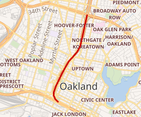
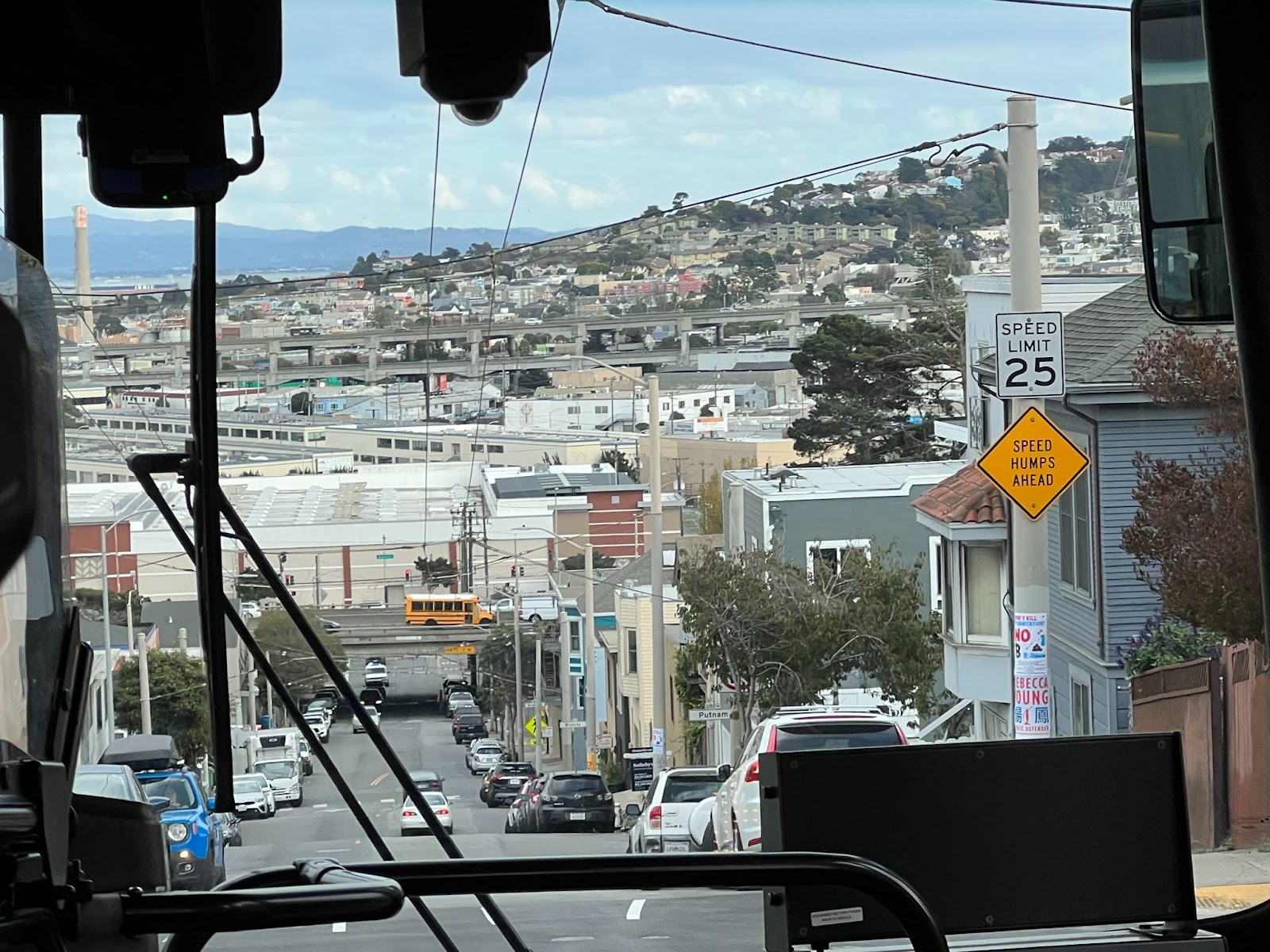

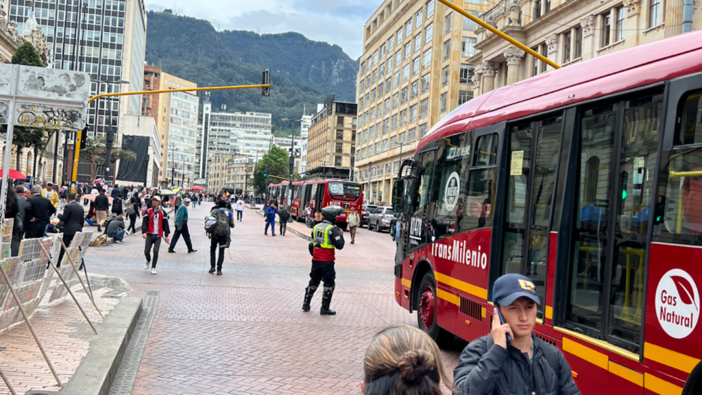
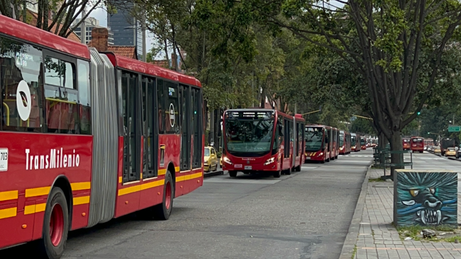
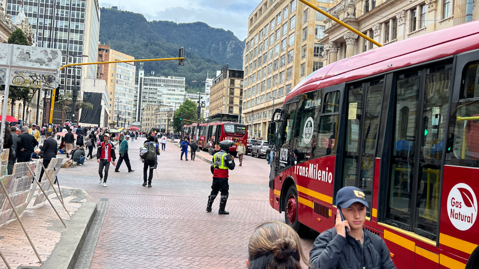
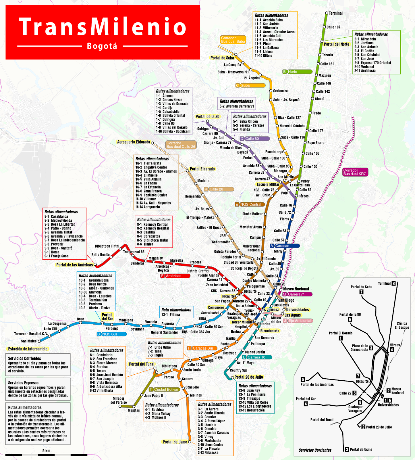
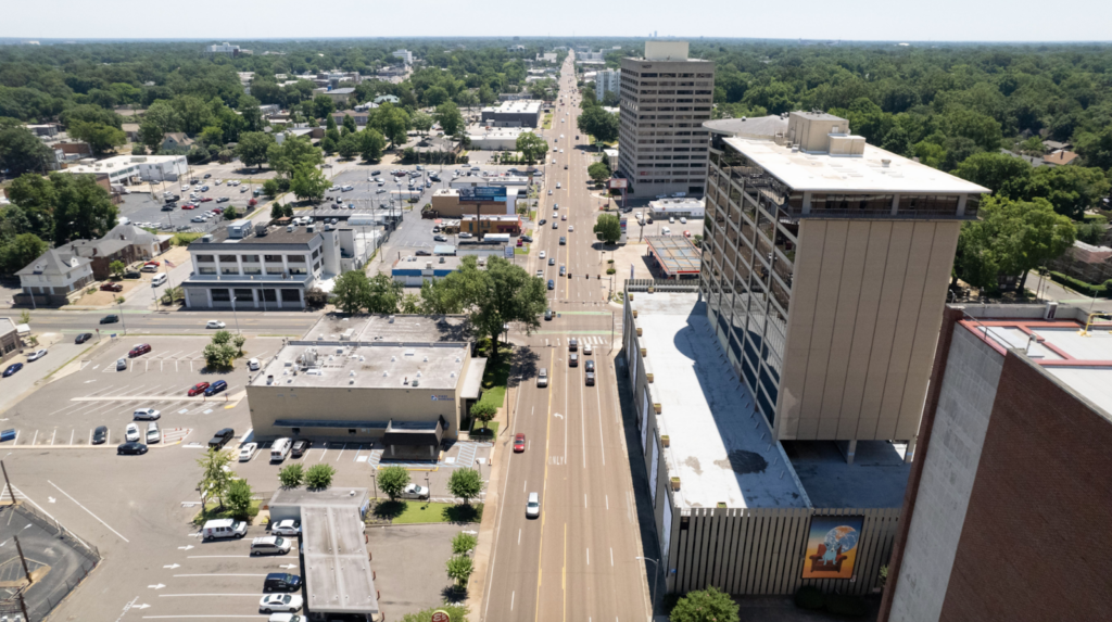

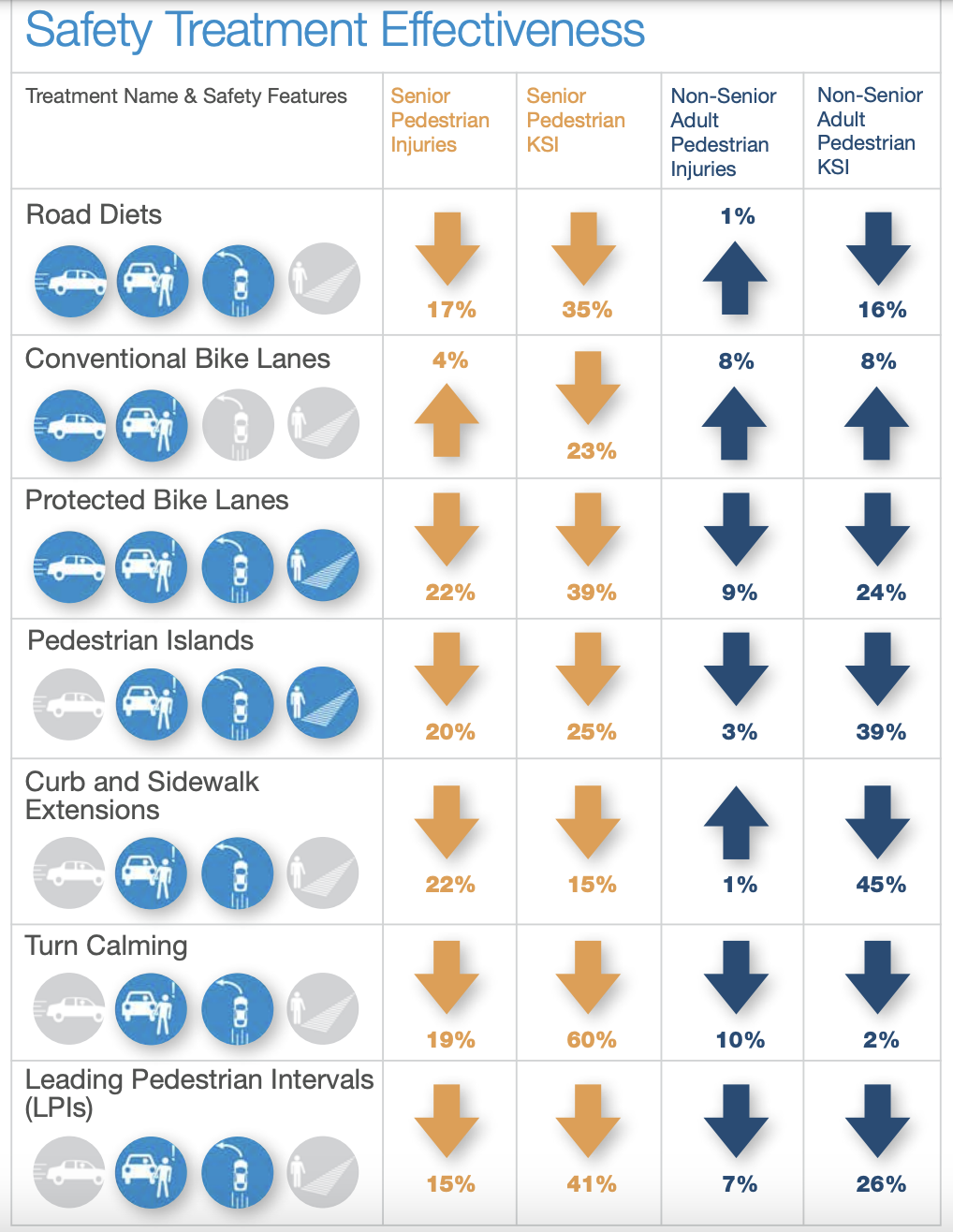
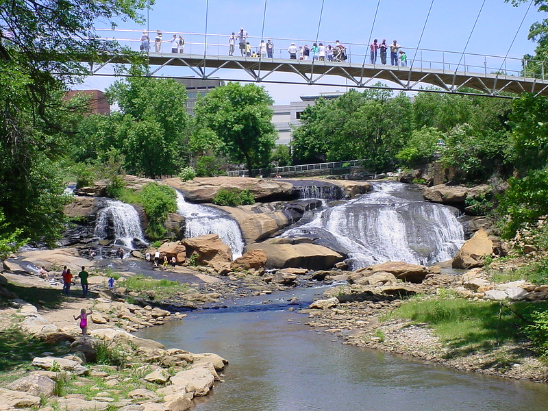
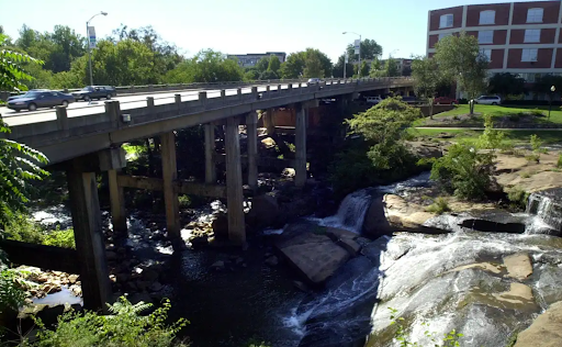

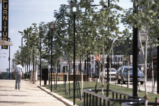
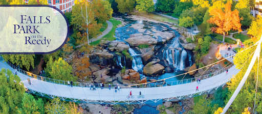
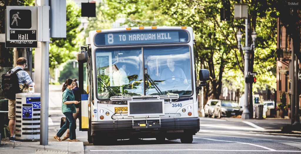

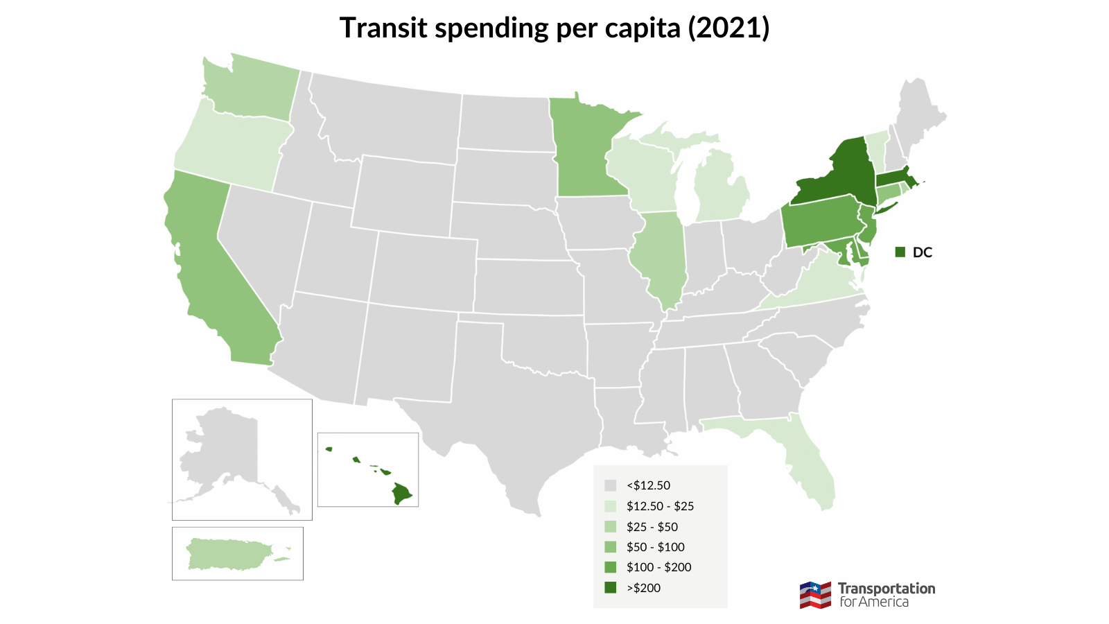
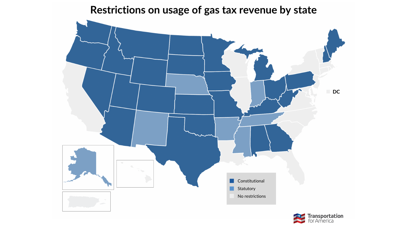
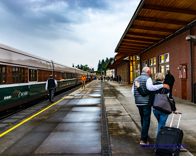
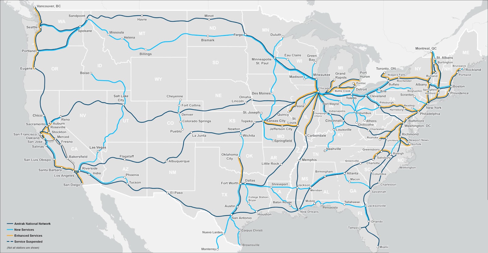
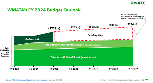
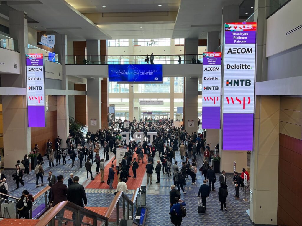

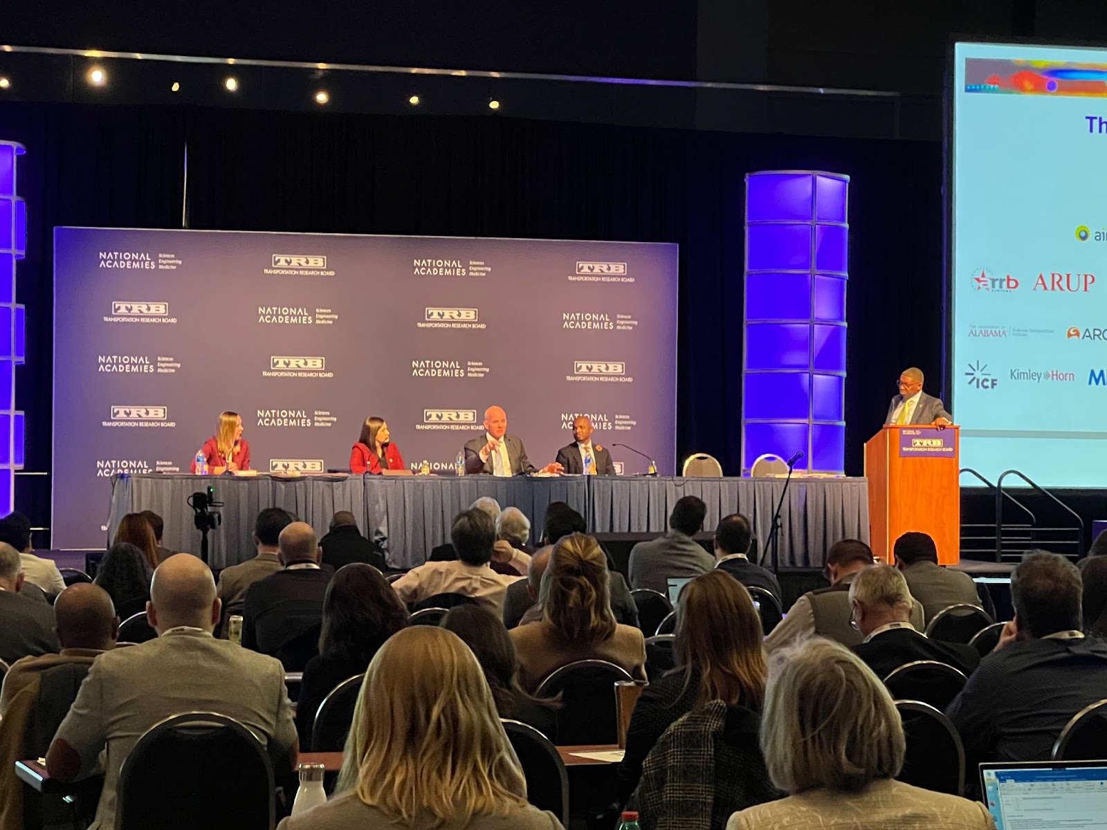

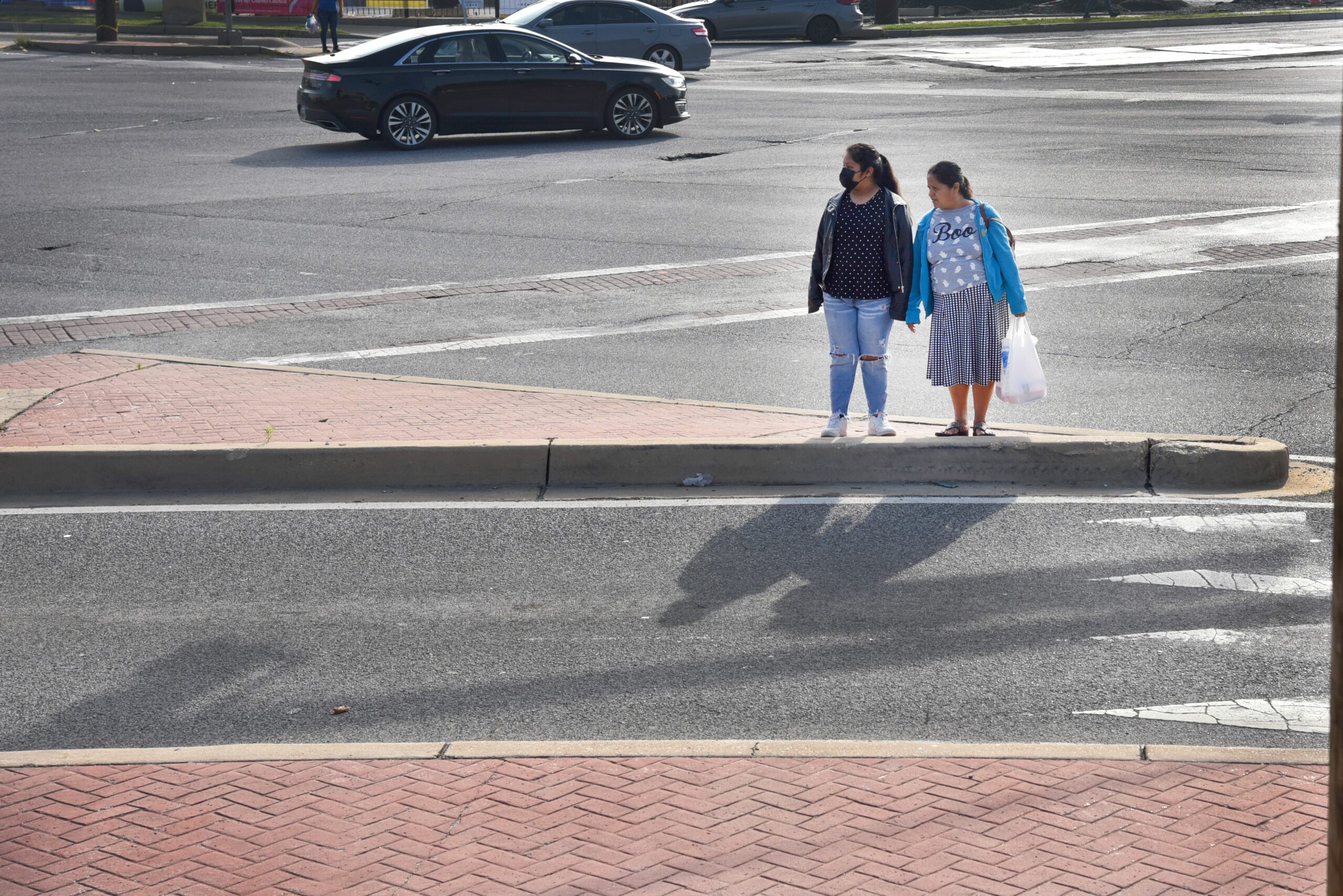
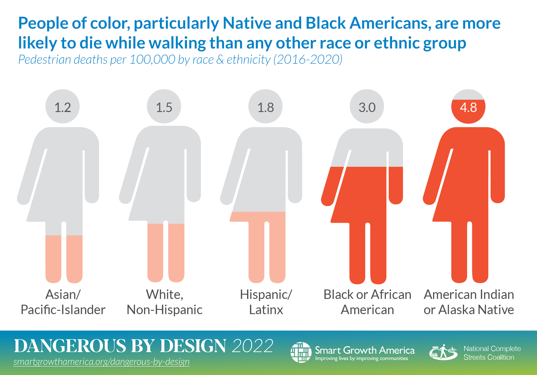
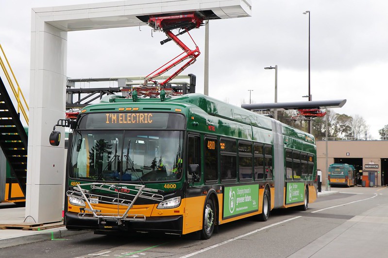
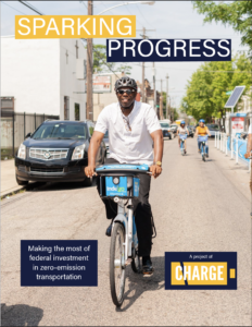
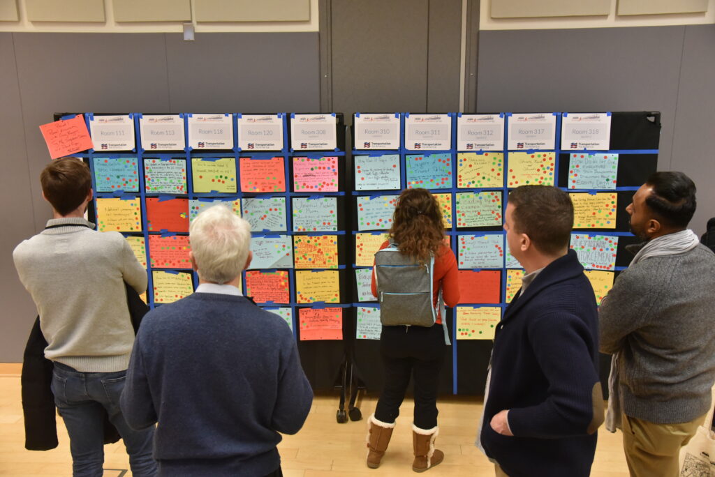
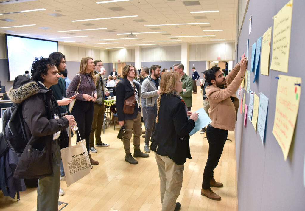
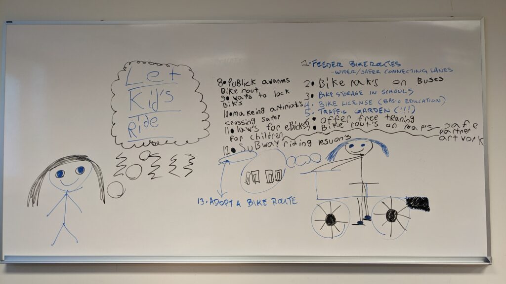
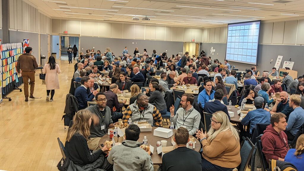
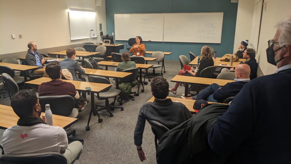
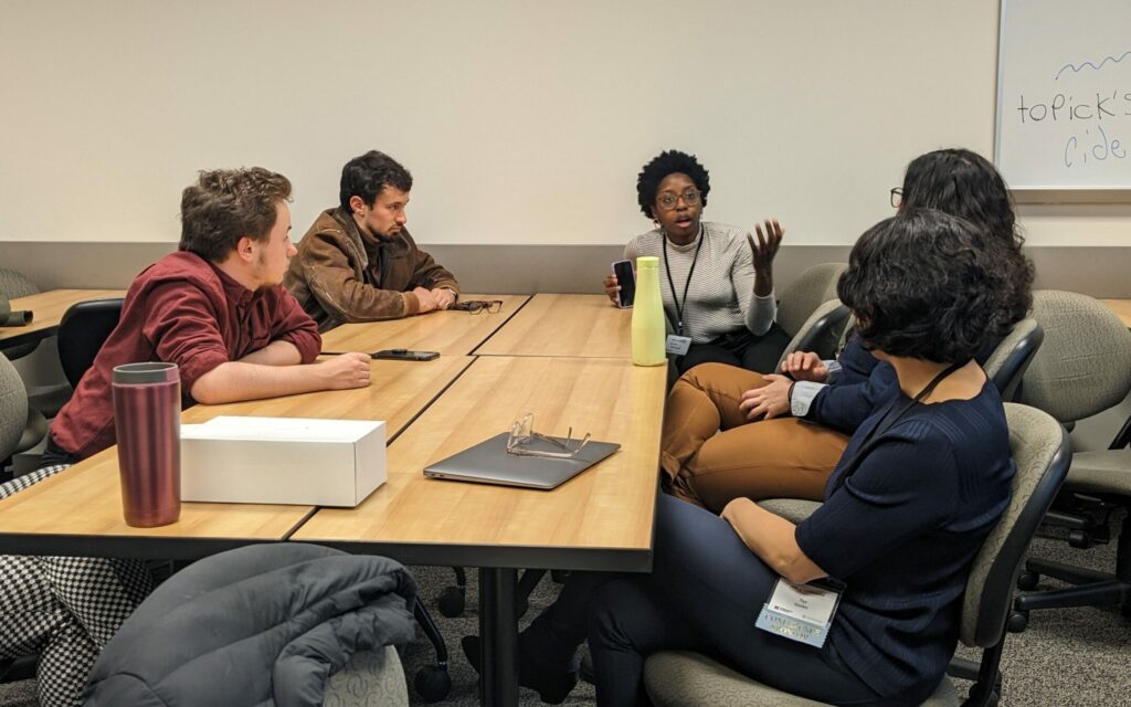
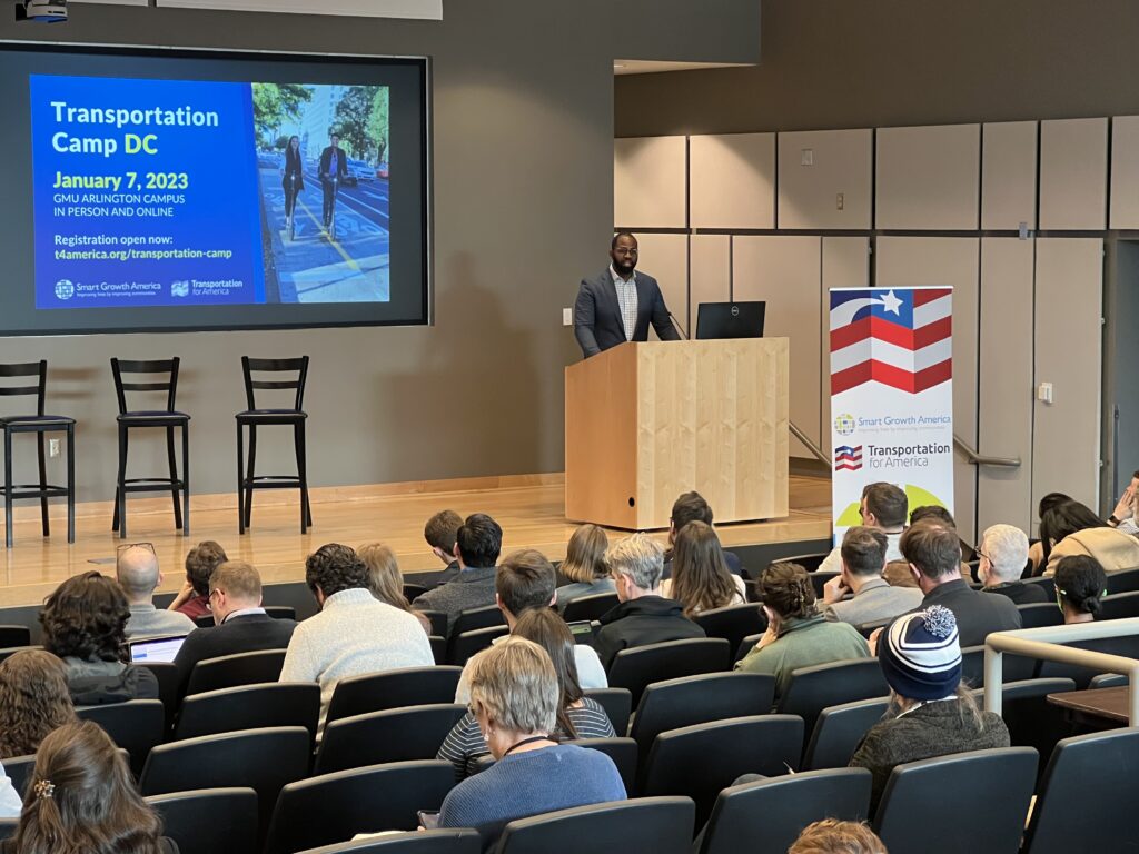

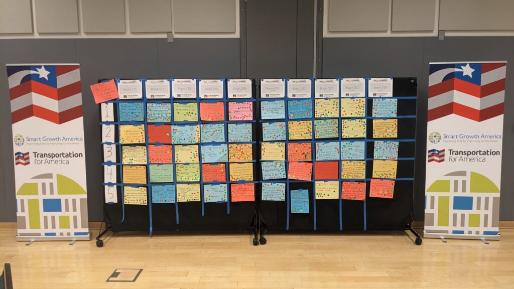
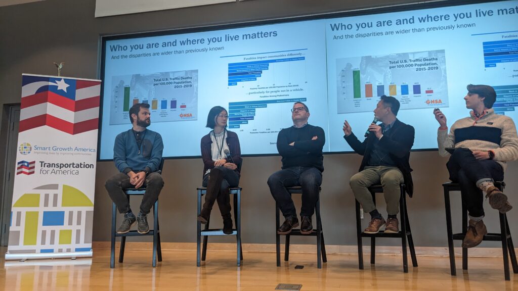
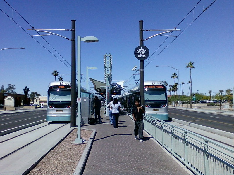
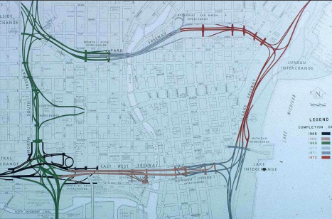

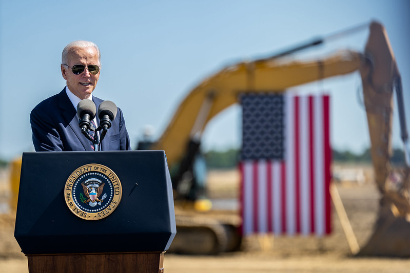

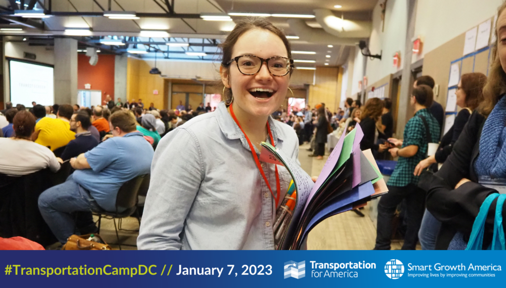

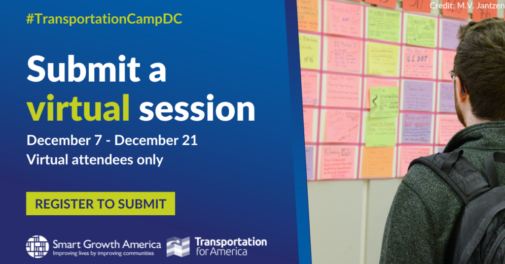
#/media/File:Map_of_Proposed_Southern_Crossing_(1956).jpg)