
 About Steve Davis

Stephen Lee Davis is the AVP for Transportation Strategy at Smart Growth America.

16 cities join T4America’s Smart Cities Collaborative to tackle urban mobility challenges together

In a new collaborative supported by Sidewalk Labs, cities will work together to create policies, pilot emerging technology & share insights to improve transportation in cities small and large.

Washington, DC; New York, NY – Transportation for America (T4A) and Sidewalk Labs announced today the sixteen members of a new T4A Smart Cities Collaborative to explore how technology can improve urban mobility, creating a tangible new opportunity for the scores of ambitious cities that did not win or weren’t eligible for USDOT’s Smart City Challenge. Over the coming year, the collaborative will bring together these cities to tackle the challenges related to implementing smart city policies and projects — sharing best practices and technical assistance, and piloting new programs.

Nearly 60 cities applied to be a part of the collaborative, which will hold its first meeting in Minneapolis on Nov. 9-10, 2016.

“We’re in the midst of the most transformational shift in urban transportation since the start of the interstate era more than 50 years ago. And just like that era, cities have enormous potential to help or harm their residents with the decisions they make,” said James Corless, Director of T4America. “It’s incredibly encouraging to see this long list of cities proactively shaping the future to ensure that this monumental shift in transportation doesn’t shape their cities without their input and produce a new generation of transportation haves and have-nots.”

“We have spent the past several months speaking directly with cities across the country, and what we’ve heard is mobility is a major issue across the board. Cities know that technology offers ways to improve mobility, but exactly how to realize its potential isn’t obvious,” said Sidewalk Labs Chief Policy Officer Rohit T. Aggarwala. “Cities understand that they need to work together, but the question has always been how best to band these municipalities in partnership. This collaborative will be an unprecedented step in unifying these urban areas and accelerate solutions that provide affordable, efficient ways to get around.”

Through the collaborative, the member cities will form working groups that will focus on three core areas:

  • Automated vehicles, and their potential impact on urban transit systems, congestion, transportation equity, and the environment.
  • Shared mobility, and how it could help cities provide equitable, affordable, and more sustainable transportation choices.
  • Performance measures and data analytics, and how to use data to manage complex transportation networks and achieve transit equity and environmental goals.

Initially, the cities will participate in a variety of information-sharing meetings, both with each other and with industry-leading transportation experts. From there, the groups will receive direct technical assistance, create pilot programs, and share results with the rest of the collaborative to drive best practices across the country.

The collaborative is the result of the partnership T4A and Sidewalk Labs announced in June to engage cities in developing efficient and affordable transportation options for all. The partnership builds on T4A’s experience collaborating with state and local governments to develop forward-looking transportation and land-use policy, combined with Sidewalk Labs’ expertise working with cities to develop digital technology that solves big urban problems.

The sixteen cities participating in the collaborative are:

  • Austin, TX
  • Denver, CO
  • Centennial, CO
  • Chattanooga, TN
  • Lone Tree, CO
  • Los Angeles, CA
  • Miami-Dade County, FL
  • Madison, WI
  • Minneapolis/St. Paul, MN
  • Nashville, TN
  • Portland, OR
  • Sacramento, CA
  • San Francisco, CA
  • San Jose, CA
  • Seattle, WA
  • Washington, DC

ABOUT TRANSPORTATION FOR AMERICA:
Transportation for America is an alliance of elected, business and civic leaders from communities across the country, united to ensure that states and the federal government step up to invest in smart, homegrown, locally-driven transportation solutions — because these are the investments that hold the key to our future economic prosperity. T4America is a program of Smart Growth America.

ABOUT SIDEWALK LABS:
Sidewalk Labs is an urban innovation company that works with cities to develop technology that solves big urban problems across transportation, housing, energy, and data-driven management. It’s the result of a partnership between Alphabet and Daniel Doctoroff, the former Deputy Mayor of Economic Development and Rebuilding for the City of New York and the CEO of Bloomberg LP.

For interview requests, please contact:

Going deep with regional leaders on using performance measurement

We wrapped up an in-person workshop today with seven local groups of metropolitan leaders, learning how performance measures and a data-driven approach to assessing the costs and benefits of transportation spending can lead to better decisions and a smarter transportation network.

Transportation Leadership academy boston 1 Transportation Leadership academy boston 2 Transportation Leadership academy boston 3

Throughout yesterday and today in Boston, MA, a team of T4America staff have been joined by some notable experts with on-the-ground experience to dive deep into the topic of performance measures with metropolitan leaders from seven regions across the country. It’s part of our yearlong Transportation Leadership Academy focused on performance measures.

What’s performance measurement? More carefully measuring and quantifying the multiple benefits of transportation spending decisions to ensure that every dollar is aligned with the public’s goals and brings the greatest return possible for citizens.

If you’ve been following along, we’ve been writing regularly about how the transportation law that Congress passed in 2012 (MAP-21) created a new system for states and metropolitan planning organizations (MPOs) to measure the performance of their investments against federally-required measures.

This year’s iteration of our Transportation Leadership Academy is focused on providing these local leaders with tools and support to incorporate this new system into their processes of creating plans, selecting projects, and measuring the effectiveness of each transportation dollar that gets spent. This program, created in partnership with the Federal Highway Administration (FHWA), is educating these seven teams made up of local business, civic, elected leaders, and transportation professionals.

Though the academy is focused on working with regional leaders, a few states also have experience with performance measures. In Massachusetts, as part of a 2013 deal to raise new revenue for transportation, the legislature required the DOT to develop and use performance-based criteria in the state’s transportation investment decisions. Stephanie Pollack, the head of MassDOT, shared her experience with this week’s attendees and why it makes sense to assess transportation projects together and against one another, rather than just sone-by-one.

“Transportation works as a network and fails as a network,” she said. “So why do people think we can fix the network project by project by project? I’m most interested in what is the best suite of projects.” She went on to describe why data matters, but only if you measure the right things. “You should be asking people what matters to them and measure that. If you don’t, you are telling your customers that what matters to them is unimportant. …Data is only useful if it helps you tell a story or make better decisions.”

There are other metro areas that have been using performance measures for years and have valuable experience to share.

The MPO for the Bay Area, the Metropolitan Transportation Commission (MTC), has done more than most metro areas when it comes to using data and sophisticated modeling to aid and assess their decision-making. Participants got to hear the Hon. Steve Kinsey discuss MTC’s deep experience using cost-benefit analysis and their quantitative approach to performance measures.

And Robin Rather, a strategic communications veteran who has done deep research into the topic, explained how the messages and language matter, i.e., making the case for performance measures in economic terms is one of the most effective ways to get skeptical MPO board members or the public to buy-in to the idea.

This second academy workshop wraps up early this afternoon, marking the end of the academy’s in-person gatherings. Training will continue via other forms through the rest of the year, and we’ll be following up with some thoughts on the academy and sharing the perspectives of some of the participants. Stay tuned.

USDOT reopens the comments on the MPO Planning and Coordination Rule

In an interesting move, US DOT has reopened public comment on the MPO Planning and Coordination rule, which proposed requiring urbanized areas with multiple MPOs to coordinate their planning efforts together, among numerous other changes. The proposed rule received over 500 public comments before it closed on the original August 26 deadline. (See T4America’s public comment here.)

The extension allows for an additional month of public comments, setting the new comment deadline to October 24, 2016. 

USDOT appears to taking the unusual step of leaving the question entirely open of whether any provisions in the proposed rule will actually be finalized and turned into new regulations. FHWA and FTA are requesting specific public comment to inform their decision of “whether to finalize any provisions within the scope of the NPRM” including comments on:

  • potential exceptions that should be included in the final rule, and criteria for applying such exceptions;
  • the impact of the proposed requirements for unified planning products where multiple MPOs serve the same urbanized area; and
  • detailed comments on expected costs of the rule.

Comments submitted under the extension should address the points above and previously submitted comments should not be resubmitted. Federal Register Notice here. T4America’s summary of the NPRM is here and T4America’s public comment is available here.

Measuring what we value: Prioritizing public health to build prosperous regions

A new package of case studies released today by T4America, in partnership with the American Public Health Association, showcases a range of strategies that metro area planning agencies can use to strengthen the local economy, improve public health outcomes for all of their residents, promote social equity and better protect the environment.

CDC APHA health case studies

Today, we’re launching Measuring what we value: Prioritizing public health to build prosperous regions, four short case studies that extend our previous work on data-driven decision-making for choosing transportation projects.

Download the four case studies below.

A growing number of the metro leaders, elected officials and citizens we talk to are asking questions like: can the people in neighborhoods more likely to be unhealthy easily get out for a walk or bike ride without having to traverse dangerous streets? Do our regional planners effectively consider the impacts on regional air quality as we choose which projects to build? Is the area putting forward the most competitive possible projects to win limited state or federal funding for walking and biking?

A handful of metro areas have found smart, data-driven ways to better conceive, select and build the transportation projects that can help address these looming questions. We’re happy to share with you four of those stories from metro areas big and small: Sacramento, CA; Broward County, FL; Nashville, TN and Greensboro, NC.

Download each one below.


SACRAMENTO, CA
Promoting health and economic prosperity through data-driven decision-making

Citrus Heights community center groundbreakingUsing a lens of improved economic performance by improving public health, the Sacramento Area Council of Governments (SACOG) adopted several health- and social equity-related performance measures into a rigorous, data-driven process for choosing transportation projects, resulting in more projects that make it safer and more convenient to walk or bicycle.

Download the Sacramento case study. (pdf)

BROWARD COUNTY, FL
Healthy, safe & prosperous by design: Building complete streets

Prompted by a need for safer streets, the Broward Metropolitan Planning Organization (MPO) spearheaded an effort to build regional consensus and political support for planning, designing and building more complete streets projects. As a result, 16 of the MPO’s 31 jurisdictions have adopted Complete Streets resolutions or guidelines, and the MPO increased funding for active transportation projects, with 90 individual bicycle and pedestrian projects totaling $120 million awarded funding since 2012.

Download the Broward case study. (pdf)

NASHVILLE, TN
Prioritizing public health benefits through better project evaluation

Nashville missing sidewalksBacked by data from comprehensive health studies and growing public demand to make biking and walking safer and more convenient throughout the region, the Nashville Area Metropolitan Planning Organization (MPO) designed a new scoring and selection process to prioritize transportation projects that can bring health benefits. The MPO’s new approach substantially increased the amount of funding in the their long-term transportation budget dedicated to making it safer and more attractive to walk or ride a bicycle, making strides toward improving the health of the region’s residents.

Download the Nashville case study. (pdf)

GREENSBORO, NC
Healthy competition: Using data and modeling tools to win funding for active transportation projects

Greensboro sidewalks Guilford CollegeTo make walking and biking safer, more equitable and more convenient in Greensboro, North Carolina, the Greensboro Metropolitan Planning Organization (MPO) developed a rigorous evaluation and data-driven selection process to analyze and select the best possible bicycle and pedestrian projects for the metro area’s available funds, and to help the region better compete for the limited, competitive funding controlled by the state.

Download the Greensboro case study. (pdf)


The development of these case studies was made possible through a contract between the American Public Health Association and Transportation for America funded through cooperative agreement 5U38OT000131-03 between the Centers for Disease Control and Prevention and the American Public Health Association.  The contents of this document are solely the responsibility of the authors and do not necessarily represent the official views of the American Public Health Association or the Centers for Disease Control and Prevention.

Metropolitan planning for healthier, safer, more prosperous regions

How can metro area planning agencies strengthen the local economy, improve public health outcomes for all of their residents, promote social equity and better protect the environment? Join us to hear the stories of how a handful of metro areas have found smart, data-driven ways to better conceive, select and build the transportation projects that will help meet those regional goals.

Flickr photo by the Broward MPO. /photos/speakupbroward/24986492294

Flickr photo of an event by the Broward MPO. /photos/speakupbroward/24986492294

Metropolitan planning organizations (MPOs) not only have responsibility to create regional plans that govern federal spending within their borders, but those in larger regions also control a limited amount of transportation funds directly. How they manage these responsibilities has a huge impact on the health of their residents and their access to jobs and other opportunities.

Can the people in neighborhoods more likely to be unhealthy easily get out for a walk or bike ride without having to traverse dangerous streets? Does an MPO effectively consider the impacts on regional air quality as they choose which projects to build? Is the area putting forward the most competitive possible walking and biking projects to win limited state or federal funding?

We’re excited to bring you the stories of a handful of MPOs that have good answers to all of these questions next week via a new series of short case studies and an accompanying webinar on Thursday, September 22 at 1 p.m. EDT. Register for the webinar with the link below.

REGISTER NOW


Register for the webinar and you’ll be the first to receive a copy of these new case studies. If you work for an MPO, advocacy group or health organization and want to learn about ways to increase or improve the quantity and quality of active transportation projects in your region, this one is for you.

The MPOs we’re featuring have found ways to better use data and modeling tools to win funding for active transportation projects, standardize the process for building safer, more complete streets, or promote health and economic prosperity through transparent, data-driven decision-making. And we’re excited to share their stories with you.

On the webinar, we’ll have a short conversation with staff from four MPOs featured in the case studies. They’ll share details on their policies and programs, the transportation projects that resulted and the partnerships they had to forge to taste that success.

Join our team and experts on September 22nd at 1pm EDT. Register today!


Development of the case studies featured in this webinar was made possible through a contract between the American Public Health Association and Transportation for America funded through cooperative agreement 5U38OT000131-03 between the Centers for Disease Control and Prevention and the American Public Health Association.  The contents of this document are solely the responsibility of the authors and do not necessarily represent the official views of the American Public Health Association or the Centers for Disease Control and Prevention.

How can cities embed creativity through artist-in-residence programs?

Join us for the second webinar in our series further exploring the role of arts and culture in transportation planning and community development, as we discuss two cities’ artist-in-residence programs.

7950801038_97d5418c7c_o

The Architecture of Endlessness designed and painted by NKO, a mural on the Red Wall surrounding the Link Capitol Hill Station. Flickr photo by Sound Transit

In 1977, Mierle Laderman Ukeles became the first, and still only, artist-in-residence at New York City’s Department of Sanitation, a job she still holds today. Four decades and thousands of handshakes later, Ukeles’ pioneering work has become a model for cities engaging with artists to bring a creative approach to municipal challenges.

Today, Minneapolis, Seattle, Saint Paul, Boston, Los Angeles, and other cities across the US run artist-in-residence programs, embedding local artists inside city departments to promote creative thinking, attract attention to mundane but crucial municipal processes, and shift narratives about city residents and workers.

Register to join us on September 21, 2016 at 4 p.m. EDT for our online discussion about artist-in-residence programs and hear from experts as we explore some recently created and established artist-in-residence programs in city agencies.

  • Ben Stone, Director of Arts & Culture, Smart Growth America/Transportation for America
  • Seleta J. Reynolds, General Manager, Los Angeles Department of Transportation
  • Alan Nakagawa, Creative Catalyst Artist in Residence, Los Angeles Department of Transportation
  • Colleen Sheehy, President & Executive Director, Public Art Saint Paul.


REGISTER TODAY


Reminder: Have you browsed our new guidebook to creative placemaking yet? Visit Back in February, T4America launched The Scenic Route, an online interactive guide to creative placemaking in transportation to introduce the concept to transportation planners, public works agencies and local elected officials who are on the front lines of advancing transportation projects.

To continue building on that work, we’ve launched this series of webinars to further explore the role of arts and culture in transportation planning and community development. Catch up with the first one from August here.

State legislative stalemate jeopardizing millions in federal transit funding for Minneapolis rail project

Business leaders and suburban mayors in the Twin Cities are pleading with state legislators, urging them not to throw away dedicated federal funding for a long-planned regional transit expansion by dropping the state’s financial commitment. Updated 9/1 with new information at the bottom of the post.

Opening day on the Green Line. Flickr photo by Michael Hicks. /photos/mulad/14238058898/

Opening day on the Green Line. Flickr photo by Michael Hicks. /photos/mulad/14238058898/

One of the major bills Minnesota legislators have been aiming to hammer out in a special session this fall is a capital bonding and transportation package to raise new state funding for transportation. But so far, Gov. Mark Dayton, the DFL-controlled Senate and the House Republican majority have failed to agree on a much larger package of tax cuts, transportation and infrastructure improvements — a package intended to include promised state funding to extend the existing Green Line light rail southwest into Minneapolis’ suburbs toward Eden Prairie.

Though $900 million in federal New Starts transit funds and $750 million in local tax funding have been pledged and $140 million has already been spent, this political stalemate over the state’s $135 million share is threatening to kill the project and send nearly a billion dollars in federal funds back to Washington (and then off to another project elsewhere in the country.)

Republican legislators in the House majority largely oppose spending state funding on the project whatsoever, even opposing a recent compromise to allow additional local funding to cover the state’s gap. This last-gasp effort at saving $900-plus million in federal funding would cover the state’s inaction by tapping a greater share of local funding on top of the $750 million already committed in local taxes.

As the Star Tribune reported last week:

Under the new proposal, which Dayton said his administration and Met Council staff devised just a day earlier, three entities would raise the $145 million state match: the Met Council would contribute $92 million, Hennepin County would contribute $21 million and the Counties Transit Improvement Board (CTIB) would kick in $32 million.

This compromise would allow the project to proceed without state legislative action, though there would still be hurdles to clear: each of these three bodies noted above would have to vote separately to approve their share of the $145 million, and do it quickly. Barring legislative action or successful votes on the compromise plan to increase local funding, the project will run out of funds by the end of September, forcing staff layoffs and the reassignment of private engineering firm employees.

A prominent group of 12 area CEOs that employ more than 100,000 area residents penned a letter to the Star Tribune back in the spring about state funding for transit and the planned regional projects, including the southwest light rail extension.

Wise investments in transit are worth making. Passing a comprehensive transportation bill that includes transit is critical in this session. If the state doesn’t act to provide funding for these projects, these federal dollars will go to a transit project in another state. Failure to act this year also means some of these projects will be in jeopardy. The business community can’t afford to miss out on this investment. Neither can the health of our communities, our region or the state of Minnesota. We hope state lawmakers will take action to ensure the best future for our region.

Minnetonka is one of the southwestern suburban cities the completed light rail line would pass through. Mayor Terry Schneider told the Star Tribune last week in that article above, “We’ve worked on this for five years, and we’ve come to the strong conclusion that it’s the best way for our city, the state and the region to meet the needs of the future. To waste the opportunity now, to squander it for internal bickering, would be a huge disservice to citizens of our state and region.”

9/1 UPDATE: The local jurisdictions reached a deal to cover the state’s unpaid $135 million share for the project to keep it moving ahead — including paying nearly $10 million in delay costs incurred by the state’s inaction during the legislative session. From The Met Council today:

The Southwest LRT Project is officially moving forward, after securing the remaining local funding commitments this week. …These contributions will together fill a $144.5 million funding gap, made up by the remaining necessary state match of $135 million plus $9.5 million in local delay costs caused by the legislature’s inaction in May.


Capital Ideas banner sacramento promoFinding solutions to debates over state funding for transit are the kind of topics we’ll be exploring in depth at Capital Ideas, our conference on state transportation funding and policy.

Check out the agenda, register today and join us in Sacramento this November 16-17

Register here

USDOT faces widespread opposition to proposed congestion rule

Nearly 5,000 individuals and 150 organizations — including dozens of local chambers of commerce and elected officials — joined with T4America to oppose USDOT’s flawed proposal for measuring traffic congestion and urge them to rethink their approach.

Here's what 5,000 pieces of paper looks like next to a terrific book about Complete Streets for scale purposes. We didn't have to waste 5,000 pages for your letters since USDOT allows digital submissions.

Since USDOT allows digital submissions and we didn’t have to waste any paper for your letters, here’s what 5,000 pieces of copy paper looks like next to a terrific book about Complete Streets for scale.

Almost 5,000 of our supporters sent letters urging USDOT to rewrite the department’s new requirements for measuring (and addressing) congestion — requirements that, as written, would induce sprawl, harm the economic potential of our main streets by treating them like highways, punish cities investing in public transportation, completely ignore people walking, biking, carpooling or telecommuting, and push local communities of all sizes to waste billions of dollars in vain attempts to build their way out of congestion.

“There’s a direct connection between how we measure congestion and the ‘solutions’ that we invest in,” said James Corless, director of Transportation for America, in our full press release yesterday. “And by prioritizing vehicles over people and completely ignoring a diversity of transportation options, this proposed rule would fail the communities that our transportation investments are intended to serve.”

USDOT has been undertaking a welcome and necessary shift toward measuring what our federal transportation spending actually accomplishes by establishing a new system of performance measures to hold states and metro areas accountable for making progress on important goals.

We know these rules sometimes seem arcane or obtuse, so we explained a real-world example of how they could play out in this opinion piece for The Hill last week:

The measure would fail to reward places that use existing streets more efficiently — particularly in urban areas where space is at a premium.

Take for example the 16th Street NW corridor in Washington DC. The street is often clogged at rush hour but, since it’s in the middle of the city, it can’t be widened. So how should transportation engineers address the congestion? One solution would be to add priority lanes for buses, which already carry more than half of all rush hour trips along the corridor. Prioritizing 50-passenger buses over single-occupancy cars would vastly increase the carrying capacity of the street and allow it to move even more people per hour than it does today. But under the Department of Transportation’s proposed rule, if this strategy succeeded in moving more people but had an even slightly negative impact on average travel speed per vehicle, it would get low marks.

DC Congestion Comparison 2

Part of the 16th street corridor in question, referenced in the above op-ed, is at right in the above graphic. During rush hour, buses carry more than half of all trips taken on this corridor.

That’s just one example, but in case you haven’t been following along recently, we’ve outlined the scope of the rule’s problems several times over the 120 days of the comment period, which closed on Saturday, August 20th.

In addition to the nearly 5,000 letters we delivered to USDOT last Friday night, an impressive and diverse coalition of business groups, local elected leaders and national and local organizations also signed a single letter proposing concrete ways for USDOT to fix the rule. Over the last four months, we convened more than 30 local elected officials, state DOTs, metropolitan planning organizations (MPOs) and transit agencies, national and state trade groups and advocacy organizations to develop a better measure to recommend to USDOT that has buy-in from practitioners on the ground.

The first recommendation in that letter is a simple one that gets to the heart of what needs to be fixed: “Travel time/delay is felt by the people who travel, not by the vehicle, and U.S. DOT should propose a measure that focuses on people and not vehicles.”

21 chambers of commerce from across the country also signed a separate letter signaling their concerns about a measure that would punish cities and regions investing in public transportation and walkable downtowns to stay economically competitive:

The proposed rule focuses on vehicle speeds only, which discourages local decision-makers from investing in transit, pedestrian, and bicycle infrastructure and impedes progress towards the walkable, accessible, and vibrant business districts that we are striving to achieve. A comprehensive mix of strategic transportation investments is necessary to allow American businesses to remain competitive. Hundreds of companies across the United States are moving to and investing in walkable downtown and business district locations. Companies want their location to be accessible by a range of transportation options in order to attract and retain talented workers. Performance measures included in this rule should account for all modes of transportation to both capture and encourage important investments that support resilient, strong local economies.

USDOT Secretary Anthony Foxx has embarked upon an ambitious effort to repair the damage of poorly-planned highway projects that divide communities and ensure that future transportation investments do a better job of connecting all people to economic opportunity — especially low-income communities and communities of color. Advancing a proposal that would prioritize high traffic speeds at all times of day on all types of roads would undermine the Secretary’s own efforts.

We are hopeful that USDOT will heed this call and change the rule to count everyone and support the local, metro and state leaders planning ambitious, smart transportation investments to better connect all people to opportunity.

Time is running out to tell USDOT to measure more than just vehicles

These two streets in Nashville, Tennessee are very different and have different functions. Why does the U.S. Department of Transportation want to measure their success the same way? 

Nashville congestion comparison 2

One is intended to move goods and people, largely in vehicles, quickly between two points. The other moves people — in cars, in buses, on bikes, on foot — while also creating a framework to produce lasting value, economic activity, and a sense of place.

It doesn’t make sense to measure the success of these streets the same way. Yet that’s exactly what USDOT is proposing with new rules for how states and metro areas would have to measure and address congestion — prioritizing vehicle speed above almost all other criteria.

The most successful city streets have to use limited space to move people efficiently, whether walking, biking, taking transit or driving. Yet this congestion rule as it is currently written would count only vehicles.

A street that moves a lot of people should never be considered unsuccessful, even if it doesn’t necessarily move a lot of cars.

The proposed rule would make driving fast the ultimate goal of our transportation system, regardless of what type of road or street you’re on. Should driving fast be the highest priority on main streets where people go to shop or sit and eat at an outdoor café? Should moving cars quickly be the top priority in residential neighborhoods where children might be biking or walking?

A street that creates value, economic prosperity and a sense of place should never be considered unsuccessful, even if it doesn’t necessarily move a lot of cars.

We have a chance to change this rule, but time is running out. Public comments on the rule close this week, and now is a crucial time to speak out.

Tell USDOT to improve their proposed rule and send a letter today.


You can view or share examples from a handful of other cities below.

SF congestion comparison 2 Charlotte congestion comparison 2 DC Congestion Comparison 2 Chicago congestion comparison Seattle congestion comparison 2 Portland congestion comparison 2 NYC congestion comparison LA congestion comparison 2 Denver congestion comparison 2 Atlanta congestion comparison


Applications are open for T4America’s smart city collaborative

Today, Transportation for America opened the application process for our national, multi-city collaborative with Sidewalk Labs. This partnership, announced back on June 1st, will help cities use technology to meet their pressing transportation challenges.

sidewalk lab music

When USDOT kicked off the Smart Cities Challenge and over 70 cities from across the country scrambled to put together applications detailing their smart city ambitions, it was clear that Secretary Anthony Foxx at USDOT had tapped into something vital unfolding in cities of all sizes across the country.

As we read through all 78 of those applications this spring, one thing became very clear: It’s really hard to put a finger on precisely what a smart city is right now, and what it means to be one. There are cities that have been opening up massive sets of municipal data to citizens for years allowing them to create apps or brainstorm ways to improve government services. Some cities have found new ways to use their own data to determine where transit services should be provided, but aren’t, and adjust accordingly. Some cities are testing partnerships with shared mobility providers to experiment with adding transit coverage or providing valuable last-mile connections.

Yet there are other cities that are clearly just dipping their toes into this arena, and are swept up to some degree by the availability of the grant money or enamored with technology as an end unto itself — often not yet certain of the specific problem that they’re trying to solve.

So what’s the norm? Where should a city be in relation to their peers?

To help establish a baseline and get a more organized sense of where cities are in this evolution, we’ve also distributed a State of the Smart City benchmarking survey to gather data from cities on the technologies and strategies they currently employ along with the tools they have at their disposal. T4America will use this survey as a baseline to measure the implementation of smart city technologies at both the national level and for individual cities in the coming years.

Whether or not your city is planning to apply to join the collaborative, you can help us get a better picture of your community by completing the State of the Smart City survey.

Our new national collaborative will bring cities into several working groups, each focusing on one aspect of a smart city, such as how to create a level playing field where a tiny startup of students can compete with a massive technology firm to create a new civic mobility app, ensure that new mobility options also serve the unbanked or low-income communities, or deploy congestion pricing in a way that helps provide more transportation options to more people.

The cities in the collaborative will work to develop pilot projects, share successes and failures, and engage with one another to come up with new, creative solutions to the problems at hand. If you and your city are interested in participating in the Smart City Collaborative, please fill out a short application here.

As we build this collaborative over the next few months and hear back from cities that are on varying points of this spectrum, we’ll be starting to coalesce around an idea of what a “Smart City” truly is. We have ideas, but no one has 100 percent of the answers at this point as this idea evolves, and cities should likely be skeptical of anyone who says they do.

We think a smart city is one that uses technology to discover where people are going and where they want and need to go, learns from that information and uses it to create safer, more efficient, and affordable transportation options that accelerate access to opportunity for all of their residents.

Those are our thoughts, but we’re eager to hear your feedback as well. 

So what do you think a smart city is? What does a smart city look like? How would you define one in a sentence or two?

A large congressional delegation asks USDOT to improve the proposed congestion rule

Updated 7/28 11:50 a.m. Earlier this week, a large group of senators and representatives sent a letter to USDOT Secretary Foxx, requesting that USDOT change a flawed proposed rule for measuring congestion. They asked that USDOT assess the movement of people, rather than vehicles, as a better measure of congestion and also reward the improvements that can come from transit, toll lanes, or encouraging travelers to choose other options like walking or biking.

Congestion Buses 2

As we’ve been discussing here for a few months now, a new draft rule from USDOT will govern how states and metro areas will have to measure and address congestion. That proposal as written would define “success” in incredibly outdated ways, and old measures lead to old “solutions,” like prioritizing fast driving speeds above all other modes of transportation and their associated benefits.

The shortcomings in the proposed rule got the attention of some members of Congress, and earlier this week Senators Tom Carper (D-DE) and Bob Menendez (D-NJ) and Representative Earl Blumenauer (D-OR) were joined by 64 other members from the House and Senate on a letter to Secretary Foxx about the rule. (19 senators and 48 representatives total.)

From the (Senate) letter: (pdf)

“How we measure performance and outcomes directly affects the choice of investments that will be made. If we focus, as this proposed rule does, on keeping traffic moving at high speeds at all times of day on all types of roads and streets, then the result is easy to predict: States and MPOs will prioritize investments to increase average speeds for cars, at the expense of goals to provide safe, reliable, environmentally-sensitive, multimodal transportation options for all users of the transportation system, despite those goals being stated in federal statute. Encouraging faster speeds on roadways undermines the safety of roads for all road users, as well as the economic vitality of our communities.”

We’re encouraged to see this large group of elected leaders on board with the idea that how we measure congestion matters. It certainly matters for the communities — of all sizes — that they represent, and getting it wrong will have real impacts. In the letter, they note that the proposed rule doesn’t quite line up with some of the stated goals of Secretary Foxx, his Ladders of Opportunity program, and the Every Place Counts Challenge intended to help communities and neighborhoods that have been cut off or isolated by poorly-planned highway projects.

Yet, for far too long our transportation investments have focused solely on moving vehicles through a community rather than to a community, and without regard for the impacts to the community. In the process we have created real barriers for millions of Americans to access essential destinations. These barriers are most present for low-income communities and communities of color.

Nail on the head.

Our streets are about far more than just moving people through a community as fast as possible. They’re community assets and the framework for creating value and economic prosperity, and should be treated like more than just a simple pipe moving one thing quickly all day long.

Note: the House letter is here (pdf)

UPDATE: Representative Earl Blumenauer added his personal thoughts to the release of the letter:

Our federal highway system is stuck in the 1950s. By failing to properly evaluate the billions we spend on road maintenance and construction, we’ve created a transportation system that is unsafe, is increasingly harming the environment despite improving technology, and has left a legacy of racial exclusion and segmented communities.  We have to do better. The Department of Transportation has an opportunity to make sure that federal spending can help meet our goals of safety, sustainability, and accessibility. I hope these comments are considered.

And in case you missed it, Senator Tom Carper also wrote a short note about the congestion rule for the T4America newsletter yesterday. (Don’t get our bi-weekly newsletter? Rectify that immediately by signing up right here.)

Our federal transportation system’s ability to move people and goods is key to an efficient and growing economy, which is why it’s critical for the Department of Transportation to focus on the movement of people instead of vehicles in its congestion relief measures. In order to improve the safety of our roads, and build a world-class transportation system that revitalizes our regional economies, we need to invest in innovative congestion relief techniques that facilitate the movement of people without encouraging faster speeds or incentivizing costly highway expansions. 


Have you sent a letter to USDOT yet? There’s still time to generate a letter that we’ll deliver on your behalf before the comment period closes in a few weeks. We’ve already delivered 2,400 letters, but we’re aiming for far more.

Send yours today.

Three separate ballot measures for transportation in the Atlanta region cleared to proceed

After the crushing defeat of a huge regional transportation ballot measure back in 2012, Atlanta is poised to rebound this fall. After recent action by city and county leaders to place measures on the ballot, voters in metro Atlanta will be making at least three critical decisions this fall about sizable new investments in transportation.

Atlanta beltline bike biker housing

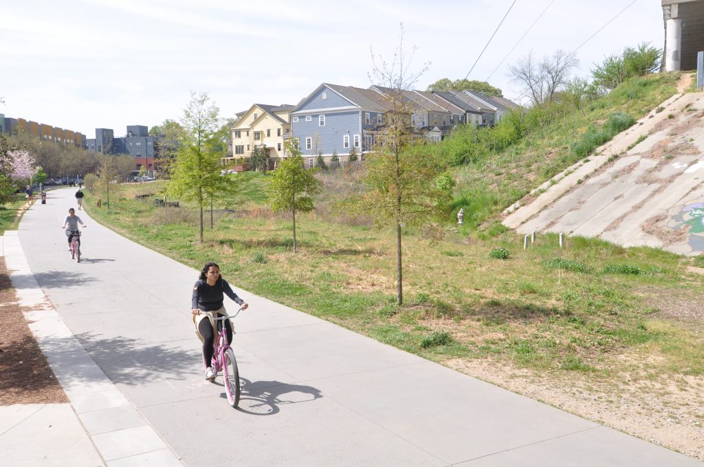
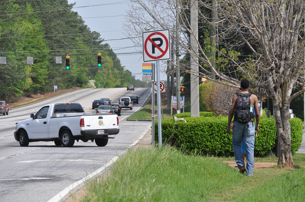
People biking along the booming Atlanta Beltline’s east side trail, which would get a big boost through two separate ballot measures in November to help buy additional right-of-way and start to add transit to the mix.

Thanks to a law passed by the Georgia legislature (SB 369) in the dying hours of the 2016 session, the city got the go-ahead to put at least two questions on the ballot that will raise funds to finally add transit to the one-of-a-kind Beltline around the city, expand existing bus and rail service, fund other new transit projects, and make other general transportation investments in the city.

We wrote about the legislation back in March:

The legislation enables three new local funding sources, each dependent on approval through voter referenda. 1) The City of Atlanta can request voter approval for an additional half-cent sales tax through 2057 explicitly for transit, bringing in an estimated $2.5 billion for MARTA transit. 2) Through a separate ballot question the city could ask for another half-cent for road projects. 3) And in Fulton County outside the city, mayors will need to agree to a package of road and transit projects and ask voters to approve up to a ¾-cent sales tax to fund the projects.

The first of these three options got the go-ahead back in June when the Atlanta City Council approved a tentative list of transit projects to fund with a new half-penny tax for MARTA and placed the measure on the ballot — though this list of projects could still change as they move into planning and public meetings following a successful vote.

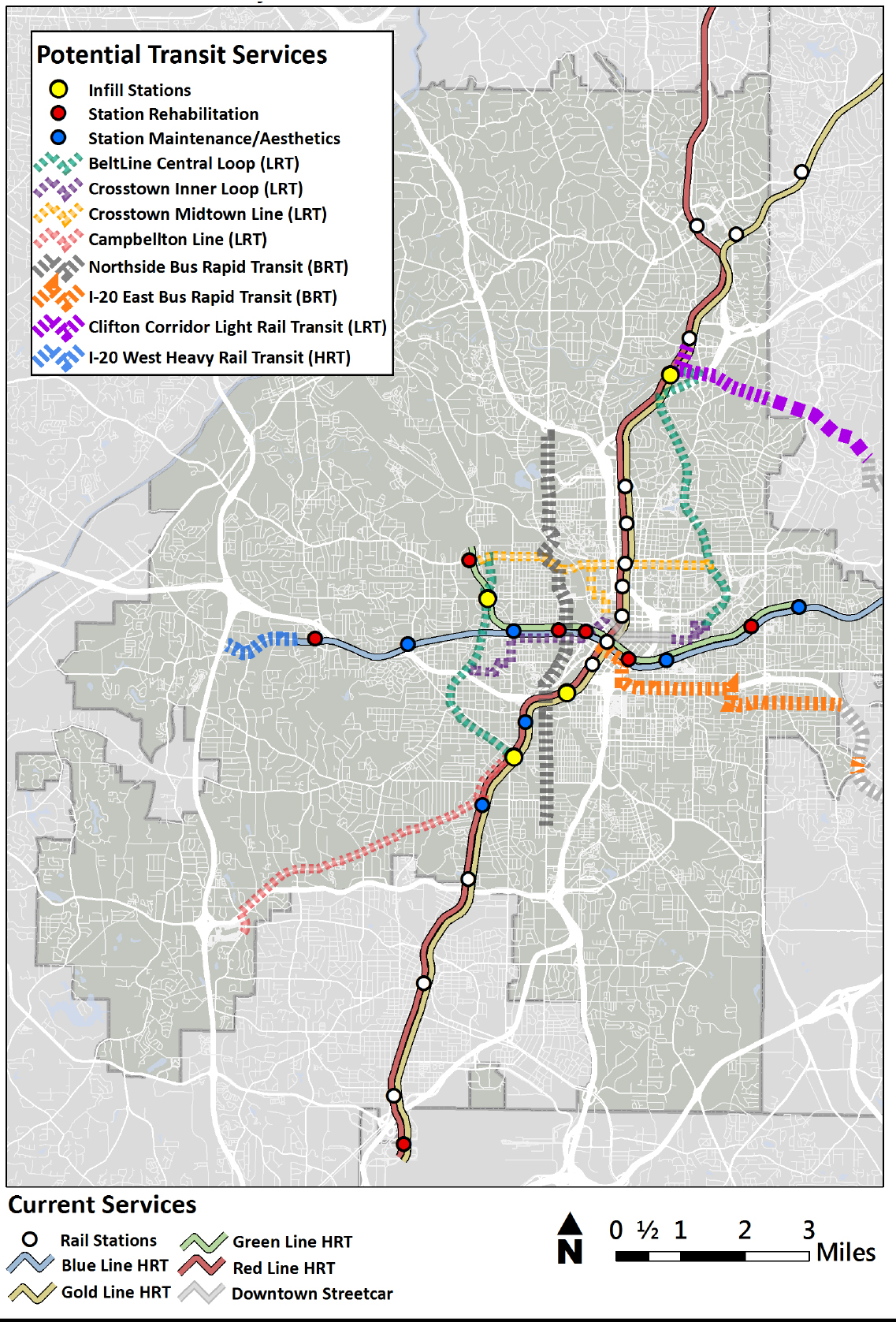
But for now, according to the presentation from MARTA (pdf), the $2.5 billion that would be generated by the new half-penny sales tax raised locally would help fund subway extensions, hefty improvements in bus service, new light rail on the Beltline project which will eventually encircle the city with transit, a walking/biking trail and linear parks, and improvements to bike and pedestrian connections near stations and bus stops. The half cent tax would run for 40 years.

marta tax transit projects`marta tax bike ped projects

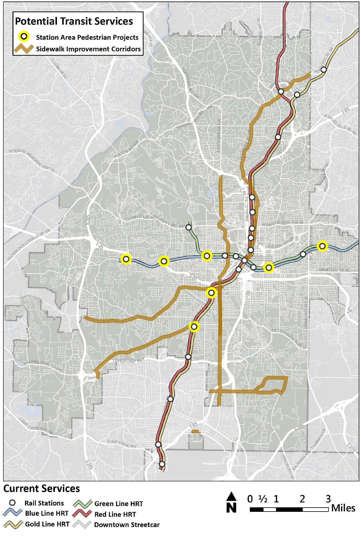
The state legislation also allowed The City of Atlanta to additionally raise up to another half-cent sales tax for a shorter period of time (five years) for other local transportation projects within the city limits. The Atlanta City Council chose to use only part of that taxing authority, putting a second measure on the ballot asking voters for 0.4 cents in additional sales tax, which will raise $260 million over the five-year life of the extra 0.4¢, and go toward a range of projects, according to a release from Mayor Kasim Reed’s office:

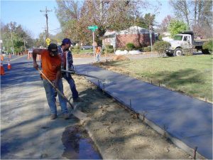
  • $66 million for the Atlanta BeltLine, which will allow the BeltLine to purchase all the remaining right of way to close the 22-mile loop;
  • $75 million for 15 complete streets projects;
  • $3 million for Phase 2 of the Atlanta Bike Share program;
  • $69 million for pedestrian improvements in sidewalks; and
  • $40 million for traffic signal optimization.

Note: The traffic signal optimization was a core part of the city’s application to the USDOT Smart City Challenge.

Mayor Reed said in his press release:

Infrastructure investments are vital to Atlanta’s quality of life and continued economic competitiveness. Between the $250 million being spent through the Renew Atlanta bond program and these TSPLOST funds, Atlanta will reap the benefits of more than a half billion dollars invested in new and improved roads, sidewalks, neighborhood greenways, parks and congestion reduction efforts. Combined with a $3 billion expansion of our public transit system through MARTA, Atlanta residents will see unprecedented new investments in strengthening our transportation networks.

If both of these ballot measures for transportation are approved — half a penny for MARTA and 0.4 cents for transportation — Atlanta will have a local sales tax rate of 8.9 percent, certainly among the higher rates in the country but still lower than Seattle, New Orleans, Chicago, nearby Nashville and other cities.

There’s also a third measure on the ballot this fall, but it only applies for residents of Fulton County that live outside of the city’s borders. There, voters will be deciding on a 0.75 percent sales tax for transportation projects that would fund only projects outside of the city limits in unincorporated Fulton County and in other cities. Fulton is a large county that stretches far enough to the north and south to encompass suburbs on both sides of Atlanta proper.

This Fulton-only measure would be explicitly for road projects, with nothing going toward public transportation. Widening roads, safety projects, resurfacing roads, and some streetscape improvements including bike lanes and new sidewalks.

This roads-only measure for the county is the result of the legislature’s lack of agreement on a larger bill that would have enabled a bigger single transit measure in Atlanta and both adjoining counties, Fulton and DeKalb. The larger MARTA ballot measure would have raised somewhere around $8 billion for MARTA. Opposition to new transit measures — especially in parts of Fulton County — sunk that legislation.

So Fulton County gets this roads-only ballot measure, but no chance at MARTA expansion further into the county for the immediate future.

In 2012, Atlanta’s large regional transportation measure that would have split over $7 billion between road and transit projects across the ten-county region failed miserably at the ballot, for a number of reasons. Yet voters in the City of Atlanta and Dekalb county strongly voted in favor of it, and we suggested at the time that an Atlanta-only measure could be the next path forward for the city.

Four years on, Atlanta voters will soon be deciding whether or not to make one of the biggest investments in infrastructure of any city of its size over the next few years. Taken with the $250 million Renew Atlanta infrastructure bond measure that passed last year, these measures would raise over $3 billion to invest in transportation over the next 40 years, with about $500 million of that coming over just the next five years.

Keep up with all of the notable local ballot measures we’re tracking with Transportation Vote 2016

Transpo Vote 2016

Catch up on the launch of our guide to the FAST Act

Last week, we launched our guide to the FAST Act, covering the shortcomings, omissions and opportunities in the federal transportation law that sets policy and funding for transportation until the year 2020. Download your copy of the guide below and if you missed the launch webinar, catch up with the presentation at the end of this post.

In 2015, Congress adopted their first long-term surface transportation law in more than a decade. Known as the Fixing America’s Surface Transportation (FAST) Act, the bill provides federal transportation policy and funding for five years (FY2016-2020).

Though the bill will provide a level of funding certainty through 2020, to accomplish this feat, Congress essentially killed the concept of a trust fund for transportation by transferring $70 billion in general taxpayer funds into the highway trust fund, offset by accounting maneuvers and budget gimmicks.

While there were a few positive changes, the FAST Act doubled down on the status quo of federal transportation policy and failed to make virtually any of the changes so urgently needed by our rapidly urbanizing and changing country.

For example, the bill is virtually silent on the issue of emerging tech-enabled mobility options or other coming innovations, provides no increase in local control over funding — continuing to defer almost all authority to states — and fails to move the ball forward on performance measures after the first steps made by MAP-21 in 2012, among other shortcomings and missions.

This short guide explores the shortcomings and opportunities presented by the law in further detail, and provides several short tables that show the funding available to states and metro areas over the life of the bill.

Get your copy here.

fast act webinar featuredOn July 14th, our policy team was joined by Mayor Chris Koos, T4America advisory board member and Mayor of Normal, Illinois, to discuss the FAST Act in detail, with a focus on the impacts for local communities.

Did you miss the webinar? You can catch up with a recording of the presentation, the slides, and the questions that were asked & answered here.


What would a better measure of congestion look like? Unpacking an alternative

USDOT’s draft rule that will govern how states and metro areas will have to measure and address congestion would define “success” in incredibly outdated ways. In a webinar earlier this week, we discussed better ways to measure congestion and a proposal we’re sending to USDOT.

Nearly 3,000 of you have already sent letters to USDOT telling them that their draft rule takes the wrong approach. But is there an alternate proposal that could get traction with USDOT as they modify the proposal based on the feedback they receive?

congestion-webinar-feature-slideIn a webinar on Wednesday, July, 13th, our policy team discussed alternative measures for congestion and unpacked the proposal that we’re submitting to USDOT for their consideration, which was developed in collaboration with a handful of MPOs, transit agencies, state DOTs, and advocates throughout the country.

Click the image at right (or here) to view the presentation from the webinar and hear more about the proposal we are submitting to USDOT this week. Update: For those of you who are more technically inclined, you may download our full 12-page proposal (pdf) that we submitted to USDOT on July 14th.

Deciding how to evaluate which projects are “successful” will influence which transportation projects are selected and built for years to come. And the problem with using old measures for assessing traffic congestion is that it leads directly to old “solutions,” like prioritizing fast driving speeds above all other modes of transportation and their associated benefits. We’ve been illustrating this with some simple graphics that show what results when “moving cars fast” becomes the prime or only consideration:

Congestion We All Count

Have you sent your letter yet? There’s still time.

Success is about a lot more than moving cars fast. Tell USDOT to improve their proposed rule. Sign an individual letter that we will deliver on your behalf to USDOT.

Crucial transportation and transit-related ballot measures coming up in 2016

Throughout 2016, ballot measures and referenda that will raise new revenue for transportation at the local or state level will be decided during elections across the country. As in years past, we’ll be keeping a close eye on several of the most notable questions in the 2016 edition of Transportation Vote.

We’ll be profiling a few at length on the blog over the next few months and keeping all the relevant information organized in a table: https://t4america.org/maps-tools/state-policy-funding/2016-votes

Transpo Vote 2016

Two years ago in 2014, a handful of states moved to create “lockboxes” for transportation funds and several others raised new funding. At the local level, cities and counties from Atlanta to Seattle approved important ballot measures to raise new funding to either preserve or massively expand public transportation service.  The voters in a growing list of states and localities will be deciding similar questions this November, and we’ll be keeping a close eye. Stay tuned for more, and bookmark Transportation Vote 2016.

Transportation-related ballot measures tend to do well with voters — whether statewide or exclusively local measures — passing at around twice the rate of all other ballot measures. And transit or multimodal measures always do well, passing about 71 percent of the time since 2009.

As soon as election day is over, the focus will shift to 2017 and especially the state legislative sessions beginning around the beginning of the year. If you want to know more about state legislation related to transportation revenue, you need to join us in Sacramento for Capital Ideas II. There’s still time to register and make travel plans to meet us there. Don’t miss your opportunity to be a part of this terrific event that will help equip you to make things happen in 2017 and beyond.

Capital Ideas banner sacramento promo


Note: We don’t track 100 percent of all transit-related measures — for an overview of all transit-related ballot measures, turn to the Center for Transportation Excellence, the authority on tracking such data. Questions about measures or know of a significant one we should be following that doesn’t appear here? Reach out to Dan Levine on our staff.

Join us on 7/14 for the release of a helpful new guide to the FAST Act transportation law

Next week, T4America will be releasing a new guidebook intended to help you understand the changes made in 2015’s five-year transportation law and provide you with the necessary information to best leverage the federal transportation program. Sign up for a kickoff webinar next Thursday afternoon and receive an early copy by email.

FAST Act Guide Promo

Join us Thursday, July 14th at 4 p.m. as we briefly discuss Falling Forward: A Guide To the Fast Act with some of our policy experts and other special local guests who will add some insight on what the bill means for local communities. Register for the webinar and we’ll email you a copy first thing on July 14.

REGISTER NOW


About the FAST Act and this new guide

In 2015, Congress adopted their first long-term surface transportation law in more than a decade. Known as the Fixing America’s Surface Transportation (FAST) Act, the bill provides federal transportation policy and funding for five years (FY2016-2020). Though the bill will provide a level of funding certainty through 2020, to accomplish this feat, Congress essentially killed the concept of a trust fund for transportation by transferring $70 billion in general taxpayer funds into the highway trust fund, offset by accounting maneuvers and budget gimmicks.

While there were a few positive changes, the FAST Act doubled down on the status quo of federal transportation policy and failed to make virtually any of the changes so urgently needed by our rapidly urbanizing and changing country. For example, the bill is virtually silent on the issue of emerging tech-enabled mobility options or other coming innovations, provides no increase in local control over funding — continuing to defer almost all authority to states — and fails to move the ball forward on performance measures after the first steps made by MAP-21 in 2012, among other shortcomings or omissions.

There were also a few notable changes (positive and negative) made in the FAST Act, and we’ll explore the shortcomings and opportunities presented by the law in further detail in this guide.

Register today and join us on Thursday, July 14th to hear more and get your copy.

USDOT’s congestion measure is not good — what would a better one look like?

Thousands of you have sent letters to USDOT on their draft rule that will govern how states and metro areas will have to measure and address congestion — a proposal that currently defines “success” in outdated ways. It’s clear that USDOT’s proposed measure doesn’t cut it, but if you want to hear more about a better way to measure congestion, join us next week.

Join T4A’s policy team on July, 13th at 3 p.m. EDT to learn about some proposed alternatives to improve USDOT’s congestion performance measure, as well as measures covering performance of the National Highway System, Interstate freight movement, on-road mobile source emissions, and greenhouse gases.

REGISTER NOW


Nearly 3,000 of you have already sent letters to USDOT telling them that their draft rule takes the wrong approach. But what would a better measure look like, and is there an alternate proposal that could get traction with USDOT as they modify the proposal based on the feedback they receive?

The alternatives we’ll be discussing on this webinar were developed in collaboration with a handful of MPOs, transit agencies, state DOTs, and advocates throughout the country. Join the webinar on July, 13th at 4pm EDT to learn more, ask questions, and engage in this rulemaking process.

Deciding how to evaluate which projects are “successful” will influence which transportation projects are selected and built for years to come. And the problem with using old measures for assessing traffic congestion is that it leads directly to old “solutions,” like prioritizing fast driving speeds above all other modes of transportation and their associated benefits. We’ve been illustrating this with some simple graphics that show what results when “moving cars fast” becomes the prime or only consideration:

Congestion We All Count

Have you sent your letter yet? There’s still time.

Success is about a lot more than moving cars fast. Tell USDOT to improve their proposed rule. Sign an individual letter that we will deliver on your behalf to USDOT.

How can we reinvigorate and refocus our country’s transportation program?

Though the FAST Act is just six months into its five-year lifespan, it’s never too early to start discussing how to overhaul the outdated priorities of our nation’s transportation policy — especially when Congress failed to address them in that five-year transportation bill. One of our experts was a featured guest in a congressional briefing intended to move that conversation along.

Beth Osborne, senior transportation advisor for T4America, discussed these ideas at a short briefing on Capitol Hill entitled New Vision, Principles and Funding to Reinvigorate the Transportation Program, organized by Senator Tom Carper (D-DE) and Rep. Earl Blumenauer (D-OR).

Senator Carper at Hill hearing

Senator Carper introducing the briefing on Wednesday, June 15th.

We hear a lot about how the gas tax has lost its value and we need to find ways to increase funding for our country’s transportation system. While this is all true, we also must use our existing resources far better.

Beth Osborne at hill hearing

Beth Osborne presenting at the briefing

In New Principles for Our Transportation Program, a report Beth Osborne recently penned for The Century Foundation, she laid out four key changes we should make, which she presented in yesterday’s hearing: fix what we have first, focus on moving people and goods instead of vehicles, use competition to spur innovation, and come up with an honest way to fund transportation that doesn’t depend on general tax dollars to shore up an outdated, broken funding mechanism.

While a lot in Congress point to the need for more funding, “there is a lot that is not understood about the problem,” Beth suggested.

“There’s a disconnect between the policy, programs and the way the money is spent.” When faced with a funding shortfall, rather than assessing how bad development decisions drive the need for further transportation investments, Beth asked the crowd while referring to the map below, “is this really a funding problem or a planning problem we [federal government] are being asked to pay for?” she asked.


Denham Springs, LA, where even a short trip requires a car

One way to spend money more wisely is to find ways to award it to the best projects, rather than formulas that spread money around like peanut butter across states, regardless of need or merit, funding as many (if not more) ill-conceived projects as wise ones.

Competition in TIGER and other programs provide a great incentive for bringing in the best possible projects and generating innovation,” she said. “But more competitive funding programs and better measures of success are needed.”

Private investment and more public-private partnerships have been regularly invoked by members of Congress across the political spectrum as solutions to the funding shortfall for transportation, but why don’t we see more public-private partnerships (P3s), and how can local communities ensure they’re getting a good deal?

Beth was joined in the briefing by T4America alumnus Sarah Kline, who just wrote a paper for the Bipartisan Policy Center showcasing practical solutions that can get support from both parties, focusing also on what the private sector can do to meet more of America’s infrastructure needs.

One suggestion was that projects need to have a clear statement of public benefit before receiving any public funds — what should the public expect to receive for their investment? Projects also need a full accounting of life-cycle costs. Whether a P3 or not, too many municipalities have a solid plan for upfront costs and aren’t prepared for maintenance or operation costs with projects down the road.

We were grateful to be invited to speak by Rep. Blumenauer and Sen. Carper and look forward to continuing this incredibly important debate.

Join us for the release of Planning for a Healthier Future

2016_0504 Kresge Calthrope PM ReportThanks to 2012’s MAP-21 legislation, all metro areas and states will soon be using a limited array of performance measures. While the in-progress federal requirements will cover a limited range of measures, T4America is releasing a new resource next week to help metro areas find ways to use performance measures to improve public health, address social equity concerns, and advance environmental quality.

Join us next week on Wednesday, June 22 at 4:00 p.m. EDT for a special online discussion about the new report, including firsthand experience from some of the metro regions that participated in a related two-year collaborative — more about that below. Sign up and be the first to get a copy of the Planning for a Healthier Future report in your inbox next Wednesday.

REGISTER NOW


While the federal performance measures currently being developed will cover limited metrics like safety, condition of roads and bridges, or how to measure congestion, this report lays out additional measures that enable MPOs and regions to understand the health impacts of transportation and land use decisions within three other dimensions: physical activity, traffic safety, and exposure to air pollution.

This report is the result of our two-year Planning for a Healthier Future collaborative with teams from the regions of Seattle, WA, Portland, OR, San Diego, CA and Nashville, TN. These four regions are actively working to improve health, increase access to opportunity for vulnerable populations, protect the environment and promote economic competitiveness by developing and implementing transportation performance measures for their respective metropolitan planning organizations (MPOs)

Performance measures and health?

urban design for health transportation impacts health

Cities and regions around the country face important choices about how and where they want to grow, how to connect people to economic prosperity and how to use limited resources to promote healthy communities and provide a great quality of life for all of their residents.

Performance-based planning allows stakeholders and decision-makers to understand how a given investment, policy, or decision “performs” across certain measures over time — providing more clarity and transparency on exactly what state or regional transportation dollars are accomplishing. As a result of the transportation projects that get built, is the air cleaner? Do more people have access to opportunity? Is environmental quality made better or worse? Are the impacts on people’s health — especially vulnerable populations — positive or negative?

This detailed report summarizes current best practices in the development of health, equity and environmental measures that can be used to evaluate the performance of transportation investments at a regional scale. It aims to explore and test a variety of different data-driven measures that can evaluate packages of transportation investments — such as those frequently bundled together by MPOs in transportation plans.

Join us next week to learn more and get your copy!

REGISTER NOW

Kresge Calthorpe report logos

California officially dumped the outdated “level of service” metric — your state should too

California made a small but crucial change to how they measure the performance of their streets in 2013, shifting away from a narrow focus on moving as many cars as fast as possible and taking a more holistic view and measuring a street’s performance against a broader list of other important goals. So what is this outdated “level of service” measure and how can other states follow California’s lead?

Wanting to rejuvenate their local economy, a community cooks up plans to redesign the local street running through downtown that was perhaps even short-sightedly widened or converted to one way travel in the 1960’s or 70’s. But as the street is also a state highway, they soon hear from the state department of transportation (DOT) that their proposed changes will slow down traffic and fail to meet “level of service” requirements and won’t make the cut of the state’s short list of projects. Worse yet, the community is told that in order to make a street safer, they actually need to widen it and smooth out any curves, making it a virtual speedway, undercutting their plans to build a place with more enjoyable places to walk and visit — a framework for creating economic prosperity. Heard this story before?

What is level of service, and how do DOTs come to this conclusion?

Though there are no formal or federal requirements to do so, most DOTs, metropolitan planning organizations and traffic engineers rely on a metric known as level of service (LOS). According to Jason Henderson, professor of geography at San Francisco State University, “Every city I’ve ever come across has some use of [LOS].” Because of the ubiquity of LOS, this largely misunderstood measurement has profound influence on the design of our communities.

Level of service is a system by which road engineers measure how well a road is performing based on the number of cars and the delay that vehicles experience on that roadway. Letters designate each level, from A to F. A, B and C represent free-flowing conditions and F is stop-and-go traffic. The score is assessed based on the highest level of congestion on that roadway, even if it only occurs a few minutes a day. Traditionally, roadway conditions are acceptable if they score a C or higher on non-urban streets and a D or higher on urban streets.

The LOS measurement is calculated by first measuring the amount of traffic during the busiest 15 minutes of an evening rush hour. Next, traffic engineers project the amount of traffic on the road in 20 or 30 years to determine if the road has enough capacity to cover the lifespan of the asset. If a road is projected by traffic engineers to lack capacity 20 years in the future — an incredibly fuzzy practice that’s far more art (or magic?) than math — that road still receives a failing LOS grade today, even if the road is adequately suiting capacity needs.

This heavy reliance on LOS has dramatically shaped our cities. As Gary Toth from the Project for Public Spaces brilliantly put it in this piece, transportation professionals, “in search of high LOS rankings, have widened streets, added lanes, removed on-street parking, limited crosswalks, and deployed other inappropriate strategies” all because LOS has been the de facto standard over the last 50 years. This terrific cartoon from Andy Singer that Toth includes shows the rationale in practice:

A guy rototills his garden to eliminate weeds

andy singer cartoon rototil congestion city level of service street road design

Where did this measure come from?

The 1965 federal Transportation Research Board Highway Capacity Manual introduced the LOS metric and it quickly became accepted as the standard measure of roadway performance. One reason that states adopted the LOS so quickly was that it suited our country’s transportation goals in the 1960’s of building out a network of interstates and prioritizing automobiles to travel quickly.

Although LOS quickly became the standard, transportation agencies at any level are not explicitly required to use it: there are no planning or project design requirements that mandate the use of either LOS or travel modeling. FHWA recently issued a memo clarifying that level-of-service was never a federal requirement. Read more about that (and some other important changes) in this recent story:

If we are going to change the way our streets and communities are designed, we will need to change the way we measure their performance. And that’s exactly what California has set out to do. In 2013, California legislature passed a law that began the shift, directing the Office of Planning and Research (OPR) to use an alternative of measuring vehicle-miles traveled (VMT).

In 2013, Governor Jerry Brown signed into law SB 743, eliminating the use of LOS for projects within designated transit priority areas (TPAs). As Streetsblog LA reported in 2013, because most urban areas fall within the state-defined parameters of a TPA, this means that LOS is largely eliminated for urban projects. Additionally, SB 743 authorized Governor Brown to develop a new way of measuring traffic impacts of major projects statewide and based the new way on total vehicle miles traveled (VMT) rather than intersection congestion. This will change how development projects are analyzed and scored in traffic impact studies and thus the type of projects that match up with the state’s goals for development.

In short, instead of measuring the success of a project by only the limited measure of whether or not it will make it less convenient to drive, CalTrans will now measure whether or not a project contributes to other state goals, like reducing greenhouse gas emissions, developing affordable multimodal transportation options for residents, preserving open spaces, and promoting diverse land uses and infill development. It is expected that this change will make it easier to build transit projects, as well as bicycle and pedestrian-friendly infrastructure — instead of encouraging more development that works against California’s own environmental and other goals.

How can other states replicate this move?

Great question.

This change in California is just one of the many smart policy changes that we’ll be covering in detail in Sacramento this November at Capital Ideas II, our one-of-a kind conference on state transportation policy. We’ll have experts on hand from California who will be discussing their legislative and policy shift away from level of service. Expect to hear more about that as we finalize the agenda in the coming weeks and share it here with you.

Learn More & Register

Capital Ideas II