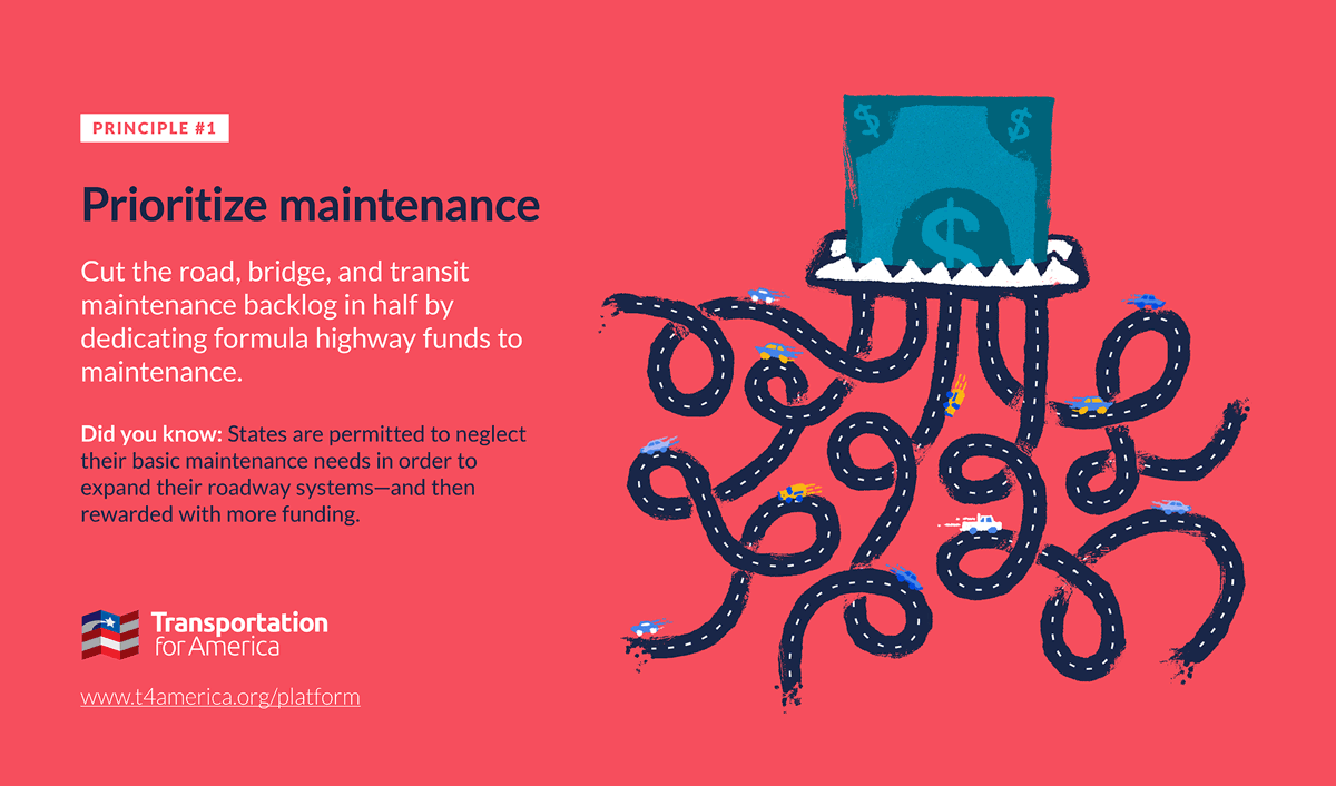
Things DOTs say: “It’s in the model”
Transportation planners and engineers use complicated models to forecast future travel loads and travel patterns and determine which projects are needed and how they are designed. But these models have embedded assumptions that are out of date, they measure the wrong things, and the way their results get treated as sacrosanct make them a problematic barrier to doing anything different.
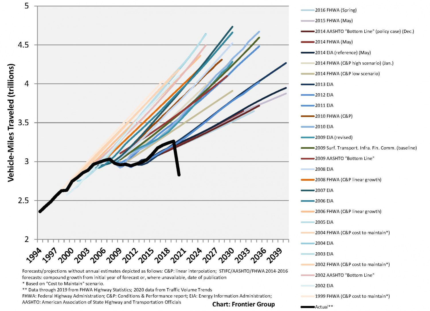
This near-comical graphic from the Frontier Group combines past federal projections of future growth in vehicle miles traveled. Every year a new optimistic projection was made that ultimately didn’t pan out, but they kept on predicting the same thing.
The typical approach to transportation modeling, known as the four-step process, treats the transportation system as a series of nodes connected by lines. The nodes are destinations: job centers, retail centers, office buildings, housing, etc. The lines are routes between destinations: mostly roads, but can include rail lines. You can think of the nodes as generating trips, and the lines as carrying those trips. These models are also influenced by projections for population growth and economic forecasts for the area. Some planners are moving away from the four-step process to activity-based models, which allow for the consideration of a wider range of modes like bicyclists and transit riders.
When drafting long-range plans and transportation programs, planners begin by modeling the base condition—the traffic patterns that would occur through the next 10-20 years if they did nothing. They then input a list of improvements to measure whether they improve congestion and air quality over the base condition. Plans that score the highest over the base condition are likely to succeed.
Five problems with the existing models
First, models are too often trusted to give decision-makers a clear-cut answer, but this is not their purpose. They are supposed to provide a piece of information that will be used in a decision.
Second, the current transportation models are attempting to answer the wrong questions by assuming that traffic congestion is always the most important consideration. What if addressing congestion leads to unsafe conditions, divides a neighborhood, or pollutes the water? The model can’t answer those questions.
Third, the model assumes that overbuilding is good, but under-building is always a problem. The models are trying to determine if there will be traffic congestion on a corridor over the next 20 years. The idea is that the transportation agency is investing in an asset that is meant to last 20 years so we want it to be useful that long. But should that roadway never reach capacity over that time period? That would mean it was overbuilt.
Fourth, the models attempt to answer questions that are impossible to answer. How can anyone know what the population or economy in a region will be in 20 years? How many regions project population or economic loss over 20 years, even though this happens all over the country due to technological changes, natural disasters, pandemics, wars, and housing crises? A better question would be whether more people can reach more opportunities whether they drive or not.1More information on that approach can be found here.2
Finally, the models are flawed and they are not checked. It is hard to be confident in any model that isn’t reviewed for accuracy. We should be looking back at past projects to see if they delivered what the transportation models predicted and, if not, seek to update them and ensure we are being informed by the best information possible before spending large amounts of taxpayer dollars. But we don’t.
Moreover, the models:
- can’t detect most pedestrian trips,
- can’t understand how a walkable community might get people to walk whereas a sprawling community will not,
- don’t consider induced demand, the concept that more roadway space gets more people to drive—a phenomenon that has been understood for a century,
- don’t consider how long it takes for people to reach destinations, just the average speed the vehicle travels, and
- are rarely re-examined and reconsidered when their forecasts are inaccurate.
Overcoming the models
Ask questions. Ask how accurate their models are on average and how they check them. If you know of a roadway expansion that didn’t alleviate traffic or didn’t work for long, ask how this is any different. Ask about their safety projections, projections for walking and transit use. Get reporters to do the same.
Look at old projections. Look back at previous forecasts and predictions used to justify existing projects that were built. Was the model accurate? If not, what was changed as a result? See the graphic at the top of this page.
Use supplemental tools to assess the full range of benefits and/or harms of transportation projects. Especially priorities like carbon emissions, racial equity and public health. Considerations like induced demand can be factored into modeling with tools like the Rocky Mountain Institute’s SHIFT calculator (developed in partnership with T4America, NRDC and SSTI at the University of Wisconsin based on the work of Susan Handy and Jamie Volker at the University of California at Davis). The federal government recently produced guidance on how to factor carbon emissions into models. The tools are out there.
Including this one that explains things using humor:
This is my favourite video of the year. Maybe of the DECADE.
“It means you spend a lot of money now for a very short-term benefit."
A PERFECT reminder of why wider roads won’t solve congestion, via Australia’s great show “Utopia” on @ABCTV. Please share! pic.twitter.com/Xl2qaEgZ3i
— Brent Toderian (@BrentToderian) December 18, 2019
Community Connectors: tools for advocates
![]() You may be fighting against a freeway expansion. You may be trying to advance a Reconnecting Communities project to remove an old highway. You might be just trying to make wide, dangerous arterial roads a little safer for people to cross. This Community Connectors portal explains common terms, decodes the processes, clarifies the important actors, and inspires with helpful real-world stories.
You may be fighting against a freeway expansion. You may be trying to advance a Reconnecting Communities project to remove an old highway. You might be just trying to make wide, dangerous arterial roads a little safer for people to cross. This Community Connectors portal explains common terms, decodes the processes, clarifies the important actors, and inspires with helpful real-world stories.
Thank you
We are grateful to support from the Summit Foundation, the Barr Foundation, the McKnight Foundation, and the Robert Wood Johnson Foundation for their support of various pieces of this ongoing project.Read about our grantees
We’re supporting 15 teams from small to mid-sized cities with plans to reconnect communities separated or harmed by transportation infrastructure.
Learn more about these 15 projects