
Smart cities: why now?

The US Department of Transportation’s Smart Cities Challenge was just the latest event to expose the growing interest for cities using technological solutions to solve pressing transportation problems like reducing transportation costs while also making it easier to get around, making housing more affordable and ensuring that low-income residents benefit from our increasingly prosperous cities.

Flickr photo by Paul Krueger. https://www.flickr.com/photos/pwkrueger/9220398978/

Flickr photo by Paul Krueger. https://www.flickr.com/photos/pwkrueger/9220398978/

While the verdict is out on just how the trends we outline below will affect our cities, one thing is certain: we’re in the midst of the most significant shift in urban transportation in decades. To wit, just a few weeks ago, Uber’s self-driving pilot kicked off in Pittsburgh.

The creation of the interstate system to connect cities (and also speed commuters through them to new outlying suburbs) was the last truly epochal shift in urban mobility. We’re on the cusp of the next one right now. So why does this appear to be “the moment” for the interest in being a smart city?

Cities are bursting at the seams with new residents

Since 2008, for the first time in human history, more than 50 percent of the global population lives in cities. Experts estimate cities will house 70 percent of the global population by 2050. In the United States alone, urban areas account for 85 percent of the total population and nearly one in three Americans lives in the ten largest metro regions.

This surge has created new opportunities for thriving urban areas, but it also brings new challenges and exacerbates existing ones.

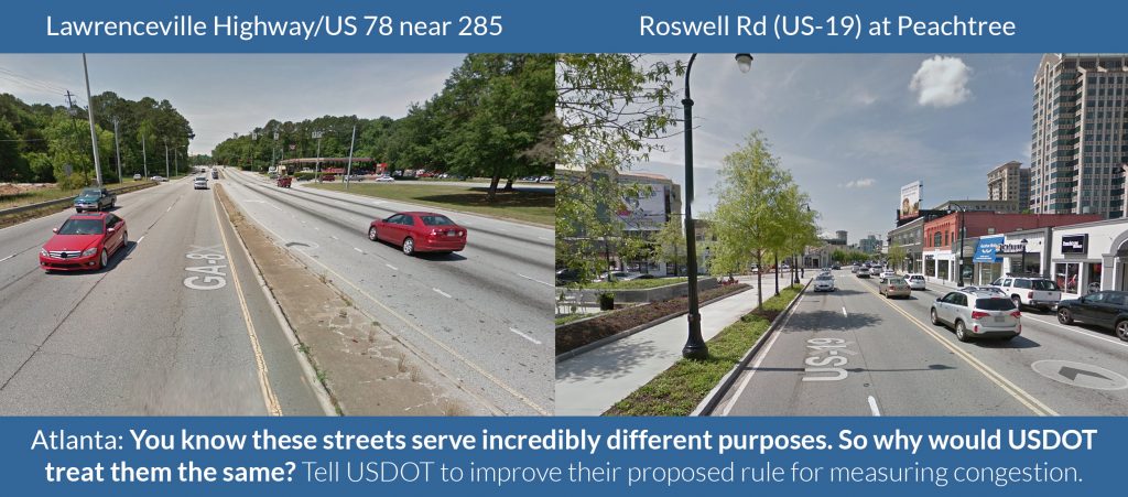
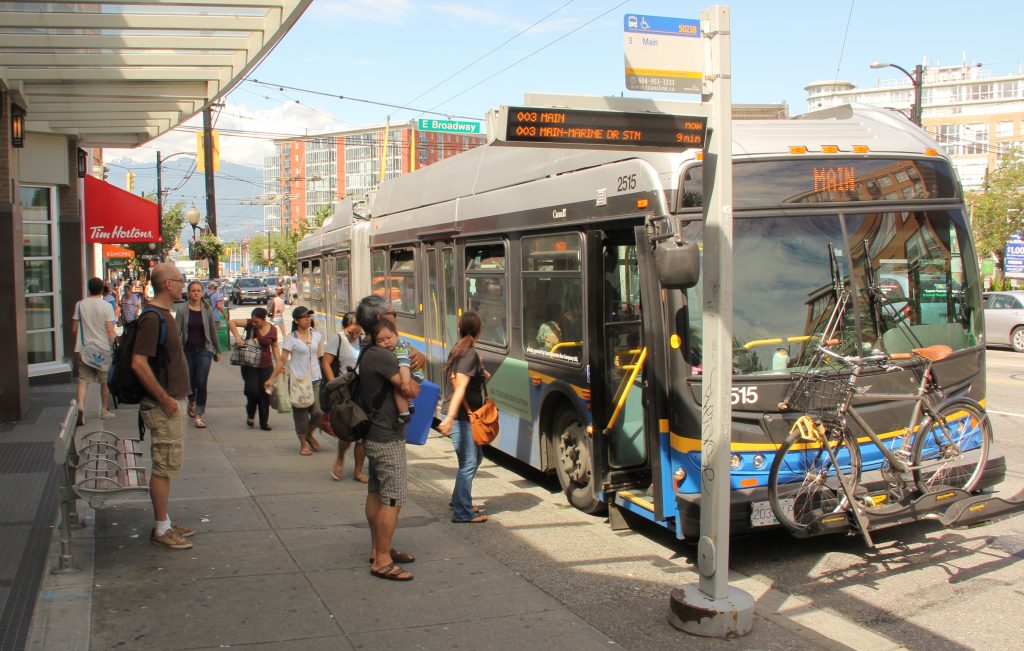
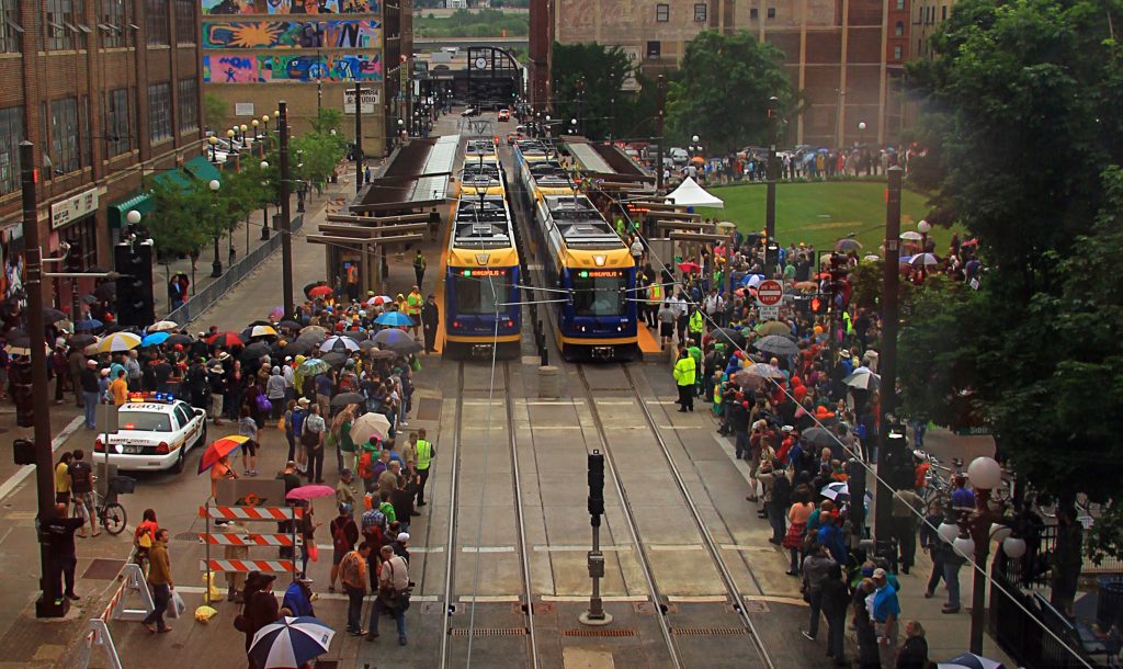
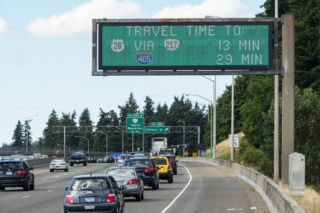
Cities of any size thrive on their ability to efficiently move people, goods and ideas from point to point, yet many cities still struggle to provide the basic infrastructure to do so, whether a comprehensive transit system to move large numbers people in limited space, well-maintained roads and streets for automobiles, buses or bikes, or safe sidewalks — because almost everyone begins or ends their trip with a walk. And it’s an ongoing struggle to keep it all running smoothly. Washington D.C.’s Metro is currently undergoing a such an extensive repair project that whole sections of the system are shut down for weeks at a time, while New York is preparing to close one of its most popular subway lines for 18 months.

The demand for urban living is at an all-time high, but that opportunity comes with a greater challenge of moving even more people safely, affordably and efficiently.

High-speed internet access is ubiquitous and consumer demand is growing

Since 2000, whether at home, at work or on mobile devices, high-speed internet access has become ubiquitous in cities, driven both by innovation and consumer demand. High-speed internet availability hovers near 100 percent in urban areas in the U.S. and Wi-Fi coverage is also available for free or low cost in most buildings, stores, and coffee shops. Contrary to conventional wisdom, the cost of broadband has actually dropped by a factor of nearly 40 times over the past 10 years.

Beginning largely with the release of Apple’s iPhone in 2007, smartphones have saturated the market. 68 percent of Americans owned a smartphone last year, nearly double the number of just five years ago.

App Quest Challenge

Unfortunately, far too many lower-income residents still lack affordable access to broadband or a connection to the useful tools driving this movement. Though this movement presents cities with additional challenges of equity and access to solve, the fact that the majority of urban residents now have an internet-connected supercomputer in their pocket all day long has fed a growing demand for more data and real-time information about the cities we inhabit. Which leads us to…

Data sensors and processing power have become more affordable and accessible

While the demand for having more information at our fingertips is also driving an expectation that everything should be online and connected, two other factors are making this possible.

First, over the last decade prices for sensors — that can monitor everything from when your laundry is done to air quality to location — have dropped by roughly 50 percent over the last decade. Second, during that same time period, the low-cost and availability of virtually limitless computing power through cloud computing has given the power of aggregation, analytics and visualization to anyone with a desktop computer or smartphone. The result of all of this is that startups, entrepreneurs and “makers” are testing the addition of sensors in every conceivable context.

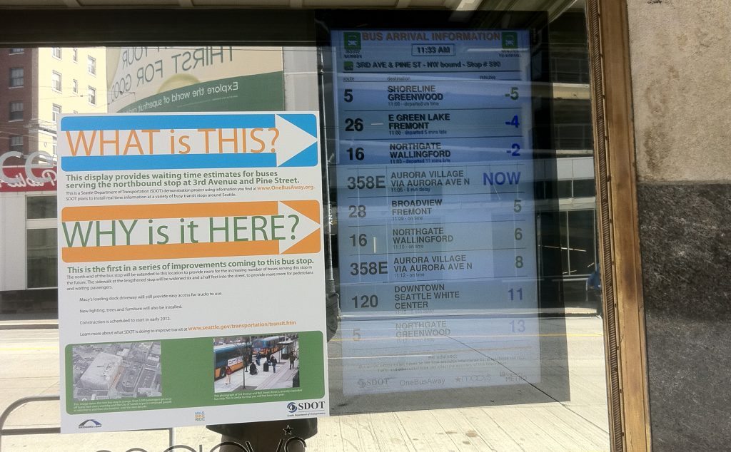
There are hundreds of civic applications for these sensors — such as measuring air quality in low-income neighborhoods to water pipe leakage to knowing precisely where a bus or train is located to predict its arrival — that cities can take advantage of to give them a better idea of what’s happening in their communities.

Huge private sector investments in new business models & disrupting old ones

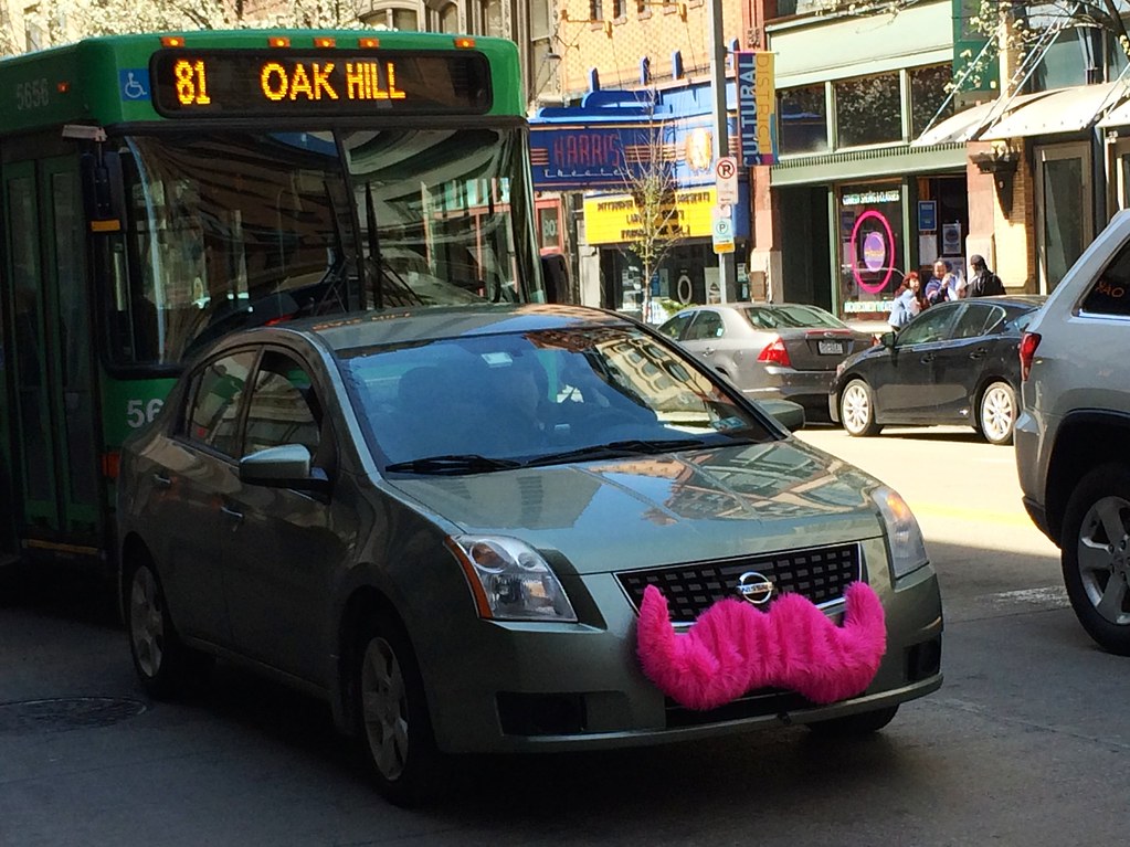
Enabled by all this data and processing power, the penetration of smartphones and the desire for improved urban mobility, the last five years have been marked by private sector efforts to “disrupt” traditional transportation markets. Scores of private companies, whether old guard car companies like Daimler (through Car2go) or new providers like Lyft or Uber, have been investing money and resources to provide new options for getting around. Google is a primary investor in Uber, while also developing its own self-driving car.

Uber, Lyft and other ride-hailing companies are also still on shaky ground when it comes to their business models and are ultimately seeking automated solutions (i.e., self-driving cars) to bypass their biggest cost: labor. Uber has lost over $4 billion since it was founded with $1.2 billion in the first half of 2016 alone. And, while some of that is certainly caused by developing automated vehicles and their expansion troubles in China, much of it comes from incentivizing drivers to maintain their market share in the U.S.a

day 107: a pink mustached car

With the decline in auto ownership led by millennials, even some old guard auto manufacturers are attempting to rebrand themselves as mobility companies, investing in or acquiring dozens of startups and testing out new product lines unthinkable for them just five years ago. Just a few weeks ago, Ford not only purchased shuttle service Chariot, but also launched a partnership with Motivate to expand bike-sharing operations in San Francisco.

It’s a perfect storm right now, and the “smart” cities will be the proactive ones

We’ve reached a tipping point where the ubiquity of technology has coincided with a growing need for our cities to become or remain prosperous, equitable, enjoyable places to live. While connected and automated vehicle technology certainly has the potential to dramatically improve pedestrian and driver safety, decrease traffic congestion, and improve freight and shipping technology, there are real consequences to be mindful of.

We’re clearly at a crossroads as we tip over into this monumental shift in urban transportation. But as we mentioned in our last blog post, smart cities are those that thoughtfully take advantage of the new technological tools at their disposal to accomplish what’s most important to them.

The smartest cities will take advantage of this moment in time and this transformation to become more prosperous, efficient, affordable and equitable.

What will happen to the cities that innovate without including everyone?


This post was written by our smart cities team of Russ Brooks, Rob Benner and Steve Davis

Webinar wrap: How MPOs are prioritizing public health to build prosperous regions

Last week, we had a terrific online discussion detailing how public health professionals are working with regional transportation planners to plan, fund, and support building more state of the art active transportation projects — accompanying the release of Measuring What We Value: Prioritizing Public Health to Build Prosperous Regions.

For this webinar, we were joined by staff from the American Public Health Association, the Centers for Disease Control and Prevention, and metropolitan planning organizations from the regions of Broward County, Sacramento, Greensboro, and Nashville.

Did you miss last week’s webinar or want to see it all again?

Stay tuned for more information targeted at MPO staff, public health professionals and local advocates on how to work with regional transportation planners to plan, fund, and support building more state of the art active transportation projects.

CDC APHA health case studies


USDOT reopens the comments on the MPO Planning and Coordination Rule

In an interesting move, US DOT has reopened public comment on the MPO Planning and Coordination rule, which proposed requiring urbanized areas with multiple MPOs to coordinate their planning efforts together, among numerous other changes. The proposed rule received over 500 public comments before it closed on the original August 26 deadline. (See T4America’s public comment here.)

The extension allows for an additional month of public comments, setting the new comment deadline to October 24, 2016. 

USDOT appears to taking the unusual step of leaving the question entirely open of whether any provisions in the proposed rule will actually be finalized and turned into new regulations. FHWA and FTA are requesting specific public comment to inform their decision of “whether to finalize any provisions within the scope of the NPRM” including comments on:

  • potential exceptions that should be included in the final rule, and criteria for applying such exceptions;
  • the impact of the proposed requirements for unified planning products where multiple MPOs serve the same urbanized area; and
  • detailed comments on expected costs of the rule.

Comments submitted under the extension should address the points above and previously submitted comments should not be resubmitted. Federal Register Notice here. T4America’s summary of the NPRM is here and T4America’s public comment is available here.

Webinar wrap: How artist-in-residence programs can embed creativity in city agencies

The second webinar in our series further exploring the role of arts and culture in transportation planning and community development was a terrific discussion of two cities’ artist-in-residence programs.

creative placemaking webinar presentation play

Click to play the full webinar recording

On September 21, we had a great online discussion about artist-in-residence programs, hearing from experts and exploring some recently created and established artist-in-residence programs in city agencies.

  • Did you miss the webinar? Catch up with the full recorded presentation here.
  • Download the accompanying slide presentation here. (pdf)

Minneapolis, Seattle, Saint Paul, Boston, Los Angeles, and other cities across the US run artist-in-residence programs, embedding local artists inside city departments to promote creative thinking, attract attention to mundane but crucial municipal processes, and shift narratives about city residents and workers.

Rather coincidentally, and proving even further that these programs are topical, the New York Times published an article on NY Department of Sanitation Artist in Residence Mierle Ukeles yesterday. Finally, if you’re interested in following along with progress in St Paul’s City Artist program and LA DOT’s Artist-in-Residence program, visit their websites here and here.


Reminder: Have you browsed our new guidebook to creative placemaking yet? Visit Back in February, T4America launched The Scenic Route, an online interactive guide to creative placemaking in transportation to introduce the concept to transportation planners, public works agencies and local elected officials who are on the front lines of advancing transportation projects.This series of webinars is continuing to explore the role of arts and culture in transportation planning and community development. Catch up with the first one from August here.


Measuring what we value: Prioritizing public health to build prosperous regions

A new package of case studies released today by T4America, in partnership with the American Public Health Association, showcases a range of strategies that metro area planning agencies can use to strengthen the local economy, improve public health outcomes for all of their residents, promote social equity and better protect the environment.

CDC APHA health case studies

Today, we’re launching Measuring what we value: Prioritizing public health to build prosperous regions, four short case studies that extend our previous work on data-driven decision-making for choosing transportation projects.

Download the four case studies below.

A growing number of the metro leaders, elected officials and citizens we talk to are asking questions like: can the people in neighborhoods more likely to be unhealthy easily get out for a walk or bike ride without having to traverse dangerous streets? Do our regional planners effectively consider the impacts on regional air quality as we choose which projects to build? Is the area putting forward the most competitive possible projects to win limited state or federal funding for walking and biking?

A handful of metro areas have found smart, data-driven ways to better conceive, select and build the transportation projects that can help address these looming questions. We’re happy to share with you four of those stories from metro areas big and small: Sacramento, CA; Broward County, FL; Nashville, TN and Greensboro, NC.

Download each one below.


SACRAMENTO, CA
Promoting health and economic prosperity through data-driven decision-making

Citrus Heights community center groundbreakingUsing a lens of improved economic performance by improving public health, the Sacramento Area Council of Governments (SACOG) adopted several health- and social equity-related performance measures into a rigorous, data-driven process for choosing transportation projects, resulting in more projects that make it safer and more convenient to walk or bicycle.

Download the Sacramento case study. (pdf)

BROWARD COUNTY, FL
Healthy, safe & prosperous by design: Building complete streets

Prompted by a need for safer streets, the Broward Metropolitan Planning Organization (MPO) spearheaded an effort to build regional consensus and political support for planning, designing and building more complete streets projects. As a result, 16 of the MPO’s 31 jurisdictions have adopted Complete Streets resolutions or guidelines, and the MPO increased funding for active transportation projects, with 90 individual bicycle and pedestrian projects totaling $120 million awarded funding since 2012.

Download the Broward case study. (pdf)

NASHVILLE, TN
Prioritizing public health benefits through better project evaluation

Nashville missing sidewalksBacked by data from comprehensive health studies and growing public demand to make biking and walking safer and more convenient throughout the region, the Nashville Area Metropolitan Planning Organization (MPO) designed a new scoring and selection process to prioritize transportation projects that can bring health benefits. The MPO’s new approach substantially increased the amount of funding in the their long-term transportation budget dedicated to making it safer and more attractive to walk or ride a bicycle, making strides toward improving the health of the region’s residents.

Download the Nashville case study. (pdf)

GREENSBORO, NC
Healthy competition: Using data and modeling tools to win funding for active transportation projects

Greensboro sidewalks Guilford CollegeTo make walking and biking safer, more equitable and more convenient in Greensboro, North Carolina, the Greensboro Metropolitan Planning Organization (MPO) developed a rigorous evaluation and data-driven selection process to analyze and select the best possible bicycle and pedestrian projects for the metro area’s available funds, and to help the region better compete for the limited, competitive funding controlled by the state.

Download the Greensboro case study. (pdf)


The development of these case studies was made possible through a contract between the American Public Health Association and Transportation for America funded through cooperative agreement 5U38OT000131-03 between the Centers for Disease Control and Prevention and the American Public Health Association.  The contents of this document are solely the responsibility of the authors and do not necessarily represent the official views of the American Public Health Association or the Centers for Disease Control and Prevention.

Transportation for America’s long-tenured director tapped to lead the Sacramento Area Council of Governments

press release

FOR IMMEDIATE RELEASE
September 21, 2016

T4America’s James Corless will depart in 2017 to lead Sacramento’s pioneering metropolitan planning agency

James Corless headshot
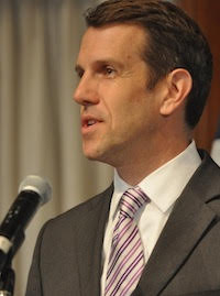
WASHINGTON, DC — After more than eight years as the director of Transportation for America, the only national non-profit coalition dedicated to smart, homegrown, locally-driven transportation solutions, James Corless has been selected by the Sacramento Area Council of Governments (SACOG) to become the agency’s new chief executive officer beginning in the spring of 2017.

James Corless will replace Mike McKeever as CEO, who is retiring at the end of this year after a long career helping SACOG become one of the most forward-looking metropolitan planning agencies in the country.

Upon his appointment, Corless made this statement:

I am honored to be given the opportunity to lead SACOG into its next chapter. From its work strengthening rural communities and preserving agricultural land to the progress promoting more walkable, transit-oriented, and compact development through the Sacramento Region Blueprint, on the ground success can be seen across the region. SACOG’s leadership and role as convener and collaborator is going to be critical in the years ahead in order to promote economic prosperity, innovation, and a high quality of life that will benefit each and every resident of the region.

James Corless has served as director of T4America since January 2009, steering the organization through numerous changes over the years and producing significant accomplishments. Since 2013, Corless has been the primary force behind building T4America’s strong national network of civic, elected, and business leaders who understand that smart, strategic investments in infrastructure are crucial for attracting economic development.

Under his leadership, T4America created an ongoing series of training academies aimed at helping local leaders of all stripes make their ambitious transportation plans a reality, helped launch the national Smart Cities Collaborative for municipalities looking to use technology to improve mobility options, and found ways to train and encourage dozens of regional planning agencies across the United States to implement data-driven decision-making to improve transparency and get more bang for the buck.

“While we will certainly miss James and the valuable leadership he has provided to this organization over the years, he built an incredibly strong foundation and catalyzed a movement of local leaders working hard to change the status quo; a movement that will long outlast his time at T4A,” said Geoff Anderson, president and CEO of Smart Growth America, of which T4America is a program. “He recruited passionate, talented people to come and work for us, and worked to show scores of state, metro and local agencies smarter ways to spend their transportation dollars. All of which makes it no surprise that an organization like SACOG with a terrific reputation of people-first planning would come looking for a leader like James.”

Corless will stay on as director of T4America through March 2017. We’ll be sharing additional information about his replacement over the coming months.

Transportation for America is an alliance of elected, business and civic leaders from communities across the country, united to ensure that states and the federal government step up to invest in smart, homegrown, locally-driven transportation solutions — because these are the investments that hold the key to our future economic prosperity.

For any California-based inquiries, please contact Monica Hernández at SACOG
916-599-4568 / MHernandez@sacog.org

Now hiring: Economic Analyst

Jobs

Smart Growth America seeks a skilled, experienced Economic Analyst with two to six years experience to conduct technical and quantitative analyses regarding a wide variety of issues associated with the built environment and transportation, including economics, real estate, social equity, and the environment. The Analyst will report to Smart Growth America’s Vice President for Economic Development, and work across a number of SGA programs, including the National TOD Technical Assistance Program, the Rural Development program, and other transportation and community technical assistance programs.

Position description
An ideal candidate has a complementary set of skills—a quantitative mindset with exceptional data analysis skills, and background and experience applying this to policy research. This position will provide evidence-based advice, building on leading-edge research, to policy makers across the country about how and why to build sustainable communities. This position will also support work providing technical assistance in economic development and community revitalization. Initial projects potentially include: Fiscal analyses of alternative development patterns; market analyses to determine market demand for different development products at a particular development site; value capture potential for transit-oriented development; analysis of revitalization plans for a small town downtown; analysis of impacts of changes of transit routes; and, analysis of the economic impacts of a complete streets project.

Responsibilities

  • Developing research proposals including scopes of work and budgets
  • Conducting fiscal impact analyses and refining SGA’s fiscal impact model
  • Analyzing metropolitan development and real estate market trends
  • Analyzing affordable housing strategies/policies
  • Estimating revenue potential of various “value capture” plans to finance new transit or other community benefits
  • Analyzing local market, demographic, regulatory and other factors affecting revitalization, and participating in the creation, drafting and presentation of revitalization strategies
  • Writing reports, and preparing and/or delivering presentations

Requirements
A successful candidate will have a demonstrated interest in urban planning issues, and care about changing America’s built environment. Candidates should have the confidence and ability to independently design, manage, and conduct multiple research assignments with minimal supervision, while working in a collaborative environment. Candidate should have two to six years of related experience; a graduate degree in urban planning, economics, real estate, or geography would be ideal. In addition, candidates should have the following skills:

  • Most important: a quantitative mindset with exceptional data analysis skills, experience with ESRI’s ArcGIS; familiarity with descriptive and inferential statistics (esp. regression analysis), and with statistical packages (SPSS, Stata, R). Ability to apply statistics to inform overall analysis and policy recommendations. Ability to use MS Excel for moderate to advanced data analysis (pivot tables, macros, moderate-to-advanced Excel functions). Familiarity with MS Access, databases, and SQL highly desirable.
  • Analyzing and synthesizing large amounts of data to the most salient points. Familiarity and ability to use key data sets. This includes familiarity with U.S. Census data, as well as various transportation statistics from US DOT (Bureau of Transportation Statistics), state, local, and MPO data sets. Ability to find key data sets, download and process the data, and prepare data for analysis. Ability to interpret and assess trends in large data sets.
  • Real estate market research; real estate financial analysis and projections using advanced Excel; and fiscal analysis.
  • Conducting research and writing proposals; writing professional reports and delivering presentations.
  • Detail-oriented and motivated to be accurate.
  • Strong writing skills.
  • Ability to prioritize and efficiently deal with multiple assignments, a “self-starter”, capable of learning on the job when necessary, ability to work in teams.
  • Dedication to achieving smarter growth.

Compensation, location and time frame
Salary commensurate with experience. This is a full-time position based in Washington, DC. Benefits include health insurance, 401(k), and paid vacation and sick time.

How to apply
Please send a resume, cover letter, three references, and two short writing samples (no more than two pages each) to jobs@smartgrowthamerica.org, with “Economic Analyst” in the subject line. Applications will be accepted immediately on a rolling basis until the position is filled.

Equal Opportunity Employment
Equal opportunity and having a diverse staff are fundamental principles at Smart Growth America. Employment and promotional opportunities are based upon individual capabilities and qualifications without regard to race, color, religion, gender, pregnancy, sexual orientation/preference, age, national origin, marital status, citizenship, disability, veteran status or any other protected characteristic as established under law.

An overwhelming number of cities applied to join our smart cities collaborative

Nearly 60 local governments from 31 states applied to join our collaborative for smart cities, including nearly half of the cities that entered USDOT’s Smart City Challenge. Applications closed two weeks ago — so what’s next?

smartphone-bus

After the outpouring of interest in the U.S. Department of Transportation’s Smart Cities Challenge, perhaps we shouldn’t have been surprised to see tremendous interest and enthusiasm from cities nationwide for our smart cities collaborative in partnership with Sidewalk Labs.

Nearly 60 local governments from 31 states applied to join the collaborative — including nearly half of the Smart City Challenge applicants and a number of the seven finalist cities — underscoring their desire to find ways to thoughtfully use technology to solve their pressing transportation and mobility challenges.

The applications came in from an incredibly diverse range of cities, from small to large and from coast to coast, including places like Seattle, WA; Kirkwood, MO; Charlotte, NC and Los Angeles, CA. A diverse group of cities will be at the table as members of the collaborative begin to define and design the “connected streets” of the future.

What do cities want?

Each applicant city identified a transportation-based problem they’re challenged by, an outcome they’re seeking, and a specific project they’re interested in developing to meet their needs. The applications showcased a diverse array of projects that shared an innovative drive toward problem identification, solution generation, and a willingness to take risks.

The application also included a list of fifteen potential technical and topical working groups to focus on in the collaborative. So far, cities expressed the greatest interest in connected and automated vehicles, carbon reduction strategies, shared mobility and first- and last-mile solutions, vehicle-to-infrastructure (V2X) implementation, and performance measures and data analytics. Although there was enthusiasm for all of the groups, we’ll eventually be narrowing the field down to just a few of the groups with the deepest interest.

In addition to the applications, we also received nearly 100 responses to our State of the Smart City Survey, which will help provide an incredibly valuable picture of where cities are at when it comes to technology and smart city ambitions.

This detailed survey asked cities to evaluate themselves on their status in implementing smart cities projects and technologies. Their submissions will enable T4America to develop a better understanding of what cities want, what gaps need to be filled, and how we can begin to provide technical assistance on a national scale.

We’re thrilled to work with local leaders and help them learn from each other as they figure out how to move forward with their ambitious plans.

We’ll be releasing the results of the State of the Smart City later this fall as well as sharing the work from the collaborative and what we’re all learning along the way as it takes off over the next few months.

This post was written by our Smart Cities team of Russ Brooks, Rob Benner and Steve Davis.

Metropolitan planning for healthier, safer, more prosperous regions

How can metro area planning agencies strengthen the local economy, improve public health outcomes for all of their residents, promote social equity and better protect the environment? Join us to hear the stories of how a handful of metro areas have found smart, data-driven ways to better conceive, select and build the transportation projects that will help meet those regional goals.

Flickr photo by the Broward MPO. /photos/speakupbroward/24986492294

Flickr photo of an event by the Broward MPO. /photos/speakupbroward/24986492294

Metropolitan planning organizations (MPOs) not only have responsibility to create regional plans that govern federal spending within their borders, but those in larger regions also control a limited amount of transportation funds directly. How they manage these responsibilities has a huge impact on the health of their residents and their access to jobs and other opportunities.

Can the people in neighborhoods more likely to be unhealthy easily get out for a walk or bike ride without having to traverse dangerous streets? Does an MPO effectively consider the impacts on regional air quality as they choose which projects to build? Is the area putting forward the most competitive possible walking and biking projects to win limited state or federal funding?

We’re excited to bring you the stories of a handful of MPOs that have good answers to all of these questions next week via a new series of short case studies and an accompanying webinar on Thursday, September 22 at 1 p.m. EDT. Register for the webinar with the link below.

REGISTER NOW


Register for the webinar and you’ll be the first to receive a copy of these new case studies. If you work for an MPO, advocacy group or health organization and want to learn about ways to increase or improve the quantity and quality of active transportation projects in your region, this one is for you.

The MPOs we’re featuring have found ways to better use data and modeling tools to win funding for active transportation projects, standardize the process for building safer, more complete streets, or promote health and economic prosperity through transparent, data-driven decision-making. And we’re excited to share their stories with you.

On the webinar, we’ll have a short conversation with staff from four MPOs featured in the case studies. They’ll share details on their policies and programs, the transportation projects that resulted and the partnerships they had to forge to taste that success.

Join our team and experts on September 22nd at 1pm EDT. Register today!


Development of the case studies featured in this webinar was made possible through a contract between the American Public Health Association and Transportation for America funded through cooperative agreement 5U38OT000131-03 between the Centers for Disease Control and Prevention and the American Public Health Association.  The contents of this document are solely the responsibility of the authors and do not necessarily represent the official views of the American Public Health Association or the Centers for Disease Control and Prevention.

How can cities embed creativity through artist-in-residence programs?

Join us for the second webinar in our series further exploring the role of arts and culture in transportation planning and community development, as we discuss two cities’ artist-in-residence programs.

7950801038_97d5418c7c_o

The Architecture of Endlessness designed and painted by NKO, a mural on the Red Wall surrounding the Link Capitol Hill Station. Flickr photo by Sound Transit

In 1977, Mierle Laderman Ukeles became the first, and still only, artist-in-residence at New York City’s Department of Sanitation, a job she still holds today. Four decades and thousands of handshakes later, Ukeles’ pioneering work has become a model for cities engaging with artists to bring a creative approach to municipal challenges.

Today, Minneapolis, Seattle, Saint Paul, Boston, Los Angeles, and other cities across the US run artist-in-residence programs, embedding local artists inside city departments to promote creative thinking, attract attention to mundane but crucial municipal processes, and shift narratives about city residents and workers.

Register to join us on September 21, 2016 at 4 p.m. EDT for our online discussion about artist-in-residence programs and hear from experts as we explore some recently created and established artist-in-residence programs in city agencies.

  • Ben Stone, Director of Arts & Culture, Smart Growth America/Transportation for America
  • Seleta J. Reynolds, General Manager, Los Angeles Department of Transportation
  • Alan Nakagawa, Creative Catalyst Artist in Residence, Los Angeles Department of Transportation
  • Colleen Sheehy, President & Executive Director, Public Art Saint Paul.


REGISTER TODAY


Reminder: Have you browsed our new guidebook to creative placemaking yet? Visit Back in February, T4America launched The Scenic Route, an online interactive guide to creative placemaking in transportation to introduce the concept to transportation planners, public works agencies and local elected officials who are on the front lines of advancing transportation projects.

To continue building on that work, we’ve launched this series of webinars to further explore the role of arts and culture in transportation planning and community development. Catch up with the first one from August here.

State legislative stalemate jeopardizing millions in federal transit funding for Minneapolis rail project

Business leaders and suburban mayors in the Twin Cities are pleading with state legislators, urging them not to throw away dedicated federal funding for a long-planned regional transit expansion by dropping the state’s financial commitment. Updated 9/1 with new information at the bottom of the post.

Opening day on the Green Line. Flickr photo by Michael Hicks. /photos/mulad/14238058898/

Opening day on the Green Line. Flickr photo by Michael Hicks. /photos/mulad/14238058898/

One of the major bills Minnesota legislators have been aiming to hammer out in a special session this fall is a capital bonding and transportation package to raise new state funding for transportation. But so far, Gov. Mark Dayton, the DFL-controlled Senate and the House Republican majority have failed to agree on a much larger package of tax cuts, transportation and infrastructure improvements — a package intended to include promised state funding to extend the existing Green Line light rail southwest into Minneapolis’ suburbs toward Eden Prairie.

Though $900 million in federal New Starts transit funds and $750 million in local tax funding have been pledged and $140 million has already been spent, this political stalemate over the state’s $135 million share is threatening to kill the project and send nearly a billion dollars in federal funds back to Washington (and then off to another project elsewhere in the country.)

Republican legislators in the House majority largely oppose spending state funding on the project whatsoever, even opposing a recent compromise to allow additional local funding to cover the state’s gap. This last-gasp effort at saving $900-plus million in federal funding would cover the state’s inaction by tapping a greater share of local funding on top of the $750 million already committed in local taxes.

As the Star Tribune reported last week:

Under the new proposal, which Dayton said his administration and Met Council staff devised just a day earlier, three entities would raise the $145 million state match: the Met Council would contribute $92 million, Hennepin County would contribute $21 million and the Counties Transit Improvement Board (CTIB) would kick in $32 million.

This compromise would allow the project to proceed without state legislative action, though there would still be hurdles to clear: each of these three bodies noted above would have to vote separately to approve their share of the $145 million, and do it quickly. Barring legislative action or successful votes on the compromise plan to increase local funding, the project will run out of funds by the end of September, forcing staff layoffs and the reassignment of private engineering firm employees.

A prominent group of 12 area CEOs that employ more than 100,000 area residents penned a letter to the Star Tribune back in the spring about state funding for transit and the planned regional projects, including the southwest light rail extension.

Wise investments in transit are worth making. Passing a comprehensive transportation bill that includes transit is critical in this session. If the state doesn’t act to provide funding for these projects, these federal dollars will go to a transit project in another state. Failure to act this year also means some of these projects will be in jeopardy. The business community can’t afford to miss out on this investment. Neither can the health of our communities, our region or the state of Minnesota. We hope state lawmakers will take action to ensure the best future for our region.

Minnetonka is one of the southwestern suburban cities the completed light rail line would pass through. Mayor Terry Schneider told the Star Tribune last week in that article above, “We’ve worked on this for five years, and we’ve come to the strong conclusion that it’s the best way for our city, the state and the region to meet the needs of the future. To waste the opportunity now, to squander it for internal bickering, would be a huge disservice to citizens of our state and region.”

9/1 UPDATE: The local jurisdictions reached a deal to cover the state’s unpaid $135 million share for the project to keep it moving ahead — including paying nearly $10 million in delay costs incurred by the state’s inaction during the legislative session. From The Met Council today:

The Southwest LRT Project is officially moving forward, after securing the remaining local funding commitments this week. …These contributions will together fill a $144.5 million funding gap, made up by the remaining necessary state match of $135 million plus $9.5 million in local delay costs caused by the legislature’s inaction in May.


Capital Ideas banner sacramento promoFinding solutions to debates over state funding for transit are the kind of topics we’ll be exploring in depth at Capital Ideas, our conference on state transportation funding and policy.

Check out the agenda, register today and join us in Sacramento this November 16-17

Register here

What does it mean to be a smart city?

What does it mean to be a smart city? Though the definition is certainly evolving and will continue to do so, it’s important for municipal leaders and advocates in aspiring smart cities to begin developing a good answer to this basic question.

Real-time bus arrival information in a Seattle bus stop. Flickr photo by SDOT.

Real-time bus arrival information in a Seattle bus stop. Flickr photo by SDOT.

This year’s Smart City Challenge from USDOT generated a tremendous amount of excitement and also forced cities to step out of their comfort zones, work across departments and put together a coherent business plan for their ambitions. Overall, as we noted in our last post, as we read through the applications, it’s still really hard to put a finger on precisely what a smart city is right now, and what it means to be one.

One of the first tasks for our Smart City Collaborative will be to start defining that question.

t4america sidewalk labs partnershipThe Smart City Collaborative is our national, multi-city collaborative with Sidewalk Labs to help cities use technology to meet their pressing transportation challenges. Cities in the collaborative will join working groups focused on one aspect of a smart city and collaborate to develop pilot projects, share successes and failures, and engage with one another to come up with new, creative solutions to their unique problems. Find out more and apply here.

At Transportation for America, we start with the concept that a smart city uses technology to discover where people are going and where they want and need to go, and learns from that information to create safer, more efficient, and affordable transportation options that accelerate access to opportunity for all of their residents.

While technology is important, it’s only a tool in the toolbox. It’s the means, not the ends. But what ends? What goals? Every conversation about smart cities should start with outcomes and purposes first, such as:

  • Engaging a wider range of our community and solicit feedback from people who might have been left behind in the past.
  • Building a more efficient city that gets greater returns from each investment.
  • Developing a more equitable and inclusive city with improved access to opportunity for everyone.
  • Understanding as much as possible about residents’ needs, in order to craft solutions to better meet them.
  • Testing and failing and learning from mistakes quickly to take charge of their destiny.

Technology is a part of helping cities reach those goals, but it needs to be wielded thoughtfully and intentionally. As Allison Arieff said in an interesting New York Times piece recently, “Are we fixing the right things? Are we breaking the wrong ones? Is it necessary to start from scratch every time?”

Cities don’t need to have social media or a fancy app to meaningfully engage their residents. There are still proven ways to improve transportation options for more people without on-demand transit or new mobility apps. Cities can smake safety for people walking or biking a high priority immediately without new vehicle-to-infrastructure technology or smart traffic signals.

With these thoughts in mind, here are four things starting to emerge as core aspects of a smart city.

Smart cities are more equitable and inclusive

Smart cities ensure that new technologies are used to accelerate access to opportunity for all residents — not just certain segments of the population. The most successful cities are good at creating opportunity for people of all incomes. This starts with the city driving the discussion and ensuring low-income residents and communities of color, and especially the unbanked and digitally disconnected, are always included in the conversation. It’s critical that any new developments or technologies reduce the divide between the transportation haves and have-nots.

Smart cities use technology in a way that brings benefits to every resident — regardless of age, ability, income, or zip code.

Smart cities work closely and transparently with constituents

Engaging more people in more productive ways is a bedrock of better, more inclusive decision-making. Like the process of creative placemaking (chronicled in depth in this T4America resource), when residents are involved in meaningful ways in the process, they’re not only more likely to feel ownership of the outcome, but the end product is almost always better.

Face-to-face, old-school community meetings should still be a staple of any city’s efforts, but new technologies offer the chance to receive feedback from people in new ways; real-time feedback and data on everything from air or noise pollution to dangerous intersections to places where transit service is lacking.

Smart cities are dealmakers who aren’t afraid to take risks

Cities that sit on the sidelines while these disruptions take place will see their cities shaped by others, without their feedback, and very possibly without the best interests of all of their residents in mind.

Cities need to learn how to drive the discussion and be the dealmakers. The old 20th century regulatory framework no longer applies. Cities need to make deals and negotiate vendors and providers on their terms and ensure that these changes enhance transportation choices for everyone.

start up city gabe kleinA cultural shift within municipal governments will also be necessary; political and executive leadership will need to be willing to test and fail. As former Chicago and Washington, DC transportation head Gabe Klein illustrates with real-world examples in his terrific short book Startup City, cities need to think more like flexible, nimble tech startups than lumbering bureaucracies.

Cities need to be willing to launch pilot projects, test ideas, learn from those experiments, and be willing to share the results even when they fail. Big companies, universities, and startups across the country are developing new pilot projects for first/last-mile solutions, automated vehicles, urban delivery technologies, new parking platforms, and much more. Smart city leaders are the ones that proactively engage these groups to help solve their major challenges to accomplish their city’s goals. Innovation and solutions are coming from every direction today.

Smart cities know what data to collect and how to use it

It’s important that cities know what’s happening in their communities and on their networks, and that means collecting data — lots of it. That information can come from a variety of sources; from residents, sensors, cell phones, vehicles, cameras and much more. Cities need to have a complete and holistic picture of what’s happening in order to make the best possible decisions.

Cities must have a process in place for analyzing and understanding their data in order to accomplish their goals. Only then will they begin to know how to use it to inform their day-to-day operations and long-term policy goals. And this is the underlying goal that can often be lost in the “smart city hype:” finding ways to make more informed and educated decisions to help a city become what they want to be.

As urban populations continue to grow, many of the problems of yesterday and today – congestion, economic inequality, pollution – grow with them. There are ways to leverage technology and better data in order to combat these challenges in new and more efficient ways and be vibrant, attractive, inclusive, prosperous places to live.

This post was written by our Smart Cities team of Russ Brooks, Robert Benner and Steve Davis.

Now Hiring: Communications Intern (paid)

Transportation for America is hiring a paid Communications Intern to produce and write compelling stories and content, help manage our website and social media channels; and contribute to our grassroots advocacy and media work focusing on smart investments in transportation.

The intern will join a small, dynamic communications team at T4America (and Smart Growth America) that forms the outward face of Transportation for America’s work. This is an opportunity that features a great deal of responsibility, direct collaboration with our supporters and valuable hands-on experience.

Position description

The ideal intern is an exceptional writer and editor who is plugged-in to news and developments about transportation funding and policy at the federal, state and local level, and can perform and synthesize research on a range of related issues. The successful candidate will be able to use all these skills to create engaging content (i.e. longer reported pieces and blog posts) for Transportation for America’s website and a range of other on- and off-line outlets.

Our interns are dependable team players who can perform regular duties when asked, but also proactive self-starters who can offer and implement new ideas for how to make the team’s work even better. Interns will be writing assigned posts and longer stories, but will also be counted upon to do enterprising work on producing story ideas to pitch to the rest of the team.

The intern’s primary responsibilities include:

  • Managing and maintaining our social media channels on a daily basis, predominantly Twitter and Facebook.
  • Reporting and writing original newsy content for our blog and longer-form profiles of local regions and leaders making innovative investments in transportation, including doing interviews with local leaders or advocates for background and quotes.
  • Writing, posting and managing content on our WordPress-powered website.
  • Writing, formatting and sending HTML emails to our members and supporters, including a bi-weekly newsletter.
  • Tracking new developments in federal, state and local transportation policy that are worth emulating and sharing with others on staff and beyond.
  • Assisting with our outreach to reporters and bloggers; and
  • Providing general communications support for the organization and our allies.

Requirements

All T4America internships require a self-motivated, detail-oriented person with excellent writing, oral communication and organizational skills, as well as the ability to think creatively and work independently with minimal supervision. Candidates should have a strong interest in economic development, transportation, smart growth or related areas.

In addition, the Communications Intern should have a working understanding of HTML and CSS; familiarity with (web) content and customer relationship management tools (WordPress is our CMS and Salsa is our CRM for grassroots email list and advocacy work); and a solid understanding of organizational social media protocol. Knowledge of Adobe Creative Suite (Photoshop and/or InDesign or Illustrator) for light graphics support a plus.

Candidates should have at least a bachelor’s degree and all candidates should be highly computer literate.

Compensation, location and time frame

The position is full time (40 hours per week) and requires a six-month commitment. Some former interns have joined our full-time staff. Transportation for America interns receive a stipend of $1,500 per month. This position is based in our offices in Washington, DC and will be starting around mid-October.

To apply

Please send these materials to info@t4america.org with “Communications Intern” in the subject line:

  • A short cover letter that includes a 50-word description of the assets you would bring to this position
  • A current resume with references
  • Two recent writing samples (500 words or less.)

Applications will be accepted immediately on a rolling basis until the position is filled.

Equal Opportunity Employment

Equal opportunity and having a diverse staff are fundamental principles at Transportation for America. Employment and promotional opportunities are based upon individual capabilities and qualifications without regard to race, color, religion, gender, pregnancy, sexual orientation/preference, age, national origin, marital status, citizenship, disability, veteran status or any other protected characteristic as established under law.

About Transportation for America

T4America is an alliance of elected, business and civic leaders from communities across the country who are united to ensure that states and the federal government step up to invest in smart, homegrown, locally-driven transportation solutions. Learn more at https://t4america.org

USDOT faces widespread opposition to proposed congestion rule

Nearly 5,000 individuals and 150 organizations — including dozens of local chambers of commerce and elected officials — joined with T4America to oppose USDOT’s flawed proposal for measuring traffic congestion and urge them to rethink their approach.

Here's what 5,000 pieces of paper looks like next to a terrific book about Complete Streets for scale purposes. We didn't have to waste 5,000 pages for your letters since USDOT allows digital submissions.

Since USDOT allows digital submissions and we didn’t have to waste any paper for your letters, here’s what 5,000 pieces of copy paper looks like next to a terrific book about Complete Streets for scale.

Almost 5,000 of our supporters sent letters urging USDOT to rewrite the department’s new requirements for measuring (and addressing) congestion — requirements that, as written, would induce sprawl, harm the economic potential of our main streets by treating them like highways, punish cities investing in public transportation, completely ignore people walking, biking, carpooling or telecommuting, and push local communities of all sizes to waste billions of dollars in vain attempts to build their way out of congestion.

“There’s a direct connection between how we measure congestion and the ‘solutions’ that we invest in,” said James Corless, director of Transportation for America, in our full press release yesterday. “And by prioritizing vehicles over people and completely ignoring a diversity of transportation options, this proposed rule would fail the communities that our transportation investments are intended to serve.”

USDOT has been undertaking a welcome and necessary shift toward measuring what our federal transportation spending actually accomplishes by establishing a new system of performance measures to hold states and metro areas accountable for making progress on important goals.

We know these rules sometimes seem arcane or obtuse, so we explained a real-world example of how they could play out in this opinion piece for The Hill last week:

The measure would fail to reward places that use existing streets more efficiently — particularly in urban areas where space is at a premium.

Take for example the 16th Street NW corridor in Washington DC. The street is often clogged at rush hour but, since it’s in the middle of the city, it can’t be widened. So how should transportation engineers address the congestion? One solution would be to add priority lanes for buses, which already carry more than half of all rush hour trips along the corridor. Prioritizing 50-passenger buses over single-occupancy cars would vastly increase the carrying capacity of the street and allow it to move even more people per hour than it does today. But under the Department of Transportation’s proposed rule, if this strategy succeeded in moving more people but had an even slightly negative impact on average travel speed per vehicle, it would get low marks.

DC Congestion Comparison 2

Part of the 16th street corridor in question, referenced in the above op-ed, is at right in the above graphic. During rush hour, buses carry more than half of all trips taken on this corridor.

That’s just one example, but in case you haven’t been following along recently, we’ve outlined the scope of the rule’s problems several times over the 120 days of the comment period, which closed on Saturday, August 20th.

In addition to the nearly 5,000 letters we delivered to USDOT last Friday night, an impressive and diverse coalition of business groups, local elected leaders and national and local organizations also signed a single letter proposing concrete ways for USDOT to fix the rule. Over the last four months, we convened more than 30 local elected officials, state DOTs, metropolitan planning organizations (MPOs) and transit agencies, national and state trade groups and advocacy organizations to develop a better measure to recommend to USDOT that has buy-in from practitioners on the ground.

The first recommendation in that letter is a simple one that gets to the heart of what needs to be fixed: “Travel time/delay is felt by the people who travel, not by the vehicle, and U.S. DOT should propose a measure that focuses on people and not vehicles.”

21 chambers of commerce from across the country also signed a separate letter signaling their concerns about a measure that would punish cities and regions investing in public transportation and walkable downtowns to stay economically competitive:

The proposed rule focuses on vehicle speeds only, which discourages local decision-makers from investing in transit, pedestrian, and bicycle infrastructure and impedes progress towards the walkable, accessible, and vibrant business districts that we are striving to achieve. A comprehensive mix of strategic transportation investments is necessary to allow American businesses to remain competitive. Hundreds of companies across the United States are moving to and investing in walkable downtown and business district locations. Companies want their location to be accessible by a range of transportation options in order to attract and retain talented workers. Performance measures included in this rule should account for all modes of transportation to both capture and encourage important investments that support resilient, strong local economies.

USDOT Secretary Anthony Foxx has embarked upon an ambitious effort to repair the damage of poorly-planned highway projects that divide communities and ensure that future transportation investments do a better job of connecting all people to economic opportunity — especially low-income communities and communities of color. Advancing a proposal that would prioritize high traffic speeds at all times of day on all types of roads would undermine the Secretary’s own efforts.

We are hopeful that USDOT will heed this call and change the rule to count everyone and support the local, metro and state leaders planning ambitious, smart transportation investments to better connect all people to opportunity.

Proposed federal rules for measuring and addressing congestion in states and metro areas generate widespread opposition

press release

Nearly 150 organizations — including dozens of local chambers of commerce and elected officials — and nearly 5,000 individuals spoke out in opposition to a flawed proposal from USDOT.

WASHINGTON, DC — Led by Smart Growth America (SGA), Transportation for America and the National Complete Streets Coalition, a broad coalition of business groups, local elected leaders, national and local organizations and thousands of individuals filed formal comments last week urging USDOT not to incentivize transportation projects that would punish cities investing in public transportation, treat main streets like highways, ignore the needs of people walking or biking, and push local communities of all sizes to waste billions of dollars in vain attempts to build their way out of congestion.

The comments were in response to a proposal from USDOT that will, when finalized in 2017, govern how states and metro areas are required to measure and address congestion and other metrics like freight movement and emissions, on a large share of our nation’s roadways. The 120-day public comment period closed on Saturday, August 20th. (The letter from the full coalition is here, a separate letter signed by 21 chambers of commerce is here, and the comments submitted by individuals are here.)

For two years, as required by 2012’s MAP-21 transportation authorization, USDOT has been working to establish a new system of performance measures to help govern how federal dollars are spent and hold states and metro areas accountable for making progress on important goals — a welcome shift toward measuring what our transportation spending actually accomplishes.

But this proposed rule would lead to negative outcomes in communities and billions of dollars wasted due to its singular focus on moving single-occupancy vehicles as fast as possible while failing to count the benefits of carpooling, public transportation, telecommuting, bicycling or walking. (T4America outlined the problems with the rule in detail here.)

“There’s a direct connection between how we decide to measure congestion and the ‘solutions’ that we decide to invest in,” said James Corless, director of Transportation for America (T4America). “And by prioritizing vehicles over people and completely ignoring a diversity of transportation options, this proposed rule would fail the communities that our transportation investments are intended to serve.”

To develop a stronger alternative measure to submit to USDOT, SGA convened a working group of more than 30 local elected officials, state DOTs, metropolitan planning organizations (MPOs) and transit agencies, and national and state trade groups and advocacy organizations.

This work was supported by numerous state DOTs, MPOs, transit agencies and advocacy organizations; Oregon Metro (Portland) and Indy MPO; Trimet; Metro Atlanta Chamber and Indy Chamber; and the Transportation Equity Caucus, League of American Bicyclists, Safe Routes to School National Partnership, People for Bikes, PolicyLink, the Leadership Conference on Civil and Human Rights, Center for Neighborhood Technology and many others.

The coalition specifically requested the following changes to the final rule:

  • Focus on the movement of people instead of only vehicles — the rule would treat a bus full of commuters the same as a single vehicle carrying one person;
  • Remove the duplicative vehicle speed measures that provide marginal benefit;
  • Provide a timeline for USDOT to implement an accessibility performance measure;
  • Measure greenhouse gases (GHG) from the transportation sector, which represents the largest GHG emissions sector in the country; and
  • Improve data sets to incorporate accurate roadway volumes, strategies to develop and implement safe and accessible multimodal networks, accessibility, and trip origin and destination.

In addition, a congressional delegation led by Senators Carper and Menendez in the Senate and Representative Blumenauer in the House also sent letters to USDOT Secretary Foxx requesting that USDOT assess the movement of people, rather than vehicles, as a better measure of congestion and also reward the improvements that can come from transit, toll lanes, or encouraging travelers to choose other options like walking or biking.

We are hopeful that the Obama Administration will heed our call and change this rule to encourage a more holistic approach for measuring traffic congestion that counts everyone and supports the ambitious plans of local, metro and state leaders to make smart transportation investments to better connect all people to opportunity.

For immediate release
Contact: Steve Davis
steve.davis@t4america.org
202-971-3902

Transportation for America (www.t4america.org) and the National Complete Streets Campaign (www.completestreets.org) are programs of Smart Growth America (www.smartgrowthamerica.org).

Time is running out to tell USDOT to measure more than just vehicles

These two streets in Nashville, Tennessee are very different and have different functions. Why does the U.S. Department of Transportation want to measure their success the same way? 

Nashville congestion comparison 2

One is intended to move goods and people, largely in vehicles, quickly between two points. The other moves people — in cars, in buses, on bikes, on foot — while also creating a framework to produce lasting value, economic activity, and a sense of place.

It doesn’t make sense to measure the success of these streets the same way. Yet that’s exactly what USDOT is proposing with new rules for how states and metro areas would have to measure and address congestion — prioritizing vehicle speed above almost all other criteria.

The most successful city streets have to use limited space to move people efficiently, whether walking, biking, taking transit or driving. Yet this congestion rule as it is currently written would count only vehicles.

A street that moves a lot of people should never be considered unsuccessful, even if it doesn’t necessarily move a lot of cars.

The proposed rule would make driving fast the ultimate goal of our transportation system, regardless of what type of road or street you’re on. Should driving fast be the highest priority on main streets where people go to shop or sit and eat at an outdoor café? Should moving cars quickly be the top priority in residential neighborhoods where children might be biking or walking?

A street that creates value, economic prosperity and a sense of place should never be considered unsuccessful, even if it doesn’t necessarily move a lot of cars.

We have a chance to change this rule, but time is running out. Public comments on the rule close this week, and now is a crucial time to speak out.

Tell USDOT to improve their proposed rule and send a letter today.


You can view or share examples from a handful of other cities below.

SF congestion comparison 2 Charlotte congestion comparison 2 DC Congestion Comparison 2 Chicago congestion comparison Seattle congestion comparison 2 Portland congestion comparison 2 NYC congestion comparison LA congestion comparison 2 Denver congestion comparison 2 Atlanta congestion comparison


Fulfilling transit’s need for speed in King County

Improving bus travel times and overall reliability can not only lower the cost of providing service and potentially attract new riders, but every dollar saved is a dollar that can be spent on more transit service elsewhere. Attracting new riders and stretching every dollar as far as possible are critical for regions striving to meet the demand for housing, jobs and retail near effective transit. T4A member King County has a novel approach to improving transit speed and reliability.

2016_08_02_MemberBlog_S&R_Photo (1)

Transit agencies traditionally improve transit speed and reliability by investing in big light rail and bus rapid transit (BRT) projects that give transit vehicles dedicated right-of-way unimpeded by traffic. But how can transit agencies improve reliability and speed of their existing transit service when dedicated right-of-way isn’t possible or affordable?

King County Metro, the transit agency for a county that contains 39 cities including Seattle and Bellevue — while still investing in many RapidRide BRT corridors — has a department that develops lean, flexible solutions that can be applied more broadly over its bus network to make service more convenient and reliable.

True to its name, King County Metro’s Transit Speed and Reliability (S&R) group works to sustain and improve the speed and reliability of the system, which carries 120 million riders per year. To accomplish this, S&R employs a toolbox of engineering solutions that range from large corridor-wide projects to smaller spot improvements that can improve speed and reliability anywhere on the network, regardless of whether the line is a designated BRT corridor or just a typical bus line.

These spot improvements are small- to medium-scale solutions to maintain or improve bus performance, like bus lanes, on-street parking management, intersection channelization, traffic signal retiming, traffic signs, roadway channelization and transit signal queue jumps to eliminate delay and improve travel times and reliability.

Two recent examples of spot improvements help illustrate how cost effective this approach can be, and just how critical partnerships and collaboration are to the process, because streets are often owned by cities.

In the northern neighborhoods of Seattle, four separate bus routes carrying 1,950 total riders per day were experiencing significant delay at Wallingford Avenue N and 80th Street due to a traffic signal prioritizing east-west traffic in the evening hours when the dominant bus traffic pattern is actually north-south. Speed and Reliability worked with the Seattle Department of Transportation (another T4A member) to change the signal timing from 9 p.m.- 12 p.m. creating a 12 second reduction in bus delay. That may not sound like much but multiplied over the 27 buses that pass through the intersection over those 3 hours, it’s over 5 minutes of paid bus driver time and even more passenger time every day — all from a very simple fix.

In Bellevue, Route 249 carrying 1,210 passengers per day was getting hung up at a left turn due to a short green signal. S&R worked with the Bellevue DOT to extend the green phase allowing buses to complete the left turn, reducing delay by 77 seconds. Again, very big time savings with a small, inexpensive fix.

The work of the four-member S&R group helps Puget Sound’s transit system collectively operate more efficiently with faster, more reliable service for riders — which is overall one of the most important qualities in transit service for most riders, according to TransitCenter’s new national survey out just a few weeks ago.

Unfortunately, there aren’t many funding streams dedicated to improving system performance with strong but incremental returns on investment. For example, the major source of federal capital funds that agencies can receive, New Starts/Small Starts/Core Capacity, is used to build new lines entirely or make comprehensive improvements to entire corridors. The other capital funds that agencies receive are entirely for new equipment, so you can get money to buy a new bus, but it’s hard to get any money intended specifically to operate that bus more efficiently,

Although Metro has had success in securing federal capital funds for speed & reliability projects on RapidRide and other large corridor projects, the agency relies on locally-generated revenues as well as cooperation and support from local traffic agencies for spot improvements . Operations and maintenance of S&R treatments are even tougher to fund, which can result in degradation of the effectiveness of S&R treatments over time.

We’re glad to have King County on board as a new T4A member. As the T4A network grows, we can continue addressing the policy and funding gaps that inhibit these types of innovative, and cost-effective strategies exemplified by King County Metro’s Transit Speed and Reliability group.

Applications are open for T4America’s smart city collaborative

Today, Transportation for America opened the application process for our national, multi-city collaborative with Sidewalk Labs. This partnership, announced back on June 1st, will help cities use technology to meet their pressing transportation challenges.

sidewalk lab music

When USDOT kicked off the Smart Cities Challenge and over 70 cities from across the country scrambled to put together applications detailing their smart city ambitions, it was clear that Secretary Anthony Foxx at USDOT had tapped into something vital unfolding in cities of all sizes across the country.

As we read through all 78 of those applications this spring, one thing became very clear: It’s really hard to put a finger on precisely what a smart city is right now, and what it means to be one. There are cities that have been opening up massive sets of municipal data to citizens for years allowing them to create apps or brainstorm ways to improve government services. Some cities have found new ways to use their own data to determine where transit services should be provided, but aren’t, and adjust accordingly. Some cities are testing partnerships with shared mobility providers to experiment with adding transit coverage or providing valuable last-mile connections.

Yet there are other cities that are clearly just dipping their toes into this arena, and are swept up to some degree by the availability of the grant money or enamored with technology as an end unto itself — often not yet certain of the specific problem that they’re trying to solve.

So what’s the norm? Where should a city be in relation to their peers?

To help establish a baseline and get a more organized sense of where cities are in this evolution, we’ve also distributed a State of the Smart City benchmarking survey to gather data from cities on the technologies and strategies they currently employ along with the tools they have at their disposal. T4America will use this survey as a baseline to measure the implementation of smart city technologies at both the national level and for individual cities in the coming years.

Whether or not your city is planning to apply to join the collaborative, you can help us get a better picture of your community by completing the State of the Smart City survey.

Our new national collaborative will bring cities into several working groups, each focusing on one aspect of a smart city, such as how to create a level playing field where a tiny startup of students can compete with a massive technology firm to create a new civic mobility app, ensure that new mobility options also serve the unbanked or low-income communities, or deploy congestion pricing in a way that helps provide more transportation options to more people.

The cities in the collaborative will work to develop pilot projects, share successes and failures, and engage with one another to come up with new, creative solutions to the problems at hand. If you and your city are interested in participating in the Smart City Collaborative, please fill out a short application here.

As we build this collaborative over the next few months and hear back from cities that are on varying points of this spectrum, we’ll be starting to coalesce around an idea of what a “Smart City” truly is. We have ideas, but no one has 100 percent of the answers at this point as this idea evolves, and cities should likely be skeptical of anyone who says they do.

We think a smart city is one that uses technology to discover where people are going and where they want and need to go, learns from that information and uses it to create safer, more efficient, and affordable transportation options that accelerate access to opportunity for all of their residents.

Those are our thoughts, but we’re eager to hear your feedback as well. 

So what do you think a smart city is? What does a smart city look like? How would you define one in a sentence or two?

Three critical considerations for evaluating AASHTO’s new Bikeway Guide

As a valued T4A member, we are dedicated to providing you timely updates on transportation topics.

On July 25th, The American Association of State Highway and Transportation Officials (AASHTO) met to consider changes to their Bikeway Guide, including the long-awaited addition of designs for protected bike lanes.

AASHTO deserves credit for creating and updating this guide for building bike infrastructure, but AASHTO is largely responding to the massive, growing interest from cities across the country. Many cities have been the leaders in this area. San Jose, CA, and Champaign, IL, have had protected bike lanes since the 1970s, and Boulder, CO, and Denton, TX, since the 1980s. People for Bikes started the GreenLane project in 2011 to help more cities build protected bike lanes. The result is that — without any formal guidance from AASHTO — almost 300 protected bike lanes exist across the country today.

Aashto1

Flickr CC photo by Zane Selvans

It is important to recognize the limitations of AASHTO’s action and why it’s ultimately unlikely to lead to the significant expansion of new bike and pedestrian infrastructure onto more roadways across the country. Why? Here are three reasons.

First: AASHTO’s Guide for the Development of Bicycle Facilities is wholly separate from their standard manual for road design, the Policy on Geometric Design of Highways and Streets, also known as “The Green Book”. Unlike this new bike guide, The Green Book is the industry standard that sits on every transportation engineer’s desk.

Second: The Federal Highways Administration adopts The Green Book by federal regulation. Not so for the Bikeway Guide. This reinforces the message to engineers and local policymakers that one document has primacy over the other.

Third: These two documents are not written in conjunction. This often sends designers in different directions.

Aasto2

Flickr CC photo by Spencer Thomas

A local transportation agency interested in building bike facilities might seek out the AASHTO’s Bikeway Guide for assistance. If they do, they will be steered to some very interesting designs, but not the most cutting edge designs being deployed in many cities. For a more up-to-date approach, communities turn to the National Association of City Transportation Official’s (NACTO) Urban Bikeway Design Guide. NACTO’s authors have analyzed designs across the world, and worked with local governments more likely to build bike infrastructure.

While the AASHTO Bikeway Guide might help design bike infrastructure, the overall guidance in their flagship guide, The Green Book, pushes engineers toward roadway designs that make bike infrastructure difficult at best. The Green Book encourages wide lanes and wide roads with fast-moving traffic, which makes additional right-of-way for bicycles unlikely and creates a hostile environment for those outside of a car.

When these shortcomings in The Green Book are pointed out, many say it allows for flexibility (like this page from the Federal Highways Administration about context sensitive solutions). I work with state DOTs to analyze the barriers in their project development processes that stand in the way of building complete streets (roadways that safely accommodate all users from trucks and cars to transit users and people on foot or bike). In my experience, it’s a persistent challenge for transportation agencies to exercise flexibility that’s theoretical.

To use that flexibility, a project designer must first make up their own design without guidance from The Green Book, then undergo a challenging and strict review process for approval. For engineers judged on delivering a project quickly, this flexibility is really a Hobson’s choice.

I am excited to see AASHTO recognize the need for guidance in bike infrastructure design and support separated bike lanes, which are essential for making biking safe, convenient and attractive for far more people. Protected bike lanes appeal to seven times more people than unprotected bike lanes, according to People for Bikes. But, for AASHTO to demonstrate true enthusiasm for bike infrastructure and become a partner in building safer roads for non-motorized travelers, the organization needs to bring these designs and concerns into its flagship document, The Green Book.