
Measuring what we value: Prioritizing public health to build prosperous regions

A new package of case studies released today by T4America, in partnership with the American Public Health Association, showcases a range of strategies that metro area planning agencies can use to strengthen the local economy, improve public health outcomes for all of their residents, promote social equity and better protect the environment.

CDC APHA health case studies

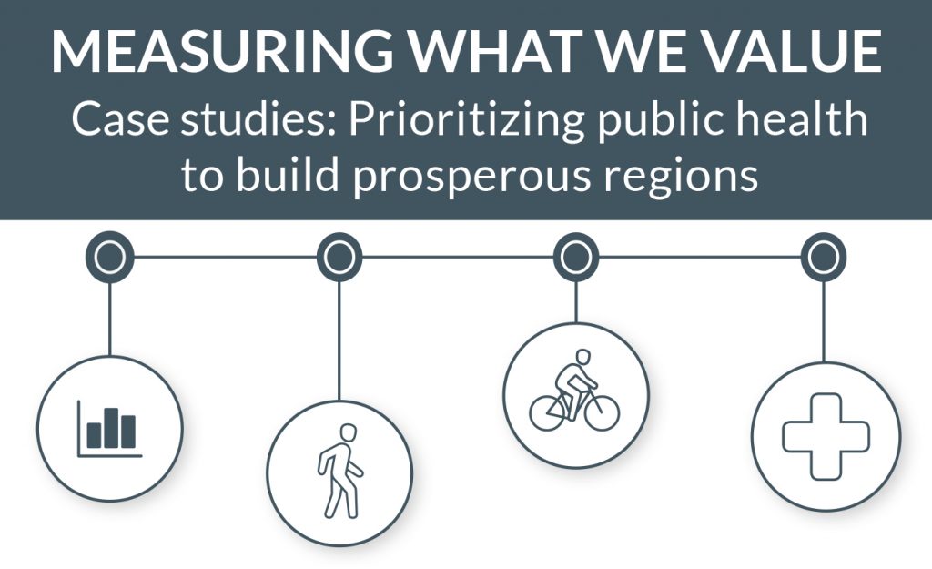
Today, we’re launching Measuring what we value: Prioritizing public health to build prosperous regions, four short case studies that extend our previous work on data-driven decision-making for choosing transportation projects.

Download the four case studies below.

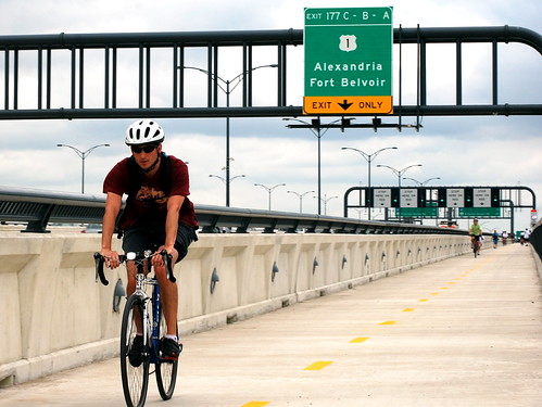
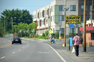
A growing number of the metro leaders, elected officials and citizens we talk to are asking questions like: can the people in neighborhoods more likely to be unhealthy easily get out for a walk or bike ride without having to traverse dangerous streets? Do our regional planners effectively consider the impacts on regional air quality as we choose which projects to build? Is the area putting forward the most competitive possible projects to win limited state or federal funding for walking and biking?

A handful of metro areas have found smart, data-driven ways to better conceive, select and build the transportation projects that can help address these looming questions. We’re happy to share with you four of those stories from metro areas big and small: Sacramento, CA; Broward County, FL; Nashville, TN and Greensboro, NC.

Download each one below.


SACRAMENTO, CA
Promoting health and economic prosperity through data-driven decision-making

Citrus Heights community center groundbreakingUsing a lens of improved economic performance by improving public health, the Sacramento Area Council of Governments (SACOG) adopted several health- and social equity-related performance measures into a rigorous, data-driven process for choosing transportation projects, resulting in more projects that make it safer and more convenient to walk or bicycle.

Download the Sacramento case study. (pdf)

BROWARD COUNTY, FL
Healthy, safe & prosperous by design: Building complete streets

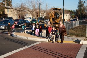
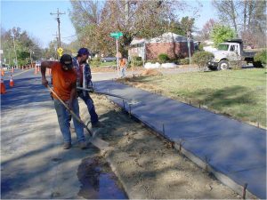
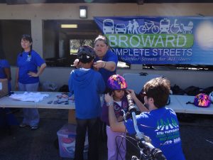
Prompted by a need for safer streets, the Broward Metropolitan Planning Organization (MPO) spearheaded an effort to build regional consensus and political support for planning, designing and building more complete streets projects. As a result, 16 of the MPO’s 31 jurisdictions have adopted Complete Streets resolutions or guidelines, and the MPO increased funding for active transportation projects, with 90 individual bicycle and pedestrian projects totaling $120 million awarded funding since 2012.

Download the Broward case study. (pdf)

NASHVILLE, TN
Prioritizing public health benefits through better project evaluation

Nashville missing sidewalksBacked by data from comprehensive health studies and growing public demand to make biking and walking safer and more convenient throughout the region, the Nashville Area Metropolitan Planning Organization (MPO) designed a new scoring and selection process to prioritize transportation projects that can bring health benefits. The MPO’s new approach substantially increased the amount of funding in the their long-term transportation budget dedicated to making it safer and more attractive to walk or ride a bicycle, making strides toward improving the health of the region’s residents.

Download the Nashville case study. (pdf)

GREENSBORO, NC
Healthy competition: Using data and modeling tools to win funding for active transportation projects

Greensboro sidewalks Guilford CollegeTo make walking and biking safer, more equitable and more convenient in Greensboro, North Carolina, the Greensboro Metropolitan Planning Organization (MPO) developed a rigorous evaluation and data-driven selection process to analyze and select the best possible bicycle and pedestrian projects for the metro area’s available funds, and to help the region better compete for the limited, competitive funding controlled by the state.

Download the Greensboro case study. (pdf)


The development of these case studies was made possible through a contract between the American Public Health Association and Transportation for America funded through cooperative agreement 5U38OT000131-03 between the Centers for Disease Control and Prevention and the American Public Health Association.  The contents of this document are solely the responsibility of the authors and do not necessarily represent the official views of the American Public Health Association or the Centers for Disease Control and Prevention.

How can MPOs and citizens better engage with each other?

Building on the range of new ideas for metropolitan planning organizations outlined in our Innovative MPO Guidebook, join us on September 30, 2015, at 3 p.m. EDT for the fourth webinar in our series as we address a common complaint from both metropolitan planning organization (MPO) staff and citizen activists: how to best engage one another to shape the regional planning process.

In next week’s webinar, we will offer examples of reliable and cost-effective options to interact with the public, including a preview of a new resource we’re producing on an approach known as “creative placemaking” which will be released this Fall.

Innovative MPO web graphic 2Join experts from T4A and the Indian Nations Council of Governments (INCOG) from Tulsa, Oklahoma, to learn helpful techniques that support planning processes and community partnerships.

Register today for our Innovative MPO webinar on Wednesday, September 30th, at 3pm.

By the way, if you haven’t yet read it, our Innovative MPO Guidebook offers examples that both groups can use to bring them closer together. Cost effective techniques such as scenario planning, new technologies and toolkits are just a few of the innovative examples the guide covers. You can read and download the guidebook for free.

Pilot program to support smart planning around new transit lines will benefit 21 different cities

It’s important that communities make the best use of land around transit lines and stops, efficiently locate jobs and housing near new transit stations, and boost ridership — which can also increase the amount of money gained back at the farebox. 21 communities today received a total of $19.5 million in federal grants from a new pilot program intended to do exactly that.

Sound Transit's LINK light rail on the Seattle-SeaTac line. Six stations will eventually be added to Tacoma's current LINK line, doubling their number of stations.

Sound Transit’s LINK light rail on the Seattle-SeaTac line. Six stations will eventually be added to Tacoma’s separate LINK line, doubling their number of stations.

Building a new transit line isn’t some sort of magic wand; a new rail or rapid bus line doesn’t automatically mean that well-planned, walkable neighborhoods will spring up to help support the line by adding new riders nearby, or result in new buildings filled with meaningful destinations bringing transit riders to the area. A lot of work goes into creating a plan that can foster and incentivize the kind of private development that a community wants to see around their transit stations, and the grants in this small pilot program will be a big boost to these 21 communities either currently expanding or planning to expand transit service to their residents.

This pilot program was one of the bright spots in MAP-21, and was a priority we worked hard to see included in the final bill during those negotiations back in the summer of 2012, along with our colleagues at LOCUS, the coalition of responsible real estate investors within Smart Growth America.

Making proactive steps to plan for development along entire transit corridors – rather than just one station area at a time – can attract private-sector interest as well as stronger buy-in from the community by creating a complete picture of the development opportunities presented by the new transit line.

A wide variety of projects received grants ranging in size from $250,000 awards to support the Woodward Avenue bus rapid transit line that will connect downtown Detroit with Pontiac and a transit overlay district in the area around the planned Valley Metro light rail expansion to Tempe; all the way up to $2 million for planning around the six stations of Sound Transit’s light rail expansion in Tacoma, including street design to improve connectivity for pedestrians, bicyclists, motorists and transit riders and a plan to expand access to jobs and job training in a fairly disadvantaged area.

Therese McMillan, the acting administrator, was on hand in Tacoma to announce the grants. “Transit-oriented development is critical to the success of new projects and to the economy of the local communities they serve,” she said. “These grants will help communities like Tacoma develop a transportation system that encourages people to use transit to reach jobs, education, medical care, housing and other vital services that they need.”

We’re excited to finally see the first fruits of this small pilot program that we worked so hard to see included in MAP-21. These grants will go a long way toward ensuring that these numerous planned transit investments bring the greatest returns and the best possible benefits to all.

The full list of winners can be found on the FTA website.

California needs smart station planning to maximize high-speed rail’s benefits

This is a projected image of the area around the Sacramento station, courtesy of the California High-Speed Rail Authority.

High-speed rail investment has the potential to yield great economic and environmental rewards for California, but only if communities make smart decisions about land-use and growth at and around new stations.

A new report prepared by the San Francisco Planning and Urban Research Association offers prescriptions for how communities can prepare for rail investments.

“The new statewide rail system presents a once-in-a-century opportunity to reshape their local economies and set the course for more compact, less automobile-dependent growth,” according to the report.

The first leg of California’s high-speed rail is the backbone of the system through the state’s Central Valley, including population-rich Bakersfield and Fresno. Once all 26 stations have been completed, the system will reach northward to Sacramento and include service from San Francisco to Los Angeles and further southward to San Diego.

The benefits are plentiful. For starters, by shortening travel time between successful metro areas, high-speed rail brings geographically distant focal points closer, connecting more people to opportunities and jobs. The new stations and ease of travel can also revitalize downtowns, bring economic opportunity to low-income communities and reduce suburban sprawl.

By providing a viable alternative to the car — and, in the case of longer journeys, to energy-intensive air travel — high-speed rail is also a terrific means of reducing greenhouse gas emissions and assisting California in meeting the targets of its groundbreaking climate change law, AB 32.

But each of these potential benefits comes with a cautionary tale. The BART system in the San Francisco Bay Area, for instance, was intended to fuel compact and transit-oriented development, but many of the more suburban stations were surrounded by parking lots and built away from town centers, missing the opportunity to add ridership by building up those areas or spurring new walkable centers. Similarly, most of California’s airports are surrounded by parking lots and access roads, making nearby development less desirable. Policymakers must make a concerted effort to avoid a similar fate near high-speed rail stations and be willing to prioritize growth in strategic areas.

The station sites face myriad challenges and opportunities. Some, like San Francisco and Sacramento already have traditional downtowns, while San Jose and Anaheim have emerging downtowns with the potential for growth. Stockton, Merced, Fresno and Bakersfield have downtowns as well, but struggle with high unemployment and a lack of private sector investment. Reconciling rail with more traditional suburbs and major airports will be the focus at other stations.

SPUR offers ten recommendations for planning preparation, which include:

  • Developing station area plans for each high-speed rail station area
  • Drafting statewide station area planning and development guidelines to inform local decision-makers
  • Drafting a statewide implementation plan
  • Providing financial support for local planning as needed
  • And, establishing local development corporations to facilitate local area development

To see the rest of SPUR’s recommendations and the entire report, you can visit their website here.

Planning for the future: Washington’s new Woodrow Wilson Bridge

A New Trail Originally uploaded by M.V. Jantzen.
A bicyclist cruises along I-495/95 on the new Woodrow Wilson Bridge “active transportation lane,” leading to the rare sight of someone not in a car using the Capital Beltway. View more photos of the opening on Flickr from Eric Gilliland, director of the Washington Area Bicyclist Association (a T4 partner.)

Two weekends ago, the 12-foot-wide bicycle and pedestrian lane of the Woodrow Wilson interstate bridge over the Potomac River held its grand opening in Washington DC, filling with bikers and walkers who can now join the thousands of cars that cross the bridge each day.

The bridge, which connects Virginia and Maryland on the southern part of the Capital Beltway, is a vital transportation link in the region, where Interstate 95 (and the large majority of truck traffic) bypasses Washington, continuing north or south along the eastern seaboard.

Hundreds of bicyclists enjoyed a ride across the bridge for the first time ever last weekend, and the renovations to the bridge also added dedicated space for a future transit line — not something you see everyday on an interstate bridge in the United States.

Building a new bridge to replace the 1961 bridge had been discussed for decades, but the planning kicked into high gear in the 1990’s, with Maryland, Virginia, and the federal government all engaged in the process (DC relinquished control to the states.)

Branch Ave and King Street Metro
The King Street (Virginia) and Branch Avenue (Maryland) Metro stops are separated by just a few miles and the Potomac River, but require a long ride into DC to travel between the two on the Metrorail system. One day, Metro might cross the Wilson Bridge instead.

Looking at a map of the Metrorail public transportation system, one can see that only a few miles separate the end of the green line in Maryland and the yellow and blue lines in Virginia. There was no active work to connect the two lines, but a handful of people in the planning process wondered about dedicating some space on the bridge for a future, useful Metro connection.

Parris Glendening, Governor of Maryland from 1995-2003, said that planning for a future transit connection was just common sense.

“Those stations are just a few miles apart as the crow flies, but no one in Maryland who has a choice is going to ride all the way up into DC to switch trains and ride all the way back out to Virginia — and end up only a few miles from where they started,” he said. (more…)