
Lyft is paying people to ditch their cars. Will it work?

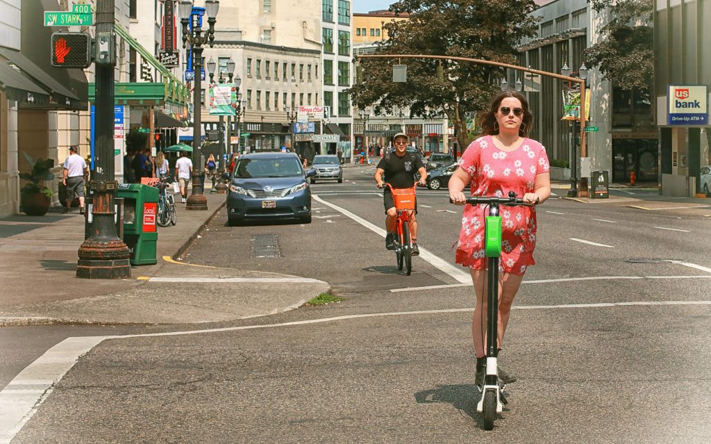
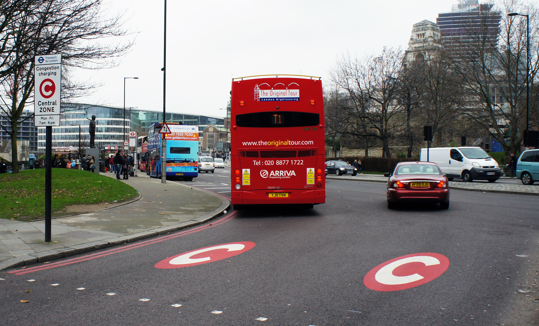
Lyft recently expanded its “ditch your car challenge” to 35 new cities, offering residents credits for transit and various shared mobility services in exchange for giving up their car for one month. Whether this will be good for cities, and what role they should play in it, remains an open question.


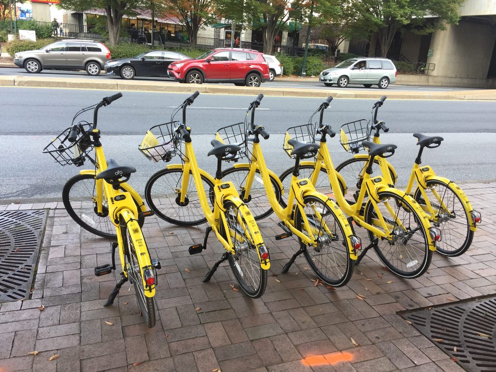
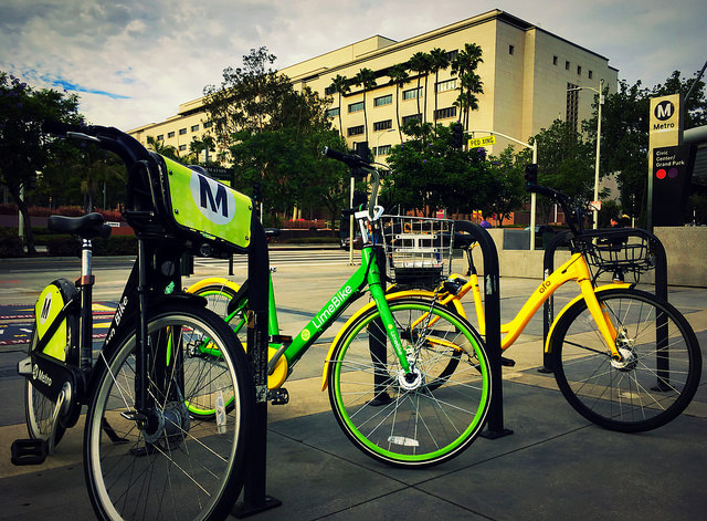
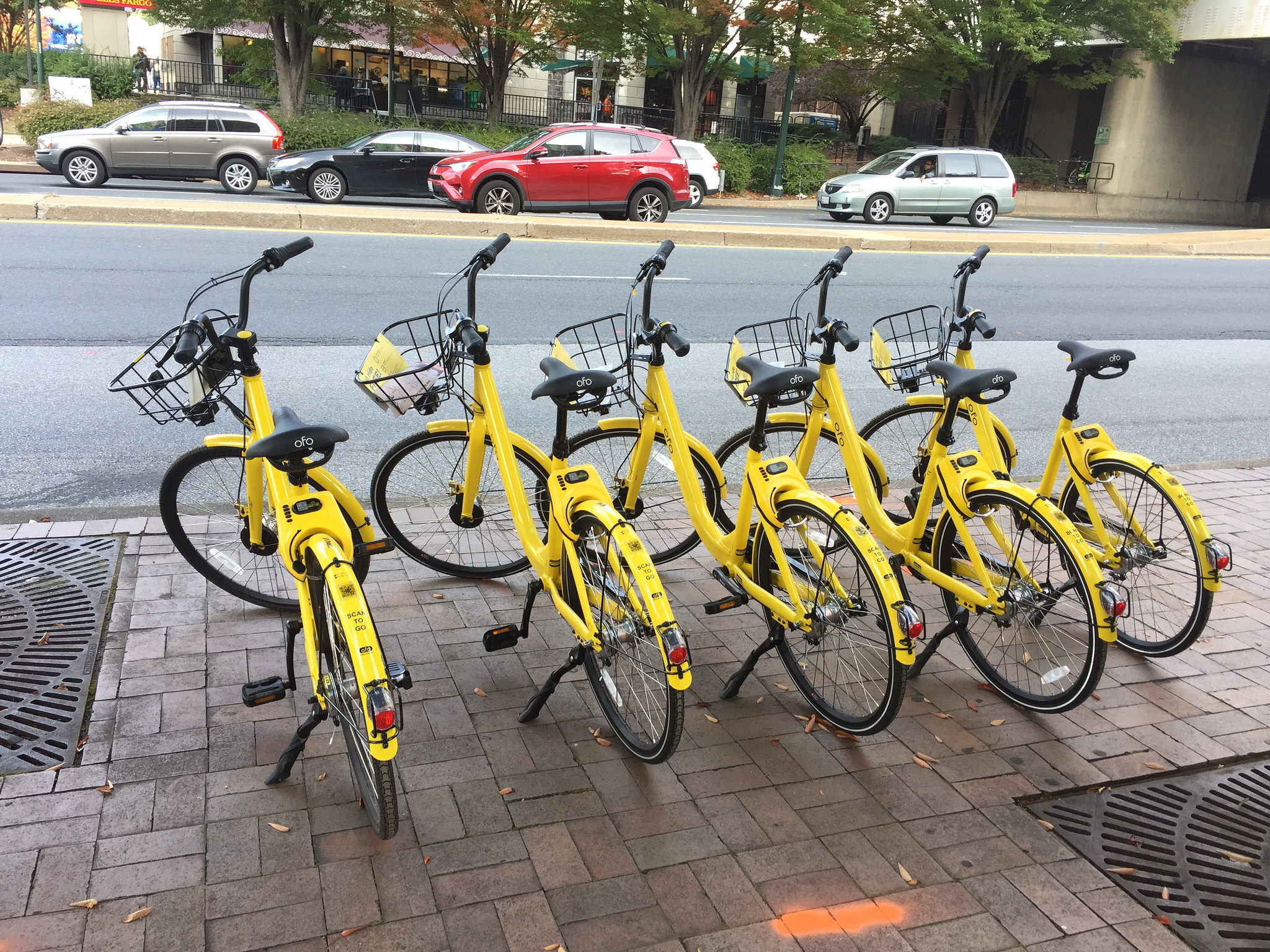
This year, companies such as Uber and Lyft have begun to buy and partner with other mobility services in an effort to shift away from an exclusive focus on ridesourcing and rebrand themselves as mobility platforms providing a broad array of services. Both acquired bikeshare companies in the past year—with Uber buying Jump and Lyft buying Motivate—and both are either deploying or integrating scooters into their apps along with putting a greater focus on public transit. This trend toward consolidating services points toward a future where companies offer a suite of options under their app, easing connections between different service types and becoming a one stop mobility shop.

As this trend continues, it points to the larger question of the appropriate role that cities and transit agencies should play as they work to manage a transportation network made up of both public and private providers. And, how should this role change in an environment where there’s possibly one or two companies providing all of the non-transit services in the region?

Cities will begin to see this firsthand soon through Lyft’s “ditch your car challenge,” launched in Chicago in August. Through this challenge, in return for pledging to give up their car for one month, Lyft provided 100 residents with $550 in credit for Lyft trips, public transit, bikeshare, and carshare. This included $300 in Lyft credits, $105 for L bus and train service, $45 for a Divvy bikeshare pass, and $100 in Zipcar credits. Based on the positive results from this pilot, Lyft expanded the challenge to 35 additional cities in the U.S. The list of cities includes a wide variety of communities with varying levels of car ownership and transit access, such as Richmond, VA, Orange County, CA, Washington, DC and New York City. The stated purpose of Lyft’s challenge is to convince people to get rid of their cars by highlighting the high cost of personal car ownership and enabling access to a suite of cost effective and more sustainable transportation services.

Redefining the user experience
Lyft’s challenge is the first major attempt in the U.S. to test out a variation of Mobility as a Service (MaaS). The idea behind MaaS is to create a single access point for a suite of mobility options. This can be offered either as a subscription service or as a pay-as-you-go model. In its most developed form, MaaS allows users to plan, pay, and take trips across a number of different services, such as transit, bikeshare, scooters, Uber or Lyft, carshare or any other transportation service through a single user interface.

The first permanent MaaS deployment took off in 2016 in Helsinki. Through Whim, a consumer-facing app developed by MaaS Global, residents can access taxis, transit, car rental services, and bikeshare for a single monthly fee, with different pricing packages depending on the level of services they want, along with a pay-as-you-go option. As of July, Whim had 45,000 users in Helsinki, with 5,100 paying monthly fees. This spring, Whim also launched in West Midlands, UK, offering similar mobility options throughout the region. Other MaaS services, such as Ubigo in Sweden, have also launched pilots and are planning for full launches as well.

While Lyft’s challenge does not provide all of these services in one interface and, depending on the market, only covers one or two additional mobility services, it serves as a basic MaaS model for users, and Lyft, to test and explore. While the challenge is largely focused on car ownership and convenience, it’s also to market its available offerings and learn about how to refine these services in the future.

What’s the role for cities?
If it’s a viable model, MaaS can have clear benefits for cities, including easier access to different mobility services that may result in reduced congestion, emissions and travel time. There’s a lot for cities to consider as they think about these platforms, but as with many challenges facing them, they’ll need to use their current goals around equity, safety, congestion, or others as a guide.

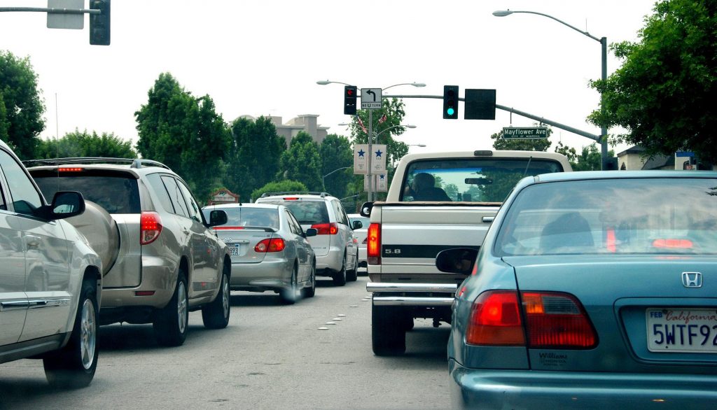
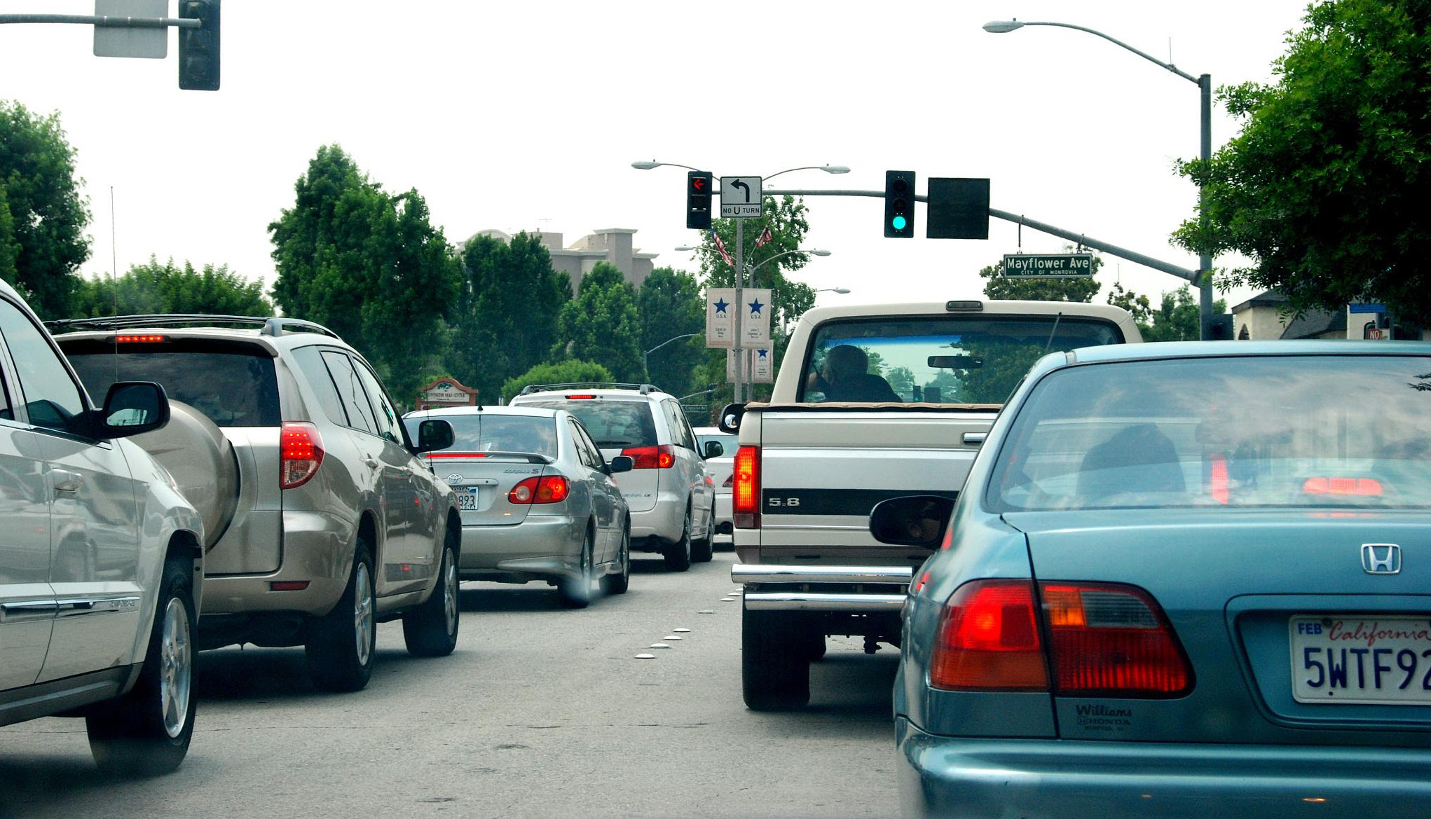
Single-occupancy vehicles are the problem
Despite success in how these platforms have been tested in European cities, and their eventual plans for expansion, they’ve only been tested in dense urban environments with a strong culture of public transportation and an existing suite of readily available mobility options. In these places, residents are accustomed to being able to move from one place to another car-free without much hassle, and MaaS allows them to more easily and seamlessly take advantage of every aspect of their existing options.

But in many American cities where driving is the norm, public transit isn’t reliable or built into most people’s transportation habits and active transportation options aren’t always readily available, this type of program is much less likely to take hold as quickly. The real challenge in these communities is getting people out of their cars, especially when they drive alone, and into more sustainable options.

While Lyft has offered ride credits exclusively for shared rides in some communities, in most of their test cities, Lyft credits aren’t dedicated toward shared rides. So, in those places where more sustainable options aren’t nearly as robust as they should be, this program could simply result in participants switching out of their own car and into one being driven by someone else. While they’re out of their own cars, they’ll still be taking trips alone, which won’t help reduce congestion or solve the problems caused by single-occupancy vehicles.

Multimodal transportation should be the top priority
Understanding this, cities can’t put the cart before the horse: they need a flexible, multimodal transportation system before an app can enhance it, not the other way around. MaaS may provide better connections and access between modes, but cities will still need to ensure those other options are available in the first place, by providing them on their own or through private sector partnerships. As Lyft helps pull people away from car ownership, cities should work to ensure they’re moving toward these other services, instead of simply replacing one car trip with another car trip.

Adopt policies that incentivize sharing and help achieve outcomes
In order foster this type of modal shift, cities will need to pass policies that incentivize the travel behaviors that actually contribute to their long-term goals. While cities can’t control every aspect of how these companies operate, they should understand the various carrots and sticks at their disposal to encourage shared, active, and carbon-free transport. This could include providing dedicated curb space for pickups and drop offs for shared or pooled rides, rather than private ones, creating dedicated lane space for shared vehicles and transit, or creating new pricing mechanisms that truly accounts for the benefits and impacts of various modal choices.

Require data from providers
As part of this, cities should ensure they can use the data these platforms produce. MaaS could put all available services under one umbrella, allowing cities to gather additional data on how each service is operating and how they’re interacting with one another, creating opportunities for better transportation planning. But, odds are they won’t get this data, as some of these platform companies haven’t freely shared data on their operations. Cities are getting valuable data from shared active transportation companies today, but this movement towards mobility consolidation raises the question of whether cities will continue to get these data once they’re acquired or included under a larger MaaS platform. To be sure, cities should adopt data sharing standards for every provider and service that will allow them to better understand these services are being used and how they themselves will need to evolve as a result.

Like many aspects of smart mobility, MaaS isn’t a silver bullet that will fix a city’s transportation challenges. In order to make these successful, they’ll need to stick to their goals and outcomes and consider how these platforms will work for them, not the other way around.

Focusing on the positives of dockless bikes and scooters

Cities are quickly passing policies to manage the influx of dockless bike share and scooters in their communities. How can they craft policies to achieve the outcomes they want, rather than simply avoiding the ones they don’t?

We’re more than halfway through 2018 and shared active transportation services such as dockless bike share and stand up electric scooters continue to expand, often without warning, to new cities across the country. As a result, cities are beginning to pass policies and regulations to manage the demands and challenges these new services create.

But, instead of shaping these services in a way that maximizes their positive impacts, so far, their policies seem to be more focused on simply preventing potential negative outcomes. In order to unlock the full benefits of these vehicles, they’ll need to craft policies that address both.

One of the starkest examples of this is how cities are allocating space for these vehicles, both when they’re in use and not. To prevent dockless scooters and bikes from blocking sidewalks and creating chaos in the right-of-way, Denver, for example, has passed requirements for operators to install and maintain painted parking zones throughout the city.

Creating parking spaces is a great way to ensure these vehicles aren’t making city streets less safe when they’re not in motion. But, this should be paired with efforts to create a safer environment for these vehicles and their users when they are in motion. In order to foster the adoption of these services and truly make their streets safer, cities should clearly articulate where these vehicles should operate and carve out protected spaces for people to ride.

The need for protected infrastructure has been apparent for years with bicyclists and pedestrians and is quickly becoming clear with scooters as well. Last month, Jenasia Summers, a 21-year-old woman in Cleveland, was struck and killed by a car while riding a scooter in a six-lane road with no dedicated space for active transportation users. Stories like this are far too common and are directly related to the low rates of active transportation users—half of Americans would like to ride bicycles more, but are afraid of interactions with motor vehicles.

To help create additional space and infrastructure for active transportation users, cities could use the fees they receive from private mobility providers to build out new bike and pedestrian infrastructure that will foster the adoption of these services.

But, even as scooter companies such as Bird are offering to give cities $1 per vehicle per day for cities to use for better bike infrastructure and safety measures, cities aren’t actually codifying this in policy.

A city’s budget reflects its priorities. If cities are truly committed to increasing active transportation, they should include provisions to directly allocate revenue from these services toward providing better infrastructure as these vehicles increase in popularity. Even if the total amount of money isn’t much, it’s an opportunity for cities to carve out space for their stated priorities.

A greater focus on the positive impacts of new mobility options can go beyond safety. In its updated Free Floating Bike Share Permit Requirements, the Seattle Department of Transportation (SDOT) has incentivized providers to offer adaptive cycles as part of their fleets. Adaptive cycles include a range of two- or three-wheeled vehicles, such as tricycles, hand-pedaled cycles or recumbent cycles where the rider leans back in their seat, that can be used by individuals who are unable to operate a two-wheeled bicycle. To put more of these on the road, SDOT will allow operators to expand their fleets if they provide a certain share of adaptive cycles.

Additionally, SDOT has specified in their policy that they will allocate $50,000 from permitting fees toward developing and leveraging community partnerships to increase adaptive cycling ridership and access. While it still needs to clarify some of the specifics of how these partnerships will work, SDOT has clearly outlined its priorities to increase access by providing incentives to private mobility providers and has allocated additional resources to engage people with disabilities to increase ridership.

It’s very early in the process of determining how to regulate these new shared active transportation services and there’s still much to learn about how best to utilize these new mobility options in service of our long-term outcomes. But, as cities integrate them into their communities and are generating revenue from their operations, there’s an excellent opportunity to chart a new course and develop regulations in way that truly advances their long-term positive outcomes, rather than simply trying to prevent their negative impacts.

At our next Smart Cities Collaborative meeting in Pittsburgh, we’ll discuss these challenges and explore policy provisions for shared active transportation services that maximize their benefits. Stay tuned for an update on what we learn, what the biggest challenges are, and what a model policy could look like.

Moving from theory to practice with the Smart Cities Collaborative

Many of the 24 cities in our Smart Cities Collaborative are currently knee-deep in pilot projects or a flood of new mobility services. Their direct and ongoing experiences helped shift the conversation from theory to practice during a two-day meeting of the Collaborative in Seattle last week.

It’s only been three months since we were in the same room together, but the rapid introduction of new mobility services has continued rapidly across the country. A whole new batch of cities—including Atlanta, Austin, and Minneapolis within the Collaborative—have been managing the introduction of dockless bikeshare systems and electric scooters. Cities like New York and Washington, DC have introduced new ways to regulate transportation network companies (TNCs) like Uber and Lyft, and others—like West Sacramento—have launched microtransit pilots.

During this meeting at the Seattle Central Library in downtown Seattle, it quickly became clear that the tone, pace, and feel of this year’s Collaborative is much different than last year’s. In part because of the size of this group—over 75 participants from 45 agencies representing 24 different communities—and in part because of the diversity of their projects and because of where each city is in their process. During our first year, many cities were still wrapping their heads around these new mobility options and trying to better understand emerging technologies.

This year, almost every participant, agency, and city has at least one project, policy, or permitting process they’re managing, developing, or have recently passed. This direct experience has helped moved the conversation from theory to practice with more in-depth, detailed discussions on performance metrics, data sharing, street design, pricing, and more.

Getting the ball rolling with data

Los Angeles Department of Transportation (LADOT) kicked things off in Seattle with a session about their Transportation Happiness metrics, a new process they’re piloting in an effort to measure user experience across the city’s transportation network and help them bring a human-centered focus to their decision-making process. LADOT released draft metrics last month and used this meeting to host small group discussions with other cities to review their goals and guiding principles, refine their proposed metrics, and help them brainstorm additional sources of data that would speak to each metric.

The Seattle Department of Transportation (SDOT) is in the midst of reevaluating its own data processes. Benjie de la Peña, SDOT’s Chief of Strategy and Innovation, explained how they are starting with a thorough accounting of all the information that’s flowing in and out of the department, and using that to inform where and how it needs to evolve or adapt for new mobility services.

This conversation spurred an important and necessary discussion about developing data-sharing standards for new mobility services. These services—like TNCs, scooters, and automated vehicles—often launch and scale rapidly, affecting everything from congestion to safety to equity. But, local governments often aren’t receiving the right data (or any data) from private mobility providers, resulting in a lack of information and insight into how these modes are truly impacting the community.

One of our goals during this meeting was to help cities identify data these modes are generating and then articulate which data would be most useful for cities to better understand their impacts. To start, we broke participants off into small groups and identified a comprehensive list of data being generated by each service, determined which data is most important to collect, and which metrics these data apply to in order to better decipher the impacts of these services.

Over the course of the next few weeks, T4America will compile this information, identify the consistencies across each service, and codify a set of shared data standards that any city can use with public and private mobility providers as they operate, procure, or permit mobility services.

Like the Denver meeting, we’re continuing to prioritize equity in every project

While new mobility services have the potential to make cities more equitable and improve accessibility for everyone (as we explored in this post), if cities aren’t careful, they could instead make matters far worse.

To learn more about proactively harnessing the positive potential of new mobility platforms, we were fortunate to have Naomi Doerner, Seattle Department of Transportation’s (SDOT) Transportation Equity Strategist, along with two members of our own team, Emiko Atherton, the Director of the National Complete Streets Coalition and Ben Stone, Smart Growth America’s Director of Arts & Culture, to lead a conversation on equity strategies in transportation.

Ben and Emiko spoke about the importance of engaging the community at every step of the planning and implementation process, and challenged participants to think about how their communities think about equity and what they could be doing better. Naomi provided an overview of Seattle’s Transportation Equity Program, which conducts outreach on how the city can provide affordable and accessible options to communities that need it most, provides discounted carshare, and helps residents access transit through discounted fare cards.

Closing it out with street design and pricing

The morning of our second day focused on the impacts of new mobility services on street design. We heard about how cities around the country are updating their processes to account for all the new demands on the right-of-way. Participants from Santa Monica, Boulder, and Pittsburgh shared how they are implementing new street designs, how they’re handling community engagement, and what to do when a street, arterial, or corridor doesn’t easily fit into these traditional categories.

It was a good lesson in how important it is to engage the community, understand their desires and concerns, and involve them in the hard choices necessary when redesigning the street. Adding to this discussion, Dongho Chang, Seattle’s Chief Traffic Engineer, detailed the work he’s led over the past decade and shared specific examples of how they’ve used new street designs to increase safety, reduce accidents and fatalities, and increase transit and other mobility options. (Check out his twitter feed, by the way, it’s superb!)

We wrapped up by talking about pricing, facilitated by a number of experts with experience leading projects that utilize dynamic pricing models. They shared the political, technological, and operational challenges each pricing program has faced throughout their development and operation.

Next stop, Pittsburgh

Seattle proved a perfect backdrop for the meeting—myriad new mobility services operating alongside a heavy commitment and investment to high-capacity transit, and cutting edge street design. And this meeting showed why the work of the Collaborative is urgently necessary: so many cities are knee deep in pilot projects or scaling up new services and the pace of change is continuing to accelerate. But these leaders from 24 cities are clearly ready to continue tackling these challenges and are committed to working together to do so.

Based on the enthusiasm they have shown during the first two meetings, we have no doubt it will be the same when we meet next in Pittsburgh this September where we’ll dive even deeper into these topics once again.

Using new mobility models to increase access

New mobility services have enormous potential to change the transportation landscape and increase access for all residents. But, only a few projects are actually focused on that.

As new mobility models continue to have an impact on our transportation system and shift how our cities are designed and operate, cities and transit agencies are launching new pilot projects to test everything from microtransit to ridesourcing to automated vehicles and understand how these services can best function in and benefit their communities.

One of the most promising areas to capitalize on new mobility services is around increasing access for people most in need; people who live in areas that are currently underserved by transit, do not have bank accounts or cell phones, require wheelchair access, or commute during off-peak hours. Depending on how they’re deployed, these services could help community members more easily reach jobs, school, medical appointments, grocery stores, or wherever people need to go.

Many of these individuals are already dealing with a transportation network that has often been designed without their needs in mind—whether it’s infrequent transit, a lack of affordability, or inconsistent paratransit options. This has grown worse in recent years as many lower-income individuals, faced with the high cost of living, have been forced to move from city centers to inner and outer ring suburbs, with fewer jobs and resources and where reliable, affordable public transportation is even less likely to exist.

New mobility services have the potential to provide additional access to these communities, but have to be designed with those goals in mind. Often, projects across the country are sold on these outcomes, citing increased access to opportunity as a direct benefit, but simply piloting an automated vehicle shuttle or a microtransit service or setting up permitting processes for scooters or dockless bikeshare won’t produce these outcomes. Without careful deployment, these new services won’t help communities realize the potential benefits and could even exacerbate current inequalities.

For example, some cities have chosen to subsidize transportation network companies (TNCs) like Lyft and Uber to save money on fixed-route transit or used TNCs in place of transit altogether. While these experiments claim “improved access” as a benefit, few are designed with this as a primary goal or measurable outcome. In other cases, cities and transportation agencies design projects around the shiny new technology, next select a pilot area, and only then focus on the problem it could solve—the problem (and people being served) should come first.

For a city to truly solve its mobility challenges and actually create additional access for its residents, it needs to focus on its long-term outcomes, make thoughtful decisions about why and how it will deploy a new service, and understand how it will lead to those outcomes. This requires starting with a thorough understanding of the problems a community is facing, particularly its most disadvantaged residents, and then developing potential solutions from there.

We spoke to two communities that are currently running pilots designed to increase access to better understand how they developed their project scope, what their outcomes are, and where they think other cities and agencies could emulate their efforts.

Pinellas County, Florida—TD Late Shift

Pinellas County sits on Florida’s Gulf Coast, just west of Tampa, with a population of nearly one million. Given that beaches, tourism, and nightlife make up a major part of the county’s economy, a large share of local workers have hours that run late into the night or start early in the morning—when many transit services (including Pinellas County’s) don’t operate.

“We don’t have the density or funding to operate fixed-route service overnight, but we do have a lot of workers in the service industry,” said Bonnie Epstein, Senior Planner for Pinellas Suncoast Transit Authority (PSTA), the county’s transit provider. “We have beach bars and hotels and restaurants that stay open pretty late, so there’s a huge need for [additional] service.”

Understanding this challenge and with their problem clearly defined, PSTA launched the TD Late Shift pilot program in 2016. For $20 per month, many low-income county residents can purchase a monthly bus pass and also receive 25 free on-demand trips, through Uber, United Taxi, or Wheelchair Transport, to or from work anytime regular bus service isn’t running. The pilot is targeted at anyone who qualifies for the Transportation Disadvantaged (TD) program, a state-funded initiative. To qualify, residents must lack reliable transportation options and have a household income no greater than 150 percent of the federal poverty line.

Much of the thinking for TD Late Shift came out of PSTA’s Direct Connect Pilot, another ridesourcing project the agency launched earlier in 2016 that provides $5 discounts on rides to and from bus stops from the same providers as TD Late Shift. Direct Connect is open to anyone, but is only during regular transit service hours. After the Direct Connect pilot launched, the agency recognized that while it was increasing access during the day, late night and early morning commuters were still in need.

TD Late Shift was designed fill this need. According to Epstein, the goal is to improve job access by allowing people to work later shifts and know they can get to and from work, work additional shifts at different hours, and increase safety. Before the pilot, residents with late night or early morning hours didn’t have many options. “Some couldn’t get to work, some rode their bikes at 2am [often without adequate bike infrastructure], and some often had to wait late at night for someone to pick them up,” said Epstein. “With these on-demand, late night rides, residents have more time to spend with family, can sleep longer and are safer since they don’t have to wait outside late at night or walk or bike on potentially dangerous streets.”

So far, the program has proved popular as ridership has grown since its launch in 2016 and is slated to run through the end of June 2019.

Detroit, Michigan—Woodward 2 Work

The City of Detroit’s Department of Transportation (DDOT) launched a similar project in early May of this year that is also focused on increasing access for late shift workers. While Detroit does not have the beaches of the Gulf Coast, it has many residents working late shifts who lack reliable and safe door-to-door commuting options.

The Woodward 2 Work (W2W) pilot provides discounted Lyft rides to anyone going to or from an eligible bus stop on the Route 53-Woodward bus line. Route 53 runs 24 hours a day, beginning just south of Eight Mile Road at the northern edge of the city and connecting straight to the heart of downtown, an almost nine mile trip. DDOT chose Route 53 because of the large number of riders it could reach, especially those working later shifts.

To use the service, potential riders need to text “W2W” to the project hotline between 12am and 5am. In response, riders receive a code they enter into the Lyft app—or use over the phone through Lyft’s Concierge service—for a $7 discount on any ride.

This is the first partnership for DDOT with a TNC and the department wanted to make sure they got it right. Before the pilot started, DDOT conducted community outreach through surveys and personal interviews in order to clearly identify community challenges and build a project from those needs. “We didn’t want to pose a solution before defining the problem,” said Stacey Matlen, Senior Mobility Strategist at DDOT. “We knew there were a number of challenges for people walking to and from the bus stop at three in the morning, so we conducted interviews with late shift workers and created personal journey maps to understand everything these customers encounter.”

DDOT came up with a number of possible pilot ideas from the information they gathered during their outreach. Then, they took these concepts back to the community to see how well they might fit. “We saw that a lot of people were carpooling, so we thought about that [as a pilot], but received feedback from users through scenario testing that that’s not necessarily what either group of employees (riders and drivers) wanted,” said Kenny Fennell, also a Senior Mobility Strategist at DDOT. Through these conversations, DDOT developed W2W as a pilot that would make more sense with the community’s needs and desires.

Designing with access in mind

DDOT’s pilot is a great example of how cities can think about improving access from the ground up with the user’s perspective in mind and without a predetermined solution. Unfortunately, many cities develop pilot projects with a specific technology or service they want to deploy, such as automated vehicles or microtransit, and then go searching for problems it could solve. There is often no process of outreach and community engagement to determine how the service can best help improve access for their residents.

Instead of starting with a potential solution in mind, or a particular technology, PSTA and DDOT used a robust community engagement process to ensure the end user was involved from the beginning. They focused on their communities’ needs and put together a project that would best serve them.

With DDOT, the department made a clear decision from the start to bring these new services to the people who have the most to benefit from them. “To ensure equity, the design and decision making process should take into account how the most under-resourced user will be affected,” said Fennell. Matlen echoed this view, noting that “getting out of the building and interviewing stakeholders to know what their problems are and how our projects can help” is the most essential component of the process.

Both PSTA and DDOT did an excellent job of identify local mobility challenges, sourcing ideas from the community, and then designing an appropriate solution. For DDOT, the most important metric they’re tracking for the project is how many riders they’re getting to work and continuing to conduct interviews with riders in order to refine the pilot along the way.

With TD Late Shift, PSTA also designed the service specifically around the needs of its users that did not have access to fixed-route service or the Direct Connect pilot to get to work and made sure it was accessible for lower-income individuals, individuals without a bank account or credit, and wheelchair users. The agency has continued to learn from its efforts and has worked to continuously improve the pilot to better serve its users. As ridership continues to grow, PSTA is hoping to make it a permanent fixture of its service.

With both pilot projects, there are still plenty of questions over how best to gauge how well these pilots are meeting community needs, how they can improve service to include more riders, and how to more directly link them up to other long-term outcomes. But what’s most important is that they’re engaging with their communities to ask these questions and actively look for answers.

Vancouver mobility pricing study reveals why pricing is such a hard sell

One of the main themes in this year’s Smart Cities Collaborative is how communities can price roadway and curb space as part of their strategy to achieve their long-term outcomes, such as reducing congestion, lowering emissions or shifting trips to transit or other mobility options. A recent study out of Vancouver reveals some of the main challenges communities face as they consider these new pricing strategies.

While there are a number of different pricing strategies that cities can apply, one of the most frequently discussed is congestion pricing—which broadly refers to charging vehicles a fee based on where they’re traveling, distance, time of day and more.

Given the myriad negative impacts of congestion on the local economy, the environment and everyone’s quality of life, effective pricing strategies can help reverse these trends by reducing single occupancy vehicle trips, encouraging pooling of rides and shifting trips to transit or other modes such as walking or biking, resulting in lower emissions and leading to faster, more reliable travel times for everyone, including those driving. This has been the case in cities such as Stockholm, London and Singapore where congestion pricing has produced the intended results. But, for various reasons, pricing has struggled take hold here at home in the US.

This April, for the second time in a decade, a fully-fledged plan designed to reduce congestion in the busiest parts of Manhattan fell short of being implemented. The most recent plan addressed some of the major challenges the city is currently facing; a growing population, increasing congestion in its core business district and a transit system losing ridership—one that Governor Andrew Cuomo declared was in a state of emergency last summer. The plan proposed a charge on vehicles entering the downtown area to alleviate congestion and would then largely use that revenue to invest in transit maintenance and upgrades to provide greater options.

But even when the need for, and benefits of, congestion pricing are clearly articulated it still takes a big political lift to pass into law, let alone discuss as a serious policy proposal. Failure to enact often comes down to a lack of political will. This can be especially difficult, as it was in New York, where both of its proposals required state authorization, as the city does not have authority to implement pricing on its own. Like any new policy or technology, cities will need to take time to figure out how it will work best for them and determine how they will address any potentially negative impacts. But, based on the need for it in New York City or the benefits it’s provided to cities abroad, it’s a conversation worth having.

Understanding these potential benefits, Vancouver, BC has begun to study congestion pricing as well. The Metro Vancouver Mobility Pricing Study, released last month, highlights a number of challenges cities and regions face as they consider implementing a pricing scheme.

Vancouver today

Vancouver, situated a few miles north of the Canadian border over Western Washington, has a population of over 630,000 and is roughly akin to Boston in its density. The region has slightly fewer than 2.5 million people and is expected to add one million new residents and 500,000 new jobs by 2040.

The majority of this growth is happening outside of the City of Vancouver to the south and east in regional centers such as Surrey, Burnaby and Richmond. Since downtown Vancouver also sits on a peninsula, most trips in and out require crossing a bridge or using a tunnel. These turn into chokepoints, especially during morning and afternoon commuting hours.

Congestion is already having a significant impact in Vancouver today, costing between $500 million and $1.6 billion per year, according to the report. If new residents moving in bring the same proportion of cars as residents today it will be an increase of 600,000 cars and would likely increase congestion 40 percent by 2030, causing further negative impacts to the regional economy and residents’ quality of life. And, despite planned investments in transit, they’re worried it might not be enough to mitigate all the coming growth.

Metro Vancouver Mobility Pricing Study

With an eye to managing this growth and pushing it toward their desired goals of creating more dense, walkable neighborhoods that are connected by transit, the Mayors’ Council—composed of the 21 mayors in the Greater Vancouver Region who review and approve TransLink’s (the regional transportation authority) transportation plans, established the Mobility Pricing Independent Commission to study how congestion pricing could work in the region.

The report itself was not intended as an argument explicitly for or against congestion pricing, but to serve as a feasibility study to assess the potential impacts of a pricing strategy and identify areas for further research. As a result, the report gives a thorough and sober account of the challenges associated with implementing congestion pricing along with a host of questions that need to be asked in order to comprehensively address these concerns.

But, while the report identifies the necessary challenges with congestion pricing and provides a clear idea of how much residents would have to pay, it’s far less clear in describing the benefits and what residents will get in return. The report notes the potential reduction in congestion and the larger economic benefits of pricing, but doesn’t articulate the tangible benefits to individual households or how it will help the region achieve its long-term goals, whether it’s safety, equity, emission reductions or something else.

The process: setting a vision

The report begins by re-establishing the outcomes agreed to in the region’s long-range transportation plan, Metro 2040, which calls for continued development of diverse and dense neighborhoods that are walkable, connected by high-frequency transit and with successful demand management strategies.

With congestion pricing suggested as a possible solution, the Commission set out to solicit feedback from the community to understand possible concerns and questions about, and goals for, a pricing strategy. Over 17,350 residents and over 300 stakeholders and government officials participated in online public engagement and in-person workshops. Through polling they also learned residents are evenly split on congestion pricing—one-third are opposed, one-third are in favor and one-third are undecided. Much of their stated concerns largely revolved around the potential equity implications and how the revenue would be managed.

From these conversations, the Commission established a set of three core principles while developing a coordinated regional mobility pricing policy: reduce congestion, promote fairness and support transportation investment.

While these principles do not include explicit goals such as reducing single occupancy vehicle trips or shifting more trips to transit or other modes, this is still a good example of clearly identifying problems and developing outcomes—something that many communities have struggled with as they look to implement everything from automated vehicles to microtransit pilots to pricing schemes. By identifying their problems, setting outcomes and engaging the community, the Commission sets a strong example for how other communities should approach new policies and projects that they’re considering for themselves.

Recommendations

With its principles laid out, the report recommends two different charging mechanisms to reduce congestion throughout the region along with policy options for each.

The first is a point-based charge where drivers pay a fee when passing certain fixed points in the region, with the fee varying depending on the time of day and the direction of travel. These charge points would primarily be located on the bridges and tunnels leading in to downtown areas, which turn into congestion hot spots. These charges are reflective of what the report calls the user cost principle, where drivers pay based on how much they contribute to congestion.

The second is a distance-based charge, where drivers are charged based on how far they travel, with fees varying depending on the zones they travel between. These are aimed at what the report calls the user pay principle, where drivers pay based on how much they’re using the road network. In order to address congestion in the worst areas, prices increase the closer drivers get to the core city and during peak commuting hours. To promote fairness, the report suggests getting rid of the fuel tax if a distance-based charging system is implemented.

In addition to the two charging mechanisms, the report also lays out two price thresholds: the lowest charge necessary to realize any meaningful impact of congestion reduction and a slightly higher charge that would realize additional benefits and congestion reduction. Depending on the pricing mechanism and the threshold for congestion reduction, the report proposes a fee schedule that would result in a median cost per family of anywhere from $1,000 to $2,700 per year.

This is a significant fee, and the report authors don’t downplay it. Instead, they argue that this is the scale at which a charge needs to be implemented to have a real impact. In the report’s opening letter from the Commission Chair, it states, “it is easy to characterize a decongestion charge as a ‘money grab’ or ‘just another tax.’ The paradox is that the less you charge, the more it would be just that. The charge needs to be set at a level sufficient to unlock the considerable benefits of reduced congestion and more efficient mobility.”

Addressing equity

One of the biggest questions for any pricing program, both operationally and politically, is the impact on equity. The report clearly identifies that this will be an ongoing challenge. This is especially important as the report notes a charge of $2,700 per year would be up to 8 percent of some household incomes. This is a major concern with any congestion-pricing program, as lower income families tend to pay less in total, but a much larger share of their total income.

While this shouldn’t be a deterrent for congestion pricing in general, it does mean that there needs to be a comprehensive plan in place to address or correct the issue to avoid disproportionately impacting those who can least afford it. The report does not shy away from these concerns and suggests a number of measures that could correct the imbalance including tax credits, eliminating the fuel tax and reducing transit fares, but doesn’t recommend a specific solution and states the need for more research to understand what approach is best.

Selling the benefits

While the report makes it clear how much congestion pricing will cost the average household, it’s not as clear what the tangible benefits will be, both for the individual user and the region. The report identifies estimated travel time improvements from the charge, but congestion charging is about more than just a reduction in travel times, it should be a tool that can help a city or region achieve its long-term goals, everything from safety to health to access to resources and amenities.

Convincing a skeptical public about pricing, as with any policy or technology that’s new or different, isn’t about selling just a shorter commute time, it’s about articulating the personal benefits to them (and their community) in a way that connects with their core values and communicates the clear benefits for their quality of life. With a report in hand that does a poor job on this count, various officials from local mayors all the way to the British Columbia Premier have been reluctant to signal their support or say much more than that the idea needs more study.

Congestion pricing is a critical step we need to take in our cities in order to reduce the negative economic and social impacts of traffic congestion, emissions and much more. With this report, Vancouver has laid the foundation for what pricing might look like in their community. The report should do more to outline the tangible benefits of pricing or reducing car trips and investing in transit, but the commission has done a good job at starting the conversation, raising some of the necessary questions in an open and objective way and setting the region on a path forward.

They’ve started a dialogue that few cities have even considered that will hopefully provide lessons for others to learn and lean on in their own deliberations.

Setting effective data standards for new mobility providers

When transportation network companies like Uber and Lyft came into cities earlier this decade, they refused to share data with cities, which has presented a major challenge for cities trying to assess their impacts. As new modes such as bikeshare, microtransit, and automated vehicles enter our communities, will this happen again?

Transportation network companies (TNCs) such as Uber and Lyft have been operating in many cities for the greater part of a decade. Though they’ve changed the face of transportation, cities are still trying to determine whether (or how) TNCs are adding to congestion, cannibalizing transit or active transportation, or affecting equity. This is principally due to the fact that these companies have largely refused to share data with the communities they’re operating within. Without this clear understanding, cities haven’t been able to respond accordingly and mitigate any negative impacts of these technologies—or foster beneficial ones.

Whether it’s protecting trade secrets, consumer privacy or fear of public data requests, or even that it’s cumbersome and cities don’t know how to use the data, TNCs have provided countless justifications for withholding this information. Unfortunately, this approach has set the tone for other startups and new mobility operators.

As cities consider how to permit, procure, and deploy new mobility options such as microtransit, bikeshare, or automated vehicles (AVs), strong data-sharing requirements will allow cities to better understand and adapt to their impacts and proactively plan for their future. It’s also a critical tool for collaborating and sharing their experience with other communities as cities collectively determine best practices for implementing these technologies.

Through tools such as General Transit Feed Specification (GTFS) and General Bikeshare Feed Specification (GBFS), cities have been able standardize and share data with each other and improve their internal operations. At the same time, organizations such as Shared Streets are working to develop a universal language so cities, private companies, and others can be assured they’re talking about the same things in the same way.

To enable more consistent data sharing between the public and private sector and across communities, during our next Smart Cities Collaborative meeting this July in Seattle, we’ll start developing a set of data sharing standards for new mobility options. This process will begin by determining the outcomes cities want from these new modes, and then identify what data cities will need to track, the data they’re currently collecting, and which data are being created by each new mode that they’re not currently collecting. From this we’ll determine a baseline set of data that cities should be requiring from each of these modes.

What are cities in the Collaborative already doing? We spoke with a few of our member cities to see how they’re approaching data collection for bikeshare, microtransit, and AV pilots and what they’ve learned so far.

Bikeshare

While cities have struggled to negotiate data sharing contracts with TNCs, they’ve found more success with new modes when they’ve been able to set the tone of these conversations with a clear vision of what they want.

Cities have done a good job of this with bikeshare providers. In Washington, DC, for example, the city began its Capital Bikeshare program with fairly robust data collection, but hadn’t figured out how to use it yet. Often this had to do with data reporting that was not refined to be most helpful to the city, or that the city did not have a consistent standard for talking about the specific data it was receiving. Over the course of the program, “we’ve gotten better at sharpening our pencil to define, for example, what counts as a trip,” says Kim Lucas, Bicycle and Pedestrian Program Specialist at the District Department of Transportation (DDOT). “We’ve used an iterative process to tweak our methodology over time and understand those nuances,” in order to improve data collection practices.

In 2017, when DDOT began to develop terms for a dockless bikeshare pilot program, it applied its lessons learned for these new operators, but also took the opportunity to look at additional data that could be gathered as well. “We’ve gotten a lot out of freely available data with Capital Bikeshare. With dockless, we knew there was a desire to have publicly available data from our community, so we took suggestions to understand the data they want and how they would want it,” says Lucas. Both in the city and the community at large, open data from bikesharing had become part of the culture, and DDOT leveraged their past experience and current community needs to set a clear standard for the data new providers would have to share.

DDOT isn’t alone in using its authority to set clear and consistent data standards for new dockless bikeshare operators. The Seattle Department of Transportation (SDOT) published its bike share permit requirements last June, which set out a clear framework for their operations and established what data companies would need to provide. Since then, cities such as Chicago, San Francisco, and Los Angeles have created their own permitting processes that similarly govern data collection and sharing, often similar to Seattle’s model.

Microtransit

While cities are comfortable setting the terms for deployment with bikeshare and are learning and borrowing from one another, this comfort has not fully crossed over into other modes.

The City of West Sacramento, CA launched a microtransit pilot in May with Via. Through the pilot, the city receives data on pickup and drop-off location requests, the number of passengers per ride, travel time and distance, fares paid, whether a wheelchair accessible vehicle was used, and aggregated data on ridership trends.

In determining the data to collect, the city “developed an agreement for a discrete dataset that we knew we wanted, but also built in language committing Via to work in earnest to provide additional data (or a sufficient proxy) as other available data emerges over time—whether unforeseen or otherwise excluded—which could inform broader transportation planning and investments decisions,” says Sarah Strand, Assistant Transportation Planner for the City of West Sacramento. The city set out initial terms for data collection, recognized that it would need more, and built that into the contract in order to enable the program to evolve to further help it understand the impact of this new mode.

If the provider isn’t willing, setting these terms isn’t enough. Last year, Lone Tree, CO launched its Link On-Demand service in partnership with Uber to provide shared, on-demand rides throughout the city. While the pilot was one of the first of its kind, it only got off the ground because the city backed down on its data concerns.

“We had to make a choice—were we going to let data stop us from doing the pilot?” says Jeff Holwell, Economic Development Director for the City of Lone Tree, recalling initial conversations with Uber. While the city was able to launch a pilot, and is able to receive some data because pilot vehicles are city owned, it’s not getting the necessary information to fully understand how well the pilot is operating and how it might be improved, scaled, or iterated over time.

This is a problem not only for the city, but for the many other communities interested in similar pilots for on-demand, dynamically routed vehicles. These are brand new technologies that both the public and private sector is still figuring out how to operate. Without this data, cities won’t know how to replicate similar projects in their own communities or modify them to unlock the positive benefits of these technologies. Instead, companies know cities want these technologies in their communities and use the leverage to bully them into agreements that are entirely on their terms.

Automated vehicles

Like many TNCs and some microtransit providers, AV companies have also been extremely reluctant to share their data.

Some cities, such as San Jose, CA, are working on AV pilots with robust and flexible data sharing agreements. Last year, the city released a Request for Information (RFI) for an AV demonstration project. Since the release, the city has worked with potential providers to clarify its goals of increasing transit and reducing single-occupancy drivers, while addressing the larger question of how well AVs operate in the right-of-way. “The question we’re asking is, what impact will AVs have and how can we make it positive?” says Jill North, Innovation Program Manager with the City of San Jose.

To answer this, San Jose is prioritizing providers that are willing to help by sharing their data. “We want to collaborate and figure things out together,” says North of the city’s plans for data collection. “We want a provider we can learn with and help us understand the correlations we’re not thinking about.” With clear outcomes in mind, the city will keep its data sharing open and fluid to learn and adapt along the way.

Information from San Jose’s pilot will help other cities design their own AV projects. And while San Jose has been very intentional in using its authority to get the data it needs, unfortunately this represents a stark difference from other cities with AVs testing in their communities.

In Tempe, AZ and Pittsburgh, PA, where data sharing wasn’t required as an initial part of testing agreements, they have struggled to understand how and where these vehicles are operating in their communities, as evidenced by Uber’s refusal to share data in the immediate aftermath of the crash that killed Elaine Herzberg in Tempe, AZ in March 2018.

Refusing to require or share data, especially on disengagements and crashes, not only harms the communities developing best practices and considering street redesigns to accommodate these vehicles, but also prevents other operators from learning from potentially fatal crashes.

Preventing a race to the bottom

Private providers are gathering data and learning everywhere they’re testing, but cities are not. When cities don’t get data from these private providers, it not only hamstrings their own ability to adapt to these modes, but it hurts other cities when they’re unable to learn from each other. Even if they don’t know the entirety of the data they want from private providers, they can begin the conversation with clear outcomes in mind and set the stage for success.

Additionally, in order to increase their leverage, cities, transit agencies, and others need to stand together on the need for data in their regulations, permitting processes, and procurement to realize the potential and understand the impacts of these new modes.

Working together will also prevent a race to the bottom where companies run rampant through our communities and share zero data. Cities like Lone Tree should not have to be in a position where they are forced to choose between running a pilot and receiving helpful data. Private providers need to be partners in the cities they’re operating in, and they should not be able to freely roll into cities, testing their products in the public right-of-way without providing any data in return to local governments.

This requires the public and private sector to come together on data sharing and determine a way forward that benefits both parties. Local governments need to truly understand what’s happening in their communities and work to optimize and harmonize these new modes. Private sector companies will also benefit as providing data can help cities tie these new modes to transit, upgrade the appropriate infrastructure, develop new policies for curb management, encourage modal shift, and more.

Recently developed dockless bikeshare and scooter permit processes and regulations are showing that cities and the private sector can work together effectively and in a way that meets both their needs. In order to realize the full benefits of this technology, and to enhance safe, equitable, and affordable transportation access in communities across the country, cities and the private sector will need to replicate these lessons for additional modes.

Ding, Ding! Round one of dockless scooters

The deployment of dockless, electric scooters in cities across the country has been hectic to say the least. What’s been happening, what lessons are cities learning, and how can these systems be deployed in ways that serve the public and the cities’ goals?

Dockless, electric scooter-sharing systems are exploding in popularity since first arriving in U.S. cities nine months ago, and for good reason. Along with dockless bikeshare, scooters have highlighted the desire by many residents to cover short distances quickly and easily.

In April, the scooter-sharing company Bird released ridership data showing that over 30 days and 100,000 rides, its users averaged 1.5 miles per trip in San Francisco. With 35 percent of U.S. vehicle trips two miles or less in length, there’s not only market potential, but also a clear opportunity to shift many of those trips to a cleaner, more sustainable mode. Frankly, they’re also fun.

Just like Uber or other new providers, the scooters have also come with their fair share of controversy. Often dropped overnight in cities in huge numbers without any regulations in place and without approval, they’ve been scattered across sidewalks, blocking the right-of-way and even found discarded in rivers and fountains.

These issues and others are forcing cities to develop regulations on the fly to manage their impacts and also to integrate them into their transportation networks — another strain on cities and transportation departments across the country. In the past two months, both San Francisco and Austin have passed emergency ordinances to begin the process of setting up regulations and set caps on how many scooters can operate in their communities.

The rapid pace with which new transportation technologies are being introduced into our cities not only highlights the need to create flexible regulatory frameworks that can be applied broadly, but also the need for private sector companies to come to the table as true partners and work with cities.

When companies don’t take this approach, it’s often more expensive, takes longer and is less productive for everyone. To say nothing of the distrust this behavior creates or the negative precedent they set for long-term cooperation or partnerships between the public and private sectors.

Whether scooters or something else, as new technologies multiply and private sector companies continue to operate with a “move fast and break things” ethos, cities will need to proactively develop flexible, but consistent, processes that will help them integrate new technologies into their communities on their own terms.

Nine of the 24 cities participating in our Smart Cities Collaborative this year already have scooters operating in their communities. We spoke with three of them to get a better sense of how they are dealing with scooters and summarize their experiences into a few clear lessons for other cities.

Santa Monica, CA

The first system of dockless scooters in the U.S. launched in Santa Monica in September 2017. Like many scooter launches to follow, Bird had spoken with city officials beforehand and the city responded by asking for Bird’s help in determining what changes to their city code would be necessary to allow them to operate. Unfortunately, soon after this conversation, but before any regulatory changes could be made, Bird deployed their scooters on city streets.

After a few months of scooters clogging sidewalks, causing safety hazards and failing to acquire a business license, Santa Monica passed an emergency ordinance. Through the ordinance, the city created a temporary framework to allow scooters to operate. “We modified our existing vending permit since this was the most applicable permit as it is usually issued to businesses selling anything mobile,” said Francie Stefan, Mobility Division Manager with the City of Santa Monica. This gave Bird, and other companies, the ability to operate on private property, but also allowed the city to impound and collect a fee on scooters parked in the public right-of-way.

But, that doesn’t mean the city is actively impounding all scooters parked on sidewalks. “Council directed staff to enforce when there were immediate ADA or safety risks—but, this has also created some difficulty around enforcement, especially when the scooters are moving around more quickly than officers can get to them,” according to Stefan. The ordinance is temporary—it will expire on January 1, 2019—and the city is currently developing a pilot for these scooters to inform a final permitting process.

San Francisco, CA

Similarly to Santa Monica, in March, San Francisco was suddenly confronted with scooters from Bird, LimeBike and Spin on their streets and sidewalks. While many residents were excited, complaints also poured in about scooters blocking the right-of-way and creating unsafe conditions on streets and sidewalks. After the San Francisco Attorney General sent out a cease and desist letter, the Board of Supervisors quickly established a requirement that any scooter would need a permit to park on a sidewalk.

In response, the city set up a new pilot program for permitting. The one-year pilot regulates the number of scooters each operator can have and the type of data operators need to share, requires operators to provide membership options to low-income individuals, and gives operators clear instructions on how these vehicles can operate safely.

San Francisco got all of this done in a couple of weeks, but according to Warren Logan, Senior Transportation Planner at the San Francisco County Transportation Authority (SFCTA), it wasn’t a choice. But, given their history of other mobility providers deploying on their streets without permission, they were prepared.

“Our hand was forced to move very quickly on this issue,” says Logan. “Everyone is trying to be the next Uber, but it’s a different landscape now that we know the playbook.”

Austin, TX

While the city was in the middle of developing a pilot program to regulate both dockless bikes and scooters, Bird—and later LimeBike—launched in early April without receiving approval. The challenge facing Austin was a loophole in the city’s code giving scooters the ability to legally operate and left the city with no authority to impound them. “We had outdated ordinances that were originally designed for vending in the right-of-way,” says Karla Taylor, Chief of Staff at the Austin Department of Transportation. “These ordinances were written 20 years ago and were not written with dockless in mind.”

To fix this, the Austin City Council pushed back its proposed pilot timeline and passed an emergency resolution banning the presence of dockless scooters in the right-of-way until a permitting process could begin and gave the city the authority to impound vehicles. After the resolution passed, Bird and LimeBike promptly pulled their scooters from Austin’s streets until they could go through the permitting process, which will now begin on May 15th.

What can other cities learn from these cities’ experiences?

Be proactive

Whether cities are ready for them or not, scooters are coming. Fast. Over the last few weeks alone, other systems launched in Atlanta, Nashville and Charlotte despite receiving a cease and desist letter in Nashville and a forced shutdown in Charlotte.

While cities like Austin and San Francisco were caught off guard when scooters launched, they were able to act quickly in part because they were already thinking about how to address these issues—and related ones. “We know the playbook,” as SFCTA’s Logan said. Austin was actively working on an implementation plan and San Francisco had a proposed resolution to create a permitting process just a few weeks before the launch.

According to Karla Taylor in Austin, the best move for cities is to open up their code. “Cities should look at their governing ordinances. A lot of cities will not have the legal capabilities to manage this.” Taylor notes that if the city doesn’t figure out where the holes are, the private sector will. “These companies know where there’s a weakness, and they’ll exploit this weakness,” as they deploy into new communities. Without an understanding of what their options are to regulate, cities won’t be able to effectively manage them.

Even with preparation and planning, both cities were forced to be reactive when scooter systems launched. This should be a signal to other cities to begin this process now. There’s no longer an excuse for being caught off guard.

Don’t reinvent the wheel

These cities were on their own when it came to the first wave of dockless scooters. But, given that they’ve had to figure out how to approach this problem, other communities should start with a much better understanding of what will be necessary and learn from them. While no city claims to have the perfect formula yet, they’ve tried and tested various approaches and each of the cities we spoke with expressed a willingness to help others.

And, as these cities start to gather data on how their operations are affecting the mobility landscape, they’ll learn more and more about the impacts of scooters on access, safety and modal shift giving them more information and tools to hone their regulations.

Develop flexible frameworks that can govern any new mode—not just scooters

When one scooter company deploys, others tend to follow. “We’re being circled actively by every other provider I can think of,” said Francie Stefan in Santa Monica about the constant push to deploy more scooters since Bird’s launch last year. San Francisco reflects a similar sentiment. “If one of these companies launches, they all have to launch,” says Warren Logan at SFCTA.

When cities show they’re open for business, other companies come knocking at the door as well. And while some the challenges that have come with the introduction of scooters are unique to scooters, they’re also reflective of what cities face with the introduction of new mobility options and technologies.

Being clear about long-term outcomes (such as safety, equity, or mode shift) and how new technologies can contribute to those goals is a great way to get started. It’s also important for cities to understand what they want and need out of any new technology or company (such as placement, data or fare structures) as the regulations are developed. Collaborating with and learning from other cities’ experiences can help crystalize the issues at hand and accelerate the process.

As cities manage the introduction of dockless scooters – and other new mobility options in the future – they’ll need clear, flexible processes to ensure it’s on their own terms and helps achieve their outcomes.

Want more news from the Smart Cities Collaborative in your inbox? Sign up here.

Sign up

Smart cities proactively manage their partnerships to drive long-term outcomes

The second year of our Smart Cities Collaborative will tackle how new technologies and new mobility are reshaping the right-of-way and curb space via four key topics. Our third post in a series on these four topics examines how cities can develop public-private partnerships and use curb management strategies to drive long-term outcomes.

As we continue building a forum for collaboration and providing direct technical assistance to a new cohort of cities, the second year of the Collaborative will explore how new technologies and new mobility are reshaping the right-of-way and curb space. The content and curriculum will be separated into four sub-topics; design, measure, manage and price. Our third topic, manage, will cover best practices for establishing public-private partnerships, managing private providers in concert with public transit and using technology to manage curb space dynamically.

Manage

We’re in the midst of the most transformational shift in urban transportation in more than 50 years as new technology and mobility solutions are combining to change the landscape of cities. But, unlike that shift 50 years ago, spurred in part by the public creation of the interstate highway system, this transformation is largely being driven by the private sector. If cities are not mindful and intentional in driving the outcomes they seek, the benefits and costs of these changes will be unevenly and unfairly distributed.

Many cities, however, have often taken a “wait and see” approach. They have been unwilling, or someties unable, to use the regulatory authorities at their disposal to drive the outcomes they seek. To avoid a race to the bottom, cities need to lead the process, make deals, and negotiate with private mobility providers on their terms to ensure the benefits of these changes enhance opportunities for everyone.

Cities have also struggled to work with the private sector as these new models have been deployed in their communities. Much of this is due to the historical structures of cities and the experience gap between cities and the private sector. City governments have typically dealt with procuring multi-decade infrastructure projects and lack processes for regulating or permitting new modes such as transportation network companies, dockless bikeshare and others that want to operate in their jurisdiction and will have a measureable impact on their roads or transit networks.

Additionally, for services they do want or need such as an on-demand, micro-transit service or a data analytics platform, their procurement processes haven’t been designed for six-month pilot projects or rapidly updated digital products. This has been evident over the past decade as cities have signed agreements that don’t ultimately provide them with the data or services that meet their needs.

But, cities are beginning to realize that in addition to increasing their technical capacity in new and different ways, a cultural shift is necessary in order to design and manage these new projects and mobility options, drive the discussion with the private sector and maximize the positive benefits these tools can provide.

This year, the Collaborative will continue to serve as a forum for sharing strategies to effectively manage partnerships with the private sector and address how cities can get what they want and need. We’ll identify the carrots and sticks cities have at their disposal and can leverage in these discussions. We’ll work to standardize templates and agreements that can be shared across cities and adapted for their individual needs while examining some of the innovative procurement models that agencies are using to test new products and services.

As some of the primary assets under a city’s control, we’ll also take a deeper dive into managing road and curb space. Given that different city departments often oversee parking, ridehailing, or urban delivery and rarely collaborate, we’ll review the organizational changes some cities are making to meet this need. We’ll also examine the foundational data inventories that cities are creating to better understand their exisiting curb space, its current uses and how they’re determining demand. Coupling this work with the new street and curb space designs we explored in this post, we’ll help participants develop new strategies to effectively manage their road and curb space through various approaches such as flex-use and loading zones, performance-based parking and other context-sensitive strategies.

A strong component of these strategies will be dynamic pricing, so stay tuned for our next post on our fourth and last Collaborative topic this coming year — Price — and how cities can use pricing as a mechanism to manage demand, shore up municipal revenue streams and achieve their long-term goals.

And stay tuned — we’ll be announcing the cities selected to participate in year two of the Collaborative in just a few weeks.

Over 50 cities applied to join the second year of our smart cities collaborative

Over 50 local governments from nearly 20 states applied to join the second year of our Smart Cities Collaborative, a forum for collaboration and direct technical assistance to cities advancing smart mobility policies and projects.

From November 2016 to the end of 2017, the Collaborative helped 16 cities take a broader look at how these cities and others are grappling with automated vehicles, shared mobility and data analytics. Participant cities tested concepts to understand market potential, assess regulatory and political hurdles, address environmental and equity issues and help refine their approach to implementing smart mobility concepts.

For year two, we received applications from over 50 local governments in nearly 20 states to participate in the Collaborative. Applications came from cities of all sizes and all parts of the country, including places like West Sacramento, CA; Des Moines, IA; Woodstock, VA and New York, NY. We were heartened to see that 14 of our 16 first-year cities reapplied and that many of them are hoping to bring in additional participants, both from their cities but also from other regional agencies and surrounding communities in order to better cooperate on these issues.

Applying cities were asked to reflect on the challenges they are facing as new mobility options such as ridesharing, ridehailing, microtransit, dockless bikesharing and more have come to their communities. Applicants also shared the various approaches they’re taking to design projects to test and understand the impacts of these new models and determine strategies to use them to achieve their long-term outcomes.

All of the applications underscored the continued desire to learn from their peers, develop policies, launch pilot projects, form partnerships across cities and agencies and determine how to maximize the transformational potential of new and emerging technologies. This coming year we’ll sharpen our focus and address how these changes are reshaping the right of way and curb space. Our content and curriculum will be divided between four sub-topics; design, measure, manage and price.

We’ll be announcing the participating communities in the coming weeks and will continue to share what we’re learning through the Collaborative, starting with our first meeting in April. We’re excited to work with these communities and help them collaborate with each other as they develop policies and projects that best use these technologies to achieve their long-term goals.

Helping cities use data to measure progress and outcomes

The second year of our Smart Cities Collaborative will tackle how new technologies and new mobility are reshaping the right-of-way and curb space via four key topics. Our second post in a series on these topics examines the concept of using data to measure progress and outcomes.

Reminder: Applications for year two of the Collaborative are open until Friday, February 16. Find out more information about eligibility and apply to participate here.

As we continue building a forum for collaboration and providing direct technical assistance to a new cohort of cities, the second year of the Collaborative will explore how new technologies and new mobility are reshaping the right-of-way and curb space. The content and curriculum will be separated into four sub-topics; design, measure, manage and price. (Read the first post on design here.) This second topic will examine the importance of utilizing data to measure project and system performance to ensure that new technologies and mobility options are implemented in ways that help cities make progress on their long-term outcomes.

Measure

A heat map of biking trips logged in Seattle using the Strava app. Via https://labs.strava.com/heatmap/

Automated vehicles, shared mobility options, and innovations in transit have tremendous power to transform both the way we move around our cities and how our cities are designed. Yet, as these technologies become increasingly available, the possibilities for both positive and negative impacts for our communities grow in parallel.

And, although the tools are new and perpetually changing, cities must remain steadfast in pursuing their community’s vision.

These advances in technology are providing a wealth of detailed, real-time data that cities can and should use to measure their daily operations and inform their decision-making. Many cities recognize the value of this data and the impact it can have, but have struggled to find the right way to gather and utilize it effectively. As a result, even though they have access to more raw data than ever before, they are struggling to quantify how particular projects or initiatives are helping—or hurting—as they develop and test new solutions to their major challenges.

By using a robust set of performance metrics, cities can evaluate the impacts of pilot projects and better calibrate them to drive the outcomes they’re seeking. This data-driven approach ensures that cities implement new technologies in ways that tackle regional priorities, are anchored to long-term community goals and mitigate potential negative impacts of new technologies.

This focus on data tied to outcomes helps cities stay rooted and grounded in a climate where technologies are changing every single day.

This year, the Collaborative will continue to refine existing metrics that best indicate success across numerous priorities, such as equity, access to employment, safety, user experience and system performance, while working to develop new metrics and indicators for things such as curb utilization or street redesigns.

We’ll also endeavor to develop shared standards, allowing cities to compare the success of projects across jurisdictions, discover the best applications of innovative technologies and better determine how to affect positive change in their own community.

With these metrics firmly in mind, the Collaborative will introduce participants to the fundamentals of data science and cover best practices in data collection and analysis. We’ll focus on how internal governance can change to reflect a data-driven approach and ensure that resulting analyses are fed back into planning and real-time dynamic operations. We’ll also explore efforts across the country to create third-party repositories of mobility data—like Seattle’s, for example—that include both public and private transportation providers, and how cities are aggregating, anonymizing and utilizing these data.

Stay tuned for our next post on our third Collaborative topic this coming year—manage—and how cities can develop public-private partnerships and use curb management strategies as tools to drive long-term outcomes.

Federal approach to regulating automated vehicles described as a “giveaway to the industry”

After producing draft legislation for discussion last week, the Senate Commerce Committee held a hearing this week about automated vehicles (AVs). Some of the witnesses’ testimony highlighted the continued problems with the committee’s approach that would hand the oversight keys to automakers and manufacturers, kick cities to the curb, and threaten the safety of millions.

The hearing, “Transportation Innovation: Automated Trucks and our Nation’s Highways,” was intended to inform the Senate’s approach to the inclusion of commercial vehicles in their AV legislation. But the hearing also highlighted many of the larger issues about the proposed framework to manage all automated vehicles — commercial or not — and much of the discussion focused on the need to get the framework right before setting it into law.

It’s hard to imagine they’ll get it right with the private sector in charge.

Ken Hall, General Secretary-Treasurer of the Teamsters, raised this point throughout the hearing, noting the private sector and auto industry’s long history of skirting rules and putting consumers at risk, and warned that we “can’t trust the industry to guide the process to safety based on their past behavior.”

The hearing came the same week that the National Highway Traffic Safety Association released new guidance on automated vehicles, guidance which Senator Richard Blumenthal described as “anemic,” and “a giveaway to the industry,” adding that the introduction of these vehicles “could result in lives lost unless we have enforceable rules to protect the public.”

Not only have both the House and Senate ignored the important role of state and local governments in the process of testing vehicles, but their approach threatens state and local ability to regulate their own roads. From our statement about the Senate draft:

The bill strips states and local governments of the authority to manage the vehicles on their roadways and leaves them without the tools to deal with problems already arising during the testing and deployment of automated vehicles. Cities work to make streets safe places for all users and are not willing to endanger citizens for the sake of innovation with no levers of control. For example, if the safety report showed that a certain type of LIDAR system is incapable of reading a stop sign if vandalized with graffiti, or confused by bike lanes if painted a certain shade of green, state or local authorities — who own and maintain almost all roadways — would have no ability to intervene.

Public confidence in AVs will be vital to their adoption, and it’s hard to imagine how they could ever be deployed effectively by hiding their safety performance from the public and preventing the managers of our roadways and public safety officers from having a role in managing them.

“States and municipalities have to be at the table, whether we’re talking about lane markings and how we have systems that interact with each other, or about the rules of the road we set,” Deborah Hersman, President of the National Safety Council, said in the hearing. “We need to bring all parties in the loop and state and local leaders need to have a role in that.”

The committee has asked for all comments on the draft discussion to be submitted by the end of the day today (Friday). Based on how quickly they’ve moved so far, we expect them to take comments, produce a revised draft, and prepare for a markup soon. In the meantime, we’re continuing to push the committee to consider the issues that we and their witnesses raised in the past week and produce a bill that provides all levels of government with the tools to ensure the safety of these vehicles on our roads and in our communities.