
After your next trip, bring back a fresh perspective on transportation

pedestrian walks under bridge rolling a suitcase

Visiting communities other than our own can remind us to envision more for transportation in our own communities. This is especially important now, with so much infrastructure funding starting to flow that could actually make these visions reality.

pedestrian walks under bridge rolling a suitcase
Photo from Flickr/stirwise

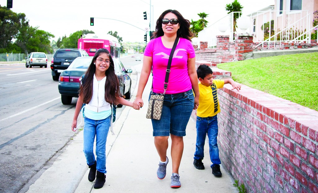
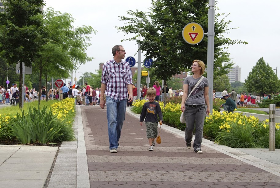
When people travel, they shed routines and become open to new experiences. They’re likely to use various modes of transportation from carshare services and bike rentals to exploring the nearby environment on foot. For me, doing so gives me a more complete experience of the place I am visiting, and I often learn something.

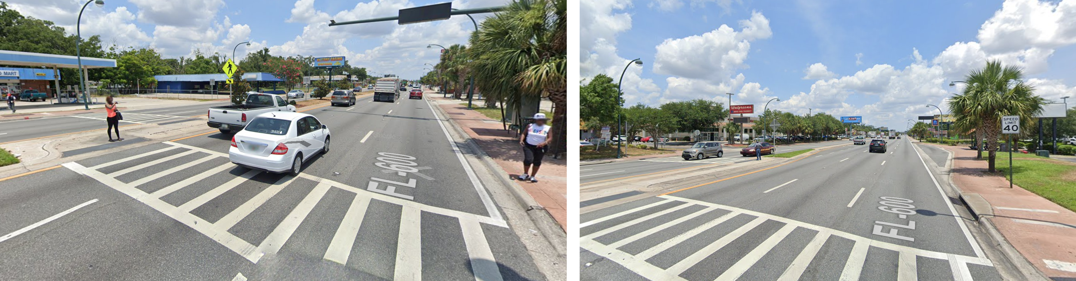
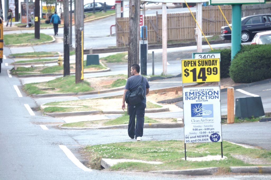
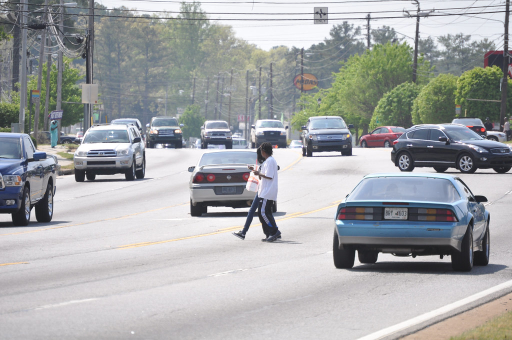
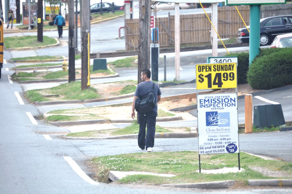
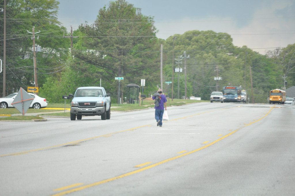
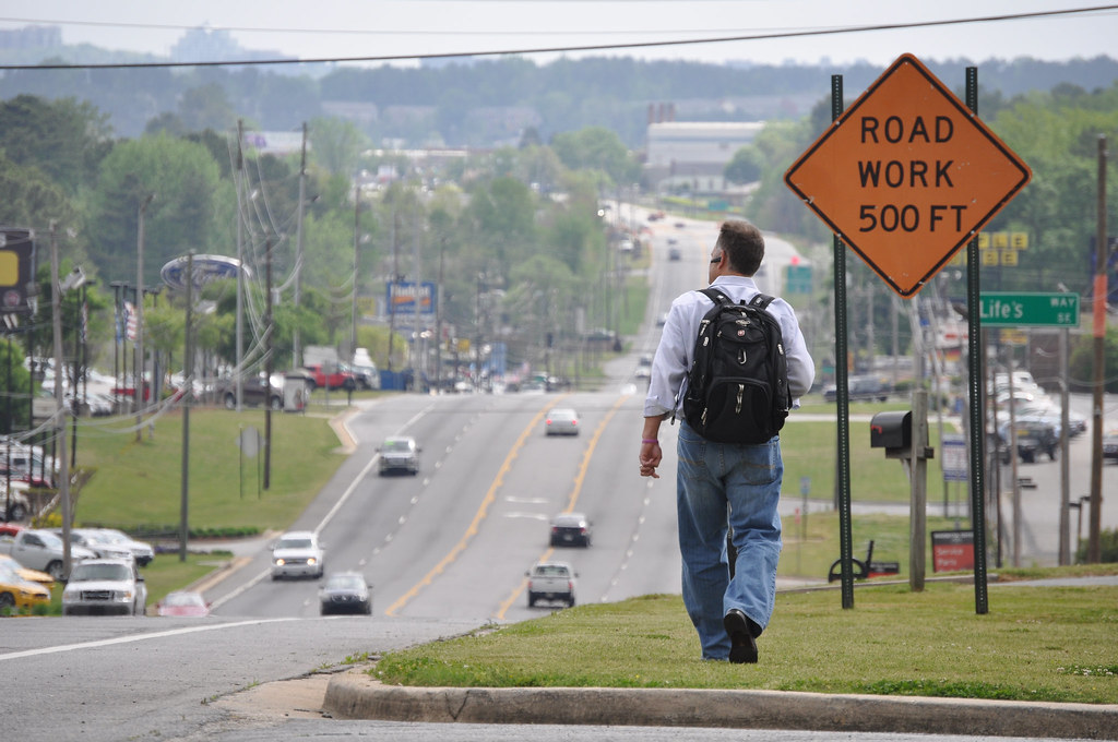
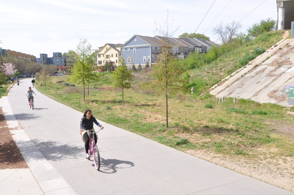
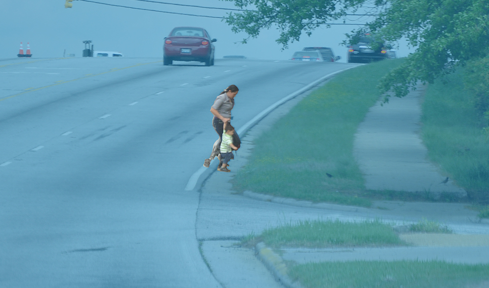
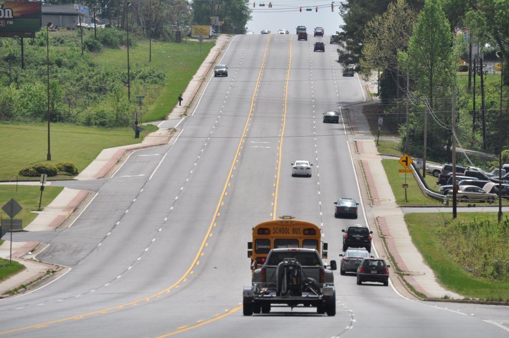
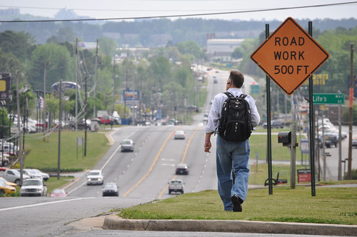
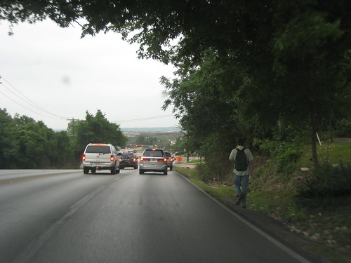
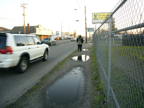
For example, I recently visited a U.S. city which has made major strides to improve its transit and biking infrastructure. To get around, my family took advantage of a great new train line and enjoyed biking on separated paths. But my kids were quite frightened when we struggled to make it across a gap in the bike network the day we rented bikes. In addition, two of my children were very nearly hit by a right-turn-on-red driver speeding through the right-turn-only slip lane and failing to stop on time as we crossed a busy arterial road with the walk signal and the right-of-way. I was impressed by some of the improvements, but appalled by the gaps in networks, which mostly existed on dangerously fast arterial streets with little improvement to make them safer for people outside of cars.

I’m not naming the city in question because that’s not the point. Instead I want to emphasize that the perspective of the outsider, or visitor, is so valuable in helping us to see the infrastructure of our own communities with fresh eyes and fresh perspectives. 

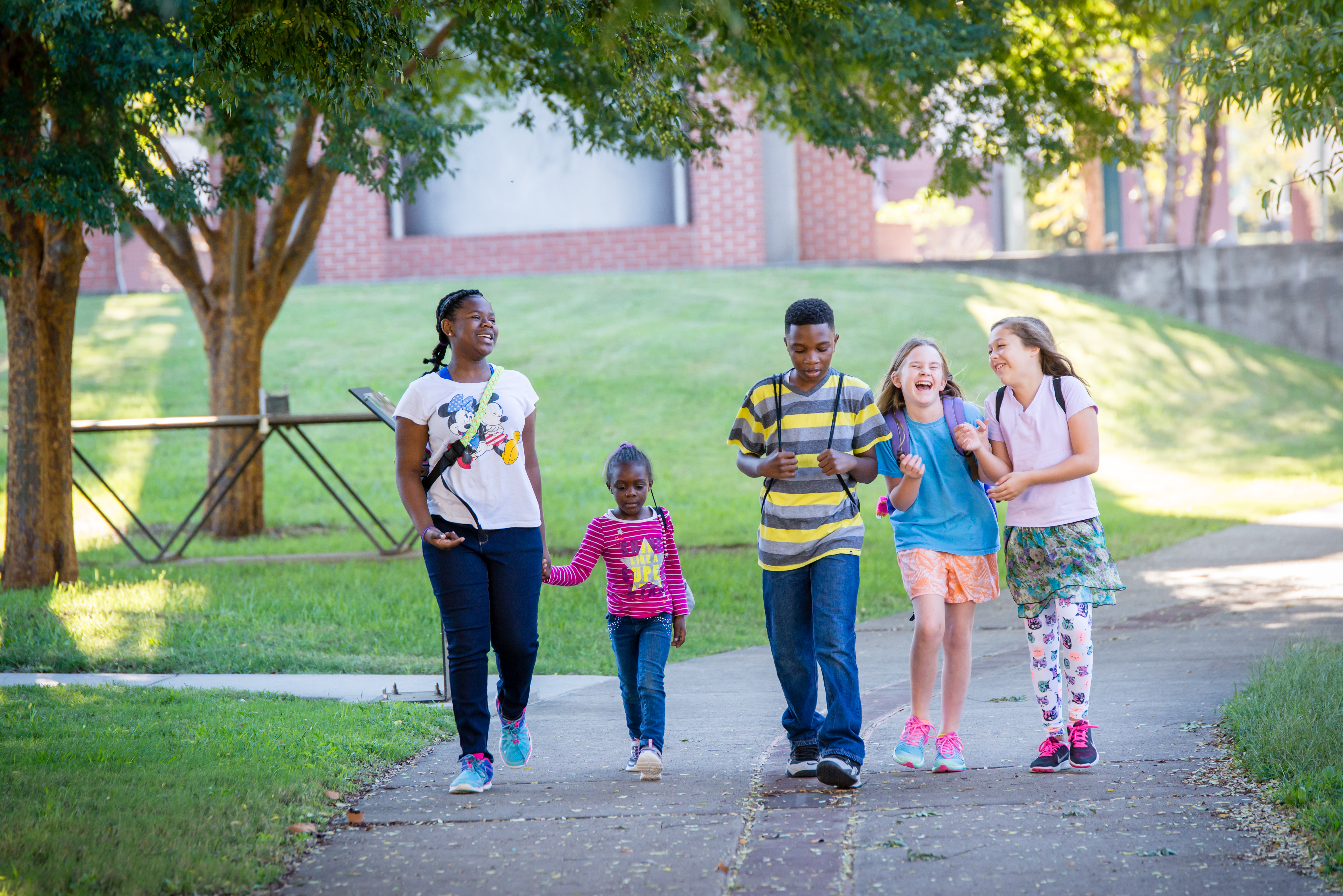
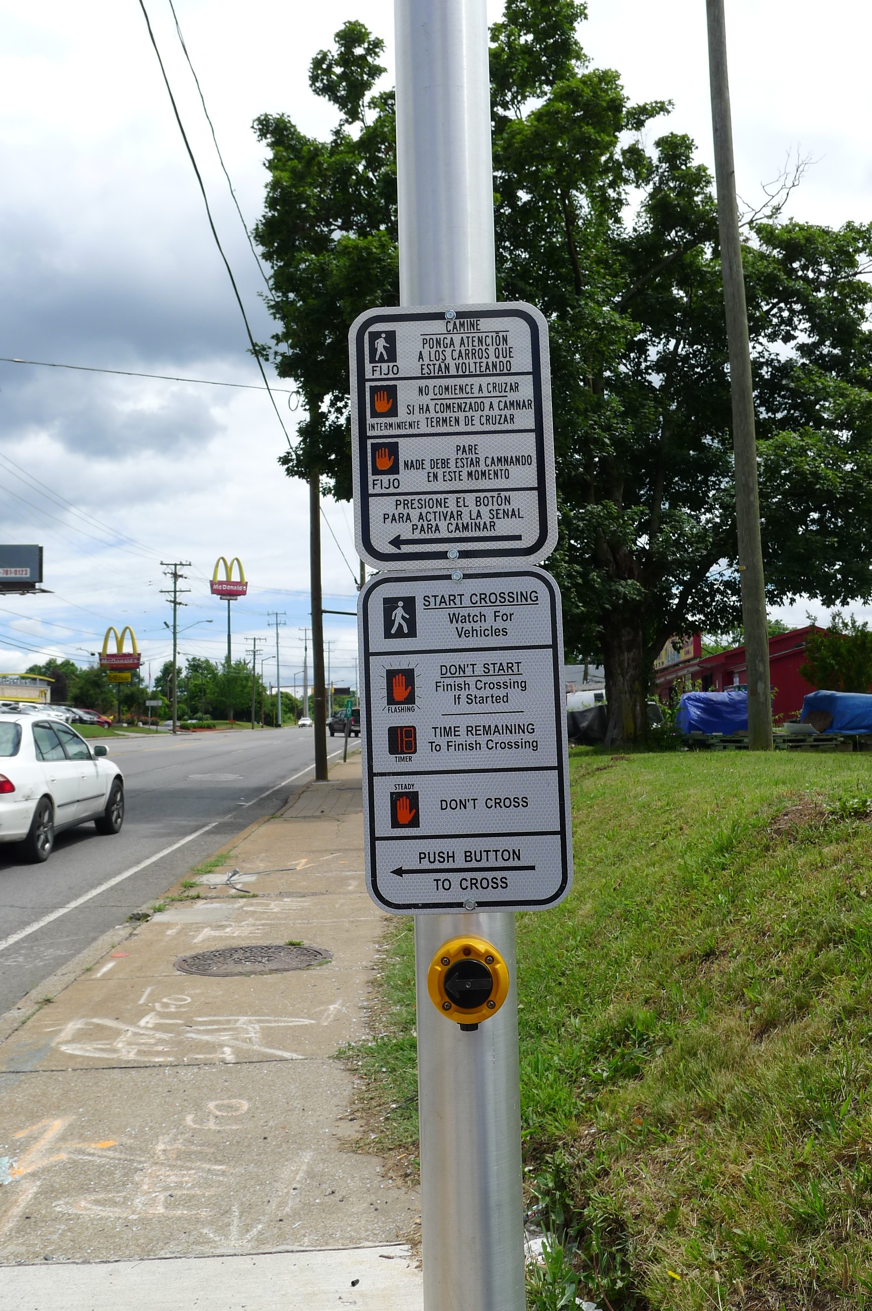
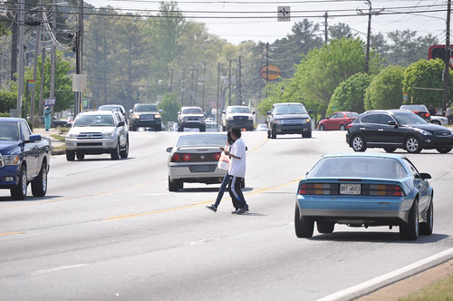
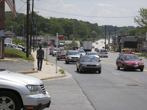
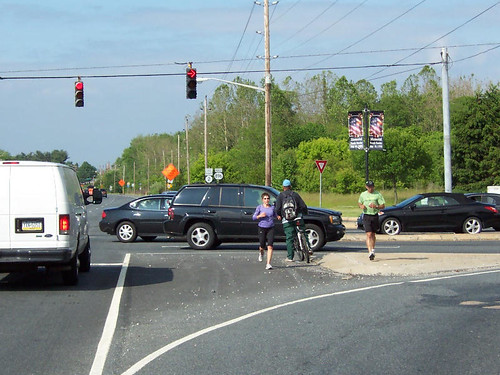
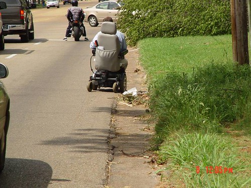
So how can you get this sort of new or fresh perspective on the transportation options and infrastructure in your community? You might think about how a newcomer navigates your community, or even someone with different physical abilities or a different race. How would a blind person or someone in a wheelchair navigate this intersection? A child on a scooter? Do wide streets without adequate crossings result in speeding or jaywalking? Does enforcement on those streets fall disproportionately on Black community members?

There are great examples of people doing exactly this all over social media. Vignesh Swaminathan (or Mr. Barricade, as he’s known on social media), who joined us at Smart Growth America’s Equity Summit last January, uses Tiktok to explain how street design can better meet the needs of all members of the community.

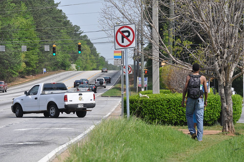
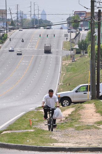
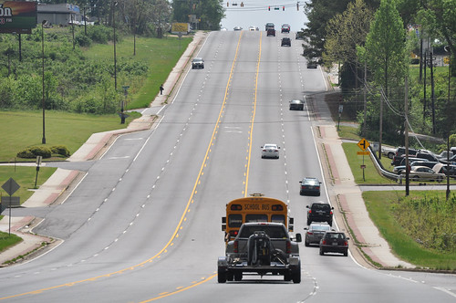
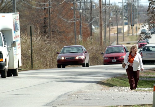
When you try to take on the perspective of someone different than you, or a visitor or tourist perhaps, and see your community with new eyes, you may see some of your successes (as Swaminathan often does), but you may also see the gaps in the network, confusing intersections and missing or confusing wayfinding. These are real barriers for your neighbors who may be thinking of trying out transit, biking or walking for the first time in their and your own community and people who are already get around in those ways. Maybe it renews your outrage at arterial streets that still lack safe bike infrastructure and safe pedestrian crossings, the longstanding gaps in the bike network, and the infrequent transit service.

Seeing your community’s infrastructure with this sort of “beginner’s mind” can help you better see how the status quo is failing to serve us. We’ve become so used to our transportation system being dangerous, inconvenient and expensive, that sometimes that terrible reality just fades into the background. But let’s face it. Aliens from outer space would give America’s transportation infrastructure a D- at best, and so would visitors, outsiders, and a lot of people living in the community that might be getting overlooked.

Try looking at your own community anew. If you travel, bring that fresh perspective back home and challenge the status quo in your own community. Take a walk audit. Talk to visitors about what they see. Reach out to decision makers to fill safety gaps, and stay wise to the strategies they use to deter change. Use our guide to implementation of the infrastructure law to think about how the infrastructure law’s historic funding can be spent to make transportation systems more accessible, safe, and intuitive.

We’re fighting a long fight and making incremental progress, but let’s not let go of making our transportation system truly great. We should imagine and fight for a time when the visiting alien analogy no longer works. It no longer works because we’ve built a transportation system that is so safe and sensible that anyone would be able to navigate it safely, without so much as a second thought.

Safety over speed week: The U.S. builds death traps, not streets

We took a look at one busy road outside of Orlando where a dozen people have been struck and killed by drivers in recent years. The mix of high-speed traffic with people walking, biking, and taking transit is a dangerous combination; in the event of a crash, people die. The Complete Streets Act of 2019 would go a long way to give local government more resources to redesign these dangerous streets so everyone can travel along them safely.

South Orange Blossom Trail isn’t a pleasant path through an orange grove, as the name would suggest, but rather a busy street in the Orange State that runs south from downtown Orlando. South Orange Blossom Trail is like many similar ‘arterial’ roads across the country: grocery stores, places of worship, clothiers, gas stations & auto repair shops, apartments & homes, restaurants, and a multitude of other businesses have sprouted along the route. And like so many similar streets surrounded by development in cities and towns of all sizes, it’s also a death trap for people on foot.

A street view of South Orange Blossom Trail and the location of this image relative to the 12 pedestrian deaths along this stretch of road from 2008 to 2017.

Between 2008 and 2017, 12 people walking were struck and killed by drivers along a 3,400 foot stretch of South Orange Blossom Trail. This six-lane thoroughfare (three lanes in each direction) is a gauntlet for people walking, and with the multitude of shops and homes in the area and bus stops regularly dropping people off on the side of the road, people walking are everywhere.

The nearest crosswalk isn’t even visible from this bus stop outside an apartment building.

This particular segment has a posted speed limit of 40 mph, but there is absolutely nothing about the design of this road that would encourage drivers to observe that limit. The wide, straight lanes and open skies communicate to drivers that this is a highway and you should thus be driving at high speeds. There are even signs that tell you which intersection you’re coming up on (because you’re certainly driving too fast to see it, as in the picture above). The only two signalized crosswalks along this stretch for pedestrians are at either end, 3,400 feet apart or about a 15 minute walk. While there are some unsignalized mid-block crosswalks, you have to be brave, stupid, or have no other choice to try crossing three lanes at a time hoping drivers going 50+ mph will stop for you. This street was built for speed not safety. It’s no wonder that a dozen people have been killed while walking along it in recent years.

South Orange Blossom Trail is the quintessential example of how U.S. street design standards and a focus on speed above all else have created such dangerous roads and why we have an epidemic of pedestrian deaths in this country. It’s a street designed for speed and to avoid vehicle delay. People walking, biking or taking transit are merely afterthoughts, just guests on this road designed for cars. Simply ask the people waiting to cross in the middle of these six lanes if it feels like this street was designed with someone walking in mind.

two images showing pedestrians attempting to cross the street.

It’s also the quintessential example of a street that the Complete Streets Act of 2019 in Congress is designed to fix. The Complete Streets Act would designate a small slice of federal highway funding to create Complete Streets that are safe for people walking, biking, taking transit, or driving. Any community with a Complete Streets policy—be it a county, city, town, or tribal government—would be able to apply for this funding directly to retrofit dangerous streets with safer designs.

Take action

Under the Complete Streets Act, counties could adopt a Complete Streets policy (if one isn’t already on the books) and then apply for dedicated funding to retrofit roads like South Orange Blossom Trail in unincorporated areas. Depending on the context, a safer street could include narrower lanes, protected bike lanes, signals at mid-block crosswalks, street trees, and other design interventions that can help slow cars and make space for different uses. On locally-owned roads, cities and towns could use the same pot of federal funding to implement similar improvements on dangerous roads.

For too long, prioritizing cars going fast above all else has been the top consideration in the design of our streets. It’s how we ended up with dangerous streets that look more or less exactly like South Orange Blossom Trail in all 50 states (even in Alaska, just add mountains along the skyline). According to current U.S. street design standards, this road and its ilk are designed exactly as they should be; that’s the problem.

We have to start putting safety over speed. Safety—literally keeping people alive—is more important than shaving a few seconds off a driver’s commute. And prioritizing safety is fundamentally incompatible with high speeds on these kinds of streets. The Complete Streets Act of 2019 would be a major step in the right direction, if Congress can pass it.

Send a message to your representatives urging them to support the Complete Street Act.

Many of the most dangerous states for people walking are planning for more people to die

13 Americans per day were struck and killed while walking from 2008-2017, according to a report released today by our colleagues at the National Complete Streets Coalition. Dangerous by Design 2019 also shows how some of the most dangerous states are, astonishingly, committed to making the problem even worse.

View the rankings and the full report

Over the last decade (2008 through 2017, the most recent year with data available), drivers struck and killed 49,340 people walking in communities large and small across the U.S. To put that into perspective, it’s the equivalent of a jumbo jet full of people crashing—with no survivors—every month. During a period when fatalities for people inside vehicles went down 6 percent, pedestrian fatalities increased by 35 percent. Since the last version of Dangerous by Design was released two years ago, the problem has only gotten worse: 4 out of 5 states and major metro areas have become more dangerous for people walking.

How are states planning to tackle this problem?

More than a third of all states aren’t planning to do anything at all. 18 states—including 10 of the 20 most dangerous for people walking—planned to actually increase the number of people killed while walking or biking from 2017 to 2018.

New requirements from the Federal Highway Administration require state departments of transportation to set performance targets for traffic fatalities and serious injuries and then monitor their progress over time. Back in 2017, states had to update their safety goals for 2018, which included setting target numbers for deaths and serious injuries among people walking, biking, or using other non-motorized forms of travel.

Did states respond by setting ambitious targets and creating accompanying plans for how they’d spend their share of billions in federal transportation dollars to make their streets safer for everyone? Unfortunately, a closer look at these targets reveals just how low the bar is for safety in many states.

18 states established targets for non-motorized deaths and injuries that are higher than the number of people killed or injured in the most recent year of data reported. With billions in 2018 federal transportation dollars available to them to devote to improving safety, more than a third of all states committed to…doing what they did last year—or worse. 10 of these 18 states are among the top 20 most deadly according to Dangerous by Design 2019.

The only “acceptable” number of deaths on our roadways is zero. We can and must raise the bar by requiring states to set safety targets that reduce rather than increase the number of people killed or seriously injured while walking or biking on our streets, ultimately working toward eliminating all traffic-related deaths and serious injuries. However, to make this vision a reality, we need strong federal policy with binding enforceable requirements that hold states to higher safety standards. Dangerous by Design 2019 helps make this case.

For more information on epidemic of people struck and killed while walking and to see the full rankings of the top 20 most dangerous metro areas and states, view the full Dangerous by Design report.

This content, adapted from Dangerous by Design 2019, was co-authored and edited by T4America staff.

Changing the transportation paradigm, one project selection at a time.

Ringling Bridge in Sarasota, FL. (Image: Rich Schwartz, Flickr)

Thanks to support from the Kresge Foundation, Transportation for America helped several regions around the country take tangible steps toward aligning their spending with their policy goals using performance measures. We asked them about it…here’s what they said.

“If you can’t measure it, you can’t manage it.”

If that mantra ever needed to be applied anywhere, it’s in the world of transportation investment decision making. The state and regional transportation agencies that make funding decisions often say they want to fund the projects that best align with their community’s goals—such as increasing access to jobs and opportunity, improving health, making more equitable investments, and ensuring a good state of repair, to name a few. But too often, their practices don’t line up with intent. That’s why it is noteworthy that some regions around the country are making real headway to better align their spending with their stated priorities.

In a previous post, we explored this idea of choosing transportation projects that actually match our priorities. But what does it look like in practice to match funding decisions to a goal like economic competitiveness? And how is this process changing the transportation funding paradigm?

From the horse’s mouth

Rather than speak for them, we asked some of the professionals we worked with about how this assistance helped them address the specific transportation goals that their community is focused on. Each community has different goals, and the focus of our work shifted accordingly with each community, but the principle is the same: measure what you want to manage.

Reevaluating the status quo:

Typically, regions prioritize projects using factors like political priorities and geographic distribution, but this approach rarely produces the best set of investments to accomplish a long-term vision with limited funding. By contrast, some of the regions we worked with have established measurable goals and scoring systems to rank potential projects based on those goals. Many common policy priorities like equity and quality of life have traditionally been difficult to measure, so this systematic approach is a game-changer.

“In reviewing our past planning efforts we realized that there was not always a great connection between the projects selected for funding and our long-range plan’s goals. We also had more project requests than funding. Identifying performance measures and targets allowed us to prioritize the projects that would best help achieve our plan’s goals and make the best use of limited resources. T4America helped us refine our scoring process to ensure it was meaningful and performance-based, understood by non-technical stakeholders, and easily implementable by MPO staff.”

– Dylan Mullenix, Assistant Director of the Des Moines Area MPO

“The Lake Charles region is currently updating its long-range metropolitan transportation plan and will soon be selecting priority projects to fund. The Transportation for America team gave us ideas to simplify the measures used in project selection, eliminate duplication, consider the cost-effectiveness of projects, and make our scoring criteria publicly available. These suggestions and examples from other MPOs will allow the region to better prioritize projects based on a clear vision moving forward.”

– Cheri L. Soileau, AICP, Lake Charles MPO Director

Creating equitable and affordable transportation:

Equity was a common thread throughout this work. Many regions consider equity a priority, but have trouble effectively applying it to funding decisions. We helped these regions elevate needed investments in disadvantaged communities to improve access to economic opportunities and essential services. Some regions also wanted to prioritize investments that address community affordability. For example, the Sarasota/Manatee MPO hopes to raise the priority of projects that make it easier to walk, bike, and take transit to food, medical, or education facilities to help reduce the costs associated with accessing those necessities.

“Our partnership with T4A changed the transportation planning conversation in our region by bringing new voices to the table, from health and social service providers to environmental scientists. Using the FHWA performance measures framework, we have gone beyond traffic management and turn lanes to consider affordable housing, access to services for disadvantaged neighborhoods, and advancing best practices. We are confident this will lead to project priorities that consider all modes and that better serve all users.”

– Leigh Holt, Strategic Planning Manager, Sarasota/Manatee MPO

Supporting people who want to walk and bike safely:

Projects that make it easier to walk and bike not only improve the health of residents by providing options for exercise, they also support local economies by contributing to a quality of life that attracts residents and tourists. We helped several regions determine how to use performance measures to elevate the investments that make it easier to walk and bike safely.

“During Transportation for America’s workshop, the team encouraged us to renew our initiatives in active transportation for healthier communities. Our agency had developed a metropolitan bike and pedestrian master plan; however, as a result of the push, we began the process of actually producing every project in that plan. These 57 miles of active transportation improvements will be in place within the next six years! Furthermore, we are now replicating the same award-winning process in a neighboring urban area to further the goal of healthier communities through active transportation across our region.”

– Matt Johns, Executive Director, Rapides Area Planning Commission

Ensuring economic competitiveness:

Many regions measure their economic success by looking at how projects would reduce traffic congestion. But traffic congestion goes up with good economies and down with bad; so while it may be an important transportation priority, congestion reduction is not a good proxy for economic strength. We helped several of the regions determine how to use performance measures to invest in the right projects for the long-term economic vitality of their regions—projects that will help draw a talented workforce, retain residents, and grow a tourist economy.

“The Roanoke Valley Transportation Planning Organization is working to make the region more economically competitive by identifying places where growth is desirable and sustainable because plans for future development enable multimodal connectivity and mobility. The technical assistance provided by T4A helped us better understand performance measures and how we can more directly achieve our transportation and economic development goals through targeted investments.”

– Cristina Finch, Director of Transportation, Roanoke Valley-Alleghany Regional Commission.

These regions are able to make real change:

The six regions we worked with are already leading the way by seeking new ways of doing business. And thanks to Kresge’s support, we were able to introduce them to tools, approaches, and ways of thinking to help them do so. We are excited to see more innovative practices from these regions moving forward.

“The technical assistance provided by the Transportation for America team was more than a typical workshop—it opened the eyes of our local technical experts to a revolutionary way of thinking about transportation planning. We were taught how to better identify what problem we actually wanted to solve in order to avoid jumping to the usual prescribed solutions of cookie-cutter type thinking. In a way, the team provided a deeper validity and appreciation for REAL planning working in concert with engineering, and this is a necessity for better planning in an era when we truly cannot afford to “build our way out” of our problems.”

– Matt Johns, Executive Director, Rapides Area Planning Commission

On National Walking Day, too many Americans are still having to endure unsafe streets

Since we missed recognizing National Walking Day last week while the Complete Streets conference was happening in Nashville, we wanted to come back this week and revisit a T4America post from 2012 looking at what’s actually keeping more people from walking in many of our metro areas.

Originally posted on April, 4 2012.

You may not have known it — its not the most publicized special day on the books — but today is National Walking Day. Some of you may have traded part or all of your drive or transit trip today for a walk to work. But for many, every day is walking day, and it happens on streets with dangerous or inconvenient conditions that no one should have to endure just to walk to school, their job, or the grocery store.

Last Friday, I spent some time driving around the sprawling Atlanta, Georgia metroplex photographing some well-known trouble spots for pedestrian safety. Though some improvements have been made in places, there are still so many unsafe streets, corridors and intersections for pedestrians, finding streets that are dangerous by design is about as easy as blindly putting your finger down on a map.

The Atlanta Regional Commission has helped address some of these problems through their popular and oversubscribed Livable Centers Initiative that gives metro communities small grants to help make a dangerous street safer, improve MARTA access, add new crosswalks or streetscaping, or other small improvements to the built environment that help improve quality of life for residents. And the local group PEDS has had their boots on the ground for years now, working hard to make metro Atlanta more walkable. But we need far more of these kinds of efforts — and similar efforts from others in cities across the country — to make the kinds of improvements we need to save lives and end the 4,000-plus deaths that happen to people walking each year.

Many of these deaths occur simply because the design of a road just hasn’t adapted to the changing needs of all the people who use it.

Consider: at one point, Old National Highway in South Fulton County was probably a sleepy state highway through a relatively unpopulated area on ones way south out of Atlanta. Now, its teeming with retail on both sides of the street just south of Interstate 85. Add in the fact that its a relatively low-income area (read: people more likely to walk or take transit) with apartment complexes on both sides of the main highway and you’ve got a street that no longer meets the needs of everyone who uses it, and certainly not for the people who live there.

Metro ATL Pedestrians15

Though the first few miles away from Interstate 85 have sidewalks and there are a handful of signalized intersections with crosswalks, sidewalks soon end completely and there are many stretches where there are no safe places to cross for hundreds or thousands of feet — all in an area with MARTA bus stops on both sides of the highway. The sidewalks may end, but the walking doesn’t, as the desire paths through the grass indicate.

Metro ATL Pedestrians06

Of course, the most well-known road in Atlanta thats dangerous for walking and biking is certainly Buford Highway. This stretch near Clairmont Road is a whopping seven lanes across, with crosswalks often so far apart as to be merely dots on the horizon.

Metro ATL Pedestrians36

This corridor is lined with more affordable apartments and has also been a popular landing place for Latino and Asian immigrants for years, and many portions of the street are filled with small ethnic shops catering to the local clientele — many of whom are likely to be walking. According to the data in our map, in just the few miles from I-285 south down to 400, 20 pedestrians were killed from 1999-2009. There are stretches with no sidewalks on either side of the street and no safe crosswalks almost as far as the eye can see.

Metro ATL Pedestrians41

In this picture alone, not only are there no sidewalks but there are nine separate curb cuts where this man could be easily struck by a right-turning car before reaching the next safe crosswalk at the intersection.

Some key improvements have been made on Buford Highway in recent years, though, which have helped to increase safety. Thanks to recent efforts by Dekalb County and the Georgia Department of Transportation, a busy stretch of Buford Highway south of Doraville with high density of retail on both sides of the street received several new signalized intersections as well as new pedestrian-only mid-block crossings that use a special light called a HAWK signal. This is a light that stays dark until a pedestrian pushes a button, activating a light that flashes before turning red for cars. These crossings also include a refuge to shorten crossing distances and give people a safe place to wait while crossing.


And then there’s southern Cobb County, the northern Atlanta suburb where Raquel Nelson was walking when her son was killed and she found herself prosecuted after the fact. Some busy corridors have sidewalks and some don’t — though walking isn’t very pleasant next to seven lanes of traffic — and crosswalks can be interminably far apart.

Metro ATL Pedestrians24

This photo below bears some similarities to the conditions on the street where Raquel Nelson’s son A.J. was killed, which isn’t too far from here.

Metro ATL Pedestrians21

Note the bus stop on the other side of the street with a Cobb County bus approaching. See a marked crosswalk anywhere? Perhaps this man is trying to catch the bus? What happens when the bus drops you off and you need to reach a destination across the street? Should we really expect people to walk half a mile out of the frame to find a safer place to cross, and then walk half a mile back?

And some streets around here just have zero accommodation for pedestrians, including a busy street that serves two major universities and the county’s biggest employer (Dobbins AFB/Lockheed) right in the center of the county.

Metro ATL Pedestrians26

Keep in mind that these pictures represent just one busy American metropolis — there are hundreds more cities and thousands of places with similar conditions that need urgent attention. We have a long way to go to retrofit these streets to help make them safer for everyone that needs to use them. The complete streets provision in the Senates MAP-21 bill would be a step in the right direction, as would be the flexible funding that local governments can use to help address some of these dangerous areas under the Senate bill. (These provisions are a little out of date now. -Ed.)

With 67 percent of all pedestrian fatalities happening on federal-aid roads — many of which that were designed in this unsafe way because of federal design guidelines and standards — theres a clear role for the federal government to play in improving them.

So what would happen in our communities if we started by looking at our map of pedestrian fatalities to see where the worst trouble areas are and devoted a small slice of transportation money into small, tangible improvements like new sidewalks, new crosswalks, and new signals for making walking safer and more convenient? What if we made it a clear priority to make every day National Safe Walking Day?

Wouldn’t we be saving lives immediately? And for a small price?

Coming soon: A new report on how metro areas are building more and better bicycling and walking projects

Metro areas of all sizes across the country are strategizing, developing, and implementing new ways to improve bicycling and walking in their regions. Over the last year, T4America worked with metro areas across the country to collect and document these stories, ideas, and strategies into a guidebook that we’re releasing on December 11.

Join us on December 11th at 12 p.m. EST for a launch webinar where we’ll release Building Healthy and Prosperous Communities: How Metro Areas are Building More and Better Bicycling and Walking Projects and hear from three of the agencies featured in it.

Over the last two years, Transportation for America, in conjunction with the American Public Health Association, has worked with metropolitan planning organizations (MPOs) across the country to collect and document stories about how they are planning, funding and building more and better walking and bicycling projects in communities. (Find our previous resources on this topic here and here.)

As the gatekeepers of billions of federal transportation dollars, MPOs have an influential role in expanding and improving options for walking and bicycling. They may establish policies, develop plans, direct funding, and help design transportation projects to allow more people to easily walk, bicycle, or ride in a wheelchair. Doing so can help people get the physical activity they need to be healthy — and healthier residents bring economic benefits for an entire region.

Places that have made biking and walking from place to place a safe, convenient, and enticing choice have produced positive impacts on businesses, jobs, and revenue. When it’s safer and more convenient for people to walk or bicycle as part of their regular routine,  more people get the amount of physical activity that science proves they need to reduce their risk of certain chronic diseases.

The following MPOs and scores of others are excelling, but there’s much more that can be done to build the necessary infrastructure to keep people thriving, safe, active, and connected to the places they need to go. The examples in this guidebook can inspire and inform your efforts, help tailor them for your region, and improve upon them to give the residents of your region the bicycling and walking infrastructure they demand and deserve.

The guidebook has detailed profiles of the work of these metropolitan planning agencies:

  • Atlanta Regional Commission (Atlanta, Georgia)
  • Broward MPO (Broward County, Florida)
  • Chattanooga-Hamilton County/North Georgia Transportation Planning Organization (Chattanooga, Tennessee)
  • Corpus Christi MPO (Corpus Christi,Texas)
  • Delaware Valley Regional Planning Commission (Philadelphia, Pennsylvania)
  • Denver Regional Council of Governments (Denver, Colorado)
  • Mesilla Valley MPO (Las Cruces, New Mexico)
  • Metro (Portland, Oregon)
  • Metropolitan Transportation Commission (Bay Area, California)
  • Nashville Area MPO (Nashville, Tennessee)
  • Mid-Ohio Regional Planning Commission (Columbus, Ohio)
  • Puget Sound Regional Council (Seattle, Washington)

During the webinar we’ll hear from three featured MPOs: The Chattanooga TPO will share how they created a new performance measures framework to prioritize multi-modal projects for funding. The Corpus Christi MPO will talk about how they customized a Bicycle Mobility Network through accessibility planning and community engagement. Finally, we’ll hear how Metro in Portland, Oregon encouraged higher rates of active transportation by changing the design of walking and bicycling projects.

Register today!

Federal program that helps tackle health disparities threatened in ’18 budget

Congress is threatening to eliminate a small yet significant federal program housed within the Centers for Disease Control and Prevention (CDC) that helps local communities take concrete steps to prevent someone’s zip code from being the most powerful determinant in their long-term health.

Walking, biking, and access to transit are part of a suite of healthy choices promoted by T4America and our colleagues at the National Complete Streets Coalition. People who walk or bicycle more for transportation are shown to have lower rates of heart disease, diabetes and other conditions that can complicate or shorten lives. And the demand for more opportunities to safely walk and bicycle is at an all-time high, in both heartland towns and urban centers alike.

Scores of communities are eager to find ways to improve the health of their most vulnerable residents — the people most likely to suffer from poor health outcomes — and those less likely to have access to safe streets for walking or biking. They want to know how to steer more of their transportation dollars into projects that will bring significant health benefits and reduce these disparities.

The Racial and Ethnic Approaches to Community Health program (REACH), a small program within the CDC, has helped these communities meet the demand for more active transportation projects, address the wide disparities in health from zip code to zip code, increase access to opportunities, and create a foundation of shared and sustainable prosperity.

REACH is an evidence-based program that directly tackles these health disparities and is the only community health program currently funded at the CDC.

Both the House and Senate Appropriations bills for next year (FY 2018) eliminate funding for this critical program. Please take a moment to send a message to your representatives and urge them to keep it going. 

A group of more than 200 diverse organizations — including The National Complete Streets Coalition and Transportation for America — signed a letter urging Congress to provide the program with another $50 million round of funding.

These funds are helping a plethora of communities make healthy living a reality. (We produced a series of case studies that includes some of these communities here.) It equips them to tackle the risk factors for some of the most expensive and burdensome health conditions impacting racial and ethnic groups. Without these funds communities across the country will have an even harder path to reduce disparities like these cited by the CDC:

  • Non-Hispanic blacks have the highest rate of obesity (44 percent), followed by Mexican Americans (39 percent).
  • The rate of diagnosed diabetes is 18 percent higher among Asian Americans, 66 percent higher among Hispanic/Latinos, and 77 percent higher among non-Hispanic blacks compared to non-Hispanic whites.
  • American Indians and Alaskan Natives are 60 percent more likely to be obese than non-Hispanic whites and have the highest prevalence of diabetes, with a rate more than double that of non-Hispanic whites
  • The incidence rate of cervical cancer is 41% higher among non-Hispanic black women and 44% higher among Hispanic/Latino women compared to non-Hispanic white women.

And as shown by the National Complete Streets Coalition in their last Dangerous by Design report, people of color are significantly overrepresented in pedestrian deaths.

Solving these kinds of pernicious issues doesn’t happen overnight.

But the REACH program is investing directly in local community coalitions with multiple years of awards, providing the time and resources necessary to address the many root causes of racial and ethnic disparities and reverse the upward trend of chronic disease.

Help protect REACH. Congress must continue to fund REACH in FY18 at the same level of investment ($50.95 million) as was provided in FY 2017.

A few of the groups leading the effort have set up an easy page for sending a message here.

Take Action

How are metro areas prioritizing health and building more biking and walking projects?

Though there’s booming demand all across the country to build more projects that can help residents get out and bike or walk — whether for exercise or just for getting around safely from A to B — it can be an uphill battle to do so. How are metro areas upending the conventional wisdom and building more projects that help improve their residents’ health?

How we get around each day shapes our quality of life, especially our health. People who walk or bicycle more for transportation are shown to have lower rates of heart disease, diabetes and other conditions that can complicate or shorten lives. And the demand for more opportunities to safely walk and bicycle is at an all-time high in cities and towns of all sizes across the country.

Communities are responding by planning, funding, and fast-tracking projects to make bicycling, walking, and riding transit safer, more convenient, and more realistic as travel options.

But getting these projects planned, designed and built can be a challenge. How can regions bring more of these projects to fruition?

This new paper, produced with the American Public Health Association, outlines four policy levers MPOs have at their disposal to help increase and improve active transportation projects to meet the demand, decrease health disparities, increase access to opportunities, and strengthen local economies — with specific short real-life stories to go with each.

For the launch of the paper, we had an online discussion with a number of the metropolitan planning organizations (MPOs) featured in this paper to hear how they’re successfully prioritizing bicycling and walking projects.

We spent some time exploring the specific policies these MPOs have adopted, and how they’ve implemented them. Catch up with the recording below.

Introducing “Dangerous by Design 2016”

Crossposted from Smart Growth America and the National Complete Streets Coalition.

Dangerous by Design 2016, released today by our colleagues at Smart Growth America and the National Complete Streets Coalition, takes a closer look at the alarming epidemic of pedestrian deaths, which are on the rise after years of declining.

Share this on Twitter Share this on Facebook

Between 2005 and 2014, a total of 46,149 people were struck and killed by cars while walking. That averages out to about 13 people per day.

Each one of those people was a child, parent, friend, classmate, or neighbor. And these tragedies occurred across the country — in small towns and big cities, in communities on the coast and in the heartland.

The fourth edition of this report being released today again ranks the most dangerous places for people walking by a “Pedestrian Danger Index,” or PDI. It also explores who is most at risk of being struck and killed by a car while walking, including data that looks at pedestrians by age, race, ethnicity, and income.

Explore the online feature to see the full rankings of the 104 largest metro areas in the country and all 50 states, as well as interactive maps of where fatal collisions occurred.

View the data and maps


Join us for the kickoff

Interested in learning more about Dangerous by Design, and what states and metro areas are doing to combat this epidemic? The report authors and other special guests will be talking about this new research during a kickoff webinar today (Tuesday) at 1 pm EST. You are invited.

REGISTER


Register for the event to to learn more about the findings and to hear from the report’s authors, national transportation policy experts, and local advocates about how we can make streets safer by design.

Will Elaine Chao address pedestrian safety?

A confirmation hearing for Elaine Chao, Trump’s nominee for transportation secretary, is scheduled to take place this week, on Wednesday, January 11th on Capitol Hill. We want to make sure pedestrian safety is on her mind.

Tell the Senate Commerce Committee to ask Chao how she plans to address pedestrian safety.

As always, we welcome your reactions, questions, and ideas. Share them on Twitter at the hashtag #DangerousByDesign.

Help show just how dangerous our streets can be for people walking

This fall, our colleagues at the National Complete Streets Coalition will release Dangerous by Design 2016, a report that will again rank the nation’s most dangerous places to walk using the Pedestrian Danger Index. This year’s report will dive deep into how income, race, and place play an outsized role in how likely people are to be killed while walking. And they’re looking for your help when it comes to illustrating just how bad it can be out there.

For too many people, a walk is a deadly risk. Poorly designed streets have led to an epidemic of pedestrian fatalities, especially among people of color and in our nation’s poorest neighborhoods. More than likely, one of these dangerous streets or intersections is near you or is one you have to use every day. When T4America last released a version of this report back in 2011, we had powerful photos submitted from all over the country.

Help illustrate the hazards you face everyday by expanding upon those photos previously submitted. Send in photos of streets in your neighborhood that are “dangerous by design.” Streets like these:

Metro ATL Pedestrians06Metro ATL Pedestrians41Walking in the ditch

Poorly designed streets like these above — often built or designed with federal dollars or guidelines — endanger pedestrians, cyclists and drivers alike. And as this latest edition of Dangerous by Design will expand upon, people of color and census tracts with below average income are disproportionately represented.

Here’s how you can help:

  • Send in photos via email to photos@completestreets.org.
  • High resolution photos are preferred for maximum quality.
  • Please indicate how photos are to be credited if used online or in the report.
  • Provide information about the photo. Where was the photo taken? Is this a street that you have to use regularly?

We want to see the missing crosswalks, missing curb ramps, and the long and dangerous treks along busy highways. We want to see every way that our current road designs have failed to provide for the safety and convenience of everyone that needs to use them. Help show just how difficult and dangerous we’ve made walking for so many people. The NCSC folks are preparing the report now, so pass them along soon!

Webinar wrap: How MPOs are prioritizing public health to build prosperous regions

Last week, we had a terrific online discussion detailing how public health professionals are working with regional transportation planners to plan, fund, and support building more state of the art active transportation projects — accompanying the release of Measuring What We Value: Prioritizing Public Health to Build Prosperous Regions.

For this webinar, we were joined by staff from the American Public Health Association, the Centers for Disease Control and Prevention, and metropolitan planning organizations from the regions of Broward County, Sacramento, Greensboro, and Nashville.

Did you miss last week’s webinar or want to see it all again?

Stay tuned for more information targeted at MPO staff, public health professionals and local advocates on how to work with regional transportation planners to plan, fund, and support building more state of the art active transportation projects.

CDC APHA health case studies


U.S. Surgeon General issuing a rare call-to-action to make walking safer & more convenient

The Surgeon General will issue a new call-to-action next Wednesday that focuses on encouraging cities and towns to design and build their roads and public places to make walking easier, safer and more pleasant.

From an email this morning:

The Call to Action will highlight the significant health burden that exists in the U.S. today due to physical inactivity – contributing to more than 10 percent of the preventable mortality in America today. More specifically, it will make recommendations to a number of key sectors about critical actions they can take to improve community walkability and increase walking throughout the U.S..

family-cultural-trailIt’s an incredibly noteworthy moment to see the Surgeon General identify this issue as a major public health problem. Issuing an official call is a significant event for the Surgeon General, and rare — only six others have been issued within the last ten years.

According to the Surgeon General’s office, only half of American adults get enough physical activity to reduce the risk of chronic disease, which is the leading cause of death in the United States. To address this grim statistic, the Surgeon General and HHS will release a set of recommendations on how to encourage walking and better shape our communities to encourage people to get out and walk or bike more to get around each day.

Communities around the country are seeing the benefits of better walking and biking infrastructure. Nashville’s metropolitan organization recently began considering health criteria as they selects transportation projectsWashington State was the first state to adopt a Vision Zero plan to reduce pedestrian deaths to zero. Making their vision a reality includes not just educating drivers about pedestrian and bike safety but also re-designing streets and roads to slow traffic and give folks walking and biking safe and attractive facilities to use.

We can’t just ask folks to get out and walk more — we need to give them safe and convenient opportunities to do so.

The Surgeon General and the U.S. Department of Health and Human Services will be launching this report and call-to-action next Wednesday, September 9, at Kaiser Permanente’s offices in Washington, DC., and we’ll be there to cover it.

If you’d like to watch next week, the event will be webcast on the Surgeon General’s website. On September 9th, go to http://www.surgeongeneral.gov/library/calls/walking-and-walkable-communities/event-webcast.html

Urban bike trails in cities like Indianapolis, Dallas and Atlanta are proving to have rich economic benefits to city neighborhoods

Affirming a trend seen in other cities, Indianapolis’s eight-mile Cultural Trail has been a boon to the neighborhoods adjacent to it — as well as the city as a whole — increasing property values of homes and businesses and giving residents and tourists a convenient, attractive, unbroken path to walk, bike and move around the city.

Indy Cultural Trail MapSince opening in 2008, the value of properties within a block of Indy’s high-quality biking and walking trail have increased an astonishing 148 percent, according to this recent report on the impacts of the trail. The value of the nearly 1,800 parcels within 500 feet of the trail increased by more than $1.01 billion from 2008 to 2014.

The $62.5 million investment, funded mostly by private or philanthropic donations that leveraged a federal TIGER grant, is an eight-mile landscaped bike and pedestrian pathway through the heart of the city that is, in the words of the New York Times in 2014, an “accessible urban connective tissue — an amoeba of paths shot through with lush greenery and commissioned works of public art.”

Residents and tourists alike have been drawn to the trail, and it’s proven to be not just a quality-of-life asset but an economic one as well, with business and property owners witnessing firsthand the benefits of being close to high-quality infrastructure that makes it safe for almost anyone of any age to safely walk or bike through the heart of the city.

The Cultural Trail is an important cog in the city’s transportation network, which the city hopes to dramatically expand through increased public transportation service in and around the city. It provides an unbroken loop around Indy’s downtown that allows cyclists and walkers of almost any age or ability to safely traverse the city. The trail stitches together neighborhoods and connects to various theatres, hotels, sports venues and shopping areas, among other popular destinations. Spurs reach out into neighborhoods and connect to other city trails, making bike commutes to downtown easier.

family-cultural-trail

A family walking along Indy’s Cultural Trail. http://indyculturaltrail.org/about/

The numbers in this report are eye-opening, but Indy isn’t the only place where investment in ambitious projects to make cities more livable and functional for people have netted sizable economic rewards over the last few years. Dallas and Atlanta have both invested in their own similar in-town, separated, high-quality multipurpose paths to great economic rewards, just to name two.

Some bars and restaurants in Dallas claimed a threefold jump in business since the first day the new Katy Trail opened, centered in Dallas’s Uptown district. In a story last summer, The New York Times described how the Uptown neighborhood changed after the opening of the Katy Trail:

Since 2006, property value in Uptown has climbed nearly 80 percent to $3.4 billion, based on the improvement district’s assessment income. In the early 1990s, it wallowed around $500 million, said Joseph F. Pitchford, senior vice president for development at Crescent Real Estate Equities, based in Dallas. Crescent will begin building a $225 million, 20-story tower this summer that the law firm Gardere Wynne Sewell will anchor.

Dallas added 95,900 jobs in 2013 and is looking to attract young, talented professionals. While the Katy Trail helps, they still have work to do to change their reputation: Dallas was identified as one of the least walkable cities in America by Smart Growth America and George Washington University in their Foot Traffic Ahead report.

In Atlanta, when fully completed, the Beltline will be a 26-mile loop of walking and biking trails (along with transit eventually) in a loop around the city following mostly old railroad right-of-way. The few finished segments are already making a notable difference in property values of homes and businesses that surround it.

Pedestrians and cyclists enjoy the Atlanta BeltLine's Eastside Trail. http://beltline.org/explore/photos/?setId=72157651531843045

Pedestrians and cyclists enjoy the Atlanta BeltLine’s Eastside Trail. http://beltline.org/explore/photos/?setId=72157651531843045


In a 2013 Curbed article, the REMAX realty firm claimed homes near the BeltLine and other city cycling infrastructure that used to stay on the market for 60 to 90 days were now selling within 24 hours. Maura Neill, a realtor who has specialized in the Atlanta market for over 12 years told Curbed, “The new bike lanes are absolutely an attractive selling point, putting Atlanta in the limelight as a progressive city.”

“When people realize the savings of not relying solely on a car, they’re much more inclined to pay a little more now in exchange for saving a lot later,” said Rebecca Serna, executive director of the Atlanta Bicycle Coalition, pointing to some buyers’ willingness to pay upwards of $5,000 extra for a home if it means less traffic and less time spent commuting.

“The old ‘drive to qualify’ [for a mortgage] paradigm is shifting as people forego the family car. Factors like time and money saved are much more valuable than the number of square feet.”

Other cities have also seen a boost in housing prices thanks to nearby bike trails, including Vancouver, which saw 65 percent of realtors featuring new bike paths as a selling point; Pittsburgh, which “ignited commercial and business activity”; and in North Carolina, where property prices increased by $5,000 or more alongside the small Shepherd’s Vineyard greenway in the town of Apex, outside Raleigh, just to name a few of the many recent examples.

The uptick in property values and economic development are often attributed to the preferences of millennials, whom are shown (in our recent survey and others) to have a clear preference for places that provide a range of mobility and transit options, including biking and walking.

With transportation dollars more limited than ever, it’s clear that even relatively small investments in projects like Indy’s Cultural Trail or the Beltline or Katy Trail in Atlanta and Dallas are smart bets to bring significant economic benefits, and also help attract the younger, talented workforce so envied by many top employers.

Boston’s Olympic bid aims to be the first where you don’t need a car

Three Massachusetts-based organizations recently published Putting Legacy First, a report that makes a series of recommendations intended to support the official 2024 Boston Olympics bid. Their smart recommendations focus on ensuring that the transportation investments made to support a walkable, transit-oriented Olympics and Paralympics will also be primed to serve the Bay Staters well for years to come.

The authors recognize the potential of transportation as a catalyst for short and long-term change. Improvements that the city and state officials can start on now will improve Boston immediately, like addressing the backlog of MBTA’s maintenance needs or focusing future development on creating more walkable, bikeable and livable neighborhoods in affected areas, will also go a long way to making a more widely supported bid. Additionally, by rallying around the challenge of being the first Olympic and Paralympic games that visitors can attend car-free, the authors pose a challenge to federal, state and local officials to think about transportation for the disabled and enabled populations equally.

“We’ve known for a long time that our transportation system – especially the MBTA – needed lots of maintenance and investment just like many transit systems throughout our country. This winter certainly proved it. The Games could provide the deadline that the Boston area may need to create a system Bostonians can be proud of, but it requires that the state, cities and towns, and the Olympic host committee work together to overcome the political and financial barriers that stand in the way of a world-class transportation system,” said Kristina Egan, director of Transportation for Massachusetts.

How do they propose to achieve this goal? Putting Legacy First has eight transportation recommendations, Putting Legacy First Covera few of which are summarized below:

  • The Olympics and Paralympics should serve as a catalyst to accelerate efforts to make the MBTA fully compliant with the Americans with Disabilities Act (ADA).
  • Infrastructure improvements that are solely related to the Games should be financed entirely by private sources. Projects that generate shared benefits to the Games as well as long-term public benefits should be financed by a mix of public and private funds.
  • Since all the main venues are along the coast or Charles River, the report strongly suggests Olympic planners use the Games as an opportunity to build resilience to climate change, sea level rise and storm surges.

One concern expressed by the critics of the Boston 2024 bid is the fear that citizens will wind up paying for a large amount of new infrastructure while receiving few of the benefits. What they view as a current lack of public information and participation adds to this concern. In response, the report offers ways to mitigate those concerns by clearly defining public and private sector roles, as well as recommending that the Commission, “maximize public input and participation with a special focus on under-represented groups”.

“We have to put legacy first,” said Marc Draisen, executive director of MAPC, whose staff are the prime authors of the report. “It’s not just about writing a winning bid and making the Games a success; it’s about making sure our region ends up with more affordable homes, better jobs, beautiful parks, and a 21st century transportation system. These things won’t just happen by themselves. We have to leverage the Olympic bid to make them happen, and the sooner the better.”

While the International Olympic Committee will not announce the 2024 host city until 2017, many civic-minded groups are ready to fight for a blueprint that ensures their investments into such an opportunity benefit the greater Boston region and have lasting positive effects for decades to come.

Putting Legacy First was written and published jointly by the Massachusetts Smart Growth Alliance, Transportation for Massachusetts and the Metropolitan Area Planning Council (a T4A member).

Healthy economies need healthy people — Nashville leads the way for other regions

What’s the connection between healthy residents and a healthy bottom line? Why should a local business community care about improving the health of the residents that live there? Representatives from five regions gathered last week in Nashville to learn how providing better transportation infrastructure and building more walkable communities can help improve residents’ health — and boost local economic prosperity and competitiveness.

This post was written by Rochelle Carpenter and Stephen Lee Davis with Transportation for America.

The Nashville Area Metropolitan Planning Organization, responsible for planning and allocating federal transportation dollars in the seven-county Nashville region, has become a nationally recognized leader in prioritizing health when selecting transportation projects.

Getting to that point wasn’t easy, but their hard work to make that shift was kick-started by two related developments: the widespread recognition of a looming health crisis in the least active state in the nation, and the realization that there was pent-up demand among Nashville residents for healthier options to get around —whether safer streets with new sidewalks, trails, transit, or bikeshare.

One economic connection is obvious: employers are often the ones paying a large share of healthcare costs for employees. If those employees are living in a place where it’s challenging to get or stay healthy because of factors inherent to the built environment, that’s a cost that those companies have to bear. If those costs become a known challenge within the business community, it presents a major roadblock when recruiting new employers or trying to retain them.

Whether by continuing to make ambitious plans to bring new bus rapid transit to the city, building new projects that make it easier to walk or bike, or through incorporating health considerations into their process for funding transportation projects, Nashville is trying to stay ahead of their growth challenges, remain competitive for new talent and ensure that their residents can be healthy — all helping to boost the bottom line for the region. It’s a region experiencing some of the fastest job growth in the country, but they know they can’t rest on their laurels.

We’ll be publishing an in-depth profile of how Nashville began to integrate health considerations into their planning efforts sometime in the next few weeks. Watch this space, and sign up for our emails to be notified if you haven’t already. –Ed.

To learn from Nashville’s experiences, T4America and the Nashville MPO — through an ongoing grant from the Kresge Foundation — brought civic leaders and agency staff from Seattle, San Diego, Detroit and Portland, OR, to the Music City last week; sharing best practices and hoping to build on what the others have done.

Kresge Nashville gathering 2

MPO staff and advocates from Nashville, San Diego, Detroit, Portland and Seattle along with Nolensville staff and leadership during last week’s gathering in Nashville.

Meeting in the Bridge Building overlooking downtown Nashville and the Cumberland River, the group of leaders from across the country saw the rapid changes made in the downtown core to improve streetscapes and public spaces to create vibrant, welcoming places for the many families, professionals and visitors.

While Nashville proper is making significant strides, other communities around the MPO’s seven-county region are also eager to expand their options for walking, bicycling and transit.

The delegation visited the rapidly growing town of Nolensville (pop. 8,000) on the south side of the region.

Kresge Nashville gathering 1

Nolensville Mayor Jimmy Alexander led Transportation Choices Coalition Executive Director Rob Johnson, Upstream Public Health Policy Manager Heidi Guenin and Transportation for America Field Organizer Chris Rall along Nolensville Road. The town was recently awarded half a million dollars to construct a greenway parallel to Nolensville Road, providing a new safe and convenient route between popular destinations.

Nolensville Mayor Jimmy Alexander described the town’s ambitious goal that local leaders see as critical for their local economy and competitive advantage. “We want to make it possible for every student in Nolensville to be able to walk to school,” he told us. The town has passionately sought and secured federal, state and local funding for multi-use paths, sidewalks and greenways that will eventually link the community’s most-visited destinations: residential neighborhoods, the historic district and commercial town center, schools, Nolensville Ball Park and the Williamson County Recreation Center.

Nolensville’s early leadership in clamoring for more of the infrastructure that makes it easier to safely get around on foot or bike — and the Nashville MPO’s response in providing technical assistance, policy and funding — will help them reach their goal in just a few years time.

The tour of new, energetic thinking on transportation and community development in the area would not be complete without a visit to Casa Azafrán, a community center and home to several nonprofits that serve the thousands of recent immigrants and refugees that are settling in Nashville and helping shape its future.

Renata Soto, Executive Director of Conexión Américas, led the delegation on a tour of Casa Azafrán, including a day care center, culinary incubator, health clinic and classrooms. But since moving to their new location on busy Nolensville Pike in south Nashville two years ago, Soto has witnessed first hand the challenges of poor transportation infrastructure. She took it upon herself to get the city to install the city’s first bilingual crosswalk to allow clients and visitors to safely cross busy Nolensville Pike while welcoming non-English speakers.

Kresge Nashville gathering 3

During a visit to Casa Azafrán, a community center and home to nonprofits serving New Americans, Renata Soto explains the new bilingual crosswalk installed to make it safer to get to work, the bus stop and several restaurants on both sides of busy Nolensville Pike.

Kresge Nashville gathering 4

The signs on the new bilingual crosswalk on busy Nolensville Pike.

The promise of a new rapid bus line coming later in the year will help, but challenges remain. “There are so many high school students who could use our facilities,” Soto explained. “But they can’t get here — they’re so close, but so far away.”

This gathering last week in Middle Tennessee offered inspiration, new information and a meeting of the minds to generate new ideas and discuss how to overcome political and technical challenges in our path. Stay tuned as we report more from each of these regions over the coming months.

Its National Walking Day, but too many people will have to walk unsafe streets

You may not have known it — its not the most publicized special day on the books — but today is National Walking Day. Some of you may have traded part or all of your drive or transit trip today for a walk to work. But for many, every day is walking day, and it happens on streets with dangerous or inconvenient conditions that no one should have to endure just to walk to school, their job, or the grocery store.

Last Friday, I spent some time driving around the sprawling Atlanta, Georgia metroplex photographing some well-known trouble spots for pedestrian safety. Though some improvements have been made in places, there are still so many unsafe streets, corridors and intersections for pedestrians, finding streets that are dangerous by design is about as easy as blindly putting your finger down on a map.

The Atlanta Regional Commission has helped address some of these problems through their popular and oversubscribed Livable Centers Initiative that gives metro communities small grants to help make a dangerous street safer, improve MARTA access, add new crosswalks or streetscaping, or other small improvements to the built environment that help improve quality of life for residents. And T4 America partner PEDS has had their boots on the ground for years now, working hard to make metro Atlanta more walkable. But we need far more of these kinds of efforts — and similar efforts from others in cities across the country — to make the kinds of improvements we need to save lives and end the 4,000-plus deaths that happen to people walking each year.

Many of these deaths occur simply because the design of a road just hasn’t adapted to the changing needs of all the people who use it.

Consider: at one point, Old National Highway in South Fulton County was probably a sleepy state highway through a relatively unpopulated area on ones way south out of Atlanta. Now, its teeming with retail on both sides of the street just south of Interstate 85. Add in the fact that its a relatively low-income area (read: people more likely to walk or take transit) with apartment complexes on both sides of the main highway and you’ve got a street that no longer meets the needs of everyone who uses it, and certainly not for the people who live there.

Metro ATL Pedestrians15

Though the first few miles away from Interstate 85 have sidewalks and there are a handful of signalized intersections with crosswalks, sidewalks soon end completely and there are many stretches where there are no safe places to cross for hundreds or thousands of feet — all in an area with MARTA bus stops on both sides of the highway. The sidewalks may end, but the walking doesn’t, as the desire paths through the grass indicate.

Metro ATL Pedestrians06

Of course, the most well-known road in Atlanta thats dangerous for walking and biking is certainly Buford Highway. This stretch near Clairmont Road is a whopping seven lanes across, with crosswalks often so far apart as to be merely dots on the horizon.

Metro ATL Pedestrians36

This corridor is lined with more affordable apartments and has also been a popular landing place for Latino and Asian immigrants for years, and many portions of the street are filled with small ethnic shops catering to the local clientele — many of whom are likely to be walking. According to the data in our map, in just the few miles from I-285 south down to 400, 20 pedestrians were killed from 1999-2009. There are stretches with no sidewalks on either side of the street and no safe crosswalks almost as far as the eye can see.

Metro ATL Pedestrians41

In this picture alone, not only are there no sidewalks but there are nine separate curb cuts where this man could be easily struck by a right-turning car before reaching the next safe crosswalk at the intersection.

Some key improvements have been made on Buford Highway in recent years, though, which have helped to increase safety. Thanks to recent efforts by Dekalb County and the Georgia Department of Transportation, a busy stretch of Buford Highway south of Doraville with high density of retail on both sides of the street received several new signalized intersections as well as new pedestrian-only mid-block crossings that use a special light called a HAWK signal. This is a light that stays dark until a pedestrian pushes a button, activating a light that flashes before turning red for cars. These crossings also include a refuge to shorten crossing distances and give people a safe place to wait while crossing.


And then there’s southern Cobb County, the northern Atlanta suburb where Raquel Nelson was walking when her son was killed and she found herself prosecuted after the fact. Some busy corridors have sidewalks and some don’t — though walking isn’t very pleasant next to seven lanes of traffic — and crosswalks can be interminably far apart.

Metro ATL Pedestrians24

This photo below bears some similarities to the conditions on the street where Raquel Nelsons son A.J. was killed, which isn’t too far from here.

Metro ATL Pedestrians21

Note the bus stop on the other side of the street with a Cobb County bus approaching. See a marked crosswalk anywhere? Perhaps this man is trying to catch the bus? What happens when the bus drops you off and you need to reach a destination across the street? Should we really expect people to walk half a mile out of the frame to find a safer place to cross, and then walk half a mile back?

And some streets around here just have zero accommodation for pedestrians, including a busy street that serves two major universities and the county’s biggest employer (Dobbins AFB/Lockheed) right in the center of the county.

Metro ATL Pedestrians26

Keep in mind that these pictures represent just one busy American metropolis — there are hundreds more cities and thousands of places with similar conditions that need urgent attention. We have a long way to go to retrofit these streets to help make them safer for everyone that needs to use them. The complete streets provision in the Senates MAP-21 bill would be a step in the right direction, as would be the flexible funding that local governments can use to help address some of these dangerous areas under the Senate bill.

With 67 percent of all pedestrian fatalities happening on federal-aid roads — many of which that were designed in this unsafe way because of federal design guidelines and standards — theres a clear role for the federal government to play in improving them.

So what would happen in our communities if we started by looking at our map of pedestrian fatalities to see where the worst trouble areas are and devoted a small slice of transportation money into small, tangible improvements like new sidewalks, new crosswalks, and new signals for making walking safer and more convenient? What if we made it a clear priority to make every day National Safe Walking Day?

Wouldn’t we be saving lives immediately? And for a small price?

Photos of dangerous streets have been streaming in

After putting out the call far and wide for pictures of streets designed for speeding traffic at the expense of safe travel by people on foot or bike, we’ve been getting some great — and by great, we mean frightening and terrible — photos of inconvenient, poorly-planned, dangerous and downright hostile conditions for pedestrians.

Here is a sampling of some of what we’ve received so far.

Bladensburg-22 Originally uploaded by wtrecat to Flickr.
MD 450 just west of junction with MD 202. Very busy road with no pedestrian crossing at this spot across from El Primo international market, 5403 Annapolis Rd.

Note that this photo from Maryland just outside D.C. is taken at a Metro bus stop. And there appears to be no safe crossing immediately nearby.

Incomplete Street Originally uploaded by Boenau to Flickr.
No sidewalks? No problem!

There’s no sidewalk at all along this road. And the overgrowth forces anyone trying to walk out into the roadway. If there is a crosswalk at the light up ahead, pedestrians have to cross at least 8 lanes of traffic and a median to make it across.

Incomplete Street Originally uploaded by Boenau to Flickr.
As if walking on the goat path isn’t bad enough, rainfall drains and collects on the grass, forcing pedestrians into the street.

Just because there aren’t any sidewalks doesn’t mean that people won’t or aren’t walking. It has to be terrifying to walk on this narrow strip of grass next to 3 straight lanes of high speed traffic. And once again, if there is a crosswalk 200-400 yards down behind this pedestrian, people on foot will have to cross at least 6 lanes of traffic and a median in one light cycle.

elkton_rd3 Originally uploaded by Transportation for America to Flickr.
Submitted photo by Frank Warnock of Bike Delaware. www.bikede.org/ (Please credit photographer, not T4 America.)

Smooth, graduated turning radii like this are especially dangerous to pedestrians. Turns are engineered like this so traffic can make a right turn while only having to barely slow their speed, making it extremely hazardous for people on foot to cross from the island back to the side of the road.

IMG_6603 Originally uploaded by Transportation for America to Flickr.
Bee Caves Rd/RM 2244 west of Walsh Tarlton Lane in Austin, Texas. Roadway under TxDOT jurisdiction. Submitted photo by Joan Hudson, P.E., of the Texas Transportation Institute. (Please credit photographer, not T4 America.)

The photos we got from this supporter in Texas were all taken on roads managed by the Texas DOT. Pedestrians here have to walk in a ditch with nowhere to escape to if a car veers slightly out of the lane.

Photos like these could be taken in almost any place in the country. These conditions are far too common and much too accepted by the people who plan and design our streets and roads. Two-thirds of all pedestrian fatalities in the last 10 years occurred on roads much like these — high-speed arterials designed first and foremost for moving speeding traffic as fast as possible with little consideration for the needs or safety of people on foot or bike. Federal dollars and design guidelines have helped create these dangerous situations across the country, and the federal government shouldn’t be able to walk away and pin the problem on the states.

Simple policy changes and priorities for spending at the federal level can help save lives immediately.

We’re not finished collecting these photos — we want to see yours! When you send them in (click here for instructions), feel free to include location information as well and we’ll plot and share the location. And bonus points for photos that show people in them.

Thank you so much to the dozens of people who sent us photos or submitted them to our Flickr group. Keep it up!

Raquel Nelson’s story may be rare, but the dangerous conditions are not — show us

Many of you were shocked by the story of Raquel Nelson, the single mom in Atlanta charged with vehicular homicide when her son was killed while crossing an unsafe street with her. While shocking, head-scratching stories like hers are thankfully rare, it’s emblematic of the road design in many places that we live, and we want to make sure that Congress gets that picture loud and clear.

We want to show them that roads like Austell Road by Raquel Nelson’s apartment — 4 lane speedways with few considerations for pedestrians — are far too common.

So send us your photos of dangerous, unsafe and poorly planned streets out there across America.

We want to see what streets look like out there for people trying to walk. We want to see the missing crosswalks, the 1/2 mile treks to the nearest crosswalk along a 50 mph highway, and dangerous roads designed for speeding traffic rather than safe walking. More than 47,000 people were killed while walking from 2000-2009, and a large majority of them occurred on roads fitting these descriptions.

A few details about how to send in photos or video:

  • Email: You can email photos to us at photos@t4america.org. When you send them, please let us know if we can upload these to our Flickr account (with your credit information in caption like this one.) Anywhere we use your photos, we’ll always give you credit.
  • Flickr: Add photos to the T4 America Flickr group, and tag them with “dangerous by design” so we’re sure to see them. If you have photos but don’t want to add them to the group, you can just add the tag “dangerous by design”. We always prefer photos licensed with Creative Commons, so we can use these photos in meetings with Congress or on the blog with credit given to the source.
  • Video: You can upload videos directly to our Facebook page, but Youtube or other video sharing sites are fine. Send us a link. If you send in videos directly to the email address, they need to be under 10 mb.
  • If you’ve got another way to show us your photos other than these, drop us a line at photos@t4america.org

Over the next few weeks we’ll highlight some of the most heinous conditions and worst design here on the blog.

Poorly designed streets — often built or designed with federal dollars — endanger pedestrians, cyclists and drivers alike. Too many people are walking in these places where they’re likely to become the next statistic because of streets that are dangerous by design. Show Congress what this looks like and help us paint a compelling picture of why we need to invest in safer streets in the next transportation bill.

Your photos will help us in our meetings with Congress and other transportation officials as we press for policies and funding in a transportation bill that will help make walking and biking safer on streets around the country.

Here are some examples of the dangerous and inconvenient conditions pedestrians face in our cities and communities every day.

The New York Times photo by Chip Litherland

New York Times photo by Chip Litherland

Sidewalk Infill_ 82nd 022 Originally uploaded by Transportation for America to Flickr.
Credit to April Bertelsen
Pedestrian Coordinator
Portland Bureau of Transportation
image003 Originally uploaded by Transportation for America to Flickr.
(Please credit photos to Dr. Scott Crawford. Posted here with his permission)
Walking & Roads Originally uploaded by Transportation for America to Flickr.
Credit to Stephen Lee Davis/Transportation for America
Walking in the ditch Originally uploaded by Transportation for America to Flickr.
Photograph by Stephen Lee Davis/Transportation for America.

Protect, don’t prosecute, pedestrians — Raquel Nelson seeking a new trial

The story of Raquel Nelson, the Atlanta mother charged with vehicular homicide when her son was killed while crossing a street with her, continues to make waves in the local and national media. It’s been a galvanizing story, as people across the country were shocked to see a grieving mother convicted and facing jail time for doing something as ordinary as crossing a street. As we said before, this story was easy to relate to, as most Americans either regularly drive on roads like Austell Road — wide, multi-lane high-speed thoroughfares that run through suburban or urbanizing areas — or have the experience of walking in places where your safety and convenience as a pedestrian is an afterthought or wholly ignored.

David Goldberg, T4 America communications director, penned a thoughtful op-ed on the Raquel Nelson story that ran in the Washington Post today.

The prosecution of this grieving mother was shocking. In truth, though, no one should be surprised that tragedies like this are happening every day across America: Transportation officials and local planners routinely create the very conditions that underlie these “accidents” and allow them to persist…

…This is a major issue in inner-ring suburbs across the country, places originally built as auto-only suburbia that now are home to many lower-income families who don’t have access to cars. Neither the public transportation system nor the highway designs work for those who live, work and walk in these areas. People are being punished and killed simply for being pedestrians. Our research shows that thousands of lives could be saved — and millions more lives improved — by retrofitting these dangerous roads, as many communities are trying to do.

In related news, Nelson has officially announced her intention to seek a new trial, which will begin October 25. She talked about her decision with Ann Curry on the Today Show in a second interview. While Nelson is concerned with clearing her own name, she knows that others face the same situation every day.

“It’s for myself, my children, single mothers, anybody who has to take public transportation and had to be in a scary situation like that,” she told Today.

We’re still gathering signatures to join with the others petitioning Gov. Nathan Deal and the Cobb County authorities to pardon her and clear her of the previous charges without having to go through another trial. Add your name and spread the word.

Watch the full video below:

Lawmakers move to address pedestrian safety in the wake of Dangerous by Design

Tuesday’s release of Dangerous by Design outlining the 47,700 deaths and 688,000 injuries to people while walking on unsafe streets has renewed Congress’ focus on pedestrian safety in the next transportation bill. But what substantial steps the House and Senate will take to promote safer streets and improve conditions for walking remains very much in play.

As we point out in the report, federal dollars and/or design guidelines have contributed to the dangerous conditions on the roads where two-thirds of these people have died, so the federal government can’t now throw up their hands, pass the buck and declare the ongoing carnage “a local problem.”

Representative Shelley Moore Capito (right), a West Virginia Republican and member of the House Transportation and Infrastructure Committee, told the Charleston Daily Mail that she will “certainly remain a strong voice for making roads safer to pedestrians” while crafting the transportation bill. More than 200 people were killed while walking in West Virginia from 2000 to 2009, according to the report, at a cost of $1.02 billion, and the Charleston metro area had 56 of those fatalities. The entire state ranked 24th out of 50 states in overall danger to pedestrians.

Over in the Senate, the Environmental and Public Works Committee has been drafting their part of the bill and looking for points of agreement among the top four committee members from both parties. Many T4 partners from across the country have been communicating with EPW offices for the last several weeks urging the Senate to retain dedicated funding for making walking and biking safer, a key recommendation of Dangerous by Design 2011.

Sen. Boxer released a joint statement yesterday with her fellow Committee leaders from both parties on the broad principles they’ve agreed upon for the next transportation bill. (Read T4’s official response here.)

• Funds programs at current levels to maintain and modernize our critical transportation infrastructure;
• Eliminates earmarks;
• Consolidates numerous programs to focus resources on key national goals and reduce duplicative and wasteful programs;
• Consolidates numerous programs into a more focused freight program that will improve the movement of goods;
• Creates a new section called America Fast Forward, which strengthens the TIFIA program to stretch federal dollars further than they have been stretched before; and
• Expedites project delivery without sacrificing the environment or the rights of people to be heard

Boxer told reporters she supports federal efforts and funding for walking and biking. “Certainly any mode of transportation – roads that support alternatives such as bike paths, walkways – will be included and get good attention,” she said, according to Streetsblog Capitol Hill, though negotiations continue on all aspects of the bill not included in these core principles above.

California had 6,957 pedestrian deaths from 2000 to 2009, including 2,533 in the Los Angeles metropolitan area and 938 in the Riverside-San Bernardino metro area, which made the list of the top ten most dangerous metros at #5. California ranked 16th out of all 50 states, according to the report’s Pedestrian Danger Index for states.