
Minnesota takes important steps to drive down emissions

To address urgent climate needs, every state will need to make it possible for their residents to drive less every day. But too many shy away from taking concrete steps to do so, putting all of their efforts into improving fuel efficiency and electric vehicle adoption. The Minnesota Department of Transportation (MnDOT) just took a key step in the fight against climate change: setting an ambitious target for reducing driving (measured as vehicle miles traveled, or VMT). 

Riders on a bus in the Twin Cities of Minnesota, June 2020. Photo by Metro Transit.

The Minnesota Department of Transportation (MnDOT) recently made a highly anticipated decision to adopt a number of recommendations from the state’s Sustainable Transportation Advisory Council (STAC) made in December 2020, including setting a preliminary statewide goal for a 20 percent VMT reduction statewide and per capita by 2050. For the average Minnesota driver, that will mean traveling about 45 miles less per week in 2050 than today. 

MnDOT’s VMT reduction target is preliminary, and will be finalized after engaging the public and stakeholders through the Statewide Multimodal Transportation Plan process that will occur throughout 2021. MnDOT may also set interim targets, as well as different targets for the Twin Cities region (which already has locally-established targets) compared to the rest of the state.

Minnesota has already had some success reducing emissions from the transportation sector in recent years, particularly compared to some of its peers, but setting VMT reduction goals has been a gap in the state’s efforts. We highlighted the need for VMT reduction targets with our partners at Move Minnesota in our Minnesota case study for our Driving Down Emissions report, as have local advocates and stakeholders, so it is great to see the state step out as a national leader working toward reducing the need to drive. 

This step is a big deal—most states are still heavily focused on improving fuel efficiency standards and electric vehicle adoption with little or no emphasis on how growing VMT is undercutting those efforts. This is shortsighted and leaves valuable strategies that would also create more livable and equitable communities on the table. 

Importantly, MnDOT also plans to develop an approach for estimating the VMT that will result from its program and proposed projects by assessing both induced demand from adding lanes and reduced demand from increasing walking access. MnDOT will also evaluate the accuracy of existing travel demand forecasting methods—an important step, since many traditional forecasting models have a poor track record of accuracy and can prompt premature or unnecessary highway expansions that induce more driving and more emissions. 

Minnesota isn’t the only state taking action this month to reduce emissions by reducing the need to drive. The California State Transportation Agency (CalSTA) recently released a public discussion draft of its plan to reduce VMT. The Climate Action Plan for Transportation Infrastructure (CAPTI), created in response to Governor Gavin Newsom’s executive order, will be finalized later this year. It includes 28 action items with a number of potential strategies aimed at reducing driving, including pricing, using state transportation funds to incentivize land use decisions that reduce the need to drive, and establishing VMT mitigation banks that allow transportation project sponsors to purchase VMT allowances if their project will induce more driving, creating a fund for VMT-reduction projects. 

California’s plan also includes strategies aimed at addressing the transportation system’s entrenched inequities, such as pollutants that disproportionately affect low-income and minority communities. And California has also already developed an approach for estimating the induced driving that will result from its highway projects, which other states can and should adopt. 

We are very excited to see MnDOT take bold steps to address climate change emissions in transportation by addressing the role the transportation system plays in forcing people to drive more and further. They are showing themselves to be leaders and we hope to see many more states follow.

Transportation is changing, but curbs are not: Lessons from the first Smart Cities Collaborative 2020 meeting

The third year of the Smart Cities Collaborative is off to a strong start. Last week, Transportation for America brought together the three pilot cities in the Collaborative to work through devising and designing strong curbside management pilots.

A break-out session at the first Smart Cities Collaborative meeting in Boston.

In 2018—when the last Smart Cities Collaborative wrapped up—electric scooter-sharing was brand new. Now, scooters, bikeshare, rideshare, and other mobility trends have gained stronger footholds in cities, becoming important features of the transportation ecosystem. 

But while these new technologies are changing transportation, one thing has stayed the same: the way we use curbs. 

Curbs are magical places where land use and transportation collide, often times making them cities’ most valuable assets. Which is why the 2020 Collaborative—which kicked off last week in Boston—is focused on developing better curbside management strategies through pilot projects. 

Three of the 17 cities participating in the 2020 Collaborative—Bellevue, WA; Boston, MA; and Minneapolis, MN—will launch curbside management pilots later this year. These cities’ teams met with us in Boston to brainstorm how they can make their pilots successful and scale what they learn across their cities. 

The current state of the curb

Managing curb space can be a work-in-progress. A city official puts “pedestrian zone” signs that had been moved back in their rightful places.

Curbs are more valuable now than ever before, according to Cityfi’s Camron Bridgeford. T4America teamed up with Cityfi to create the curriculum for the Collaborative—which inevitably began with what makes curbs so special in the first place. 

It comes down to simple economics: The fixed supply of curb space and the number of competing demands increases curbs’ value. For example, curbs are key to the movement of goods and people, as well as used for transit, storage, short-term parking, construction, streetscaping (like street trees), tactical urbanism, and snow removal, but there are only so many curbs. With the recent (and growing) number of new mobility technologies, it is a critical moment for cities to better leverage their curbs to advance the public good. 

For cities considering curbside management pilots, Camron recommends considering the following factors: pricing, design and way-finding, demand and access, operations and enforcement, partnerships, data, and performance measures. 

The importance of outreach

In many places, demands on curb space are increasing faster than public perception of what curbs are and what they could be. This poses a huge hurdle for cities considering changing their curbside management policies: explaining what they’re doing to people accustomed to traditional uses of curb space, such as on-street parking. 

Communicating the importance of rethinking streetscapes that haven’t changed in decades calls for more than just one public meeting. Cities need to show people what different uses of curb spaces look like, and for that they need creative communication strategies. 

The Collaborative came up with a few communication ideas, such as prioritizing stories over data (what’s more compelling: statistics or a tale of someone who could now get to work safely because of a protected bike lane?) and using pilots themselves as an outreach tool—because what’s a better way to explain what you want to achieve city-wide than showing people how it works on one block? 

Outreach is critical to successful pilot projects and policy implementation. If the public isn’t on board, your project will never leave the station. 

Data with a purpose

Smart Cities Collaborative co-director Emiko Atherton assists a team in a brainstorming session.

The advent of new mobility technologies is a huge opportunity for cities to learn more about how people get around by all modes of travel. But data is useless if cities don’t determine what they want to achieve with it. 

T4America’s director Beth Osborne took Bellevue, Boston, and Minneapolis on a rhetorical journey to determine why they want to collect mobility data in the first place. That journey started with identifying a problem. 

For example: many cities experience traffic back-ups that occur when a delivery vehicle double-parks. Most people take for granted that back-ups are bad, but Beth asked our three cities: why are these back-ups a problem? 

The cities answered: back-ups are bad because they increase vehicle and bus travel times and make streets unsafe for people walking and biking, as drivers double-parking or stuck in traffic might behave in unpredictable ways. That led the cities to their problem statement: We need to reduce incidences of double-parking in order to improve safety and travel times. 

By always asking “why,” cities can make sure that the data they collect aligns with their goals. 

What’s next for the Collaborative?

Between now and May, Bellevue, Boston, and Minneapolis will work on launching their curbside management pilots. This spring, we’ll gather with them and the 14 “peer” cities in the Collaborative in Bellevue to learn more about strategies for leveraging curb space. 

ACT Fellows learn from local leaders in the Twin Cities

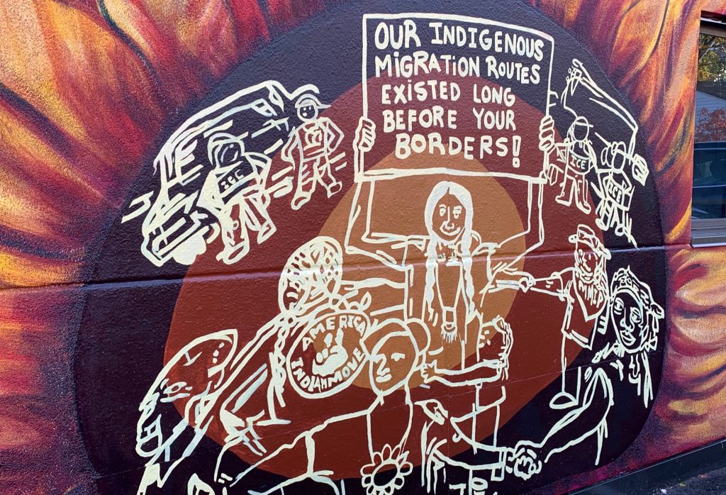
Artwork along the American Indian Cultural Corridor in Minneapolis, MN.

Transportation for America believes in hands-on learning from experienced practitioners. We put that belief into practice through programs like our Arts, Culture and Transportation (ACT) Fellowship, supported by the Kresge Foundation, where we have been able to take our fellows to different communities to experience first-hand the power of arts and culture to produce better transportation systems.

In late October, our 11 fellows participating in the fellowship visited the Twin Cities in Minnesota to learn from local practitioners using art and cultural strategies to improve transportation. We invited a few fellows to reflect on their experiences. The fellows were able to witness how community members are taking control and how transportation leadership and city government are learning from communities and becoming more responsive, and reflected on how they’ve integrated what they’ve learned into their own transportation projects at home.

Here’s what a few of our ACT Fellows had to share:

Listen to the community. They are the experts.

Sue Lambe
Manager, City of Austin Art in Public Places Program
Austin, TX

Our two days in Minneapolis-St. Paul were filled with meaningful glimpses into local culture, particularly along transportation corridors such as the Green Line in St. Paul’s Rondo neighborhood. Rondo, like communities in many American cities in the ’50s and ’60s, was divided by an interstate highway which was constructed along racial lines to divide white people from people of color.

Local activist Melvin Giles. Photo: Sue Lambe

Deeply inspiring local activist Melvin Giles narrated our walk through the Rondo neighborhood and spoke of the fight for equity that the neighborhood has waged for decades. Melvin supports peaceful interaction while working for equity. He shared one of his biggest weapons in waging peace and de-escalation of violence by gifting each of us with a vial of his ever-present bubbles with bubble wand.

Melvin shared many insights with the fellows: the need to remain present through the tough times as well as the good times, his delight in the many friends and neighbors he introduced to us throughout the Rondo neighborhood, the art installations (one featured African American railroad employees) that seek to tell important stories illuminating the history of the African American community. One tiny moment in particular sticks with me and won’t let go: a casual comment about an unassuming empty lot. As we moved along the Green Line that rainy morning, Melvin sort of threw a hand toward a space sandwiched between a restaurant parking lot and an empty storefront, stating that the unassuming grassy lot is the epicenter of neighborhood celebrations, civic events, and political campaign stops.

The “unassuming grassy lot” that hosts community events. Photo: Sue Lambe

For me, this was a revelation. Without his interpretation of this space, as an outsider I would have seen what just appeared to be there—nothing. My current work includes bringing public art to 50 miles of transportation corridors in Austin, TX and my immediate thought was: how will we be able to correctly interpret these “empty lots” in Austin as deeply meaningful spaces?

Melvin showed us one answer: planners, designers, and civic leaders embedded in a space, community, or neighborhood, must spark conversations with those living there in the process of decision making and listen to the wisdom imparted in order to ensure that valuable community resources may remain and be celebrated, possibly with public art. I’m so grateful. Thank you, Melvin!

Taking time to work with intention

Keiko Budech
Communications Manager, Transportation Choices Coalition
Seattle, WA

During our trip to the Twin Cities, our cohort met artists, activists, electeds, and community builders working in the intersection of art and urban planning. The words “community” and “belonging” came up, rooting us back to why we do this work—to create and preserve spaces where people feel a sense of connection and community belonging.

ACT Fellows from Seattle with Minneapolis Councilmember Andrea Jenkins. Photo: Keiko Budech

Community artists and activists Melvin Giles, Missy Whiteman, and Andrea Jenkins all reiterated the importance of having community members and artists as a (paid) part of a planning process (at the beginning stages), and continued to ask the question, “how do you build on assets of the community that are already here?” There’s endless collective and creative wisdom in a community that is often overlooked in urban planning.

A highlight of our visit was meeting artist, poet, and Minneapolis Councilmember Andrea Jenkins. She described a powerful community-based art project in Central and South Minneapolis called ‘This house is not for sale’ that displayed art on realty signs outside of foreclosed homes to spread awareness about displacement in the neighborhood, distributed information about what to do if someone is trying to buy your home, and explored what it means to acknowledge a home’s history. She also shared her experience transitioning as an activist/poet into elected office. She took us on a walk to the bridge over the “scar that splits our neighborhood” (the interstate highway), where she hosts an annual dinner on the bridge to connect her east and west communities. Andrea was full of ideas of ways to use art and culture to bring community together, and reminded us that art can be a powerful agent of community transformation.

Missy Whiteman and the American Indian Cultural Corridor in Minneapolis. Photo: Keiko Budech

Missy Whiteman, artist and member of the Northern Arapaho and Kickapoo tribes, guided us around the American Indian Cultural Corridor in Minneapolis along East Franklin Avenue. She explained that it’s better to take time on a project and do it right, because big land-use and transportation projects will last for generations. She also emphasized the importance of always working with indigenous community members (again, paid!) on planning projects to understand the history of the land that we are occupying, and what changes we can make to acknowledge and not repeat our oppressive history.

The Seattle fellowship team continues to explore questions around how to create public art that builds on the assets of community, and works to keep low-income communities and communities of color in place when new infrastructure is built (for example, the Puget Sound region’s current construction of our 116-mile regional light rail system). Community-informed public art can be a tool to preserve and celebrate the neighborhood’s history and culture, but if we don’t anchor community with anti-displacement tools, then who is that art work for? It was helpful to connect with experts in the Twin Cities dealing with similar questions, and explore a city with rich public art resources and multiple public art nonprofits, like Forecast Public Art, supporting community artists pursuing public art work.

Integrating on-site learning into projects at home

Erika Wilhite
Artistic Director, En Masse Arts
Springdale, AR

“Development without displacement” mural in St. Paul’s Rondo neighborhood. Photo: Sue Lambe.

My favorite day of our convening was led by Melvin Giles in the Rondo neighborhood of St. Paul. They told us the story about Rondo, which was the center of the local black community in the Twin Cities. It was heavily damaged and forever transformed in the 1960s due to the construction of a new interstate highway right through the middle of Rondo, causing the displacement of over 500 families as well as local businesses. Along the way I snapped photos of murals that state “Development Without Displacement” and signs taped to the side of buildings declaring “We will not be moved.” All around there was evidence of a community speaking up, taking their space, and directing the conversation about development.

Our final stop on the tour was the Rondo library, which is where we met with Erin Laberee of Ramsey County Public Works and artist Hawona Sullivan Janzen. They recounted a story about how the city went to the Rondo community for input on a new bridge that was to be built over I-94, but in the process city representatives learned that there was a lot of listening that first needed to be done about the negative impacts that I-94 had on Rondo. The city acknowledged that there was a need to address those wounds and give the community control of the planning process. I am especially impressed that they scrapped their original timeline and extended the community input process to listen as long as it would take. I love this story because it is an example of how community-led development can create the conditions for healing and neighborhood development.

Concept for a land bridge or cap over I-95 in St. Paul, MN.

Since the trip, I have since learned more about ReconnectRondo, an organization in place to steward the community engagement and also cast a much more ambitious vision of a “land bridge” to place a cap over I-94 at several spots to reconnect the divided neighborhood, create new meaningful gathering spaces, and “leverage the potential of the Rondo Land Bridge and the numerous innovations, partnerships and policy changes in transportation, to see a sustainable and thriving community for us all!”

I see how the current conversation about transit in my community, Springdale, Arkansas, was rushed, and how we are missing opportunities to create conditions for community cohesion. I have shared these stories from Rondo and used them to rebut the claim that the process for community engagement can’t be amended once it is underway. There were many projects and stories of collaborations in the Twin Cities that I take away as examples of community-led, artist facilitated, development processes to share with my community and the NWA Regional Planning Commission (our metropolitan planning organization) of what equitable transit planning looks like in action.

T4America selects 3 cities to launch curbside management pilots

The three pilot cities. From left: Boston, Bellevue, and Minneapolis

WASHINGTON, DC – Transportation for America (T4America) is thrilled to announce that it has awarded three cities with funding and support to complete curbside management pilot projects. The three cities are Bellevue, WA; Boston, MA; and Minneapolis, MN. 

The awards are a new component of T4America’s Smart Cities Collaborative. Now in its third cohort, the Collaborative is a year-long program for public sector transportation leaders to share their experiences with new mobility technologies and develop best practices to ensure that these services improve city life. 

“The demands on curb space are rapidly increasing, but the policies and tools on how to share this limited resource are not, said Beth Osborne, director of Transportation for America. “We’re excited to work with these three cities to put what we’ve learned from the past two cohorts into practice and identify best practices and guidelines for better curbside management.”

T4America believes that peer-learning is the most valuable part of the Smart Cities Collaborative, which is why the three “pilot cities” will be joined by participants from over 10 other cities. The final list of cities participating as these “peer cities” will be announced next week. 

“We are proud to be selected as one of only three cities nationwide focusing on how to best manage curbside space so that it meets the current and future needs of all users of city streets,” said Boston Mayor Martin J. Walsh. “I am encouraged that several of our recent efforts, such as piloting pick up and drop off space for rideshares and implementing performance parking, proved Boston’s willingness to find innovative solutions to our transportation challenges and helped to secure our participation in this joint effort.”  

“With rapidly increasing job and population growth in Bellevue, managing the city’s curbside space is becoming increasingly important,” said Transportation Director Andrew Singelakis. “Participating in the Smart Cities Collaborative will help us meet this challenge. We’re honored to be selected as a pilot city and grateful for the strong support we received from King County Metro, Bellevue Downtown Association, Bellevue Chamber of Commerce and others.”

“Minneapolis is proud to continue our partnership with T4America and the Smart Cities Collaborative, which has helped us develop capacity to harness technology to reach our transportation goals, “ said Robin Hutcheson, Minneapolis Public Works Director. “We are excited to be selected as one of three pilot cities in the 2020 cohort.  With this partnership and assistance we will develop and implement strategies to address the changing nature of curbside use, as well as learn from and share our learnings with the other participating cities.”

The third round will officially begin in February 2020. Learn more about the Smart Cities Collaborative. 

Irrigate: Turning a huge Twin Cities construction project into an opportunity

Though the new Green Line light rail line would finally connect the Twin Cities of Minneapolis and St. Paul with rail transit, business owners, local leaders, and advocates raised red flags about construction disrupting the corridor’s businesses as well as immigrant and communities of color. To mitigate these negative effects, Springboard for the Arts and other local organizations created a series of artistic interventions that did more than merely prevent painful disruptions; they helped the corridor thrive during a period of vulnerability.

Irrigate photos courtesy of Springboard for the Arts, shared by Jun-Li.

Relight the Victoria by artist Nick Clausen. Photos courtesy of Springboard for the Arts, shared by Jun-Li.

This feature is part of arts and culture month at T4America, where we’re sharing a handful of stories about how arts and culture are a vital part of building better transportation projects and stronger communities. This feature is adapted from a longer case study featured in T4America’s and ArtPlace America’s upcoming field scan on arts, culture and transportation due to be released next Wednesday, September 27. Sign up for our new Arts & Culture email list to be notified first.

The Twin Cities of Minneapolis and St. Paul have long been culturally, economically, and geographically linked, but until 2014 they lacked a meaningful, modern rail connection. The Green Line, originally known as the Central Corridor, was a new light rail line planned to run primarily along University Avenue between Minneapolis and St. Pau The area is home to a large number of immigrants and communities of color, and already has a painful history of disconnection and displacement from the construction of I-94 right through the middle of many of the same neighborhood decades ago.

With a disruptive construction project planned, civic leaders feared that months of negative press, dust, and noise might bankrupt businesses and lead to a black eye for the project before it ever opened.

In response to this concern, Springboard for the Arts, a nationally recognized community and economic development organization based in St. Paul, the Twin Cities Local Initiatives Support Coalition, and the City of St. Paul created Irrigate, a “community development strategy that mobilizes the skills and creativity of local artists to create innovative, meaningful, authentic solutions to local challenges.”

Irrigate photos courtesy of Springboard for the Arts, shared by Jun-Li.

Irrigate photos courtesy of Springboard for the Arts, shared by Jun-Li.

Springboard trained 600 artists from the neighborhoods around the rail line to collaborate with businesses and organizations along University Avenue. A total of 220 artists completed 150 creative placemaking projects over 36 months that were designed bring attention, customers, joy and beauty to the spaces and businesses adjacent to the construction. Irrigate projects included musical and theatrical performances in businesses, artistic installations in construction fencing, dance workshops, interactive musical benches, murals, street theatre and performances, and much more.

Flamenco Christmas on the Green Line: A Processional of Song and Dance by Deborah Elias. Photo by Rudy Arnold.

These projects completely changed the narrative about the long construction project and transformed the coverage. They generated more than 51 million positive earned media impressions, which spread stories about the people, neighborhoods and businesses sharing University Avenue and helped to connect new and old customers to the businesses during construction. As Nancy Homans, Policy Director for the City of St. Paul explained,

While the City of Saint Paul tried feverishly to garner positive coverage for the benefits of transit that the Central Corridor would bring to the community, their positive message was consistently diluted in the media by negative stories about the impact of construction. As Irrigate projects began popping up along the Corridor…the magic of art started a different conversation. Irrigate’s public process engaging artists from the community to support local businesses provided a nimble and creative way to influence the narrative and change community perceptions of the value of community development.

Businesses reported that Irrigate projects helped them maintain visibility and reach new customers, and Springboard felt that the project helped to change the narrative of the corridor, build social capital among neighbors and businesses, and increase the prosperity of small businesses in the corridor. Ultimately, when opening day arrived, the mood was one of celebration, instead of just relief after enduring the collateral damage that would have come from a painful construction process.

Opening day on the Green Line. Flickr photo by Michael Hicks. https://www.flickr.com/photos/mulad/14238058898/

Opening day on the Green Line. Flickr photo by Michael Hicks. https://www.flickr.com/photos/mulad/14238058898/

As with many of their successful projects, Springboard published a toolkit for communities who want guidance on running a similar program during construction. Irrigate has also been featured on ArtPlace’s website, in a documentary video, and in T4A’s Scenic Route Guide.

This project is one of the many case studies that will be featured in Transportation for America’s upcoming field scan on arts, culture and transportation, commissioned by ArtPlace America, to be released next Wednesday, September 27. The field scan is intended to examine the ways in which transportation professionals are exploring new creative, collaborative and contextually-specific approaches to engage the community in more inclusive processes for planning and building new transportation projects.

Stay tuned for more about arts and culture during the rest of September.

Smarter transportation case study #6: Managed lanes with peak-period transit discounts in Minneapolis

In Minneapolis, priority lanes and differential pricing have cleared a key interstate during peak hours and allowed more com- muters to utilize public transit.


The Twin Cities Metropolitan Area is using innovative solutions to relieve congestion on major highways in the region, with a particular focus on Interstate 35. The effort, part of a Minnesota Urban Partnership Agreement (UPA), utilizes a suite of intelligent transportation approaches, sometimes known as the 4Ts: Tolling, Transit, Telecommuting/Travel Demand Management and Technology.

The Minnesota UPA involves ITS technologies like real-time traffic and transit information, transit signal priority, and guidance mechanisms for shoulder-running buses. These technologies will significantly reduce travel time for riders.

“Trip time will be about half an hour. We’ll offer six trips in the morning and six trips home in the afternoon,” Bob Gibbons, a spokesman for Metro Transit, told Minnesota Public Radio.

First, the city is converting existing bus-only shoulder lanes and High Occupancy Vehicle (HOV) lanes along portions of the Interstate into wider lanes with prices that vary based on occupancy. Cars with only one occupant will have to pay a toll to access the lanes during peak hours, with prices set to ensure free-flowing travel. City officials say this will enable bus speeds to increase to 50 mph from the current bus-only shoulder lane speeds of 35 mph or less.

Second, a portion of the toll revenues from the new lanes will fund significant fare discounts for transit riders taking trips using the new facilities during peak periods. In and around the I-35W corridor, transit services will increase and a bus rapid transit network will be created, utilizing at least 27 newly purchased transit vehicles. There are also plans for six new park-and-ride lots with more than 1,400 additional spaces.

Third, new dynamic message signs and some existing signs will inform travelers about the availability of the lanes for non-bus use, toll rates for when the lanes are available, travel speeds on priced lanes versus on general-purpose lanes and transit alternatives.

The final element of the Minnesota UPA is telecommuting. This locally funded effort will focus on expanding upon the successful Results-Only Work Environment program, in which employers agree to provide employees the flexibility to telecommute or shift their hours to avoid congested commutes. Approximately 75 percent of Best Buy’s 4,500 corporate office employees participate in ROWE. Officials are targeting large employers, including the 20 Fortune 500 companies in the region, for participation, with the goal of reducing 500 daily peak-period trips throughout the corridor.

For More Information: Minnesota Public Radio


The MnPASS or congestion pricing lane on the left will be available at no cost to buses, car pools and to single driver vehicles willing to pay as little as 25 cents or up to $8 a trip depending on traffic levels. Traffic managers adjust the price in order to keep the lane flowing at 50 miles per hour. Photo by Dan Olson, Minnesota Public Radio

—-

Editor’s NoteOur new report on smarter mobility demonstrates how existing and emerging technologies can squeeze more capacity from over-burdened highways, help commuters avoid traffic delays and expand and improve transportation options, all while saving money and creating jobs. Many of these smart transportation solutions are already fueling innovation throughout the country, through both the public and private sector. These 14 case studies from around the U.S. and the world demonstrate the community benefits smart mobility solutions are giving regions, cities, and businesses.

Read the ITS Case Study Series

Local regions serve as laboratories for transportation reform

Salt Lake City's light-rail line.A “comprehensive, but bottom-up approach to transportation” may sound like an oxymoron, but to a panel of regional planning experts on the frontlines of reform, it sounds a lot like common sense.

Tuesday’s briefing, titled “Planning for a Better Future: Lessons from the States on Regional Sustainability Planning” featured experts from three regional laboratories on transportation reform – Sacramento, CA; Salt Lake City, UT (right); and Minneapolis, MN.

The American Planning Association and LOCUS, an association of pro-reform real estate developers, co-hosted the event at the Capitol Visitors Center on Tuesday afternoon.

Regional blueprints, or plans, outline a long-term transportation vision for a region. Metropolitan Planning Organization, or MPOs, typically have jurisdiction over this process, alongside partners at the county and municipal level. One objective of these plans is to lower greenhouse gas emissions through measures like increased transit use and building new homes near jobs.

“Comprehensive, but bottom-up” is how LOCUS President Christopher Leinberger, the event’s moderator, describes a potential direction for federal policy. In essence, the federal government would provide the funding and set the benchmarks, while regional planning authorities make allocations and are expected to achieve significant reductions in emissions.

Panelists stressed that their primary focus is on increasing choices – in transportation and housing – for all Americans. The recent economic recession was fueled in part by an over-supply of single-family homes on large lots. And while ample demand exists for mixed-use development on smaller lots, a combination of lagging infrastructure and policy restrictions have prevented the private sector from moving to meet that demand.

That is why the engagement and support of the business community is so critical.

Natalie Gochnour is the Chief Operating Officer for the Salt Lake City Chamber of Commerce. Her group’s seat at the table and engagement with a strategic and sustainable vision for the Salt Lake City area led to championing a sales tax increase to pay for 70 miles of light-rail for seven years.

“My message is this: don’t underestimate business community support for new ways of seeing and new ways of doing,” Gochnour said.

Michael McKeever, Executive Director of the Sacramento Area Council of Governments, cited a similar dynamic in his area, where the Sacramento Area Chamber of Commerce helped push the blueprint concept in its early stages and has hailed the region’s long-range plan as a signature accomplishment.

Both Sacramento and Salt Lake City have seen substantial increases in transit usage and decreases in vehicle miles traveled (VMT) since beginning to implement their blueprints.

Commissioner Peter McLaughlin of Hennepin County in Minnesota addressed successes in his region as well.

T4 America Director James Corless emphasized that there was no “silver bullet” in regional sustainability planning, but that providing benchmarks and the required funding would result in substantial leaps.

Communities should be asking, “what do we want to look like in 25 years?” Corless said. “That’s the fundamental question.”