
Divided by Design: Quantifying the damage of our transportation program

Our new report examines the racist roots of our current transportation system. Most importantly, it demonstrates how today’s policies and practices were shaped by the past, leading to racial disparities today. Without a fundamental change to the overall approach to transportation, today’s leaders and transportation professionals, no matter their intent, will perpetuate and exacerbate the damage.

Beginning in the 1950s, highways devastated communities of color and changed our cities forever. But the consequences continue, even as we begin to acknowledge our past mistakes.

To create a better system, we can’t settle for small changes. We need a total shift in approach. To learn more about the report and our analysis, join our webinar on July 25 at 2 p.m. ET.

Read the report Register for the webinar

A guide to this report

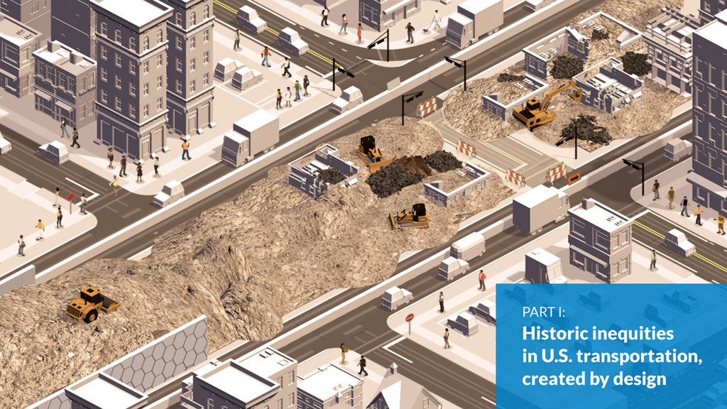
Part I examines the damage and inequities deliberately created by and in the federal transportation program from ~1950 onward. It concludes with a unique analysis of both an unbuilt and built highway segment within Atlanta and Washington, DC to quantify what was lost, who bore the brunt of the damage, and what could have been lost with highways that were never built.


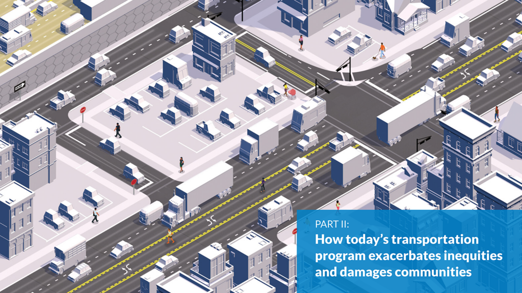
Part II examines our current transportation program to demonstrate how the programs, standards, models, and measures have their roots in the previous era and exacerbate inequities—whether intentional or not.


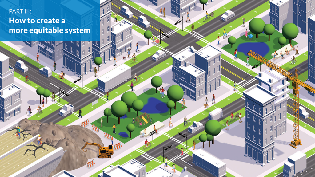
Part III outlines what needs to change—concrete steps we can take to fundamentally reorient the program around unwinding those inequities.
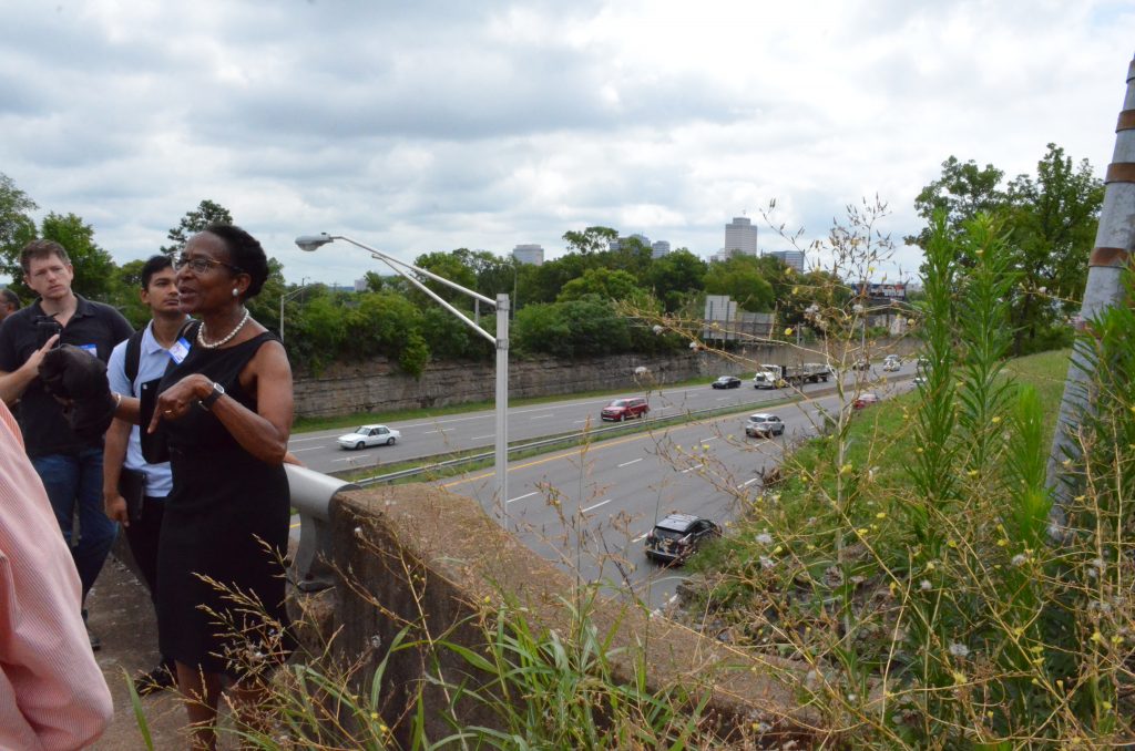
Two cities divided

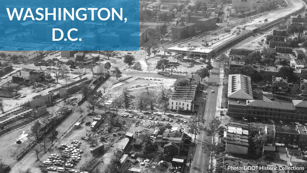
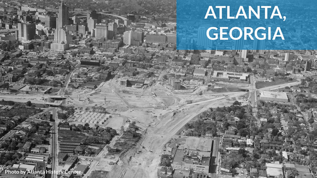
Divided by Design also quantifies the damage caused by highways in two U.S. cities: Atlanta, GA and Washington, DC. Like hundreds of others in the U.S., these cities are forever scarred by highways that demolished communities of color, robbing them of opportunity and potential.

Atlanta’s I-20 displaced over 7,500 people and destroyed 1,400 occupied homes. In DC, I-395/695 displaced over 5,000 people and demolished 2,200 homes. These numbers only scratch the surface of the full damage and dislocation.

More significant damage was also avoided in these cities. To understand what might exist in these communities if they hadn’t been disrupted by highways, we looked at two planned highway segments that were never built and the hundreds of businesses, office buildings, and homes that wouldn’t exist today. Click to read these stories:

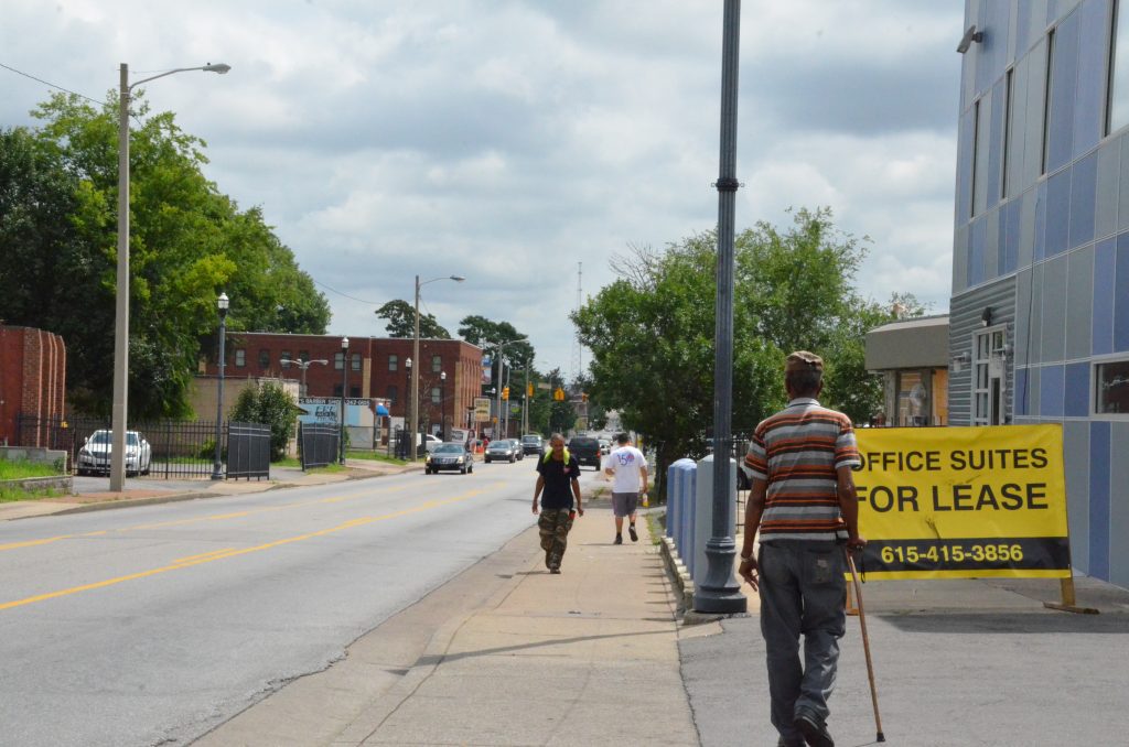
The damage continues

The models, policies, and practices we use today took root in the highway era, and they continue to inflict the most harm on people of color. Our approach leads to worse health outcomes, greater congestion, and deadlier roadways. It leaves millions of Americans without access to reliable transportation options to get where they need to go. We can’t build a better system on a rotten foundation. It’s time for a paradigm shift.

We need a new approach.

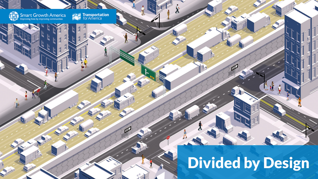
Read Divided by Design

Explore the report’s full content—jump to one of the three parts with the graphics below.

report cover graphic showing a stylized highway cutting through a city.graphic showing a stylized scene of construction of a highway through a city neighborhoodgraphic showing a stylized scene a few blocks away from a highway running through a city neighborhoodgraphic showing a stylized scene of what a neighborhood could look like after tearing a highway down

Don’t miss supplemental maps, videos, and animations in the DC and Atlanta case studies which are not in the hard copy. Download a PDF version of the report.


How best to stitch a community back together divided by an interstate?

USDOT is in the midst of a new initiative to address some of damage created by interstates driven through the heart of urban areas. Last week a group of experts traveled to Nashville to discuss ways to repair the damage inflicted upon a part of North Nashville by a segment of Interstate 40.

Photo by Rochelle Carpenter

Jefferson Street overpass over Interstate 40. Photo by Rochelle Carpenter

More than a half-century ago, the new Interstate Highway System connected millions of Americans, creating new, valuable economic connections between cities and speeding the movement of goods and people across the country in a new network of roads that were the envy of the world. But the social costs weren’t shared equitably, and inside many urban areas, interstates were most frequently constructed through communities of color, disrupting, disconnecting, and displacing them.

Acknowledging this unfortunate reality, Secretary Foxx and the US Department of Transportation announced the Every Place Counts Design Challenge in May, which “seeks to raise awareness and identify innovative community design solutions that bridge the infrastructure divide and reconnect people to opportunity,” according to USDOT. Through an open competition, USDOT selected Spokane, Minneapolis-Saint Paul, Philadelphia, and Nashville to receive pro bono design guidance to mitigate the disastrous effects of urban highways in each city.

On July 11th and 12th, a team with representatives from Transportation for America, USDOT, The Congress for The New Urbanism, Toole Design Group, and others participated in Nashville’s design challenge, focusing on North Nashville’s Jefferson Street corridor and its two intersections (one overpass, one underpass) with Interstate 40.

every place counts nashville

Jefferson Street in Nashville during a walk through the corridor. Photo by Rochelle Carpenter

North Nashville, and especially Jefferson Street, has been the cultural and educational heart of black Nashville, and is still home to three historically black colleges and universities (Meharry, Fisk, and Tennessee State University). Though more than a dozen music venues once called the corridor home, all but one have been demolished — some by the construction of I-40, and some from the later decline aided by it. (Some of the historic venues were also torn down before Interstate 40 was built.)

Today, Jefferson Street suffers from a relatively high rate of vacancy, a lack of adequate sidewalks and connections across I-40, and property owners holding on to buildings with the hope that property values will increase, rather than selling or developing. Despite this, the corridor is also home to a collection of small cultural institutions, including the Art History Class Lounge and Gallery, Woodcuts Gallery, and the nearby Norf Walls street art project. In Nashville’s hot real estate market, the very real physical barrier of I-40 encircling downtown here has contributed to slowing development in North Nashville — much to the relief of renters and the chagrin of many property owners.

It was in this context that the design team met with stakeholders representing local, state, and federal government agencies, local residents and business owners, anchor institutions, and design professionals for two days of visioning exercises. Ideas generated included everything from widening sidewalks and removing right turn lanes, to decking over I-40 and building aerial parks à la downtown Dallas.

Thaxton Abshalom Waters, founder of the Art History Class Lounge, asked the designers and experts to “focus on tapping back into the same sources that made the neighborhood a beautiful and culturally rich landscape in the first place.” It’s a reasonable request: much of the positive momentum on Jefferson Street today comes, as it did before I-40, from artists and performers, building community through cultural production, art walks, and creative resuse of structures and spaces along Jefferson Street.

every place counts nashville

Discussions during the design charette. Photo by Rochelle Carpenter

Long before the term was coined, Jefferson Street has benefited from creative placemaking, an approach to community development that acknowledges the integral role that arts, culture, and creativity play in community development and in ensuring that communities better reflect and celebrate local culture, heritage and values.

Reminder: Have you browsed our new guidebook to creative placemaking yet? Visit httpcreativeplacemaking.t4america.org

Creative Placemaking 

To learn more about the ways in which corridor revitalization and transportation projects benefit from the arts, explore T4A’s guide to creative placemaking, the Scenic Route.

The design interventions generated by the two-day charrette are a good start, but on their own, they won’t be enough to produce the kind of positive change sought by the local leaders and residents who’ve been fighting an uphill battle to see some of the pride and glory restored to their neighborhood. But the process proved to be a great organizing tool for bringing together leadership from the neighborhood, government, business community, and transportation planners and engineers.

USDOT, with assistance from The Congress for the New Urbanism and Toole Design Group, will release a report summarizing findings and suggestions from the two-day event in the fall.

58-year-old bridge collapses in Washington State on west coast’s most major interstate

Shortly after the evening commute last night (around 7 p.m. local time) an entire section of the Interstate 5 bridge  — both north and southbound lanes — over the Skagit River an hour north of Seattle, Washington collapsed and fell into the river, sending two cars tumbling down into the river, injuring three yet miraculously killing no one. One of those who plunged into the river along with his wife called it a “miracle” that no one was killed or more severely injured.

From the Seattle Times:

Rescuers pulled three people with minor injuries from the water after the collapse, which authorities say began when a semitruck with an oversized load struck a steel beam at around 7 p.m.

That caused a massive piece of the northern side of the bridge to wobble, and then fall into the water, taking with it a gold pickup, its travel trailer and an orange SUV.

Rescuers did not believe there was anybody else in the water but were planning a morning search to be sure.

Seattle Times Bridge Collapse
Seattle Times photo by Dean Rutz. Link to gallery of images here.

Perhaps the most amazing part of this story is that on a bridge that carries more than 70,000 cars daily and at a time of day when traffic could be expected to be moderate at the least, only two vehicles fell into the yawning gap and into the water. Along with everyone else, we at T4 America are relieved that no one died in this tragic bridge collapse.

Just like several years ago in Minnesota, attention quickly turned to the bridge itself. So what do we know about it today?

The Interstate 5 bridge over the Skagit River actually predates the creation of Interstate 5. It was built to carry old US 99 over the river in 1955. When Interstate 5 was built in 1957, it largely followed the US 99 corridor and just like many other bridges, this bridge was folded into the interstate system, though it certainly wasn’t built to today’s interstate standards.

Because of that (and likely other design considerations), the bridge was considered “functionally obsolete” by state and federal inspectors, which is a designation that could mean any number of things, none of which have anything to do with structural safety. The lanes could be narrower than today’s standards, the weights allowed could be less than an interstate bridge built today, or built using materials that would be considered obsolete today.

However, the bridge was not considered “structurally deficient” at the time of collapse, which means that a bridge requires repair, rehabilitation or replacement, along with much more regular inspections. To be considered structurally deficient, one of the three major components of a bridge (deck, superstructure, substructure) has to score a 4 or below on a scale of 1-10.

The data in our interactive map is not the most recent release of federal data, but the ratings for this specific bridge have not changed in the federal National Bridge Inventory that was reported in early to mid 2012 by Washington State. WSDOT likely inspected the bridge again sometime in 2012 after they reported annual bridge data to the federal government, and WSDOT is saying publicly today that the bridge was not structurally deficient and was still only considered functionally obsolete.

Here’s the snapshot from our interactive map of U.S. bridges, which you can use to look up the condition of the bridges near any U.S. address.

Skagit bridge collapse interactive map screenshot

(Amazingly, you can see that Google Maps has already updated their map to show that Interstate 5 no longer crosses the Skagit River.)

On a list of structurally deficient bridges in Washington compiled by WSDOT in September 2011, this bridge is not included, though there is at least one other nearby Interstate 5 bridge in Snohomish County that is included, built in 1933. (It’s scheduled for repair, per WSDOT.)

It’s hard to accurately describe how crucial this interstate connection is. I-5 runs from Canada to Mexico within the U.S. and touches almost every single major city on the west coast. It’s a vital corridor not only commuters but also for freight traffic — 12 percent of the daily traffic on this bridge was truck traffic. And this is the main route from Seattle up to Vancouver, certainly a direction that many Seattle region residents might have been planning to travel for the long holiday weekend starting this afternoon.

Those plans are surely on hold, and the ripple effect for freight and other travel up and down the west coast will be felt for some time to come as Washington authorities decide how to handle this painful gap in their transportation network.

We will be back later this morning with a short statement, and follow us along on twitter at @t4america for other news and developments.

PS, here’s the cover of the Seattle Times this morning.

Seattle Times bridge collapse cover

Update: this post incorrectly said the bridge 63 years old at first publication. That has been corrected.

Planning for the future: Washington’s new Woodrow Wilson Bridge

A New Trail Originally uploaded by M.V. Jantzen.
A bicyclist cruises along I-495/95 on the new Woodrow Wilson Bridge “active transportation lane,” leading to the rare sight of someone not in a car using the Capital Beltway. View more photos of the opening on Flickr from Eric Gilliland, director of the Washington Area Bicyclist Association (a T4 partner.)

Two weekends ago, the 12-foot-wide bicycle and pedestrian lane of the Woodrow Wilson interstate bridge over the Potomac River held its grand opening in Washington DC, filling with bikers and walkers who can now join the thousands of cars that cross the bridge each day.

The bridge, which connects Virginia and Maryland on the southern part of the Capital Beltway, is a vital transportation link in the region, where Interstate 95 (and the large majority of truck traffic) bypasses Washington, continuing north or south along the eastern seaboard.

Hundreds of bicyclists enjoyed a ride across the bridge for the first time ever last weekend, and the renovations to the bridge also added dedicated space for a future transit line — not something you see everyday on an interstate bridge in the United States.

Building a new bridge to replace the 1961 bridge had been discussed for decades, but the planning kicked into high gear in the 1990’s, with Maryland, Virginia, and the federal government all engaged in the process (DC relinquished control to the states.)

Branch Ave and King Street Metro
The King Street (Virginia) and Branch Avenue (Maryland) Metro stops are separated by just a few miles and the Potomac River, but require a long ride into DC to travel between the two on the Metrorail system. One day, Metro might cross the Wilson Bridge instead.

Looking at a map of the Metrorail public transportation system, one can see that only a few miles separate the end of the green line in Maryland and the yellow and blue lines in Virginia. There was no active work to connect the two lines, but a handful of people in the planning process wondered about dedicating some space on the bridge for a future, useful Metro connection.

Parris Glendening, Governor of Maryland from 1995-2003, said that planning for a future transit connection was just common sense.

“Those stations are just a few miles apart as the crow flies, but no one in Maryland who has a choice is going to ride all the way up into DC to switch trains and ride all the way back out to Virginia — and end up only a few miles from where they started,” he said. (more…)