
Rethinking the intersection to prioritize safety over speed

A cyclist crosses an intersection with the aid of a green bicycle crossing signal

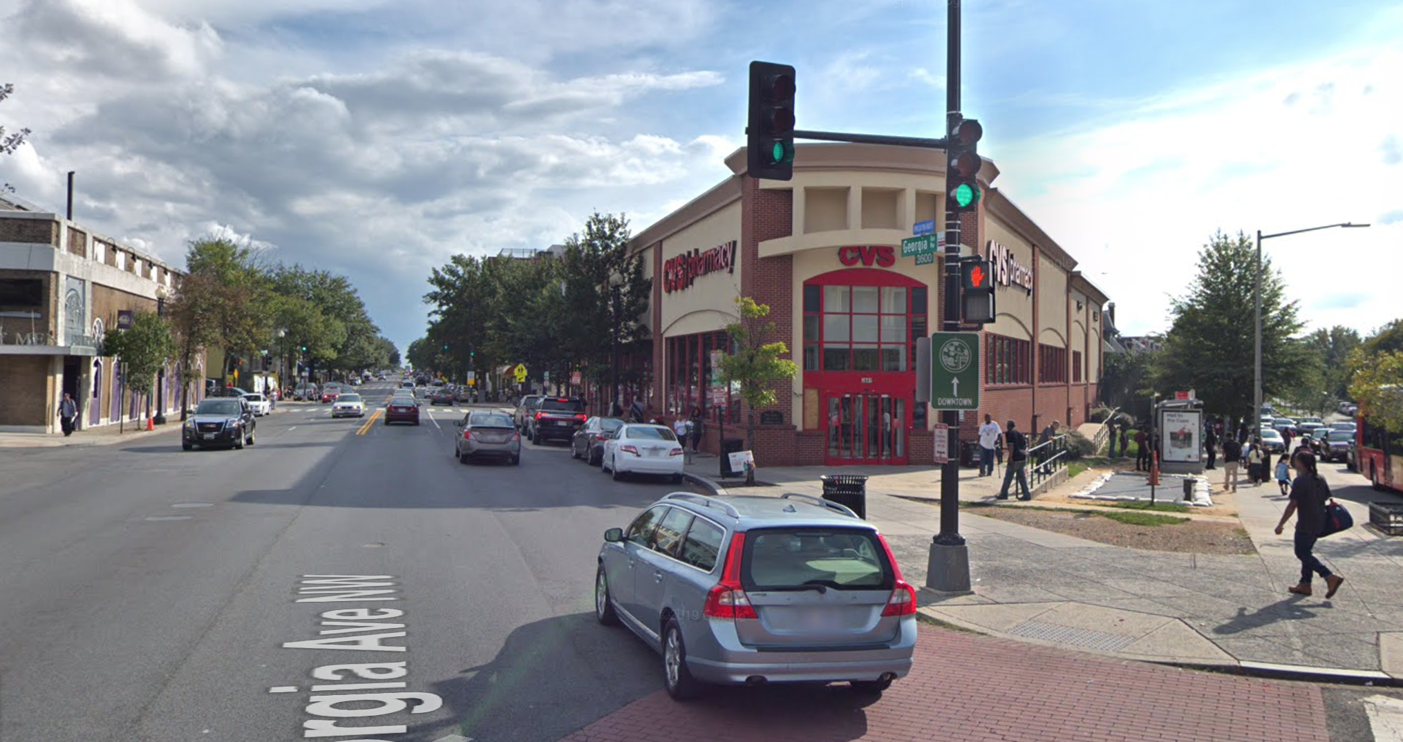
The rising rate of pedestrian fatalities is a consequence of deadly design decisions that prioritize driver speed and convenience over the safety of all other road users. Today, we dig into one example: crosswalk signals.

A cyclist crosses an intersection with the aid of a green bicycle crossing signal
Flickr photo by Seattle DOT.

As communities work to advance safe streets, they must also ensure that these efforts lead to design changes that effectively integrate with the technology managing traffic flow for all users. Many walk signals are timed based on outdated standards that prioritize maximum green time for all motorized vehicle movements. Signal timing gets reviewed on a case-by-case basis, leveraging a manual last published in 2015 that isn’t supplemented often to consider the diverse needs of pedestrians, such as people with disabilities, seniors, cyclists, or parents with strollers.

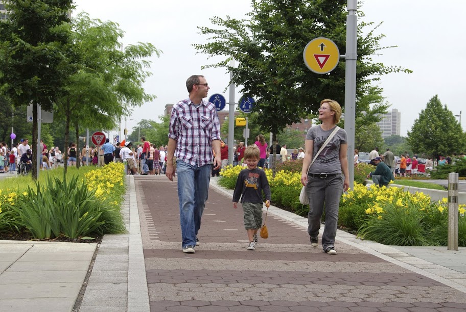
Walk signals are just one example of how our infrastructure prioritizes the speed of vehicles over the safety of other road users. This practice comes at a deadly cost.

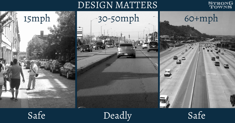
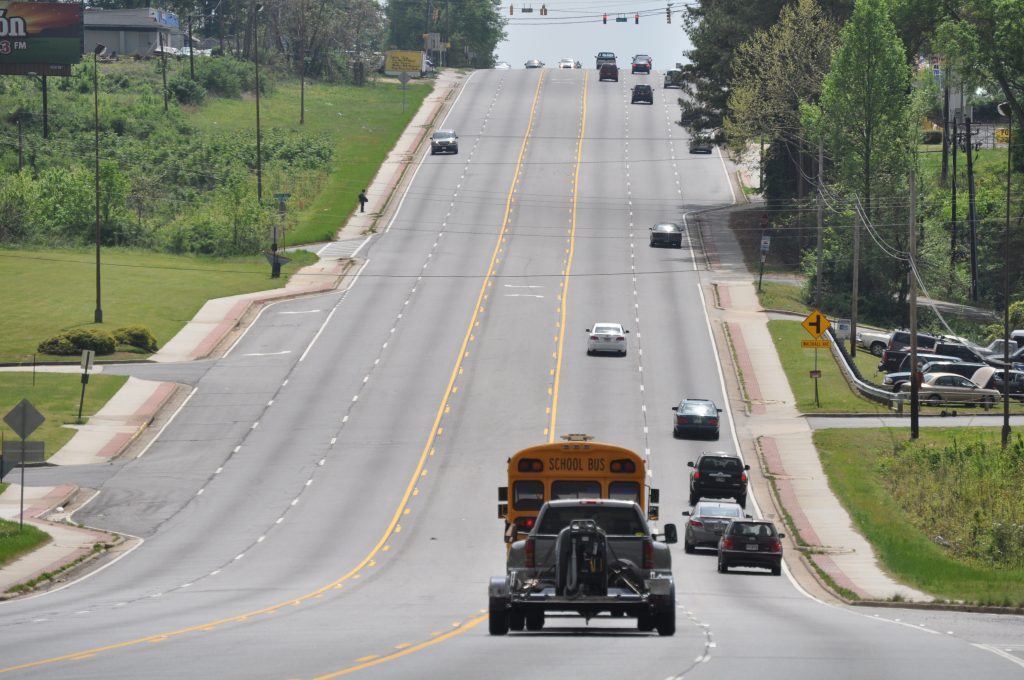
We are in the midst of a historic and alarming increase in the number of people struck and killed while walking, which has been on a steady rise since 2009, reaching levels not seen in more than 30 years. Speed is the number one culprit in these fatalities. Speed is also the best predictor of whether or not a collision will result in an injury or death. Design elements, including effective traffic signals, are essential to reducing speeds and improving safety.

If not designed correctly, intersections can be one of the most dangerous places where folks in and outside of cars interact. There are many recent examples of places that experience a high number of crashes at crosswalks. Saint Paul, Minnesota is a prime example of this. In 2016, Shelby Kokesch was killed while attempting to cross Kellogg Boulevard, a busy thoroughfare, from the Minnesota History Center. Though Kokesch used a marked crosswalk, it lacked a stop sign or a crossing signal. While one car pulled over to let Kokesch and her mother pass, the second vehicle—an SUV—did not stop.

At the time, Saint Paul responded with higher traffic enforcement around crosswalks, ticketing drivers who failed to stop at marked crosswalks and yield to pedestrians. During the crackdown, Sergeant Jeremy Ellison reflected, “An overwhelming response from people is, ‘I didn’t see them.’ People are not paying attention and they’re driving too fast.”

This is a design problem—and it has a design solution

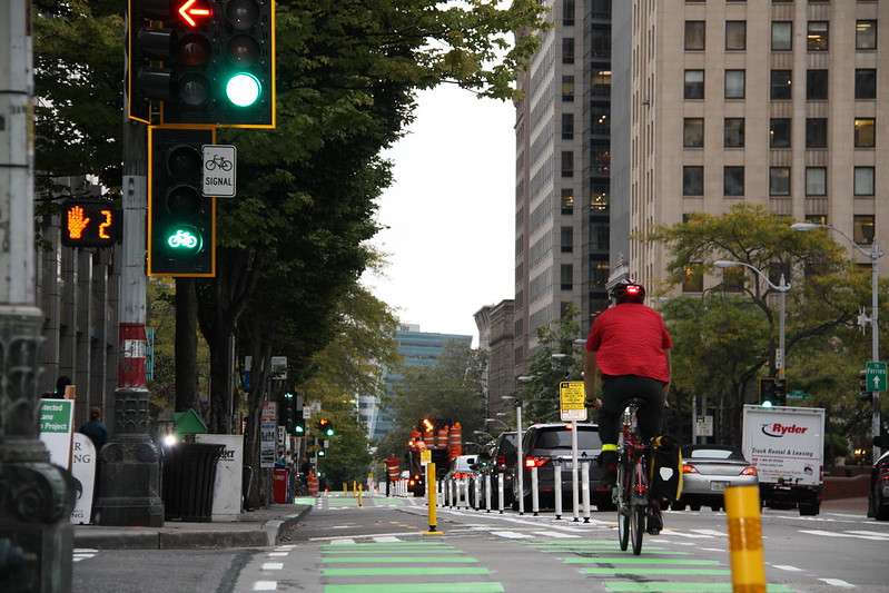
Signalized intersections draw attention to pedestrian crossings and help ensure that traffic comes to a complete stop before travelers enter the crosswalk. Street design can be more influential on driver behavior than speed limits or enforcement alone. Complete Streets—an approach to designing streets that prioritizes the safety and comfort of people who walk, bike, and roll—can lead to slower driver speeds, reducing the risk of crashes and roadway fatalities for folks both in and outside of cars.

Designing an intersection with safety in mind can take a lot of different forms, such as shortening the length of an intersection by reducing the number of vehicle lanes—or by ensuring appropriate time to cross the street. Walk signals and walk signal timing also play an important role by giving pedestrians adequate time to cross. For example, leading pedestrian intervals allow pedestrians to begin crossing the street before cars turn right or left, signaling to drivers that pedestrians are present and making it easier for them to see and yield to other people using the road.

One aspect of a Complete Streets approach is practicing effective community engagement. Administering walk audits with a variety of road users, community residents, and decision makers can assist municipal planners in determining whether a signal offers enough time to cross the street. By implementing this approach, planners and engineers can experience a street in the same way as the people who travel on it every day. Using this method can allow cities and states to make their streets safer and more accessible.

Pedestrian fatalities will continue to rise until we prioritize the safety of all road users over the speed of a few. The effective use of crosswalk signals, combined with other elements of safe street design, can reduce the danger on our roadways and ensure that everyone can safely get to where they need to go. Learn more about a Complete Streets approach here.

Competition: Which street is the most dangerously-designed?

This week, we’ll be taking a deep dive on our second principle for transportation policy: design for safety over speed. Throughout the week, send photos of streets in your area that are designed for speeds far higher than the posted speed limit or where the speed limit is way too high for the context. On Friday (Nov. 8), you’ll have a chance to vote for the worst offender.

At slow speeds, cars can mix safely with other road users. High-speed interstates remove conflicts to keep people safe. But when people and high-speed traffic mix, that’s a recipe for disaster.

There’s a difference between the speed limit posted on a road and the speed the road has been designed for. People will drive at the speed they feel comfortable, regardless of the speed limit. Wide, straight lanes with open skies, long blocks, and few traffic signals or stop signs tell drivers it’s okay to go fast. Conversely, narrower lanes, more frequent crossings, and street trees can encourage slower speeds that are more appropriate for developed areas.

Off the interstates, in areas with shops & restaurants, offices, schools, and homes, we should be designing for slower speeds—speeds that keep people walking, biking, or taking transit safe and comfortable. Too often these very streets are designed to encourage high-speed thru traffic and then we wonder why our streets are so dangerous to people walking and biking.

Send us photos of dangerous streets in your area! Email us at jenna.fortunati@t4america.org or tweet your photo(s) to @t4america and tell us a little bit about it. On Friday, we’ll poll our followers to identify the most egregious example of a street that prioritizes speed of people’s safety.

Examples of unsafe streets abound, and it’s not just suburban arterials. Take for example, Georgia Ave NW through the heart of Washington, DC. The posted speed limit is 30mph, but this four-lane, two-way road is arrow straight and drivers rarely travel at or below 30.

Within a few hundred yards of this photo there are laundromats and pharmacies, numerous bars and restaurants, homes for thousands of people, an elementary school, and a church. There’s also a metro stop and a dozen different bus stops—people walking are everywhere. Yet the design of this street clearly prioritizes the speed of car traffic over the safety of everyone else.

We want you to send us photos of streets where cars routinely drive above the speed limit (or where the posted speed limit is way too high) because the street isn’t designed to prioritize safety, or not designed appropriately for its busy context. Snap a photo this week and send them to us with a short description via twitter or email. On Friday, we’ll hold a poll on our Twitter account where you can vote for the worst offenders.

Feds get out of the way of communities that want to design safer, more complete streets

The Federal Highway Administration made two big moves this last week to clear the way for states, metro areas, and local communities to use federal dollars to design safer, more complete streets.

atlanta highway local street

Good news: old federal street design guidelines that often required local streets to be designed like this have been radically scaled back.

Both of these updates are great news for anyone advocating for streets that better meet the needs of everyone that uses them, as well as better serving the goals of the surrounding community. FHWA deserves a big round of applause for making these changes.

If you are working on a local transportation project and your DOT or some other agency cites vague federal rules when refusing to build a safe and complete street, show them the FHWA memo below. Their guidance makes it extremely clear: there’s wide latitude to design streets to best suit local needs, and old regulations that treat all roads like highways have been rolled back. 

Federal street design guidelines just got a lot simpler

Last week, FHWA finalized new street design guidelines that eliminated most of the criteria that local communities and states must adhere to when building or reconstructing certain roads — especially those with speed limits under 50 mph. Of 13 current design criteria for certain roads under 50 mph, 11 criteria have been scrapped, because, in FHWA’s words, they have “minimal influence on the safety or operation on our urban streets.”

Until now, states or cities would have to go through an arduous process of requesting an exception to do common sense things like line a downtown street with street trees, reduce the width of lanes to add a bike lane, or curve a street slightly to slow traffic and make it safer for people in cars and on foot. (This old post explains the change in more detail.)

Tfhwa design guidlines thank you
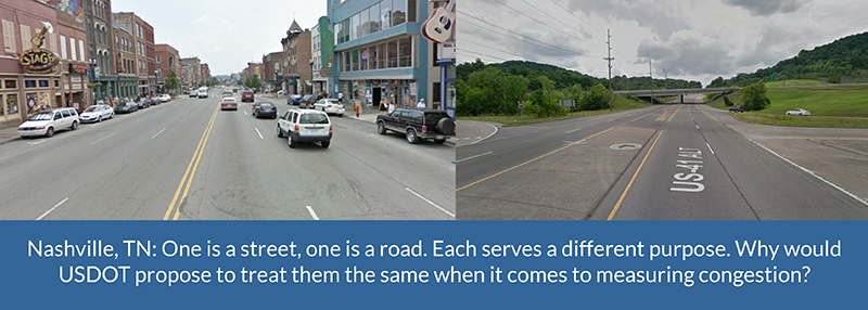
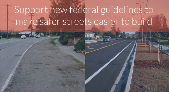
he new criteria recognize that successful streets running through a bustling downtown of any size need to be designed far differently than rural highways connecting two towns or cities. They have to meet a far more diverse range of needs than simply moving cars fast, and these smart new guidelines reflect that wisdom.

Thousands our supporters sent in letters to FHWA on this issue, and FHWA listened. From the final rule:

The FHWA received comments from 2,327 individuals and organizations on the proposed changes to the controlling criteria. Of these, 2,167 were individual form-letter comments delivered to the docket by Transportation for America. …The overwhelming support for changes to the controlling criteria indicate that the changes will support agency and community efforts to develop transportation projects that support community goals and are appropriate to the project context. The provisions included here for design documentation will result in more consistent evaluation of exceptions to the adopted design standards when controlling criteria are not met on NHS highways.

Even more encouraging, FHWA responded strongly to the handful of state DOTs that sent in comments noting their desire to keep the old design guidelines intact.

The FHWA finds that removing these controlling criteria from application in low-speed environments is supported by research and provides additional flexibility to better accommodate all modes of transportation. No new controlling criteria are proposed at this time.

In their comments, FHWA affirmed that local communities should have more leeway in how they design streets — after all, they know their local needs best — and that research shows that the old guidelines made it more difficult to accommodate all modes of transportation.

Vehicle speed- and delay-focused “level of service” metric is not a federal requirement

When planning a new street, reconstructing an old street, or conducting traffic studies for new development, most transportation agencies rely on a metric known as level of service or “LOS”. While commonly accepted amongst many traffic engineers, it’s an outdated, narrow metric that assesses how well a road performs only by looking at the number of cars and the amount of delay experienced by vehicles.

If the only goal of your community’s streets is moving cars fast, then level of service is the way to go. If your community also wants to keep people safe, or allow people to walk, bike or take transit, or support a vibrant downtown, then relying only on level of service isn’t going to cut it. It’s like trying to decide if a new pair of pants will fit by measuring the waist and ignoring the inseam.

Similar to the street design requirements that FHWA just scrapped, level of service is often used to halt plans to make streets safer for everyone or boost economic development by narrowing lanes, adding bike lanes, mid-block crosswalks, bulb-outs, or other improvements. It’s even been cited as a federal requirement in some cases. To those agencies, planners and engineers, FHWA made an announcement on May 6: (emphasis added.)

We have received several questions regarding the minimum level of service (LOS) requirements for projects on the National Highway System (NHS).

FHWA does not have regulations or policies that require specific minimum LOS values for projects on the NHS. [National Highway System] The recommended values in the Green Book are regarded by FHWA as guidance only. Traffic forecasts are just one factor to consider when planning and designing projects. Agencies should set expectations for operational performance based on existing and projected traffic conditions, current and proposed land use, context, and agency transportation planning goals, and should also take into account the input of a wide cross section of project stakeholders.

This might seem like a minor clarification, but FHWA just gave the green light to localities that want to implement a complete streets approach. By making clear that there is zero federal requirement to use level of service (and that there never has been), FHWA is implying that transportation agencies should consider more than just traffic speeds when planning street projects.

Changing policy is one thing but changing behavior is another, however. Level of service is an instructive example. It’s never been a federal requirement, but that hasn’t stopped transportation agencies all over from relying on it. And though the design guidelines have been radically pared back for most streets, that doesn’t mean that a state DOT won’t continue to adhere to them as a matter of course.

Engaging with your city, metro planning organization and state DOT will continue to be important for your community to realize its plans for safer, complete streets.

Yet, USDOT is going the opposite direction on measuring congestion

Of course, these encouraging changes from FHWA stand in sharp contrast with USDOT’s narrow, vehicle-focused proposal for how to measure congestion. While FHWA acknowledges that “traffic forecasts are just one factor to consider,” the proposed rule from USDOT would measure congestion in a way that places vehicle speed and delay far above any other factors.

This would penalize places that have made it easier to avoid congestion by making it easier to get around on transit, by foot or bike, or through telecommuting. And it would have the effect of rewarding places with long commutes that move quickly over places with shorter average commutes that move slower.

We need to measure congestion in a way that lines up with these two very encouraging moves from FHWA.

Have you sent a letter yet? Join the nearly 2,000 people who have already told USDOT they can do better.

Nashville street comparison

2,100 letters delivered to FHWA in support of easing restrictive street design regulations

Earlier this week, with our partners at the National Complete Streets Coalition, we delivered nearly 2,100 letters to FHWA supporting their proposal to ease the onerous federal design standards that make it needlessly difficult for local communities to build safer, more complete streets.

Complete Streets director Emiko Atherton

National Complete Streets Coalition director Emiko Atherton on her way to FHWA in Washington, DC earlier this week.

It was an incredibly encouraging move by FHWA, and thanks to many of you who sent in one of the nearly 2,100 letters, FHWA will hear the message loud and clear that this move has broad support.

In case you missed the news back in November, FHWA made an encouraging proposal to scrap 11 outdated provisions in the current design criteria that local communities and states must adhere to when building or reconstructing certain roads with speed limits under 50 mph — adhere to, or go through an arduous process of requesting an exception from FHWA to do things like line a downtown street with street trees, reduce the width of lanes to add a bike lane, or curve a street slightly to slow traffic and make it safer for people in cars and on foot.

Communities of all sizes are eager to capitalize on their streets as economic assets and boost the bottom line by making them safe and attractive for everyone to use them. Under these current design guidelines for federal-aid roads, communities might adhere to out-of-date FHWA regs rather than fight for exceptions that can delay a project or even increase the cost.

Along with Smart Growth America and the National Complete Streets Coalition, we rallied our networks to show support for this welcome change. And earlier this week, National Complete Streets Director Emiko Atherton personally delivered all of your letters to the U.S. Department of Transportation — trying not to fall over while balancing the 15-pound stack along the way.

The overwhelming support for the proposed rule demonstrates the groundswell of bottom-up, grassroots support for designing safer, more complete streets. We hope FHWA will take note by moving ahead with adopting the rule as it stands and making no modifications.

Thank you to all who submitted a letter of support, we look forward to keeping you updated in early 2016 with the latest developments.

fhwa design guidlines thank you

USDOT proposes to remove restrictive design guidelines that make safer streets more difficult to build

The Federal Highway Administration (FHWA) took an encouraging and surprising step, proposing to ease federally-mandated design standards on many roads, making it dramatically easier for cities and communities of all sizes to design and build complete streets that are safer for everyone.

This proposal is open for comment, and FHWA is waiting to hear from the public.

FHWA design guidelines promoSend a letter of support to FHWA

These outdated federal guidelines get in the way of better street design, but FHWA is proposing to scrap many of them. This is indeed great news, but for these changes to go ahead, FHWA needs to hear that they have strong support for the proposed changes.

Join us and generate a letter to FHWA today. We’ll be delivering your letters in person to FHWA all at once before the December 7th deadline.

Currently, FHWA has a long list of design criteria that local communities and states must adhere to when building or reconstructing certain roads, unless they choose to go through an arduous process of requesting an exception to do things like line a downtown street with street trees, reduce the width of lanes to add a bike lane, or curve a street slightly to slow traffic and make it safer for people in cars and on foot.

In this new proposed rule, FHWA decided after a thorough review to scrap 11 of 13 current design criteria for certain roads because they decided these criteria have “minimal influence on the safety or operation on our urban streets” and has a stronger connection for rural roads, freeways and higher speed urban arterials.

This new freedom for local planners and engineers would cover all roads on the National Highway System (NHS) with designed speeds under 50 mph. This covers most of the non-interstate roads and highways running through communities of all sizes that are built with federal funds, like the typical four-lane state highway through town that we’re all familiar with, perhaps with a turning lane on one side. Incidentally, many of these roads are among the most unsafe for pedestrians.

Walking & Roads

In FHWA’s own words, this move will “refine the focus on criteria impact on road safety and operation” and “encourages engineered solutions rather relying on minimum, maximum, or limiting values found in design criteria.”

In our words, this move will liberate local communities that have been working hard to make their roads safer for everyone that uses them, and rid them of the need to petition FHWA for exceptions to do exactly that. It’s a win for the movement for safer and more complete streets and also a liberating change for transportation engineers, especially those that have been working hard with their planners and elected leaders to bring innovative, safer street designs to their communities.

Since these controlling design criteria were first established in 1985, any project that didn’t meet all of the minimum design standards had to receive individual approval from FHWA. This was done on a project-by-project basis and added time and difficulty for those wanting to create safer roads. Now, for these NHS roads under 50 mph, engineers will only be required to attain design variances for just two criteria – design speed and structural capacity.

Today’s proposed rule follows on the heels of FHWA’s summer release of the Bicycle and Pedestrian Funding, Design, and Environmental Review: Addressing Common Misconceptions that addresses 10 misconceptions that often prevent or slow construction of safer roads. This is a valuable resource that will help local governments, metropolitan planning organizations and civic leaders improve the safety of our roads by debunking misconceptions ranging from the pots of money available for bike and pedestrian projects to explaining that FHWA rules are not the roadblock to complete street road design.

FHWA deserves praise for their leadership on this important issue. The rule is open to public comment for 60 days through December 7, 2015. Let’s take the opportunity to provide public comment and thank FHWA for their leadership and make sure it is implemented to help make safer streets for all to enjoy.

For these proposed changes to go ahead, FHWA needs to hear that they have strong support for the proposed changes. 

Generate a letter to FHWA now, and urge your friends to join in. It only takes a moment.

U.S. Surgeon General issuing a rare call-to-action to make walking safer & more convenient

The Surgeon General will issue a new call-to-action next Wednesday that focuses on encouraging cities and towns to design and build their roads and public places to make walking easier, safer and more pleasant.

From an email this morning:

The Call to Action will highlight the significant health burden that exists in the U.S. today due to physical inactivity – contributing to more than 10 percent of the preventable mortality in America today. More specifically, it will make recommendations to a number of key sectors about critical actions they can take to improve community walkability and increase walking throughout the U.S..

family-cultural-trailIt’s an incredibly noteworthy moment to see the Surgeon General identify this issue as a major public health problem. Issuing an official call is a significant event for the Surgeon General, and rare — only six others have been issued within the last ten years.

According to the Surgeon General’s office, only half of American adults get enough physical activity to reduce the risk of chronic disease, which is the leading cause of death in the United States. To address this grim statistic, the Surgeon General and HHS will release a set of recommendations on how to encourage walking and better shape our communities to encourage people to get out and walk or bike more to get around each day.

Communities around the country are seeing the benefits of better walking and biking infrastructure. Nashville’s metropolitan organization recently began considering health criteria as they selects transportation projectsWashington State was the first state to adopt a Vision Zero plan to reduce pedestrian deaths to zero. Making their vision a reality includes not just educating drivers about pedestrian and bike safety but also re-designing streets and roads to slow traffic and give folks walking and biking safe and attractive facilities to use.

We can’t just ask folks to get out and walk more — we need to give them safe and convenient opportunities to do so.

The Surgeon General and the U.S. Department of Health and Human Services will be launching this report and call-to-action next Wednesday, September 9, at Kaiser Permanente’s offices in Washington, DC., and we’ll be there to cover it.

If you’d like to watch next week, the event will be webcast on the Surgeon General’s website. On September 9th, go to http://www.surgeongeneral.gov/library/calls/walking-and-walkable-communities/event-webcast.html

Improving Health and Opportunities: Programs Designed to Save Lives

Community health and transportation are inextricably linked. Residents in vulnerable communities face a number of threats posed by poor street design, CO2 emissions, and inadequate pedestrian infrastructure. Investments in curbing threats posed to low income communities in particular are a matter of life and death for residents that call these communities home. In Arizona and Washington State, two new transportation programs intended to improve community health are seeing positive results for the most vulnerable populations. 

Air quality and pollution in Phoenix, AZ and surrounding Maricopa County persisted as major threats to the community for well over two decades. Under the federal Clean Air Act, the region was dubbed a “non-attainment area” in 1978 and remained noncompliant with pollution. High rates of single-occupancy vehicle driving commutes have contributed to increases in pollution.

phoenix-smog-1024x443

Flickr photo by Devin: https://www.flickr.com/photos/kingdafy/321019324/

The region’s transit agency, Valley Metro, uses their robust trip reduction program  to reduce the rate of single-occupancy vehicles commuting to and from work. This was accomplished by actively engaging employers in the region. Their work was bolstered by a state statute requiring employers to make a good-faith effort to reduce solo driving trips by participating in the regional effort. Click here to learn more about the comprehensive program and how Valley metro is reducing trips: http://bit.ly/1WcYgAB

WAgraph

Vulnerable populations disproportionately suffer negative health and safety affects from poorly planned transportation systems. High numbers of pedestrian fatalities is one of those harsh consequences. Communities of color and senior citizens in particular make up a significant portion of these avoidable traffic deaths. In the year 2000, Washington State became the first state in the nation to adopt a policy aimed at eliminating deaths on its roadways, a movement most known as Vision Zero. Since then, the state has made remarkable progress, dropping to the 4th lowest fatality rate in the country.

Similarly, Washington’s Target Zero blueprint relies on four tenants: educating, enforcement, engineering, and emergency medical services. Washington State finds its continued partnership with the governor’s administration, federal, state and local agencies, local organizations, and interested stakeholders remains vital to achieving the goal of zero traffic deaths and fatalities by 2030. Learn more about how your region and community can implement a vision zero plan here: http://bit.ly/1DDcLYy

Check out additional regional case studies in our series on Improving Health and Opportunities . Interested in more transportation equity news and trends? Contact Program Manager, Alicia Orosco, for more information at Alicia.Orosco@t4america.org.