
Supercharge your community’s quick-build safety demonstration projects with Safe Streets for All

Overhead photo of a three-lane street in Chattanooga, TN, where a quick build demonstration project has resulted in additional crosswalks, activated sidewalks, and bollard-protected bike lanes

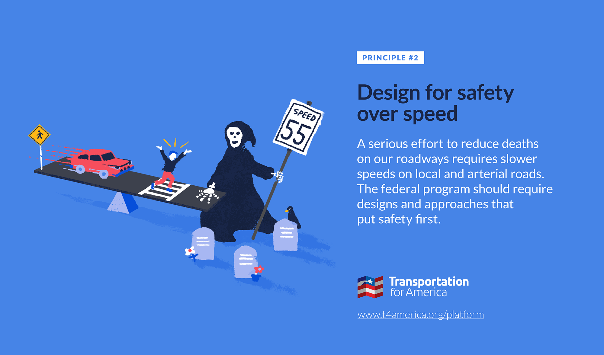
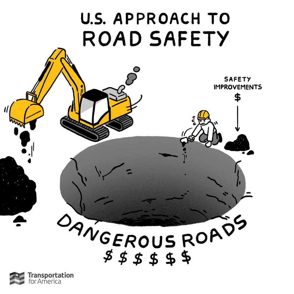
Because of a mistake by Congress in the 2021 infrastructure law, 40 percent of the new $1 billion-per-year Safe Streets for All program must be directed to planning rather than constructing tangible infrastructure projects. A clarification that the planning grants can support quick-build safety demonstration projects presents an enormous opportunity for cities and towns to directly tap the available $400 million and experiment with low-cost temporary street safety projects. This is the first of two blogs regarding opportunities to use this funding. To learn more, read part two here.

Overhead photo of a three-lane street in Chattanooga, TN, where a quick build demonstration project has resulted in additional crosswalks, activated sidewalks, and bollard-protected bike lanes
Photo by Kurt Martig, courtesy of the City of Chattanooga.

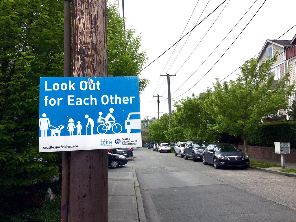
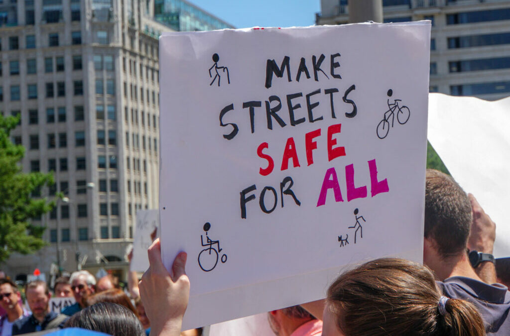
Cities and towns can typically make street safety improvements in one of two ways: they can spend their own local money on streets that they control, which comes with its own set of challenges, or they can engage their state DOT which controls federal formula transportation dollars and many of the most dangerous streets. The new Safe Streets for All (SS4A) program was so crucial because it created a new way for cities, towns, and counties to directly access federal funds to quickly create and execute on Vision Zero plans.

After Congress’s mistake requiring 40 percent of SS4A to go toward planning grants, USDOT wisely broadened their definition of planning to include demonstration projects. This creates an incredible opening for cities to receive funding to pilot temporary street design changes.

The program has $5 billion over the life of the infrastructure law, or about $1 billion per year. The next round of funding is expected to be made available this month, and cities of all sizes should consider applying for planning grants that can support quick-build demonstration projects.

What are quick-build demonstration projects?

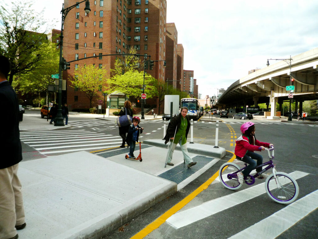
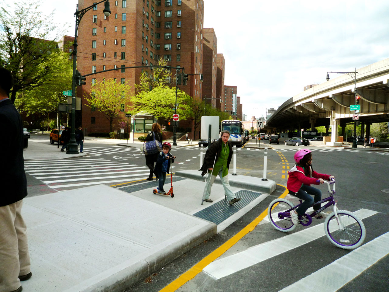
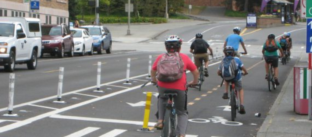
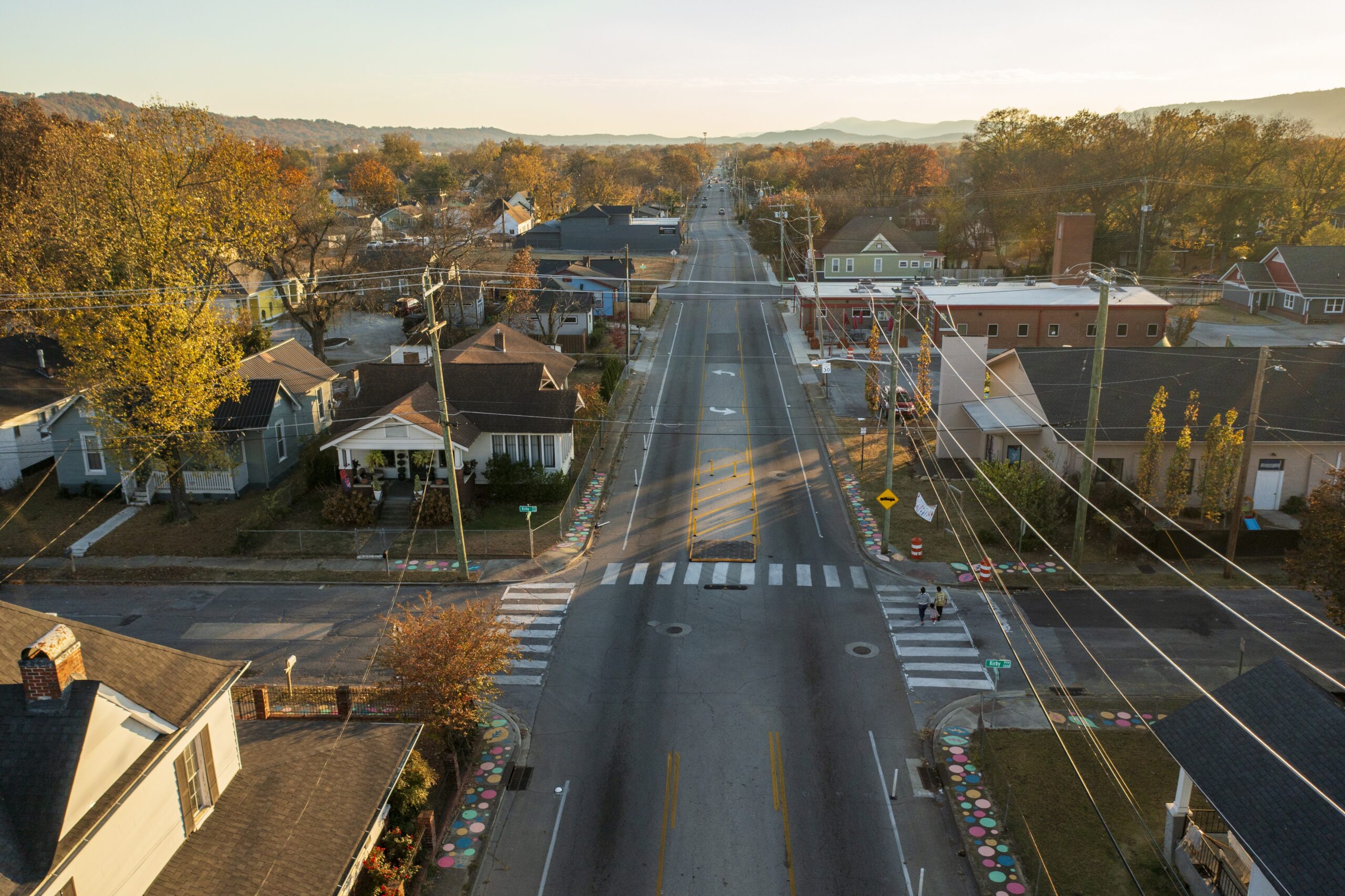
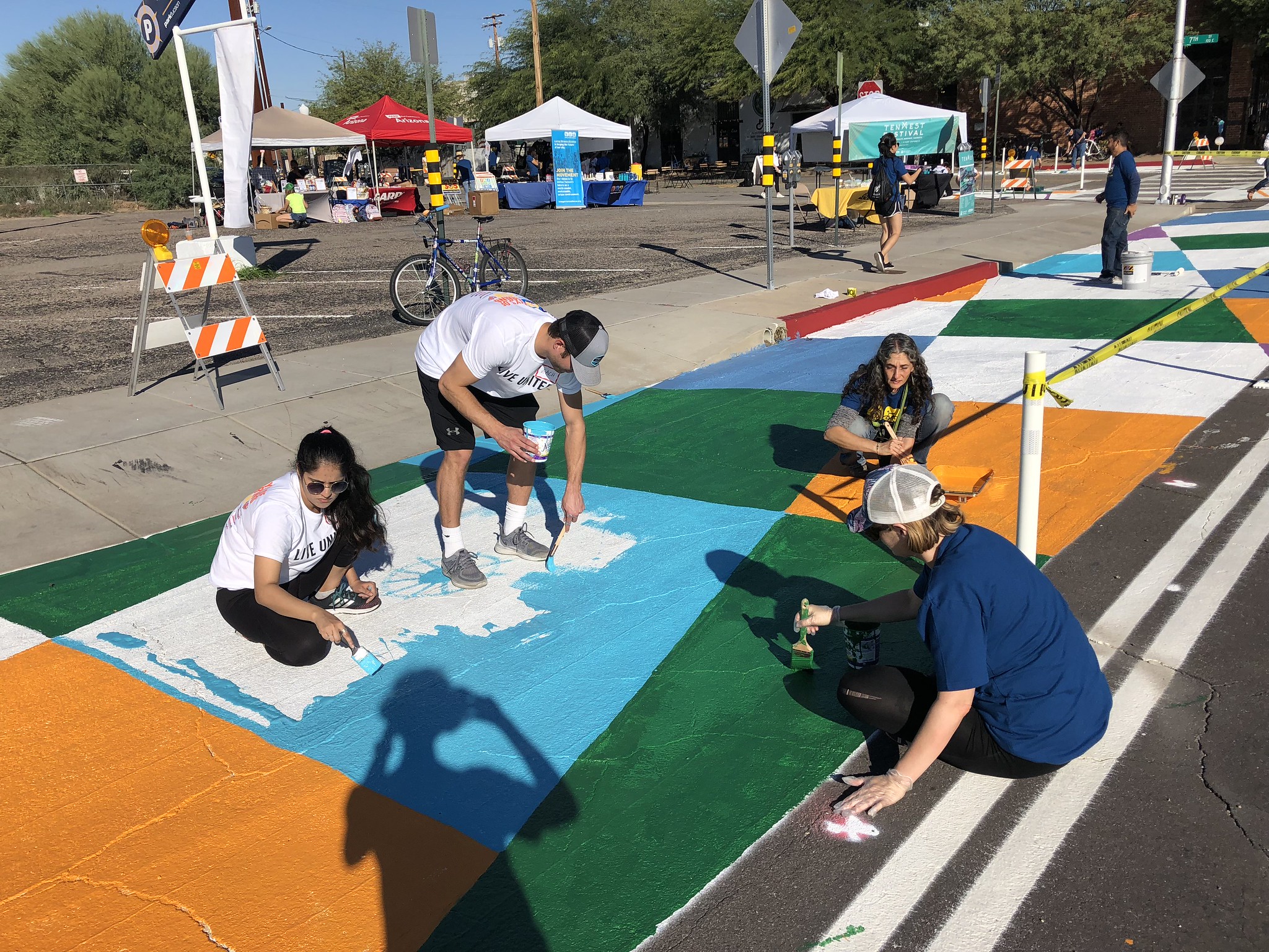
Quick-builds, also known as demonstration projects or tactical urbanism projects, are temporary, low-cost improvements to test new changes to street design.

These quick, light, flexible, adaptable projects allow everyone involved—community members, transportation staff, elected leaders—to test specific designs and interventions that measurably improve safety and convenience for everyone who uses the street, all while gathering valuable feedback. They incorporate methods and designs that are proven to reduce crashes, injuries, and fatalities—documented and supported by the Federal Highway Administration (FHWA).

Even though temporary, these projects are a vital first step toward making real, tangible changes. And many demonstration projects often end up staying in place indefinitely, or (more typically) forming the basis of the design for a permanent project to come later. The process of creating and executing them builds new knowledge and partnerships—within the transportation department and even with other jurisdictions, related agencies, and advocates—that are vital for building permanent projects.

Tucson residents paint the street orange, green, blue, and white to draw attention to a bike lane in their Complete Streets demonstration project.
Photo courtesy of Living Streets Alliance staff. From Smart Growth America’s profile of Tucson’s Complete Streets policy.

Why should a community consider quick-build projects?

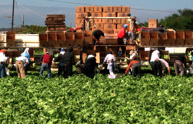
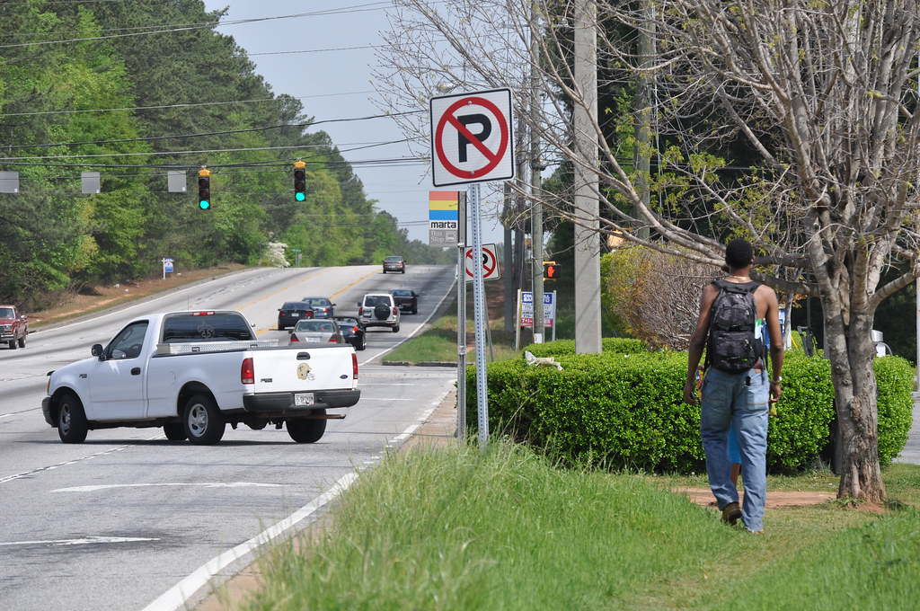
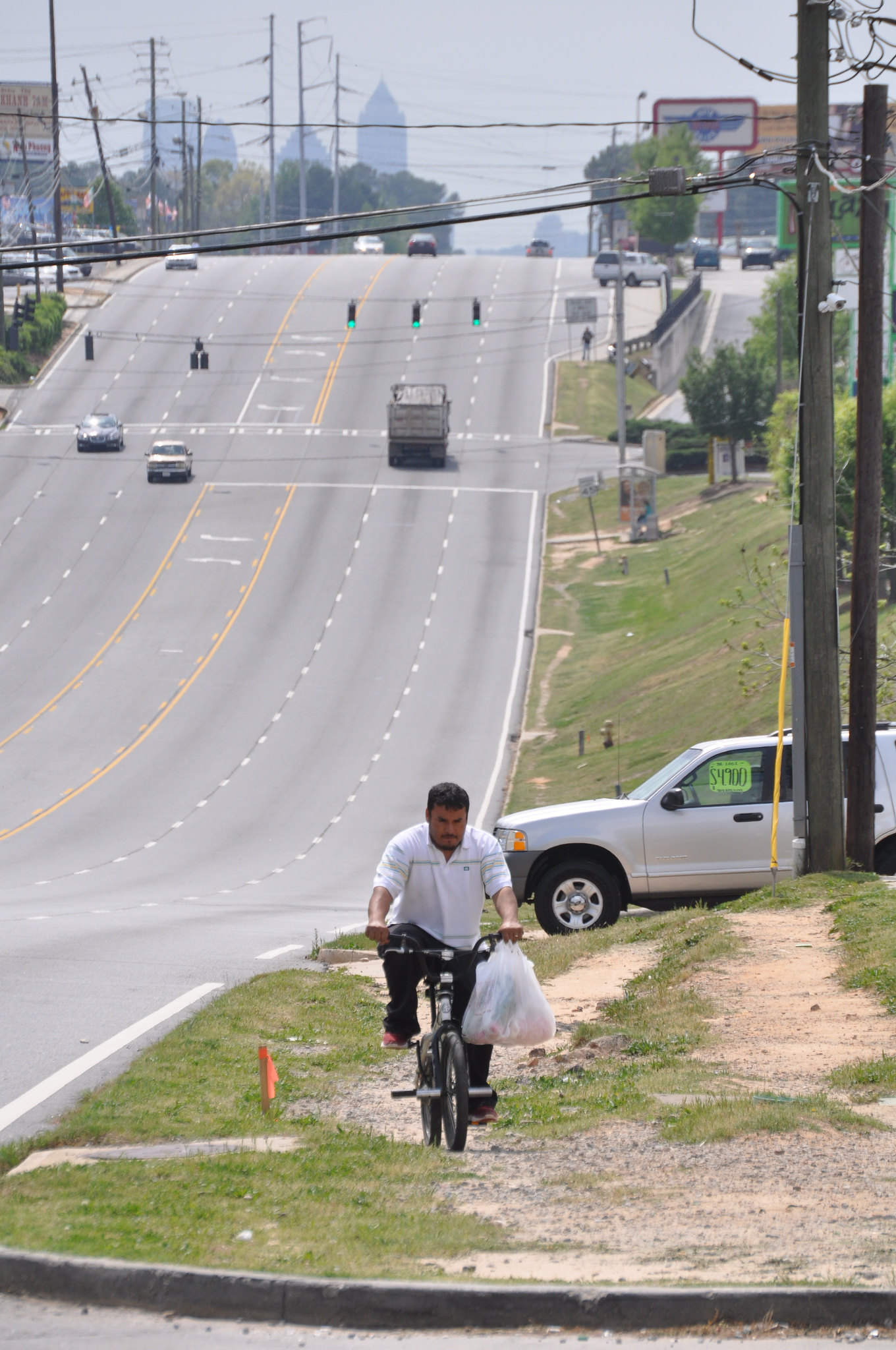
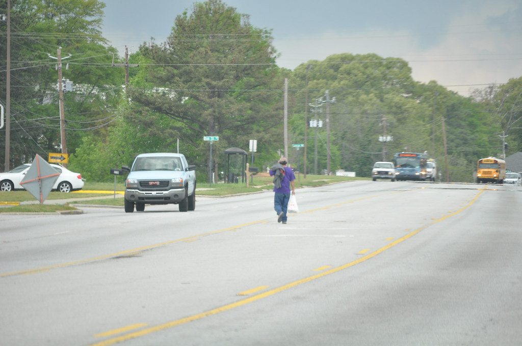
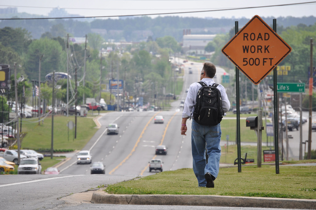
Doing something concrete—even temporarily—is a powerful way to improve safety for people walking, biking, rolling (and driving), and demonstrate an ongoing commitment to protecting all road users. It also shows how stemming the tide of preventable traffic deaths and injuries requires immediate action, creativity, and a willingness to test new things. Despite the urgent need to make streets safer immediately, even the most simple, common sense projects to build new crosswalks, widen sidewalks, add a new bike lane, or make other improvements for safety and convenience can take a lot of time and money.

Quick-build projects are one way to make some level of improvement nearly overnight at an incredibly low cost, while providing a venue for gathering valuable feedback, testing the impact of the changes, and surfacing potential pushback from community members who might oppose a permanent project. In some cases, quick-build projects end up staying in place until capital budgets and planners can execute a permanent project.

Smart Growth America will soon be releasing a summary of their 2023 Complete Streets Leadership Academy, where they worked with 10 cities and four state DOTs to design quick-build demonstration projects on state-owned roads. Stay tuned!

Demonstration projects can also be incredibly cheap. We’ve supported numerous successful demonstration projects over the last few years with grants as low as $5k-15k. Imagine what a city could do with $1 million to support a Vision Zero planning effort that’s paired with as many demonstration projects as they can build with several hundred thousand dollars?

Nearly $1 billion will be available for planning grants alone

The notice of funding availability (NOFO) from the US Department of Transportation is expected to be released sometime in February, so cities, towns, counties, metro areas or others interested in putting an application together should be getting their act together now. Unlike other USDOT grant programs that are oversubscribed, this one is far less competitive: Nearly every jurisdiction that applied for planning grants so far has been awarded funds.

In fact, over the first two rounds, USDOT didn’t receive anywhere close to $400 million in applications for planning grants. This means that nearly $450 million is rolling into this round and between $900 million and $1 billion is expected to be available for planning activities (and demonstration projects!) in this round alone. That’s an enormous sum.

This is only a temporary fix—in more ways than one

Congress made this mistake, and Congress will have to be the one to fix it. But a legislative fix is a long shot and changes to the makeup of Congress or the administration next January could complicate things further. This is just the second year of SS4A funding, and many cities already have Safety Action Plans created. As more planning funds are awarded, cities will need more capital grants instead of planning dollars. A million more demonstration projects would have a significant impact, but we need permanent changes on our streets, and more of the SS4A program should be devoted to making those permanent changes.

Finally, while demonstration projects are productive for all the reasons listed above, they’re still just short-term solutions to the long-term crisis of streets that are unsafe and inconvenient for people to use without a car. The best quick-build projects will make people safer today while also supporting and advancing local plans to apply for future implementation dollars, or create a foundation for other long-term solutions to address fatalities.

Eliminating driver error doesn’t work. What does? Part II: Designing solutions

In part I of this blog series, we reviewed the evidence on three roadway safety strategies that rely on changing driver behavior—education, enforcement, and technology—to show where they fall short in making America’s roads safer. Design-based solutions, which accept and plan for human mistakes, can avoid the pitfalls of behavioral solutions. A recent report from New York City’s Department of Transportation sheds some light on which of those solutions work best—and for whom.

Streets and roads designed for safety—not speed—are tried and true interventions that reduce injuries and deaths. They require minimal driver education, because self-educating driver cues are built in. They have self-enforcing geometric features that force drivers to obey traffic laws without the threat of police violence. And while technology can be a critical part of safe road design, slower vehicle speeds lessen the need for fast-acting automated systems to avoid crashes. 

What does a safely designed street look like? Fundamentally, it is a street with features—like narrower and fewer lanes, extended curbs, and bike lanes—that accept the mistakes made by human drivers and induce slower vehicle speeds to minimize the danger caused by those mistakes. Safe streets better reflect the complexity of a street with many different types of traffic, and are often called Complete Streets. Safe streets are going to look different in every place they’re implemented, since they are necessarily responsive to local contexts. But across the board, safe street design 1) lowers speeds and 2) considers all road users.

Evidence from the Big Apple

A recent report from New York City’s Department of Transportation (NYC DOT) provides some of the best data to date on the effectiveness of seven specific features of NYC’s safe street design efforts: road diets, conventional (unprotected) bike lanes, protected bike lanes, pedestrian islands, curb and sidewalk extensions, turn calming, and leading pedestrian intervals. Read more on each of these features in the report.

Percent change in pedestrian injuries and those killed or seriously injured (KSI). Source: NYC DOT

The results of the report show a massive impact from safe street design. In the above table, KSI stands for pedestrians killed or seriously injured. All the design features significantly reduced pedestrian deaths and injuries, with all but conventional bike lanes reducing pedestrian deaths and serious injuries by over 25 percent. These safety benefits were even more pronounced for senior pedestrians.

Percent change in driver injuries and those killed or seriously injured (KSI). Source: NYC DOT

The safety benefits also extended to motor vehicle occupants, with all the features but turn calming (which was affected by a small sample size) reducing injuries and deaths for motor vehicle occupants at nearly the same rate as pedestrians.

Street design as a core safety strategy

One of T4A’s core principles is to design for safety over speed. Read our full platform.

The cross-user benefits of safe street and road design are not unique to New York City. A review done by the Federal Highway Administration (FHWA) of rural roadways in Warren County, Pennsylvania and Augusta County, Virginia found that self-enforcing, safer street design led to fewer crashes. RAO Community Health, a nonprofit in the highly car-dependent Charlotte, North Carolina, has begun modeling the benefits of safer street design to the city’s most vulnerable communities.

Every year, more states and localities all around the country recognize the safety benefits of Complete Streets, adopting policies to promote their construction. The U.S. Department of Transportation has incorporated the principles of safe street design into their national Safe Systems Approach.

The core of the success behind design is simple: it slows vehicles down. The basic fact of the matter is that vehicle speed and road safety are opposing forces. The higher a drivers’ speed, the greater risk of fatalities. No amount of education, enforcement, or technology can make up for the fact that mistakes are inevitable. Safe street design can ensure that mistakes need not be fatal.

What’s next?

Advocates and governments should leverage the well-documented track record of safe road design in reducing crashes, injuries, and fatalities (both domestically and internationally) to push for its adoption in every jurisdiction around the country. The Vision Zero movement has done excellent work in shifting the paradigm toward design. Nearly 40,000 people were killed on our roadways in 2020. If the U.S. wants to cut down this unfathomable number of fatalities, every community will need to rethink its road design standards. 

Changes at the federal level could work to support these local efforts. For one, the FHWA needs to incorporate its Safe Systems Approach into its new Manual for Uniform Traffic Control Devices (MUTCD), the national standards for roadway design used by every jurisdiction around the country. Better national guidance on safe streets will encourage more localities to act. But it’s worth noting that the MUTCD is not gospel. State and local governments can design roads in any way they want. Advocates should remind their local officials of this fact.

In addition, FHWA must marshal all available federal funds toward safety projects. This includes not only small, safety-specific competitive grant programs like Safe Streets and Roads for All, but also broader programs like RAISE grants and federal formula dollars. We’ve outlined a strategy for federal safety spending here > >

Now you know what works, but how can you communicate the need for design to practitioners? Stay tuned for part III of this series, which will include useful advice on doing just that.

Safety and mobility choice through rural California

Juxtaposed by a well-supported bike ride from San Francisco to Los Angeles, there are many people in rural communities, particularly agricultural workers, along the route that are in critical need of vital, reliable, affordable transportation options, and suffer dire health and economic consequences as a result.

Agricultural workers harvesting lettuce in Salinas, CA. Photo from Flickr/yaxchibonam.

The 2022 AIDS/Lifecycle bike ride (June 5-11, 2022), a seven-day, 545-mile ride from San Francisco to Los Angeles raising awareness, advocacy, and financial support for community services for those afflicted with HIV, passes through many rural agricultural communities. Through Marina, Salinas, Gonzalez, King City, Bradley, Paso Robles, Santa Maria, or Lompoc, community members bike or walk along the side of the road in dangerous conditions like non-existent shoulders and roadways in need of maintenance or repair. I recently had the honor, privilege, and ability to participate in this bike ride, and along the way, I observed what is so often observed on U.S. streets: when our transportation system prioritizes vehicle speed over all else, other road users fall through the cracks. 

T4America Policy Director Benito Pérez, stopped by agricultural fields near Salinas, CA.

It is quite the experience and privilege to ride through the beautiful California countryside, supported by medical and bike tech teams. If I got tired or felt sick from riding, I could stop and get a ride to the next rest stop or hop on a chartered bus to the next overnight camp stop. This unfortunately is not an option for residents and workers alike in these rural communities. Along our route, biking infrastructure was scarce, and other convenient modes of transportation like public transit are often hard to come by. Those of us participating in the bike ride could easily spot rural residents and workers biking for long distances on unprotected paths.

Add the additional pain of high gas prices and scarce and infrequent public transportation options, and many people are left with little option but to walk or bike on hazardous roads with high speed or very large freight vehicles and tractors. For undocumented workers or people living paycheck-to-paycheck who have to show up in-person for work, high gas prices become even more of a barrier and can force people to other modes of travel, even when safe infrastructure is lacking. I observed one woman biking with a shopping cart tied to her bike to carry her goods home. 

Dangerous rural roadways aren’t specific to California. Over 1 million rural households across the nation have limited mobility options. Leaders in many rural communities are standing up and looking to make changes to improve transportation choices and safety. In California, the city of Salinas has an active Vision Zero program, enacted in 2020, looking to stem the tide on roadway fatalities. Communities like Lompoc are actively looking at policy and funding opportunities to expand their complete streets program. However, as the bulk of their busiest and most dangerous roads are state-owned, these places will have to rely on the state to make sure rural communities receive the investments they need. That will involve emphasizing a better state of repair on roadways, investing in rural transit solutions (including microtransit), not to mention supporting transportation investments, policies, standards, and strategies advancing safety and mobility choice for all roadway users.

Despite the support that cyclists on the AIDS/Lifecycle ride received and the increased safety that often comes while biking in larger numbers, a person was still killed on the final day. Roadway fatalities for pedestrians and cyclists continue to rise, and without making an effort to address the dangerous conditions on our roadways (mainly, the lack of safe infrastructure for road users outside of vehicles), this trend can only be expected to continue. (The 2022 edition of Dangerous by Design, produced by Smart Growth America and the National Complete Streets Coalition, addresses how our streets are designed for vehicles at the expense of all other road users.)

This ride was an experience for the impact it has to its mission, but it also was an experience to “ride in the shoes” of the many residents in these rural communities in Central California, only a sliver of many rural communities in America clamoring for safe, reliable transportation choices for their socioeconomic and health well-being. Often, political leaders assume that all rural residents drive, or only drive, and any investments in other modes of transportation are somehow out of touch with rural needs. But the fight for safer streets and more convenient methods of transportation can’t stop at city limits. That mindset leaves far too many behind.

Vision Zero won’t happen without Safe Streets for All

Seattle Vision Zero sign: Look Out for Each Other
Signs like this one, while welcome, aren’t enough to lower the ever-climbing rate of pedestrian fatalities. Fortunately, localities have other resources to make on-the-ground changes. Image from Flickr/SDOT

The infrastructure law created a new grant program to help communities tackle the increasing rate of roadway deaths. The Safe Streets and Roads for All program allows localities to take direct steps to improve safety for all roadway users, whether they’re setting up a Vision Zero plan or actually planning, designing, and constructing street safety improvements. Funding is available now.

Is there a particularly dangerous street near you? We and Smart Growth America want to see it. Share photos and videos of your streets on Twitter with #DangerousByDesign and/or tagging @SmartGrowthUSA. Learn more on Smart Growth America’s website.

In a recent House Transportation and Infrastructure Committee hearing, expert witnesses and representatives alike expressed their commitment to Vision Zero as well as their concern for underserved and marginalized communities. Representative Hank Johnson (D-GA) got the discussion started, and his words are worth repeating:

Rep. Hank Johnson speaking

“While pedestrian safety impacts all Americans, the risks are not evenly distributed. According to a recent Governor’s Highway Safety Association study, Black children ages four to 15 had the highest rates of fatalities involving pedestrians as a percentage of all motor vehicle traffic fatalities.”

Up to this point, localities across the United States had to rely on their own resources or engage in long, frustrating negotiations with their state DOTs to tackle roadway safety issues with existing federal formula funds. Now, localities that want to implement Vision Zero plans have a more direct route to funding and guidance through the new Safe Streets for All (SS4A) program. Created by the infrastructure law, the SS4A program sets aside $6 billion over five years to fund studies, planning, and project construction to increase the safety of all road users and shift the paradigm in road construction to safety over speed.

The Safe Streets for All program is open for business

The USDOT has released a Notice of Funding Opportunity for local authorities, state and local governments, tribal groups, and metropolitan planning organizations (MPOs). Any of these entities can now apply alone or through a joint application with other entities (encouraged). Because of the historical complexities in applying for federal grants, the USDOT’s R.O.U.T.E.S. tools have been made available to support communities needing technical help with applying and processing grants, especially rural and underserved communities.

The Federal Highway Administration (FHWA) requires a Comprehensive Action Plan (otherwise known as a Vision Zero plan) prior to funding the planning and construction of safety projects with SS4A program dollars. SS4A funding opportunities are available for applicants in varying stages of Vision Zero planning. Applicants who are starting from scratch or who require a considerable amount of work to complete an Action Plan should apply for an Action Plan Grant (or a Supplementary Action Plan Grant for plan update work). An Action Plan Grant consists of a safety analysis, equity considerations, planning structure, and other aspects that culminate in a plan to achieve the goal of Vision Zero. Likewise, applicants who are ready to build projects in their Vision Zero plan should apply for an Implementation Grant.

Type of grantMax funding
Implementation Grant$30 million
Action Plan Grant (localities or tribal governments)$1 million
Action Plan Grant (MPOs)$5 million

Drawing from the program’s $6 billion, the FHWA expects to fund hundreds of Action Plan Grants and about 100 Implementation Grants. As shown in the table above, different allotments of funding are provided for different stages of implementation (with the maximum amount of $30 million provided for Implementation Grants). If an applicant is selected for a grant through SS4A, the entity must commit to Justice40 goals including the allocation of 40 percent of funding to low-income or underserved communities.

After the application process, the FHWA will assess applications using criteria considering safety, equity, effective practices and strategies, project readiness and more.

Maximizing the potential of programs like SS4A is essential

An excavator digs a massive hole titled "Dangerous Roads $$$". On the other side of the hole, a man tries to fill the hole with a small pile of dirt (labeled "Safety Improvements $." The comic is labeled "U.S. Approach to Road Safety."
Produced for T4America by visual artist Jean Wei. IG/@weisanboo

While disappointing but not surprising, the majority of funding from the infrastructure law sticks to the status quo of giving states wide flexibility with their federal dollars, which many states use to widen roads, build new ones, and/or prioritize speed above safety, often perpetuating the same problems that programs like SS4A are created to solve. (Dangerous By Design 2022, an upcoming report created by the National Complete Streets Coalition and Smart Growth America, will get into some of these concerns.) For this reason, it’s vital that every dollar of the new SS4A program is maximized, helping as many communities as possible capitalize on this opportunity to create safer, more equitable roads that serve vulnerable road users. USDOT should act upon their commitment to equity within this program and prioritize projects that mitigate danger in marginalized communities, where the most vulnerable road users live and travel.

SS4A applications are due on September 15th. Transportation for America members get hands-on assistance in application to competitive grants such as the SS4A. Those interested in becoming members can inquire on our site.

Transportation for America members have access to exclusive resources that provide further detail on this topic. To view memos and other members-only resources, visit the Member Hub located at t4america.org/members. (Search “Member Hub” in your inbox for the password, or new members can reach out to chris.rall@t4america.org for login details.) Learn more about membership at t4america.org/membership.

Transportation for America members have access to exclusive resources that provide further detail on this topic. To view memos and other members-only resources, visit the Member Hub located at t4america.org/members. (Search “Member Hub” in your inbox for the password, or new members can reach out to chris.rall@t4america.org for login details.) Learn more about membership at t4america.org/membership.

How local governments can overcome delay and obstruction (part two)

protected bike path filled with cyclists

Local government practitioners are often highly motivated to invest in safer street designs. But they soon encounter insurmountable barriers from the state DOT, which holds the purse strings, owns the roads and highways that also serve as local streets, and interprets federal rules in ways that elevate their priorities and push safety down the list. Here are some ways for local elected officials and municipal staff to break through those barriers.

protected bike path filled with cyclists
How can local government officials overcome delay to create more projects like this? SGA photo from the Benefits of Complete Streets website

In the first installment of this series, we explored ways local advocates can overcome some of the barriers frequently thrown up by local government practitioners focused on preserving the status quo. But in many places, the local elected leaders or practitioners want to do the right thing but are stymied by state DOTs and even federal regulations.

Here are some of the obstructions that local planners and engineers often encounter with their state DOT and even federal agencies like the Federal Highway Administration (FHWA), and how they can respond to move toward real solutions that go beyond the status quo of dangerous fast streets that fail to prioritize and accommodate people walking, biking and riding public transit.

1) “We allow plenty of innovative designs, but federal rules don’t allow what you’ve submitted.”

State DOTs often (and often incorrectly) interpret federal rules in ways that make it more difficult for local jurisdictions to use federal funding. There are two steps to overcoming this issue. First, ask the state DOT rep to show you the language in federal code that prohibits your proposed design. Both US Code and the Code of Federal Regulations are available online as are most state codes, so you can look at what they send and see if the code actually says what they say it says. (Or ask an outside expert to weigh in.) 

If they do produce language, but the interpretation is questionable, you can start thinking about going above them. If this is a state DOT engineer’s interpretation, ask the agency’s policy team and/or legal team to provide an opinion on interpretation. Even if this doesn’t change the state DOT stance, it will shine light on the agency’s thinking (and if state rules are influencing the interpretation), thus informing future conversations.

If the state DOT stance hasn’t changed to your satisfaction, you can choose to involve FHWA. Ask for a joint meeting with the state DOT rep and your local FHWA regional representative. (As we noted in the first post about localities, states very often claim things about federal standards that are patently untrue.) It can also be productive and helpful to develop a relationship with someone in the national USDOT office.

While these steps can help get your project done, it still may involve additional work and expense like applying for exceptions. For example, state standards often require car lanes to be 11 feet wide or more, even though 10-foot lanes are often adequate and can even help slow traffic, making a road safer. If engineers have to file for an exception every time they need to shrink the lanes to fit in bike lanes or sidewalks, they are in effect being punished for doing the right thing.

When you explain the burden of applying for exceptions, the state agency may say:

2) “We can provide you with examples of best practices for how to apply for exceptions and/or make designs comply with unwieldy requirements.”

The main counter argument here is that the fact that just because some people somewhere figured it out does not mean that it is easy for others to do so. And it is usually very hard.

That point aside, standards should be flexible enough to allow slow-speed designs by right, and should catch up to the most innovative designs for safe and protected bike and pedestrian infrastructure, so that practitioners doing the best designs aren’t forced to take extra steps. The safest, best designs should face the least bureaucratic obstruction, not the most. Wider lanes and designs that prioritize speed first should require the exceptions—if at all—not the other way around.

So they say…

3) “We can publish guidance explaining why people can use the street design element you are proposing.”

This of course does very little to defray the difficulty and expense of having to jump through hoops to do the right thing. Doing the right thing should be easier and the default way of operating, rather than the exception.

When you explain the cost and difficulty of applying for exceptions, this often leads back in a circle to 1) but with the addition of:

4) “Oh, we can’t afford to do that.”

Again, ask them to show you where in the rules and regulations it is written that what you are proposing is not allowed. Ask them to cite the specific text and provide links to its location. Put the burden on them to show their work in a way that can be examined. This is a step where involving USDOT or a local FHWA office in the discussion may again become important, and where engaging not just the local office, but the national office (or outside experts or advocates like T4America) may be relevant. 

This could be a good time to go above the staff to the governor who is ultimately their boss, especially if they are claiming that funding is part of the issue. Your city council members or mayor may want to be a part of that conversation. Elected leaders determine budgets based on what they see, and can redirect the process and/or adjust the budget in future cycles.

We shouldn’t allow red-tape, real or imagined, to stop us from building the best possible transportation networks that fully serve everyone in our communities. Hopefully this short series will help everyone sharpen their scissors. Good luck to us all!

Want to see how advocates can overcome delay and obstruction? Visit part one of this series for more useful tips.

How advocates can overcome delay and obstruction (part one)

Advocate holding a sign that says "Make streets safe for all"
Activist holding a sign that says "Make streets safe for all"
Fickr photo by Ted Eytan

Local advocates fighting for safe streets and expanded transportation options will often struggle to make progress in places because transportation planners and engineers are entrenched in old ways of doing things. We’ve identified some patterns in the ways the establishment can block reforms and offer suggested ways to overcome those obstructions.

If you’re a local transportation advocate, you’ve probably tried to advocate for change with your local government only to find that you seem to be getting nowhere. Transportation policy is full of acronyms and layers of government that can make it hard to figure out who is responsible for what, and some local agency officials use their insider knowledge to stymie real debate and maintain the status quo. And overall, the world of transportation planning and engineering is like a massive, slow-moving ship with a tiny rudder. 

Changing deeply ingrained practices is an uphill battle, and this is why outdated standards and measures and models from decades ago continue to guide how we design and build our transportation networks. (For an incredible look behind the curtain on how transportation agencies operate with some suggestions for breaking through, do not miss Chuck Marohn’s terrific book Confessions of a Recovering Engineer.)

As an advocate, you may find yourself walking away empty handed multiple times from conversations you were sure would generate some progress, and many status quo purveyors have several ways to divert the conversation, each time setting back progress for months or more. This process can be so frustrating that some advocates have resorted to making necessary changes themselves, as Crosswalk Collective L.A. did when the city failed to add crosswalks, but we can’t always roll up our sleeves and paint our needs into reality.

Here are some things we have heard from local public agency staff about transportation reform proposals that have the potential to block progress, and some ways you can respond to push forward–and hopefully knock down multiple roadblocks at a time.

1) “Good news! We’re already doing that.”

The best way to respond to those who think they’re already doing the good stuff is to just point to the outcomes. For example, how many people have been hurt or killed in collisions on the agency’s dangerous streets? This is one reason why one of our leading messages on the last Dangerous by Design report about pedestrian safety was so simple—by every single measure that matters, our current strategy to improve safety is a total and complete failure.

Our current approach is addressing the rising number of people struck and killed while walking has been a total failure. It needs to be reconsidered or dropped altogether.

How many people are walking and biking? Rather than seeing low walking and biking rates as a vindication of ignoring these needs, consider what it says about the public’s view of the streets. Can we consider the status quo successful if few feel safe enough to use them despite polling showing that people want to walk and bike, while other communities that have much higher shares of people walking or biking? 

Are the outcomes in line with stated city goals? Often there may be a comprehensive or transportation master plan with goals for percentage of trips taken by walking, biking, transit, or other active modes. You can ask the practitioner to show how the project’s outcomes serve stated goals, but it may be helpful to have examples in your back pocket.

2) “The [local, state or federal] rules prevent us from doing that.”

Don’t take them at their word. Ask them to show you where in the rules and regulations it is written that what you are proposing is not allowed. Ask them to cite the specific text and provide links to its location. As one example, city and state traffic engineers (still!) routinely claim that they “have to” prioritize vehicle level of service on street projects (often at the expense of safety), but this is patently untrue. Back in 2016, FHWA took the significant step of sending a letter to make this abundantly clear, which we wrote about at the time:

FHWA just gave the green light to localities that want to implement a complete streets approach. By making clear that there is zero federal requirement to use level of service (and that there never has been), FHWA is implying that transportation agencies should consider more than just traffic speeds when planning street projects.

Both US Code and the Code of Federal Regulations are available online as are most state codes, so you can look at what they send and see if the code says what they say it says. However, the trick here is that they might not even know, and/or, when they look it up, they may find out the rules / data / best practices don’t say what they think they say. They may be basing their assumptions on rules or guidance that has since been updated. Or they are making claims that they know are hard for everyday citizens to refute. Put the burden on them to do the research and back up their claims.

(Sometimes state or federal rules really are an issue. Stay tuned for part two of this series on how you can help your local government overcome this barrier if it is real.)

3) “We don’t have the budget for that.”

Yes, but how was the budget created? What were the core assumptions? What was the stated purpose of the project from day one? Was the project “scoped” before the full range of needs were ever considered?

Often you will find that transportation project planners and engineers set the budget for a project based on a design for cars and trucks before they ever take into account non-driving modes. After they’ve set the budget, they hear from community members that they want changes, and act as if there is nothing they can do—changes would only add to the cost which would exceed the budget. 

Our colleagues at Smart Growth America wrote about the importance of getting project “scopes” right a few years ago in a longer series about how state DOTs so often are asking the wrong questions, and how they can do better:

One of the biggest barriers to practical solutions is the practice of defining the need for a project as a specific improvement (ex. add a turn lane) instead of a problem to be solved (i.e. northbound backups at Second and Main during the afternoon rush). And when a Purpose and Need statement goes so far as to include a specific approach (add the turn lane), then all other features—sidewalks, crosswalks, pedestrian refuge islands, or bicycle facilities—become “add-ons” or “amenities” which are first to get scrapped when confronted with funding constraints. Starting with a clear definition of the problem rather than a specific improvement can make such “amenities” central components of a future project and open the door to more inexpensive solutions (like retiming traffic lights).

You can point out this flaw in their phasing and indicate to them that they could have designed and budgeted the project for all modes in the first place. We find the budget for whatever our real priorities are. Safety and equity should not need a separate funding pot. Put the failure to budget for the whole project on them. This could be a good time to go above staff to local elected officials who are their bosses. Elected leaders determine budgets based on what they see, and can redirect the process and/or adjust the budget in future cycles.

4) “Yes, great idea! We’ll add it to the queue.”

A “yes” can sometimes just be a way for an agency to get you off their back while burying a task or project behind their own priorities and goals. Counter it by asking how the queue works. Where is the service level agreement? When will it be done? If it’s a priority list, how are projects prioritized? How and when is the list reconsidered? What projects have guaranteed funding and which projects are awaiting future funding?

Sometimes local government practitioners are highly motivated to invest in safer street designs but encounter barriers in their dealings with the state DOT. 

Want to learn how local governments can break through these barriers? Visit part two of our series for more useful tips!

On National Walking Day, too many Americans are still having to endure unsafe streets

Since we missed recognizing National Walking Day last week while the Complete Streets conference was happening in Nashville, we wanted to come back this week and revisit a T4America post from 2012 looking at what’s actually keeping more people from walking in many of our metro areas.

Originally posted on April, 4 2012.

You may not have known it — its not the most publicized special day on the books — but today is National Walking Day. Some of you may have traded part or all of your drive or transit trip today for a walk to work. But for many, every day is walking day, and it happens on streets with dangerous or inconvenient conditions that no one should have to endure just to walk to school, their job, or the grocery store.

Last Friday, I spent some time driving around the sprawling Atlanta, Georgia metroplex photographing some well-known trouble spots for pedestrian safety. Though some improvements have been made in places, there are still so many unsafe streets, corridors and intersections for pedestrians, finding streets that are dangerous by design is about as easy as blindly putting your finger down on a map.

The Atlanta Regional Commission has helped address some of these problems through their popular and oversubscribed Livable Centers Initiative that gives metro communities small grants to help make a dangerous street safer, improve MARTA access, add new crosswalks or streetscaping, or other small improvements to the built environment that help improve quality of life for residents. And the local group PEDS has had their boots on the ground for years now, working hard to make metro Atlanta more walkable. But we need far more of these kinds of efforts — and similar efforts from others in cities across the country — to make the kinds of improvements we need to save lives and end the 4,000-plus deaths that happen to people walking each year.

Many of these deaths occur simply because the design of a road just hasn’t adapted to the changing needs of all the people who use it.

Consider: at one point, Old National Highway in South Fulton County was probably a sleepy state highway through a relatively unpopulated area on ones way south out of Atlanta. Now, its teeming with retail on both sides of the street just south of Interstate 85. Add in the fact that its a relatively low-income area (read: people more likely to walk or take transit) with apartment complexes on both sides of the main highway and you’ve got a street that no longer meets the needs of everyone who uses it, and certainly not for the people who live there.

Metro ATL Pedestrians15

Though the first few miles away from Interstate 85 have sidewalks and there are a handful of signalized intersections with crosswalks, sidewalks soon end completely and there are many stretches where there are no safe places to cross for hundreds or thousands of feet — all in an area with MARTA bus stops on both sides of the highway. The sidewalks may end, but the walking doesn’t, as the desire paths through the grass indicate.

Metro ATL Pedestrians06

Of course, the most well-known road in Atlanta thats dangerous for walking and biking is certainly Buford Highway. This stretch near Clairmont Road is a whopping seven lanes across, with crosswalks often so far apart as to be merely dots on the horizon.

Metro ATL Pedestrians36

This corridor is lined with more affordable apartments and has also been a popular landing place for Latino and Asian immigrants for years, and many portions of the street are filled with small ethnic shops catering to the local clientele — many of whom are likely to be walking. According to the data in our map, in just the few miles from I-285 south down to 400, 20 pedestrians were killed from 1999-2009. There are stretches with no sidewalks on either side of the street and no safe crosswalks almost as far as the eye can see.

Metro ATL Pedestrians41

In this picture alone, not only are there no sidewalks but there are nine separate curb cuts where this man could be easily struck by a right-turning car before reaching the next safe crosswalk at the intersection.

Some key improvements have been made on Buford Highway in recent years, though, which have helped to increase safety. Thanks to recent efforts by Dekalb County and the Georgia Department of Transportation, a busy stretch of Buford Highway south of Doraville with high density of retail on both sides of the street received several new signalized intersections as well as new pedestrian-only mid-block crossings that use a special light called a HAWK signal. This is a light that stays dark until a pedestrian pushes a button, activating a light that flashes before turning red for cars. These crossings also include a refuge to shorten crossing distances and give people a safe place to wait while crossing.


And then there’s southern Cobb County, the northern Atlanta suburb where Raquel Nelson was walking when her son was killed and she found herself prosecuted after the fact. Some busy corridors have sidewalks and some don’t — though walking isn’t very pleasant next to seven lanes of traffic — and crosswalks can be interminably far apart.

Metro ATL Pedestrians24

This photo below bears some similarities to the conditions on the street where Raquel Nelson’s son A.J. was killed, which isn’t too far from here.

Metro ATL Pedestrians21

Note the bus stop on the other side of the street with a Cobb County bus approaching. See a marked crosswalk anywhere? Perhaps this man is trying to catch the bus? What happens when the bus drops you off and you need to reach a destination across the street? Should we really expect people to walk half a mile out of the frame to find a safer place to cross, and then walk half a mile back?

And some streets around here just have zero accommodation for pedestrians, including a busy street that serves two major universities and the county’s biggest employer (Dobbins AFB/Lockheed) right in the center of the county.

Metro ATL Pedestrians26

Keep in mind that these pictures represent just one busy American metropolis — there are hundreds more cities and thousands of places with similar conditions that need urgent attention. We have a long way to go to retrofit these streets to help make them safer for everyone that needs to use them. The complete streets provision in the Senates MAP-21 bill would be a step in the right direction, as would be the flexible funding that local governments can use to help address some of these dangerous areas under the Senate bill. (These provisions are a little out of date now. -Ed.)

With 67 percent of all pedestrian fatalities happening on federal-aid roads — many of which that were designed in this unsafe way because of federal design guidelines and standards — theres a clear role for the federal government to play in improving them.

So what would happen in our communities if we started by looking at our map of pedestrian fatalities to see where the worst trouble areas are and devoted a small slice of transportation money into small, tangible improvements like new sidewalks, new crosswalks, and new signals for making walking safer and more convenient? What if we made it a clear priority to make every day National Safe Walking Day?

Wouldn’t we be saving lives immediately? And for a small price?

What we’re watching: Senate Commerce Committee to mark up six-year transportation bill today

[This blog post is cross-posted from Smart Growth America. – Ed.]

Later today (Wednesday) the Senate Committee on Commerce, Science, and Transportation is scheduled to mark up the Comprehensive Transportation and Consumer Protection Act of 2015 (S. 1732), a proposed six-year transportation reauthorization. As we’ve mentioned here before, the federal transportation bill has huge implications for development across the country. Here’s what we’ll be looking for during today’s proceedings.

The bill currently includes legislation that supports and expands opportunities for transit-oriented development (TOD). The bipartisan Railroad Reform, Enhancement, and Efficiency Act (S. 1626) would expand the capabilities of the Railroad Rehabilitation and Improvement Financing (RRIF) Act, a $30 billion loan program to provide needed financing for transit-oriented development projects and infrastructure near passenger rail stations. This provision also includes provisions to improve rail safety and enhance existing rail infrastructure. These provisions are a big deal: previous transportation bills have not included a rail title, and it’s noteworthy that this bill would include both rail and surface transportation. We’re looking for S. 1626 to remain included in the final bill.

In addition, an amendment to the bill would include components of the Safe Streets Act, originally introduced in the Senate in 2014. The provision would require states and metropolitan planning organizations to adopt Complete Streets policies for federally funded projects. We’re looking for the Safe Streets amendment to be adopted in the final bill.

Finally, the bill would dramatically alter the U.S. Department of Transportation’s highly successful Transportation Investment Generating Economic Recovery (TIGER) grants. As written, the bill would refocus TIGER funding towards a new multimodal grant program exclusive to freight infrastructure. Hundreds of communities have used TIGER grants to catalyze local transportation investments and safety improvements. We’re looking to see the TIGER program retain its competitive, multimodal mission in the final bill.

Help defend the TIGER program: Send a message to your Senator TODAY >>

Ultimately the Senate Commerce Committee’s bill will be combined with bills from the Environment and Public Works and Banking committees. The final resolution could come to the floor for consideration by the full Senate as early as this week. The House of Representatives is also currently considering its strategy for transportation. No word on when the two chambers will come together on a final resolution.