Since we missed recognizing National Walking Day last week while the Complete Streets conference was happening in Nashville, we wanted to come back this week and revisit a T4America post from 2012 looking at what’s actually keeping more people from walking in many of our metro areas.
Originally posted on April, 4 2012.
You may not have known it — its not the most publicized special day on the books — but today is National Walking Day. Some of you may have traded part or all of your drive or transit trip today for a walk to work. But for many, every day is walking day, and it happens on streets with dangerous or inconvenient conditions that no one should have to endure just to walk to school, their job, or the grocery store.
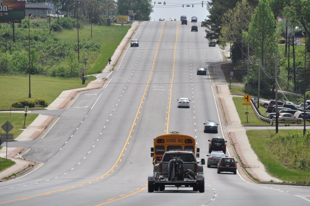
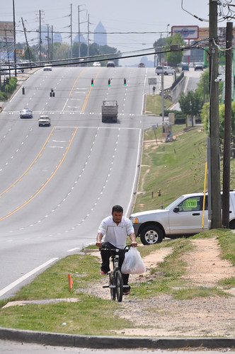
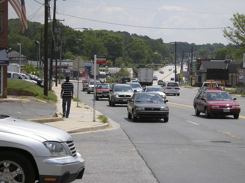
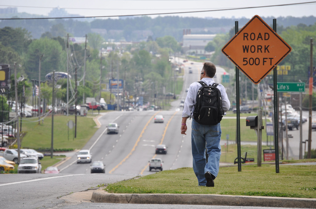
Last Friday, I spent some time driving around the sprawling Atlanta, Georgia metroplex photographing some well-known trouble spots for pedestrian safety. Though some improvements have been made in places, there are still so many unsafe streets, corridors and intersections for pedestrians, finding streets that are dangerous by design is about as easy as blindly putting your finger down on a map.
The Atlanta Regional Commission has helped address some of these problems through their popular and oversubscribed Livable Centers Initiative that gives metro communities small grants to help make a dangerous street safer, improve MARTA access, add new crosswalks or streetscaping, or other small improvements to the built environment that help improve quality of life for residents. And the local group PEDS has had their boots on the ground for years now, working hard to make metro Atlanta more walkable. But we need far more of these kinds of efforts — and similar efforts from others in cities across the country — to make the kinds of improvements we need to save lives and end the 4,000-plus deaths that happen to people walking each year.
Many of these deaths occur simply because the design of a road just hasn’t adapted to the changing needs of all the people who use it.
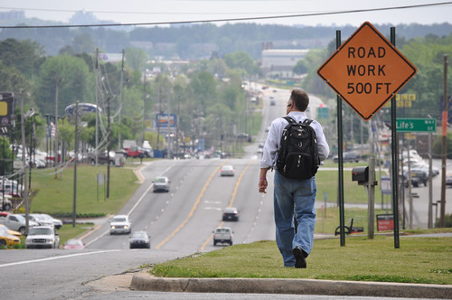
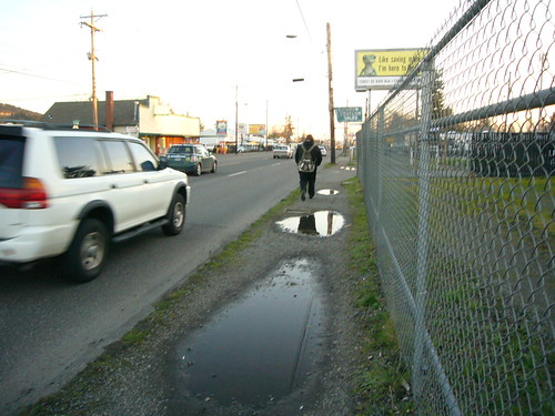
Consider: at one point, Old National Highway in South Fulton County was probably a sleepy state highway through a relatively unpopulated area on ones way south out of Atlanta. Now, its teeming with retail on both sides of the street just south of Interstate 85. Add in the fact that its a relatively low-income area (read: people more likely to walk or take transit) with apartment complexes on both sides of the main highway and you’ve got a street that no longer meets the needs of everyone who uses it, and certainly not for the people who live there.
Though the first few miles away from Interstate 85 have sidewalks and there are a handful of signalized intersections with crosswalks, sidewalks soon end completely and there are many stretches where there are no safe places to cross for hundreds or thousands of feet — all in an area with MARTA bus stops on both sides of the highway. The sidewalks may end, but the walking doesn’t, as the desire paths through the grass indicate.

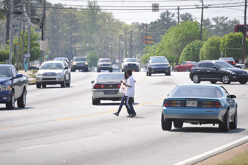
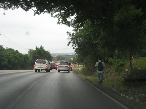
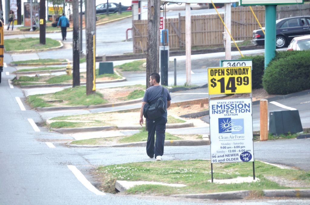
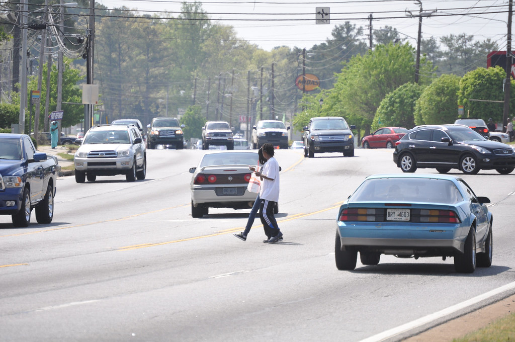
Of course, the most well-known road in Atlanta thats dangerous for walking and biking is certainly Buford Highway. This stretch near Clairmont Road is a whopping seven lanes across, with crosswalks often so far apart as to be merely dots on the horizon.

This corridor is lined with more affordable apartments and has also been a popular landing place for Latino and Asian immigrants for years, and many portions of the street are filled with small ethnic shops catering to the local clientele — many of whom are likely to be walking. According to the data in our map, in just the few miles from I-285 south down to 400, 20 pedestrians were killed from 1999-2009. There are stretches with no sidewalks on either side of the street and no safe crosswalks almost as far as the eye can see.
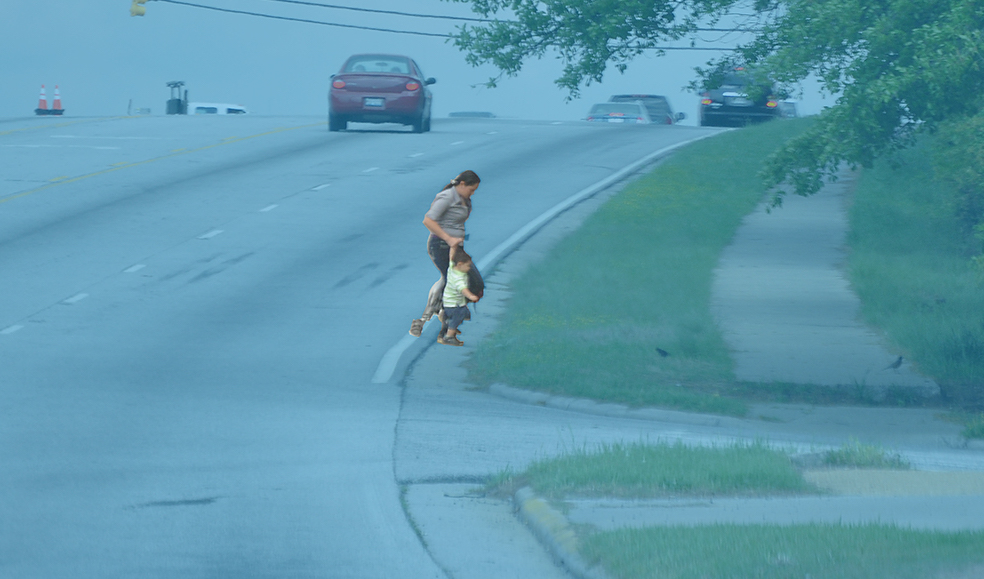
In this picture alone, not only are there no sidewalks but there are nine separate curb cuts where this man could be easily struck by a right-turning car before reaching the next safe crosswalk at the intersection.
Some key improvements have been made on Buford Highway in recent years, though, which have helped to increase safety. Thanks to recent efforts by Dekalb County and the Georgia Department of Transportation, a busy stretch of Buford Highway south of Doraville with high density of retail on both sides of the street received several new signalized intersections as well as new pedestrian-only mid-block crossings that use a special light called a HAWK signal. This is a light that stays dark until a pedestrian pushes a button, activating a light that flashes before turning red for cars. These crossings also include a refuge to shorten crossing distances and give people a safe place to wait while crossing.


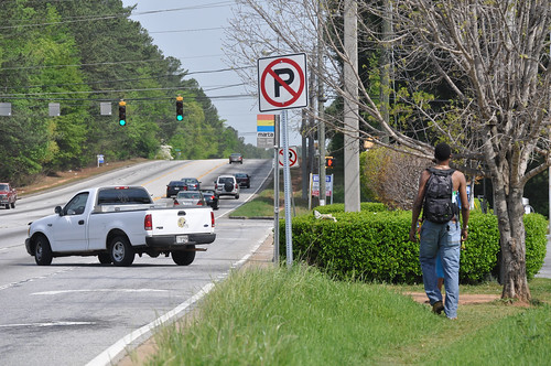
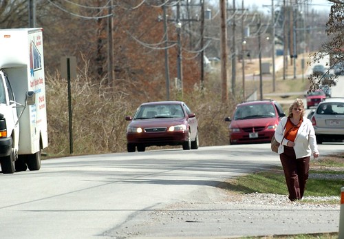
And then there’s southern Cobb County, the northern Atlanta suburb where Raquel Nelson was walking when her son was killed and she found herself prosecuted after the fact. Some busy corridors have sidewalks and some don’t — though walking isn’t very pleasant next to seven lanes of traffic — and crosswalks can be interminably far apart.

This photo below bears some similarities to the conditions on the street where Raquel Nelson’s son A.J. was killed, which isn’t too far from here.
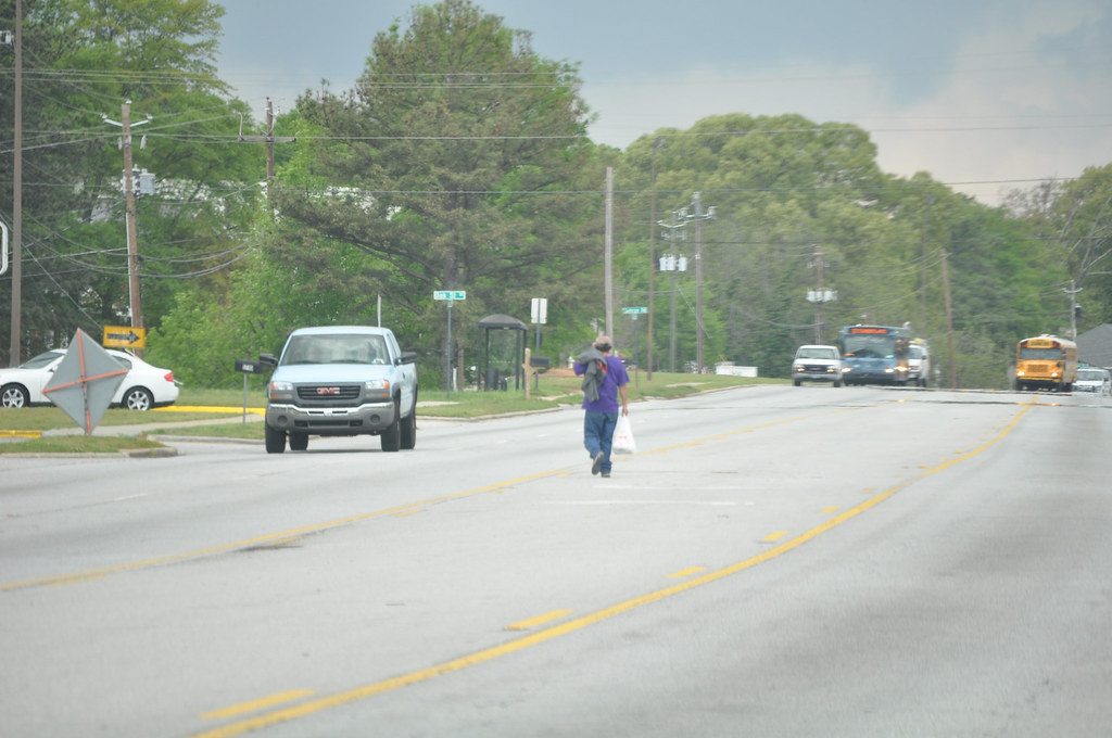
Note the bus stop on the other side of the street with a Cobb County bus approaching. See a marked crosswalk anywhere? Perhaps this man is trying to catch the bus? What happens when the bus drops you off and you need to reach a destination across the street? Should we really expect people to walk half a mile out of the frame to find a safer place to cross, and then walk half a mile back?
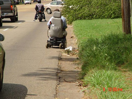
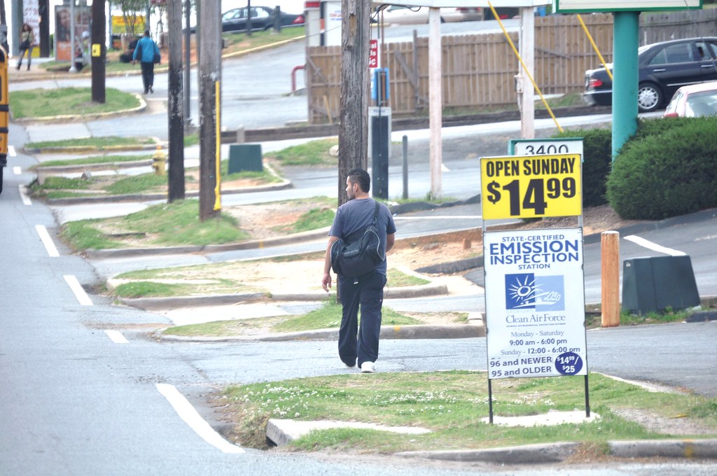
And some streets around here just have zero accommodation for pedestrians, including a busy street that serves two major universities and the county’s biggest employer (Dobbins AFB/Lockheed) right in the center of the county.
Keep in mind that these pictures represent just one busy American metropolis — there are hundreds more cities and thousands of places with similar conditions that need urgent attention. We have a long way to go to retrofit these streets to help make them safer for everyone that needs to use them. The complete streets provision in the Senates MAP-21 bill would be a step in the right direction, as would be the flexible funding that local governments can use to help address some of these dangerous areas under the Senate bill. (These provisions are a little out of date now. -Ed.)
With 67 percent of all pedestrian fatalities happening on federal-aid roads — many of which that were designed in this unsafe way because of federal design guidelines and standards — theres a clear role for the federal government to play in improving them.
So what would happen in our communities if we started by looking at our map of pedestrian fatalities to see where the worst trouble areas are and devoted a small slice of transportation money into small, tangible improvements like new sidewalks, new crosswalks, and new signals for making walking safer and more convenient? What if we made it a clear priority to make every day National Safe Walking Day?
Wouldn’t we be saving lives immediately? And for a small price?